


HERKENHAM-SKYWALKER-OLD
POST LOOP
Ocotillo frame views on the Herkenham Trail
In the
exalted realm of Sedona hiking trails, Herkenham barely registers a blip. Maybe
because it’s been around for so long, it has become invisible. Or perhaps its nexus
is misunderstood.
There’s no cave, no
natural bridge and no babbling creek. While lacking in traditional hiker
catnip, the trail’s list of don’t-haves includes one attribute that some hikers
must have. 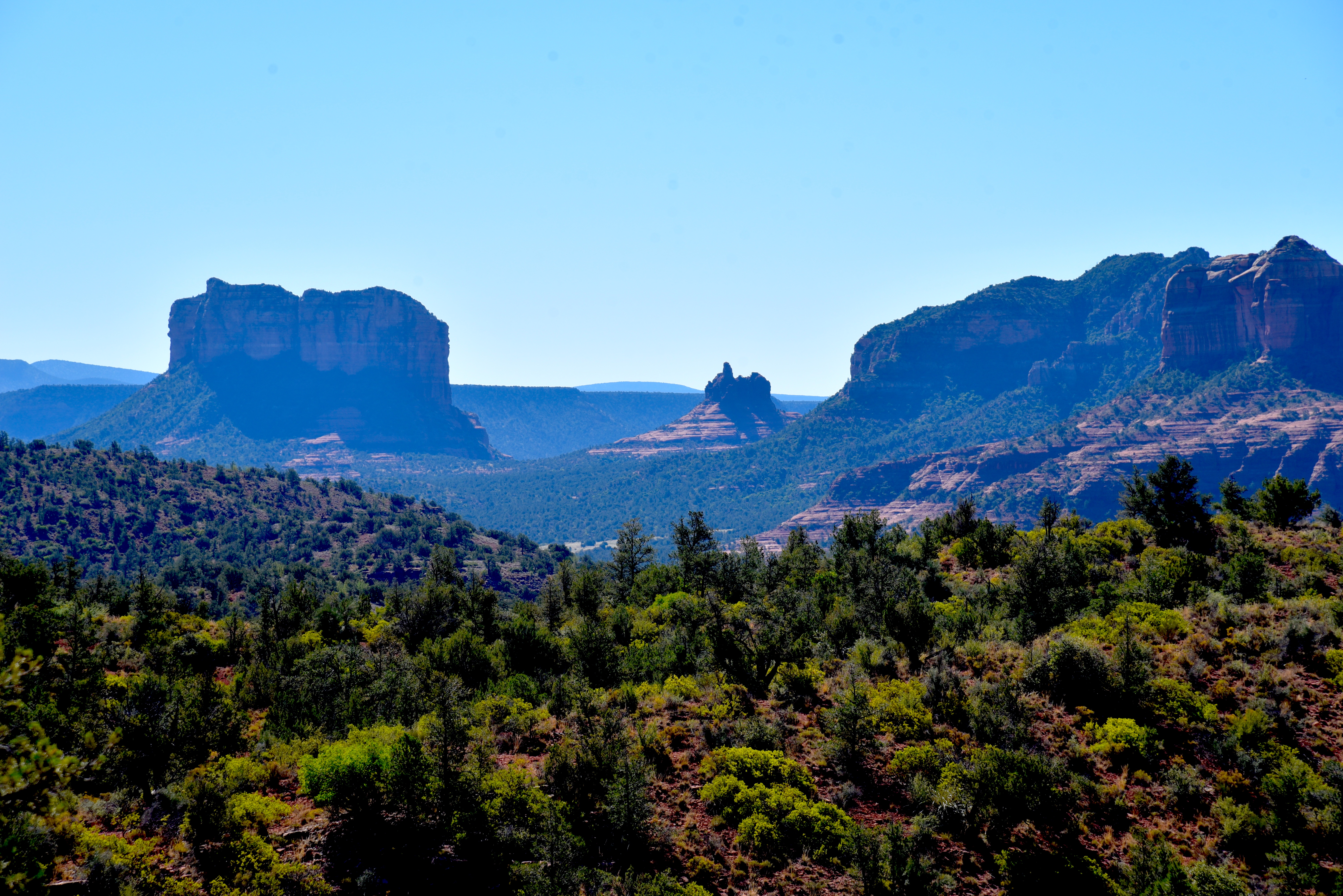
Courthouse Butte (L) and Bell Rock (C) from Skywalker Trail
There are no crowds. And to the
aforementioned some, swapping a look-at-me Instagram moment for solitude is a fair
tradeoff.
The
Herkenham Trail sits in the corrugated hills above Oak Creek on the west side
of Sedona. It’s part of a network of looped trails that trace airy ledges and
scoured gullies. 
Pyramid formation from Old Post Trail
The system that spins
around the twisted course of Carroll Canyon has easy access points and lighter traffic
than many other Red Rock Country hike destinations. But that doesn’t mean the
trails lack appeal. The singletrack
paths trudge through gorgeous high desert ecozones with enough elevation change
to guarantee good workouts and continually changing vistas. 
A rare shady spot on Herkenham Trail
The beauty of the Carroll Canyon area in
Coconino National Forest is way trail expansion has evolved around a few stalwart
heritage routes. Besides Herkenham, the Old Post and Carroll Canyon trails have
been around for years, while the newer Skywalker, Scorpion and Pyramid trails add
miles with respect for the original core routes. 
Tabletop Mesa (C) from Skywalker Trail
One way to sample old and new is to make a
loop hike using the Old Post, Herkenham and Skywalker trails. The moderate-rated
hike may be accessed from the Old Post Trailhead along Chavez Ranch Road by
hiking 0.7-mile north on the Old Post Trail to the Herkenham junction.
The loop is well signed
The
first leg is an easy-going stroll through cactus-dotted grassland. 
Skywalker Trail ducks around a gully
Sparce shade is courtesy of sporadic stands
of pinion pines and junipers that pop up in groups large enough to block the
sun for a water break but never dense enough the eclipse mountain vistas. Most of the hike’s elevation gain happens on
the 1.1-mile Herkenham Trail leg. While the loop’s overall high-to-low
elevation difference is less than 600 feet, the route is deceptively more
challenging. A constant string of rises, dips and turns keep things interesting
and pleasantly paced. Herkenham tops out
at a small parking area across from the old Red Rock High School. 
View of Oak Creek from Skywalker Trail
This site may
be used as an alternative trailhead, but it fills up fast, especially on
weekends. At the parking area, the
Skywalker Trail begins with a rocky descent outside the bounds of a residential
area. 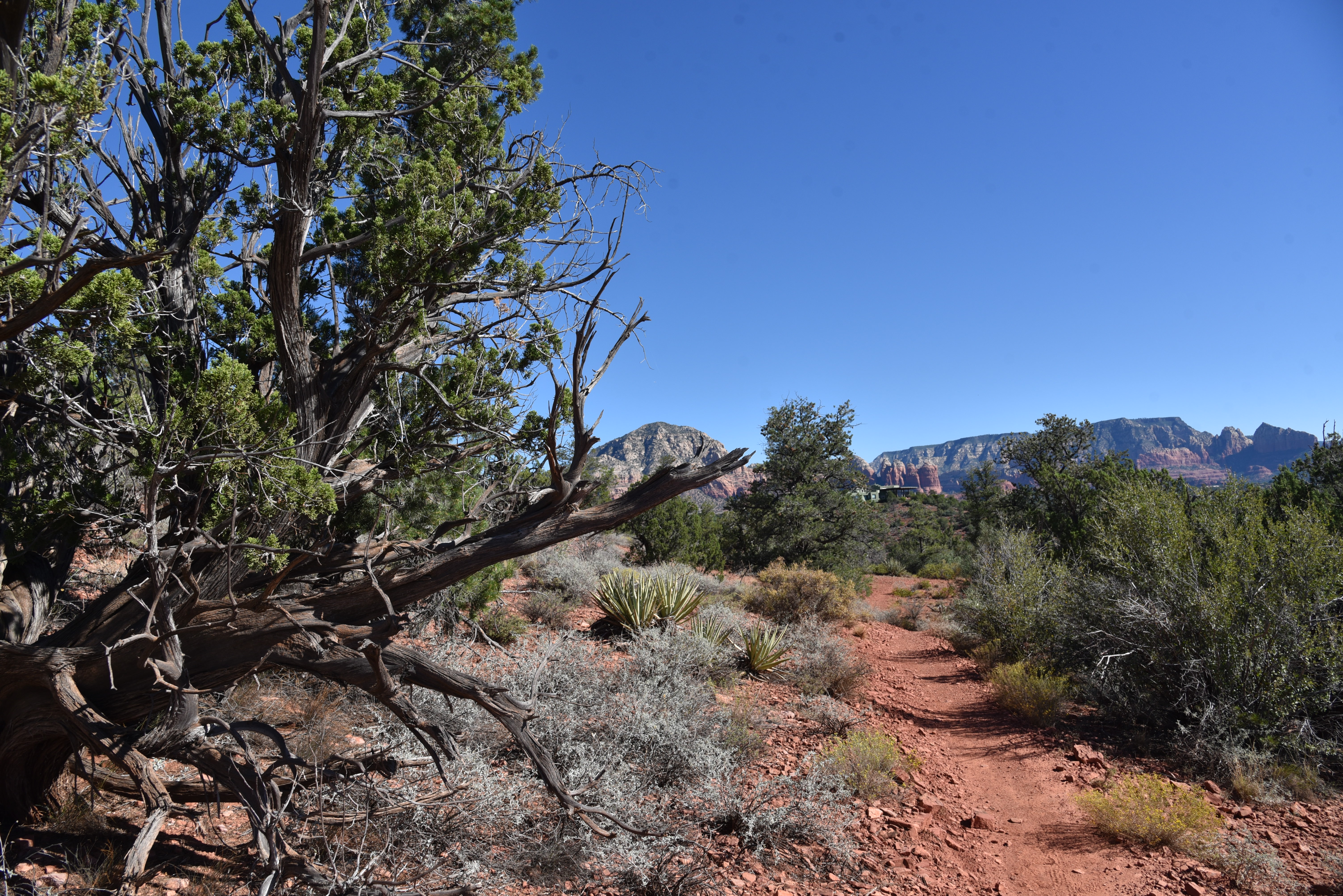
Capitol Butte (center horizon) from Skywalker Trail
Beyond the homes, the trail begins
its 1.5-mile southeast trek. The first half
of the trail rides high on a ridgeline with the best views of the loop. 
A little rain brings out the ocotillo on Skywalker
The green band of the Oak Creek corridor glows
in the valley below with outstanding peeks at Courthouse Butte, Bell Rock, and Capitol Butte. Views to the northeast are more elusive, but
quick looks at the Cockscomb formation and Bear Mountain are available to those
who pay attention. 
Carroll Canyon trails are easy to loop up
After several dozen flowing
bends, the “sky walking” portion of the trail ends where the long profile of Tabletop
Mesa and the colorfully layered peaks of Munds Mountain Wilderness stand out on
the horizon. The trail then makes a
steady descent back down to the Old Post trail for the 1.5-mile return segment
where the call of scrub jays mingles with the rumble of cars headed toward Red
Rock Crossing--the closest ooh-and-ahh catnip.
LENGTH: 5.1-mile loop
RATING: moderate
ELEVATION: 3,979 – 4,569 feet (1,037 feet of elevation change)
GETTING THERE:
Old Post Trailhead:
From the State Route 179/89A traffic circle in Sedona, go 4 miles west (toward Cottonwood) on SR 89A to Upper Red Rock Loop. Turn left and continue 1.8 miles to Chavez Ranch Road (Forest Road 216A), turn left and go 0.1 mile to the Old Post trailhead on the left. There are no fees or facilities at the trailhead.
INFO:
Coconino National Forest
https://www.fs.usda.gov/recarea/coconino/recreation/hiking/recarea/?recid=72089&actid=50


