Find A Trail. Start Your Search Here:

Showing posts with label Fall Color. Show all posts

Monday, September 9, 2024

Sandrock Canyon

SANDROCK CANYON

An Arizona Sister alights on Gambel oak

Arizona Sisters are hard to ignore.  Adorned with distinctive white markings and orange wing tips the eye-catching butterflies are familiar sights in oak woodlands. 

FR9361A crosses Sandrock Canyon

Native to Central America and the American Southwest, Adelpha eulalia are easy to spot flitting among oak canopies from late spring through fall.
Fossil Springs overlook at end of FR9361A

Unlike many other butterflies, this colorful species with a wingspan of 3 to 5 inches does not normally feed on flowers.  
Sandstone ledges over Fossil Springs Wilderness

Oak trees are their host plants and primary food source, but they can also be observed perching around mud puddles and water holes. 
Arizona Sisters stand out in oak forests

The pine-oak woodlands and riparian canyons of Arizona’s Mogollon Rim provides ideal habitat.  They have a knack for finding beautiful places to live and produce three or more broods per year between March and December.  Hikers can take a step into their terrain by seeking out quiet trails and backroads located between 4,000 and 8,000 feet in elevation where several species of native oaks thrive.  
Amazing views from above Fossil Springs

Forest Road 9361A in Coconino National Forest departs from a who-knew trailhead 27 miles east of Camp Verde on State Route 260.
Agaves grow on the rim over Fossil Springs

 
The dirt two-track leads into prime butterfly territory with a jaw-dropping beautiful payoff at the end.

From the trailhead, the FR9361A heads through a barbed wire gate and a concrete tunnel under SR260. 

Sandrock Draw Tank on FR9361A

There are three wire gates along the route. Be sure to close each gate behind you. At the 0.3-mile point, the road is signed as FR9361D, but maps show it as FR9361A, either way, it goes to the same destination.  
Sandrock Draw Tank is a wildlife magnet

A short walk past the sign, pine-shaded Sandrock Draw Tank, a created waterhole, attracts a host of wildlife. 
Water hole near the FR9361Q junction

Birds, dragonflies and Arizona Sisters twitching along its muddy fringe are common sightings.  Sandrock Draw gradually widens becoming a canyon that feeds into Fossil Springs Wilderness.
Tunnel under SR260 at the trailhead

Just beyond the tank, the route heads left at a fork and continues to the 0.9-mile point where the route veers right at the FR9361H junction to stay on FR9361A.  Here, the road traces the Sandrock Canyon dipping and climbing through juniper meadows and Ponderosa pines with occasional mountain vistas peeking through dense tree cover.  

FR9361A ends just yards from the overlook

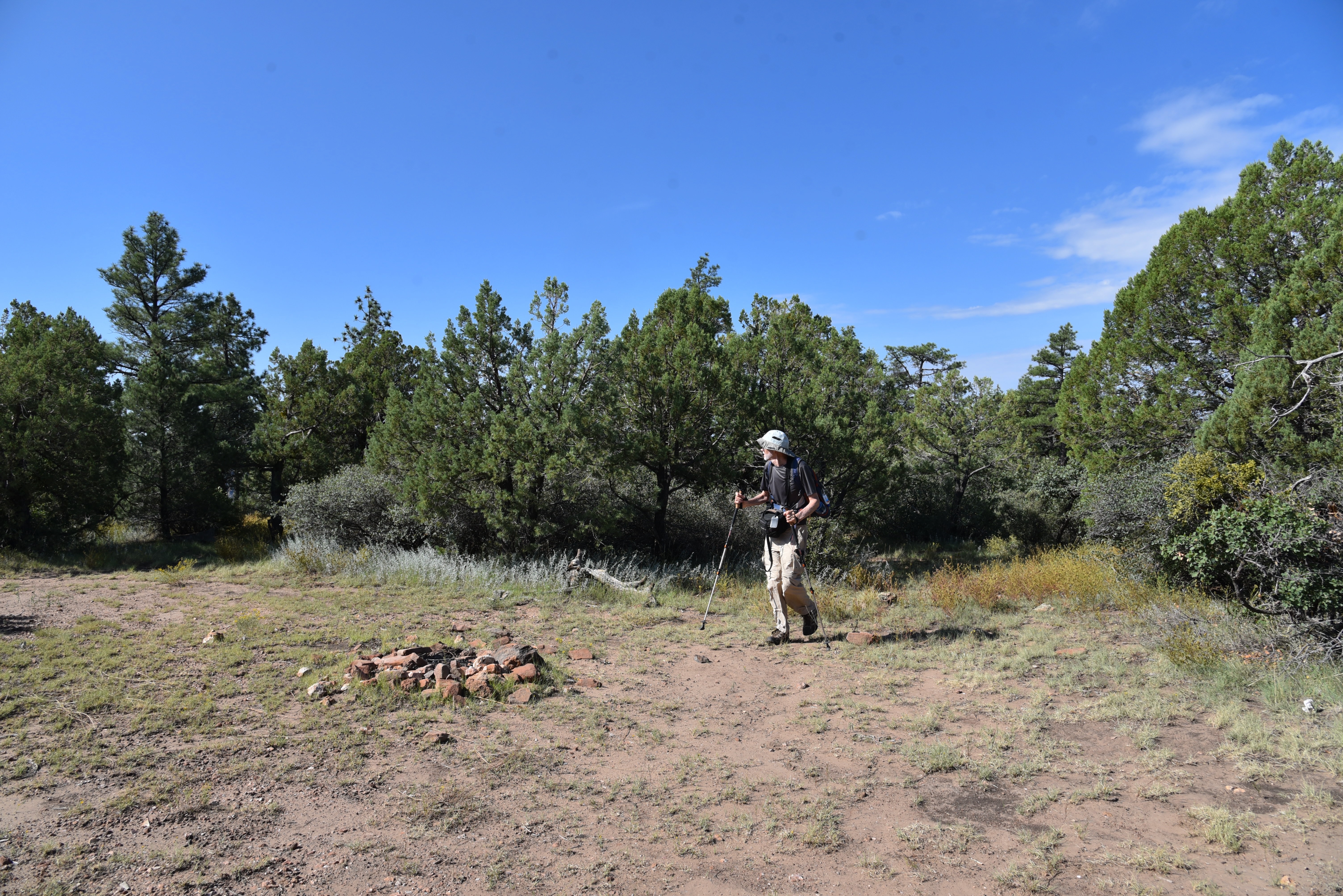
A major road fork at the 1.6-mile point is marked by a small water hole and the junction with FR9361Q.  The route heads right to again stay on FR9361A.  The final 0.8-mile leg of the hike passes through an enchanting green tunnel--bound to turn gold in autumn-- of Gambel oaks replete with Arizona Sister activity.  The lightly travelled dirt road narrows as it makes a moderate descent to its terminus at a non-descript circular campsite that belies the spectacle located just a few yards beyond. 
Mountain vistas from a sunny meadow

Faint game paths wind through a maze of agave, cacti and ancient Alligator junipers landing hikers at an overlook above Fossil Springs Wilderness.  Sandstone ledges protrude over a gorge that plunges 1,000 feet to the wilderness floor that’s home to Fossil Creek, one of Arizona’s most popular water-centric recreation areas. 
There are 3 gates on the hike. Close them behind you!

Broken agaves at the overlook

Free of the (permit-required) traffic and visitors splashing in the waterfalls, the view from above gives a seldom seen overview of the scope and magnitude of the 11,550-acre wilderness below.
Ponderosa pines shade the route


LENGTH:  4.8 miles roundtrip

RATING: easy

ELEVATION:  6,375 – 6,149 feet

GETTING THERE:

From Interstate 17 in Camp Verde, go 27 miles east (toward Payson) on State Route 260 to Forest Road 142 located past milepost 245 on the left.  Immediately past the cattle guard, turn left into a dirt parking area.  A high clearance vehicle is recommended.

The dirt parking area also serves as an access point for the General Crook Trail No. 130.

Monday, October 2, 2023

Calloway Butte-New Tank

CALLOWAY BUTTE - NEW TANK

New Tank in Coconino National Forest

Peaceful, secluded places aren’t too difficult to find along the backroads of Coconino National Forest. 

Weighing in at over 1.8 million acres in size, Arizona’s second largest national forest is ostensibly the most diverse. 

Gambel oaks shade Forest Road 142

The northern Arizona swath of public land encompasses the famous red rock high deserts of Sedona, mountain lakes and streams, aspen glens, and alpine tundra around the state’s highest point in Flagstaff.  
Barbed wire fencing around New Tank

While sandstone phantasms, plunge pools and hypoxic vistas are the hallmarks of the easily accessible land, the B-list stuff in between is quite remarkable as well. 
Mountain vistas from Forest Road 142

When viewed through a lens of discovery, who-knew pockets of forest deliver hikes with generous servings of tranquil beauty.  Wildlife water holes, often created and maintained by Arizona Game & Fish Department, are the unsung gems of back road hiking destinations.
Old corral near New Tank

Gateway to New Tank on Forest Road 142

The weedy stock tanks backed by earthen dams are plentiful along 4x4 roads so they’re easy to find.  It's possible and legal to drive to many of them, but road conditions are not for amateurs. New Tank, one of the most scenic water holes, is a sizable pond choaked with water smartweed and bulrushes. 
A peaceful place in Coconino National Forest

Situated along Forest Road 142 about 27 miles east of Camp Verde, the pond is the focal point of a pastoral scene wrapped in a dilapidated ring of log-and-wire fencing.  The tank sits at the north base of Calloway Butte, a 6,860-foot pine-covered mound south of the West Clear Creek Wilderness. 
Calloway Butte seen from FR 142

Getting to the tank involves an undulating walk on the rough track of Forest Road 142.  Beginning at a dirt parking area off State Route 260 where the General Crook Trail #130 passes under the highway, the hike makes an immediate descent to a 3-way junction. 
Meadow with a view near New Tank

FR 142 heads left, on the first of a sequence of rocky climbs.  The road is shaded by a mix of Ponderosa pines, Gamble oaks and gnarly alligator junipers, passing by several side roads before dipping down into the cut of Meadow Canyon.  A final uphill crawl reveals mountain vistas peeking through thick tree cover and first looks at the green arc of Calloway Butte.  The road flattens out as it approaches the tank and skirts a rustic corral before meeting the tank at the 2.4-mile point.  
Wildflowers and pines along FR142

Massive oaks that blaze in shades of gold in autumn serve as a leafy gateway to the water hole that attracts all sorts of wildlife.  Elk, javelina, water birds and a robust community of woodpeckers skulk its perimeter.  The photogenic site is drenched in sunlight, the air spritzed with earthy notes of mint and grass. 
Pastoral scene at New Tank

It’s a relaxing spot for a lunch break before heading back or continuing another 0.8-mile on the road to Forest Road 142B, which is also signed as FR 9396. The hiker logo on the post indicates that the Calloway Trail, a half-mile strenuous route that descends into West Clear Creek, lies ahead.
FR 142 traverses Meadow Canyon

Well-equipped, adventurous hikers may follow the narrow, rough road 3-miles the trailhead.  But to stick with the theme of enjoying the pleasure of an unassuming little place between highway and wilderness, New Tank makes for a good turnaround point.
The FR 142B turnoff for the Calloway Trail


LENGTH: 4.8 miles round trip (to the tank and back)

RATING: moderate

ELEVATION: 6,146 – 6,718 feet ( 1,501 feet of accumulated elevation change)

GETTING THERE:

From Interstate 17 in Camp Verde, go 27 miles east (toward Payson) on State Route 260 to Forest Road 142 located past milepost 245 on the left.  Immediately past the cattle guard and turn left into a dirt parking area for the General Crook Trail.  A high clearance vehicle is recommended.

Monday, October 25, 2021

Bushnell Tanks Road

BUSHNELL TANKS ROAD

First crossing of Sycamore Creek is sort of tricky

Sometimes, surprisingly fine escapes can be found just steps from busy byways in right-under-your-nose places.  Bushnell Tanks Road, located off the Beeline Highway roughly halfway between Mesa and Payson is one such find.

Rustic corral site is a highlight of the hike


Much of the road parallels part of the course of the Pine Mountain Passage 21 of the Arizona National Scenic Trail using backroads above and through the corridor of Sycamore Creek and Colcord Canyon.

Sprawling grasslands dominate the high ridges

 
It’s a rugged, undulating road hike in Tonto National Forest that’s packed with creek side sycamores, a rustic corral, stunning desert vegetation and huge mountain vistas. 
Buffalo gourds dangle from a mesquite tree

The moderate hike is also a great who-knew way to view breath-taking late autumn foliage. 
The rocky second crossing of Sycamore Creek

The hike plan is simple, although roads and junctions are not signed, so paying attention to landmarks is key to staying on track. 
A mix of riparian and desert trees shade the hike

From the trailhead, hike down the main gravel road which is Bushnell Tanks Road, Forest Road 22.  At the 0.3-mile point, the road meets the turn off for the Arizona Trail connector. 
Devil's Claw blooms through October

Stay on the main road as it descends to the first of three gorgeous crossings of Sycamore Creek.  The first crossing is a little sketchy. 
Mount Ord stands out over rangelands

The road goes straight across the braided and bent waterway, but getting through requires some creative rock hopping over the flow which varies in depth and speed with the seasons. 
An old corral complex in Ram Valley

The creek crossing is shaded with enormous sycamores and a few cottonwood, willow and alder trees that show off in shades of yellow and russet browns from late October through December. 
Hikers follow an unsigned road in Tonto NF

Once over the water, the road shimmies through a mixed bag of live oak patches and golden pastures bolstered with views of Mazatzal mountain peaks including Mount Ord, Crabtree Butte and Cypress Peak.  The road continues through a continually-changing landscape bright with wildflowers and native food plants.
Hikers approach the third crossing of Sycamore Creek

Lots of ups-and-downs and two more leafy creek hops land hikers at an unsigned road junction on the right at the 2-mile point near a rusty corral complex. 
The hike has lots of ups-and-downs

The corral makes for an interesting exploratory side trip.  Encroached with weeds, tangles of buffalo gourds and bits of frayed ropes, the maze of metal fencing, feed troughs and a newish-looking water tank sit at the core of scenic Ram Valley.  When done investigating the corral, backtrack to the road junction and follow the steep, rutted path up a catclaw-riddled ridge. Long pants, folks.
Hike gives an alternative look at AZ fall foliage

 
Concrete tank marks the hike turnaround point

The unforgiving haul unpacks spectacular views with every foot of elevation gained.  Peaks and buttes circle an environment of sprawling rangeland, deep valleys and tree-lined creek channels. 
Hikers on one of the hike's high ridges

At the top of the first rise, the road begins a relentless series of ascents and descents through open grasslands.  At the 3.9-mile point, on a bald high-point, a concrete stock tank off to the right sits among a ring of mesquite trees and low-growing cacti.  This makes for a good turn around point. 
Sycamore seed pods

For a longer trip, consult the Tonto National Forest map to scope out other routes that wind through the hills and connect with the Arizona Trail.
Extend the hike on AZT or other forest roads

Better yet, check out the Arizona Trail website (aztrail.org) for more ways to experience this beautiful slice of Central Arizona. 

FR22 traces the course of Sycamore Creek

Arizona Trail association members also get special access to maps, data and privy to dozens of loop hike options using the 800+-mile, state-traversing trail.
Desert hackberry shrubs clutter in a wash

LENGTH: 7.9 miles roundtrip

RATING: moderate

ELEVATION: 3,320 – 3,817 feet (1,720 feet of accumulated elevation change)

GETTING THERE:

From Loop 202 in Mesa, take the State Route 87 (Beeline Highway/ Country Club Road) exit 13.  Go 41 miles north on SR 87 to the turn off for Bushnell Tanks near the community of Sunflower.  Park in the gravel lot near an “area closed” sign and a large Arizona Trail kiosk.  The area is open to non-motorized use.

INFO:
https://aztrail.org/explore/passages/passage-21-pine-mountain/

Wednesday, January 20, 2021

Huckaby Trail

HUCKABY TRAIL

There are three things to know before stepping out on the Huckaby Trail.

The leafy corridor of Oak Creek on Huckaby Trail

One, that as-advertised 280 feet of elevation change? You’ll do it 4 times.  Two, there are some moderately steep sections that hang close to precipitous drops offs. And, three, the hike is worth sucking up one and two.  

Part of the hike parallels SR89A in Sedona

While it’s located just inside the boundary of Coconino National Forest and within sight of busy hotels and businesses, the classic hike southeast of uptown Sedona delivers a satisfying outdoor experience. 
Midgely Bridge & Oak Creek seen from Huckaby

The hike begins on the sunny rock shelves above Bear Wallow Canyon gradually dipping downhill on a wide dirt road. At near the half-mile point, the trail crosses the bottom of the canyon and begins its unrelenting cycle of ups-and-downs in the drainage-riffled cliffs above Oak Creek.
A scenic overlook on Huckaby Trail

 
Twisting through an airy high desert ecozone of yucca, cacti and blooming shrubs, the narrow trail features continually changing vistas of both wilderness peaks and the streams of traffic moving through a bustling resort hub.  
Midgely Bridge towers over Huckaby Trail

Huckaby Trail crosses Bear Wallow Canyon

Midway through the hike, the route traverses a high ledge above the creek. First glimpses of the waterway glint 200 feet below before the trail makes a hard eastward bend and several more swings around crumbling red rock escarpments to land on a scenic edge with views of Midgley Bridge and the iconic Steamboat Rock and Mitten Ridge formations.

Pinon pines shade parts of the trail

 
The trails crosses Oak Creek below the bridge

From this point, the path spirals downhill along edgy clefts, entering a forest of Arizona cypress and oak trees.  At the 2-mile point, the route meets the floodplain of Oak Creek, but the climbing is not yet over. 
Trail traces cliffs above southeast Sedona

There’s another half mile of trail that hangs on uneven rock shelves that parallel the creek. Here, water-loving sycamores and cottonwoods enter the botanical mix shading an under story of tangled brambles and vines. 
Manzanita is a common shrub on the trail

View of Wilson Mountain from Huckaby Trail

The damp, earthy atmosphere is magical year-round--icy grey in winter, green and vibrant in spring and a canopy of golden foliage in autumn.
View of Mitten Ridge from Huckaby Trail

The cliff hike dissolves into a sandy walk through a small meadow that leads to the banks of the creek beneath Midgley Bridge. 
Oak & sycamore trees line Oak Creek

Steamboat Rock & Wilson Mountain on horizon

For those inclined to rock hop over the water, the trail picks up on the other side and heads uphill again where it ends at the Wilson Mountain trailhead along State Route 89A.
The distinctive seeds of Arizona cypress trees

A winter scene along Oak Creek

LENGTH:  5.6 miles roundtrip

RATING:  moderate

ELEVATION:  4,211 – 4,492 feet (1,157 feet of accumulated elevation change)

GETTING THERE:

From traffic circle located at the Oak Creek bridge on State Route 179 in Sedona, turn right onto Schnebly Hill Road and go one mile to the trailhead on the left.

Roads are suitable for all vehicles. There is a restroom at the trailhead.

FEE: A Red Rock Pass or equivalent is required at the Schnebly Hill trailhead. There is a permit kiosk at the trailhead.

https://www.fs.usda.gov/detail/coconino/home/?cid=stelprdb5416207

INFO: Coconino National Forest

https://www.fs.usda.gov/recarea/coconino/recarea/?recid=55322