Find A Trail. Start Your Search Here:

Saturday, March 3, 2012

A striking desert passage of the Arizona Trail

ALAMO CANYON
Passage 17 of the Arizona Trail, Superior
Picketpost Mountain

For the first four miles of this undulating passage of state-traversing Arizona Trail, the imposing profile of Picketpost Mountain looms large on its eastern flank until the route's remote interior swallows the stony beast thus making way for spectacular canyon views.  Traveling south from Picketpost trailhead, the path begins as a mild walk in the desert but soon transitions into a roller-coaster-like hike through
Looking toward Superstition Wilderness
gullies, washes and moist drainages where mesquite trees provide what little shade there is to be had in this exposed backcountry.  Because of all the ups-and-downs, this moderate hike feels tougher than it is, so bring extra water and snacks to fuel the trek that ends at the northwest boundary of the White Canyon Wilderness.  Here, you can continue south on the Arizona Trail, Gila River Canyons passage #16  toward Tucson.

LENGTH: 11.5 miles one way
RATING:  moderate
ELEVATION:  2,360' – 3,800'
BEST SEASON: October - March
Mesquite shade

GETTING THERE:
Picketpost Trailhead:
From Phoenix, travel east on US60 to milepost 221—located just before the town of Superior  (if you reach Boyce Thompson Arboretum, you've gone  1.7 miles too far). About 0.4 mile past milepost 221, look for the signed turn off for Picketpost Trailhead (FR 231) on the right.  Turn onto this good dirt road and continue 0.2 mile to a “T” intersection  ---turn left (east) here and go 0.6 mile to the trailhead.
INFO:
Arizona Trail Association:
http://www.aztrail.org/passages/pass_16.html
Tonto National Forest, Globe Ranger District:
(928) 402-6200
White Canyon Wilderness, Bureau of Land Management

MORE PHOTOS:

Friday, March 2, 2012

New rating system for Valley hiking trails

Beware the “double black diamond” trails. 

The City of Phoenix and surrounding towns including Scottsdale, Glendale, Tempe and Fountain Hills, have adopted a new system of coding trail difficulty levels to better aid hikers in selecting routes that best match their abilities.
The system uses six color-coded symbols similar to those used for ski runs. They are:
WHITE DOT: easiest, flat, barrier-free, max 5% grade
GREEN DOT: easy, mostly smooth & wide dirt trails, max 10% grade
BLUE SQUARE: moderate, mostly smooth, variable width dirt with some unevenness, max 15% grade
BLUE DIAMOND: moderately difficult, mostly uneven dirt & rock, max 20% grade
BLACK DIAMOND: difficult, long , rocky segments with possible drops & exposure, loose, uneven rock, more than 20% grade
DOUBLE BLACK DIAMOND: extremely difficult, long , rocky segments with possible drops & exposure, loose, uneven rock, more than 20% grade, obstacles and excessive heat

The new rating system was unveiled on Feb 29, 2012 and will start popping up on area park web sites soon. Future plans also include adding the symbols to trail signs.

Monday, February 27, 2012

Prescott bird-watching hike

WATSON WOODS RIPARIAN PRESERVE
Ducks take flight in Watson Woods
Prescott
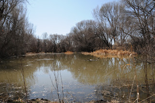
Birds flock to pools along Granite Creek 
A sign at the trailhead proclaims that Watson Woods has been designated an “important bird habitat” by the Audubon society.  This is an understatement.  Once a 1000-acre-plus stream side bosque of cottonwood, walnut and other moisture-loving plants along lower Granite Creek, the area was nearly lost to the ravages of modern development.  However, thanks to the efforts of the City of Prescott and Prescott Creeks (local watershed stewards) the woodlands are being restored.  Today, the preserve is a 126-acre bird-and-wildlife haven.  Even though it's located just yards off busy highway 69, the lush waterway boasts a bevy of natural wonders for your viewing pleasure.  A scenic interpretive trail guides hikers among restored wetlands, canopies of gigantic centuries-old trees, ponds and marshes.  Signs both at the trailhead and along the route describe the sights and chronicle on-going restoration efforts.
In addition to a sturdy pair of shoes for the dirt walkways, bring along a pair of binoculars (birds galore) and a hearty appetite for knowledge---you won't be disappointed. Also, for those who want to extend their hike, the preserve trail connects with adjacent Watson Lake Park, Lower Granite Creek trail system and the Prescott Peavine National Recreational Trail.

LENGTH: 0.5 mile one way
RATING: easy, educational
ELEVATION: 5,100'
KID FRIENDLY?: yes
DOGS: this is a sensitive riparian habitat, dogs MUST be on leash and all droppings packed out
HOURS: 7 A.M. - 10 P.M.
FEE: $2 parking fee
FACILITIES: port-o-potties (real restrooms planned for June 2012), picnic tables, maps
DISTANCE FROM PHOENIX: 112 miles one way
Red-winged blackbird 

GETTING THERE:
1626 Sundog Ranch Road in Prescott. From Phoenix, travel north on I17 to Cordes Junction  exit 262 for Prescott  AZ 69.  Turn west and go 32 miles on AZ 69  to Prescott.  Just outside of downtown, pass Walker Road and begin looking for Prescott Lakes Parkway---located across from the Prescott Gateway Mall where there's a huge Cadillac dealership. Turn right (north) on Prescott Lakes Pkwy and continue 1.7 miles to Sundog Ranch Road, turn right and go 0.2 mile  to Peavine Trail/Watson Woods Riparian Preserve parking area. HIKE: Follow the paved Peavine entrance trail for about 100 meters, pass the picnic ramada and turn left once you reach the cindered potion of the trail. The Preserve walk-in gate and kiosk are west of the large walnut tree.
INFO: 
City of Prescott
Site is managed by: Prescott Creeks, 928-445-5669

MORE PHOTOS: