MARICOPA
TRAIL SEGMENT 22
BARTLETT
DAM ROAD to CAMP CREEK FALLS
 |
Camp Creek in Tonto National Forest
|
Over its
315+-mile course, the Maricopa Trail unfurls its tendrils to link county
regional parks, suburbs, urban public spaces, canals, historic paths, and
remote stretches of national forest. To
hike the full loop is tantamount to a walking tour of the Valley’s
multi-faceted landscape.
 |
Mountain vistas on the Maricopa Trail
|
The epic non-motorized
route that circles the Valley broke ground in 2007 in the Spur Cross Ranch
Conservation Area, and the main loop was completed in 2018.  |
Hikers in the Camp Creek Falls grotto
|
The trail continues to improve, evolve, build
connectivity, and add length as it adapts to accommodate growing community
interest and enthusiastic hiker, biker, and equestrian users. Built to encourage hikers of every ilk to get
outdoors, the route’s many trailheads and neighborhood access points make it
simple to hop on and off the trail from anywhere in the Valley, with two
notable exceptions: the Spur Cross to Bronco and Bronco to Granite Mountain
segments.  |
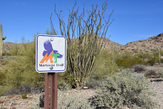
Segment 22 of the MT is wide and well signed
|
Where the northernmost
segments of the trail pass through Tonto National Forest, there’s an average of
13 miles between drive up trailheads. And, for seasoned, well-prepared trail
users, that’s where the best stuff resides.
Segment 22 which runs for 16-miles from the north border of Scottsdale’s
McDowell Sonoran Preserve to the Bronco trailhead in Tonto National Forest was
among the last passages to be completed.
 |
The trail heads downhill on brushy foothills
|
Rugged terrain, scoured washes, nasty back roads and stubborn rock
contributed the difficulty encountered by trail construction crews. Then, in
September and October 2020, the 15,000+-acre Sears Fire took a toll on several
miles of the segment located roughly 20 miles northeast of Cave Creek.  |
Hazy Mt. Ord (center horizon) viewed from the trail
|
Within months, work crews restored the damaged
trail, fixing drainages and stabilizing eroded slopes. While the moderately difficult entire
12.6-mile Segment 22 hike can sound intimidating for some, there’s an option
for an out-and-back day hike that includes a visit to one of the Valley’s most
beloved natural wonders. |
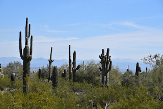
Morning vista on the Maricopa Trail
|
Beginning
along Bartlett Dam Road, Segment 22 heads north through a shadeless expanse of
catclaw and saguaros. The path briefly
traces a powerline, but then veers east into wash-riddled backcountry with
unobstructed mountain views. The rocky
domes of Kentuck Mountain (5,013 feet), Maverick Butte (4,870 feet), Humboldt
Mountain (5, 204 feet)and St, Clair Mountain (3,252 feet) populate foreground
with Mount Ord (7,128 feet) and the cloud bumping Mazatzal Range standing high
over the Verde River Basin in the distance.
 |
The Maricopa Trail crosses sandy Blue Wash
|
The trail twists downhill, clinging to foothills and stony edges landing
hikers at the sandy corridor of Blue Wash at the 3.4-mile point.  |
Where the MT crosses Bartlett Dam Road
|
From a barbed wire and wood gate, an American
flag planted on a prominent knoll with a Fresco Mines claim sign across the
wash marks the beginning of a side trip to Camp Creek Falls.  |
Interesting rock formations throughout the hike
|
The side trip veers left from the Maricopa
Trail and follows the glassy slip of Camp Creek to a box canyon where a
perennial stream of water spills about 20 feet over solid rock into a shallow
plunge pool. Desert waterfalls are rare
enough, but this one in its tiny grotto fringed by cottonwoods, willows and
reeds is a real gem. |
Camp Creek leads to a desert waterfall
|
 |
Flag (center) on knoll marks the falls side trip
|
The spring-fed
fount is a critical water source for the deer, javelina and myriad little
critters that live in the surrounding desert and makes for a scenic stop over
for both long-distance treks and short day hikes on the Maricopa Trail.  |
The spring-fed waters of Camp Creek Falls
|
SUPPORT
THE TRAIL:
If this
wild and wonderful segment of the Maricopa Trail has inspired you, please
consider supporting the effort by attending the Prickly Pedal Bike Race, the
trail’s main fund-raising event.
Prickly
Pedal on the Maricopa Trail will run 36 miles from Cave Creek to Lake Pleasant
in Peoria.
The annual
event is produced by Aravaipa Rides to benefit the Maricopa Trail + Park
Foundation which funds trail building and maintenance projects.
Heads up
that trail closures will be in effect along the racecourse.
RACE: 8:30
(pre-registration required)
EXPO &
AFTER PARTY: 11 a.m. – 3 p.m.
Public is
invited to enjoy the finish line party with beer garden, exhibitors, music, and
fun.
https://pricklypedal.com/
LENGTH: 7
miles round trip, out-and back to the falls
RATING:
moderate
ELEVATION:
2,833 – 3,303 feet (793 feet of elevation change)
GETTING THERE:
SOUTH
TRAILHEAD
BARTLETT
DAM ROAD-WILDCAT HILL OHV PARKING:
From Loop
101 in Scottsdale, take the Pima/Princess Drive exit 36 and go 13 miles north
on Pima and turn right on Cave Creek Road.
Continue 4.1 miles to Bartlett Dam Road, turn right and go 0.4-mile to a
dirt road on the right 0.1-mile past the Tonto National Forest ranger
station. Turn right and park along the
dirt turn outs. Follow the Maricopa Trail signs to cross Bartlett Dam Road and
continue north.
TONTO
NATIONAL FOREST CAVE CREEK RANGER STATION:
40202 N.
Cave Creek Road, Scottsdale.
May be
closed on weekends and holidays.
Use the
0.2-mile connector that starts at the big Maricopa Trail kiosk.
INFO &
MAPS:
https://www.maricopacountyparks.net/park-locator/maricopa-trail/


 Posts
Posts