Find A Trail. Start Your Search Here:

Showing posts with label White Tank Mountains. Show all posts

Friday, January 6, 2023

Javelina Summit Trail

JAVELINA SUMMIT TRAIL

Brittlebush colors the Tortuga Trail


One of four difficult-rated summit hikes in the Skyline Regional Park in Buckeye, the Javelina Summit doesn’t scrimp on thrills.  The 0.9-mile-long trail spools off connecting routes in the park’s far east end. 

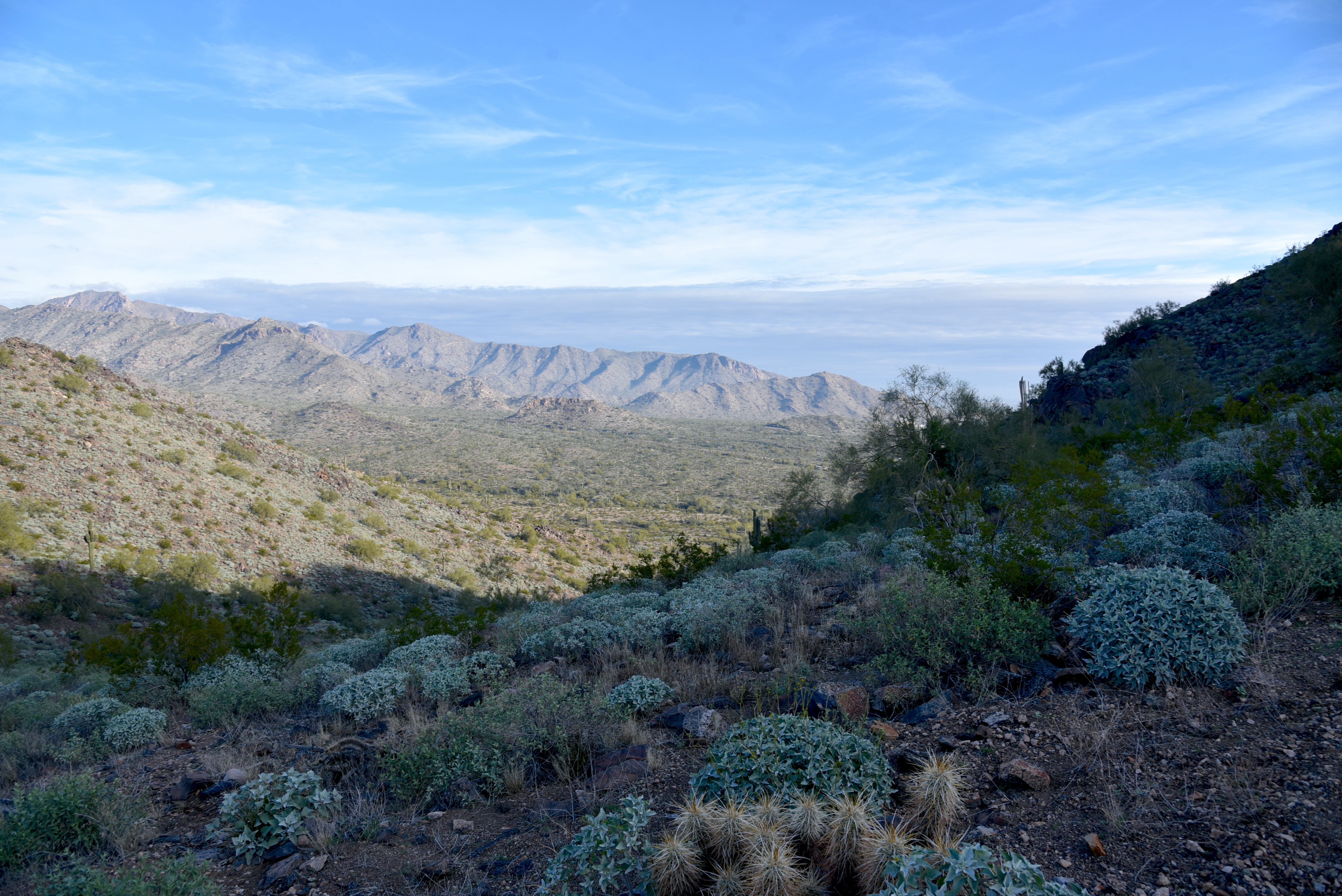
View from the Javelina Summit Trail

While it’s “just” a 745-foot climb from trail base to summit, that accounts for less than half the story.
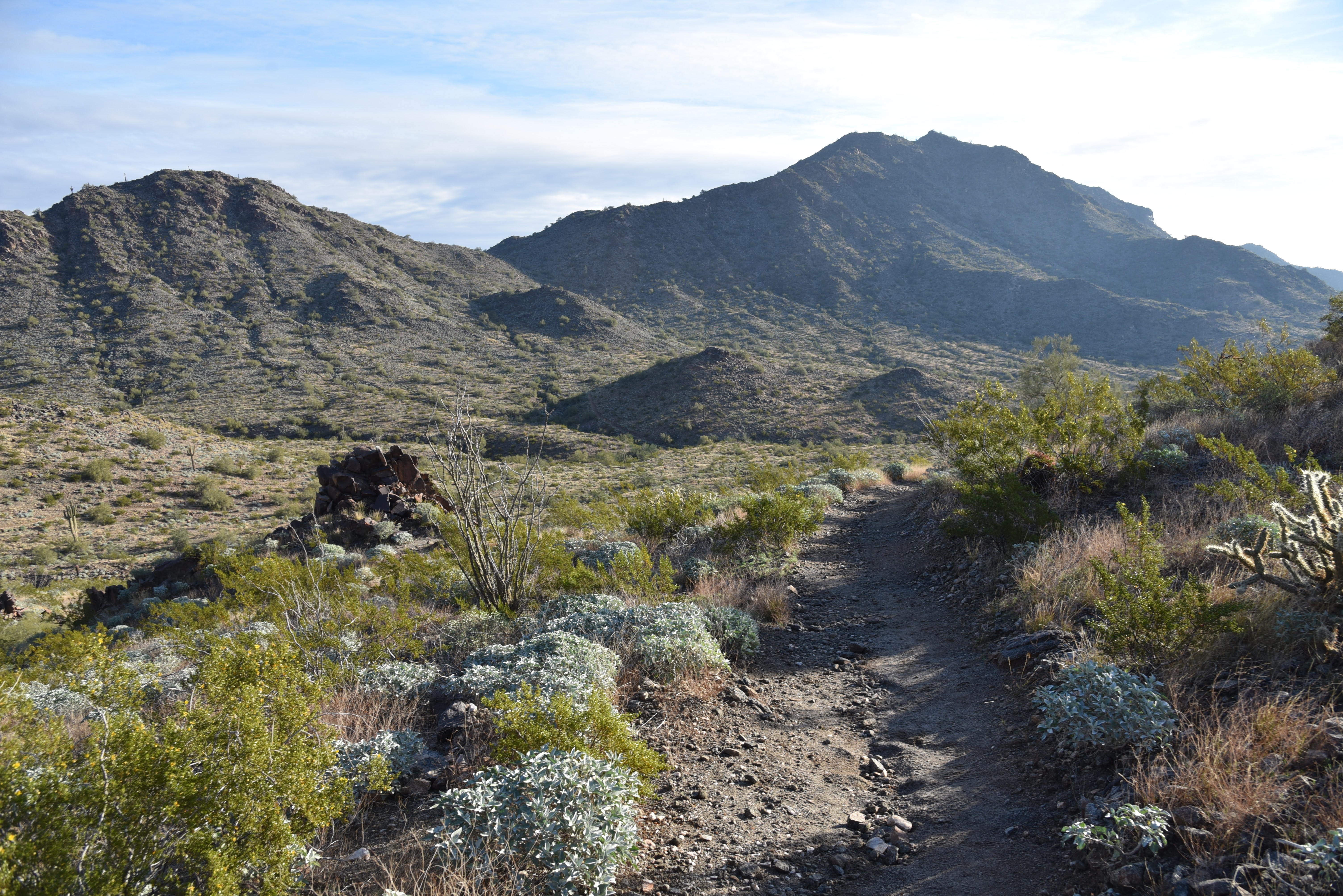
Javelina Summit (right) viewed from Tortuga Trail

Getting to the 2,200-foot mountain highpoint involves using three trails and logging over 1,700 feet of accumulated elevation change.
Hike begins on tehe Quartz Mine Trail

The rollercoaster-style trek starts from the main trailhead area with a 1.6-mile hike on the Quartz Mine Trail. About a half mile in, first peeks at the destination loom on the horizon. The prominent ridgeline rising over foothills and valleys looks imposing. And irresistible!
Beginning of the Javelina Summit Trail

The undulating path winds through washes and slopes below ragged ridges and stone outcroppings before making an ascent to a saddle where the Tortuga Trail spins off to the east.
Brittlebush are plentiful in Skyline Regional Park

The Tortuga Trail leg of the hike takes back much of the elevation gained with a smooth downhill on long lazy switchbacks. At the half-mile point, the route encounters its final segment, the 0.9-mile Javelina Summit Trail.
View of the White Tank Mountains

It's here where the real work begins. While the lower quarter mile feels just moderate and has a few level bends, the climbing becomes an unrelenting uphill haul with loose rock and a fair amount of exposure. The trail is well engineered but still very steep and precipitous as it clamors along a knife-edge sharp, rocky backbone. Persistence and careful footwork pay off on the tiny summit.

Rock outcropping on Tortuga Trail


Javelina Summit Trail is steep and edgy.

The airy pinnacle displays 360-degree vistas of the southern White Tank Mountains, the distant profile of Downtown Phoenix, the Sierra Estrella Mountains and sprawling desert plains.

LENGTH: 5.8 miles round trip (out and back hike)

RATING: difficult

ELEVATION: 1,312 – 2,200 feet (over 1,700 feet of accumulated elevation change)

GETTING THERE:

Skyline Regional Park, 2600 N. Watson Road, Buckeye.

From Interstate 10 in Buckeye, take the Watson Road exit 117 and go 2 miles north to the park. Roads are paved.

HOURS: Sunrise to sunset daily

DAY USE FEE: none

FACILITIES: restrooms, picnic ramadas, camping

INFO:

Skyline Regional Park

https://www.buckeyeaz.gov/community/skyline-regional-park

Monday, November 25, 2019

MARICOPA TRAIL: WHITE TANK-GRAND AVENUE SEGMENT

MARICOPA TRAIL: WHITE TANK-GRAND AVENUE SEGMENT

MULE DEER TRAIL

White Tank Mountain Regional Park
Hikers traverse a ridge on the Maricopa Trail
Most succinctly stated, the Maricopa Trail is a microcosm of the Valley of the Sun.
Over its 317-mile course, the non-motorized recreational trail connects 10 county parks, wanders through open desert and farmland, tethers to suburbs and urban centers and passes by the canals, dams and lakes that deliver water to the one of the largest and fastest-growing areas in the Southwest.
Beautiful White Tank Mountains
Hikers pass among ironwood trees along the Maricopa Trail
If you want a walking tour of the Valley’s diverse nature, this is your hike.
The Maricopa Trail represents decades of planning, development and construction in partnership with Maricopa County, Maricopa Board of Supervisors, Maricopa County Parks and Recreation Department and dozens of volunteer organizations and individuals that contribute time and resources to build and maintain the trail.  Phase 1 of the project (completion of the Valley-circumnavigating loop) was completed earlier this year. Phase 2 will roll out this year with designs for a spur trail that will connect with the planned 70,000-acre Vulture Mountain Regional Park in Wickenburg that’s on track to open in 3-5 years.  The trail is a huge accomplishment that few communities across the country can match.
“I talk with many county park directors across the country and they are envious of what we have in the Maricopa Trail,” said R.J. Cardin Director, Maricopa County Parks and Recreation Department. 
Board members of the MT + Park Foundation at MuleDeer TH
The trail is organized into 20 segments, each with multiple trailheads and walk-in access points that tie together existing trails, roads and fresh-built paths.
Every section presents a unique snapshot of every corner of the county. From the rugged backcountry of the far north Valley that runs through Tonto National Forest to easy water-centric strolls at Lake Pleasant and easy family favorites like the sandy trails in San Tan Mountain Regional Park.  No matter where you live in the Valley, chances are, you’re not too far from the Maricopa Trail.
“To me, the Maricopa Trail is a fast and easy way to escape the city and be one with nature,” said Bill Klewer, Volunteer Coordinator, Maricopa County Parks and Recreation Department.
“I really appreciate that the trail can be accessed in so many locations throughout the county.”
Kiosks similar to this one are being installed on the trail
With so many options, where do you start?  The county parks are a good choice for those just getting to know the trail.  Well-signed and impeccably-groomed, the sections of the trail that run through parks are low-risk, amenity-rich gateways.  One west valley segment to try is the where the trail shares space with the Mule Deer Trail in White Tank Mountain Regional Park in Waddell. The park map shows multiple ways to incorporate the trail into a day hike or long-distance trek. 
A scenic spot on the Mule Deer segment of the MT
A pleasant out-and-back suggestion begins at the Mule Deer trailhead. Head south and follow the dirt single track that traces the park’s southeast boundary through rumpled washes and lush stands of ironwoods and Palo verde trees that clutter moist drainages.  A brief uphill climb lands hikers on a ridgeline with vistas of patchwork grids of cotton fields and subdivisions, agricultural flatlands and distant city high rises.  All around, a fringe of mountain ranges circles the Valley.
Far-reaching vistas are a signature feature of the MT.
Up close, the White Tank Mountains, bolster the trail’s western edge while the Sierra Estrella, Cave Creek and Bradshaw Mountain appear as hazy mounds on the distant horizons. 
Saguaros tower over a wash on the Maricopa Trail
The route drops back down to the desert floor slipping among picnic sites in an unassuming gnarled path. At the 2.25-mile point, the trail meets a junction where a spur path leads to the nature center, a must-see stop when visiting the park.  For a quick sampler hike, the nature center makes for a good turn around point, unless, this snippet of a larger entity has inspired you to tackle the entire trail.  Fall through spring is the perfect time to explore the Maricopa Trail. And with new kiosk signs designed by the nonprofit Maricopa Trail + Park Foundation and manufactured with a grant from REI Co-op being placed at new access points across the Valley in the coming weeks, navigating the course will be easier and more attainable than ever.  
The trail traces the park's southeast edge
The nature center at White Tank Regional Park
The Maricopa Trail connects 10 county parks
LENGTH: 4.5 miles out-and back as described here, 17.2 miles entire segment.
RATING: moderate
ELEVATION:  1,506 – 1,377 feet
GETTING THERE:
White Tank Mountain Regional Park
20304 W. White Tank Mountain Road, Waddell, AZ
From Phoenix, take Interstate 10 west to the Loop 303 North exit.  Go north on Loop 303 and exit at Northern Avenue. Go left (west) at the off ramp and continue west on Northern to Cotton Lane. Turn right (north), go 1 mile to Olive Avenue, turn left (west) and go 4 miles to the park entrance.
FEE: $7 daily fee per vehicle
FACILITIES: restrooms, water, picnic areas, horse staging, nature center, camping (fee)
INFO:
Maricopa Trail + Park Foundation

Monday, January 28, 2019

Mesquite Canyon Trail

Mesquite Canyon Trail

White Tank Mountain Regional Park.
Edge-hugging segment of Mesquite Canyon Trail
Towering over cotton fields, citrus groves and an ever-expanding landscape of subdivisions, the White Tank Mountains on the western edge of Metro Phoenix rise to just over 4000 feet.
Mexican gold poppies open in daylight.
For more than 30 million years, tectonic upheavals, volcanic events and erosion have shaped the range into a mass of canyons, ruptured ridgelines and scoured drainages where “white tanks”— depressions in buff-colored granite—retain rain water.  The inhospitable terrain is made approachable by way of the trails within White Tank Mountain Regional Park in Waddell.
Make it a loop with the Willow Canyon Trail if you like.
Poppies galore!
Benches are placed at scenic spots along the first 0.25-mile.
Dainty Desert Hideseed grow in moist clefts.
Excellent views appear in the first mile of hiking.
Complex geology of the White Tank Mountains.
A lone Mexican gold poppy hides among dry grasses.
Long switchbacks ease the climb.
Although the park has many family-friendly, effortless routes, most of its more than 30 miles of trails involve difficult-to-extreme mountain ascents. While challenging hiker-favorites like Ford Canyon and Goat Camp pass through some hazardous sections of loose rock, precipitous edges and steep climbs, Mesquite Canyon Trail rises to equally dizzying heights with fewer obstacles. 
Brittlebush grow along the Mesquite Trail
The route may be accessed at either the main trailhead staging area or at ramada #7.  Starting at the ramada bypasses about a mile of flat, easy hiking and delves right into the uphill trudge.  The first quarter mile follows a roomy dirt track with benches placed at scenic overlooks.
Fragrant desert lavender attracts pollinators.
One of the best features of this trail is that great views can be had after only a short bit of climbing and the vistas continue to improve around every bend. A half-mile in, the lung pumping begins as the trail narrows and takes on a series of long switchbacks that snake up the canyon above a gorge with brilliant white stone at its base and a daisy chain of tanks.  Crowds become noticeably thinner once the path transitions into an edgy traverse of outcroppings of layered metamorphic rocks bent into accordion-like folds and gigantic boulders with peeling veneers.  Tucked among clefts, scree and exposed ledges, springtime wildflowers give reasons to pause on the way up. 
A fresh crop of jojoba fruits ripen on bushes. 
The "white tanks" can be seen at the bottom of Mesquite Cn.
Lush fringes of brittlebush, jojoba and cholla shade patches of Dainty Desert Hideseed, lupine, Emory's rock daisies, globemallow, buckwheat, scorpionweed and bright orange Mexican gold poppies that unfurl when warmed by the afternoon sun.  
Watch for fiddleneck near drainages.
The twisted terrain contains a glut of micro climates that bounce between mossy gullies and parched flats. The varied pockets of shade, sun and moisture foster a vast assortment of blooming plants.  
A scenic point on Mesquite Canyon Trail.
At the 1.8-mile point, you can opt to make an 8.4-mile loop using the Willow Canyon and part of the Ford Canyon Trails, otherwise continue uphill to the trek’s high point and the junction with Goat Camp Trail above Slick Rock Canyon.  This breezy turnaround perch makes for a fine lunch spot before descending among woke poppies.
Globemallow is a common sight in Mesquite Canyon.
Bud on a pink variety of globemallow.
Lupine grow in open areas along the lower trail.
LENGTH: 5 miles one-way from the main trailhead or 4.2 miles one-way from ramada #7
RATING: difficult
ELEVATION: 1540 – 3023 feet
GETTING THERE:
20304 W. White Tank Mountain Road, Waddell.
Construction on Interstate 10 and surface streets in the area may cause detours. Check the Arizona Department of Transportation website for updates. https://www.azdot.gov/home
Follow the main park road to the trailhead staging area or continue to Waterfall Canyon Road and ramada #7. There are restrooms at both sites.
INFO & MAPS:

-->

Monday, November 12, 2018

PYRITE TRAIL

PYRITE TRAIL
The Pyrite trail traverses several ridges & high passes.
One of the most striking features of Skyline Regional Park’s Pyrite Trail is its quiet atmosphere.  The fresh-cut route is one of the newest trails in the 8700-acre park located 2 miles north of Interstate 10 in Buckeye. 
Sierra Estrella Mountains on the far horizon.
The moderate-rated path begins 1.4 miles from the trailhead and can be harnessed into several loop hike options.  Exploring the park’s western edge, the trail spins off the heavily-travelled Granite Falls-Chuckwalla-Turnbuckle circuit and heads into a cloistered wilderness of sound-stifling mountain peaks and scoured washes.
Creosote bloom along the park trails.
 
View from a high pass on Pyrite Trail.
The muffled sounds of wind, wings and scampering critters dovetail nicely with the desert solitude.
Washes and mountains muffle noise.
Like a great actor in an even better play, the silence here is the character that anchors the storyline without disrupting the plot.  The “plot” of this adventure is how the trail mitigates a 700-foot climb to a climatic summit by way of deceptively intimidating switchbacks.
Milky quartz spills from fractured cliffs.
Just under a mile into the trail, a set of climb-calming zig-zags take on a ragged ridgeline of mineral-stained volcanic and metamorphic rocks.  Although the switchbacks look imposing from a distance, the climbing is only a moderate slog. 
The final set of switchbacks visible below a peak.
On the way up the ridge, chunks of milky quartz that somestimes occurs with pyrite-- an iron sulfide mineral commonly known as "fools gold"--cascade down the escarpments settling in shiny heaps at the bases of barrel cacti and cholla. As the trail gains elevation, views to the south feature the peaks of the Sierra Estrella Mountains and the sprawling Gila River drainage basin. After roughly a quarter-mile, the trail comes to a pass where the foothills and valleys of the southern White Tank Mountains roll out to the north. Ahead, another set of switchbacks creep up a steeper ridge with several sheer drop offs and scenic vista points. 
Chuckwalla Trail return route visible in the valley below.
Pyrite Trail ascends the ridgeline in the center of photo.
The slightly more vertical and precipitous segment culminates at an airy gap overlooking the park’s trail-rich midsection (those squiggly lines below are the return routes), green farmlands to the southwest and a glimpse of the remainder of the trail as is snakes up a bluff on a scary-looking edge to the trail’s highpoint.  Again, it’s not as bad as it looks.
Switchbacks appear more difficult than they are.
Desert lavender grows in washes along the trail.
At the top, the optional 0.6-mile roundtrip Pyrite Summit spur trail wanders out onto a queasy lookout point for rewarding 360-degree vistas.  From the highpoint, the trail then makes a 0.4-mile descent to connect with the Chuckwalla Trail where heavier foot traffic and swooping bikes mark the end of the nature-insulated hush. For a 6.7-mile roundtrip hike, go right at the junction and follow the signs back to the trailhead or use the park maps to build a longer trek.
Trailhead in distance seen from Pyrite Trail.
LENGTH: 6.7-mile loop (as described here)
RATING: moderate
ELEVATION: 1500 – 2200 feet
GETTING THERE:
Skyline Regional Park, 2600 N. Watson Road, Buckeye.
From Interstate 10 in Buckeye, take the Watson Road exit 117 and go 2 miles north to the park. Roads are paved.
Pyrite Trail spins off busier park trails.
There are restrooms, campsites and picnic areas at the trailhead. No day use fees. Camping is by reservation only.
HOURS: Trails open daily from sunrise to sunset. Gates close at 10 p.m.
INFO & MAPS: