Find A Trail. Start Your Search Here:

Showing posts with label Black Canyon Trail. Show all posts

Monday, February 3, 2025

Black Canyon National Recreation Trail: Emery Henderson Segment

BLACK CANYON NATIONAL RECREATION TRAIL: EMERY HENDERSON SEGMENT

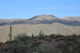
New River Mountains seen from Black Canyon Trail

The Emery Henderson trailhead on New River Road is one of the most convenient points of access to the Black Canyon National Recreation Trail from the Phoenix area. 
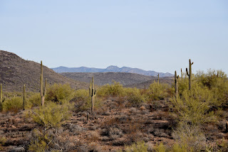
Looking north on the Black Canyon Trail

The 100+-mile historic route runs north from Carefree Highway to the Verde Valley roughly parallelling Interstate 17 along its rugged course.  
Saguaros are a key attraction on the hike

The second leg in the trail, the Emery Henderson segment

straddles desert flats and floodplains between the freeway and the Agua Fria River that spills into Lake Pleasant in the northwest Valley. 

The Emery Henderson trailhead

Its 4-mile length wanders through the last vestiges of neon and industry before ducking into mountainous backcountry, but not before delivering one of the best trips through saguaro cactus country anywhere. 
Some old trail posts are still standing along the route

But, before it gets to the good stuff, hikers must trudge through a half mile of bland terrain, cross the North El Paso Gasline Road and listen to  firearms noise from a nearby shooting range. Sucking up these minor annoyances pays off quickly, though.
An impressive specimen in the Agua Fria floodplain

Following a rocky two-track the trail soon departs the “Sahara of the Suburbs” and tucks into shadeless plains of cholla and creosote surrounded by mountain ranges.  The distinctive mound of 2,980-foot Gavilan Peak dominates the eastern horizon while band of mesas including 2,857-foor Wild Burro Mesa bolster the western skyline. Where the route begins an easy descent into the floodplains of the Agua Fria River, desert flora, led by majestic saguaros, clutters runoff channels and crumbling foothills. 
New River Mountains to the northeast

Dead saguaros are havens for wildlife

Gigantic saguaros sprout from an earthen stew of white quartz chunks, basalt blobs, assorted metamorphic stones and sediments. This complex show of  geology belies the area’s rich mining history.

But it’s the saguaros that are the segment's signature feature.  They huddle in masses around gullies, stand as lone sentinels over pebbly flats and show up as contorted,zoomorphic forms begging to be named. Even the dead ones live on as havens for wildlife and subjects for detail-driven photographers. A smattering of ironwoods and Palo Verde trees sink roots deep into the major drainages that the trail crosses, providing what little shade the trail has to offer.

Desert icons on the Black Canyon Trail

Name that saguaro

The segment ends where the 3.2-mile Boy Scout Loop takes off.  Hikers may turn back here for a moderate 7.6-mile trek or loop around for a long 10-miler. Either way, Arizona’s most iconic cacti are constant trailside companions.

LENGTH:

7.6 miles roundtrip to the loop and back

10.4 miles roundtrip with loop

RATING: moderate

ELEVATION: 1,858  1,989

1,850-1,974 feet to the loop

1,850- 2,315 feet with loop

GETTING THERE:

Emery Henderson Trailhead:

From Phoenix, take I-17 north to exit 232 (New River Road). Turn left and follow New River Road for 3 miles and look for the Emery Henderson Trailhead turn off on the right. The roads are paved all the way to the trailhead where there are restrooms (out of order at this writing), hitching posts, covered picnic areas and plenty of parking and an occasional site host.

INFO & MAPS:

https://bctaz.org/


Tuesday, November 14, 2023

Black Canyon Trail: Biscuit Flat Segment

BLACK CANYON NATIONAL RECREATION TRAIL:

BISCUIT FLAT SEGMENT

Wild burros on Biscuit Flat

Wild burros make lots of tracks--and lots of little burros.  That’s a concern for hikers and land managers because overpopulation can lead to problems like overgrazing, negative impacts on native wildlife, and public safety issues around roadways. 

New River Mesa viewed from Biscuit Flat

With few natural predators and a law that protects them from human hunters, the sturdy African imports that are the descendants of escaped or released pack beasts used by the military, ranchers, Spanish explorers, and miners dating back to the 1500s, the herds can become hordes.

The route follows single and double track paths

The free-roaming, prolific breeders adapted to the Sonoran Desert and other areas in the Western states. Herds quickly grew to the point where they exceed the land’s capacity to support them.  The 1971 Wild-Free Roaming Horses and Burros Act states that the Bureau of Land Management (BLM) and the U.S. Forest Service are responsible for managing and protecting herds and their rangelands as “living symbols of the historic and pioneer spirit of the West.”  

Wild burros cross the Black Canyon NRT

To thin the herds and maintain their health here in Arizona, the BLM uses fertility control and vaccine programs along with periodic “gathers” where burros are helicoptered out of congested public lands and either put up for adoption or transferred to Midwest off-range private pastures where they are taken care of for the rest of their lives.
Biscuit Flat is surrounded by mountains

Cholla line the Black Canyon NRT

The four-legged “spirits of the West” can be observed wandering in several Arizona ranges including the Lake Pleasant Herd Management Area, a 103,000-acre space located 25 miles northwest of Phoenix.  The Biscuit Flat segment of the Black Canyon National Recreation Trail provides non-motorized access into the heart of burro country.

The sandy floodplain of New River


Like the burros that average 400 pounds and 48-inches high, the roughly 100-mile-long historic trail is very much a spirit of Western heritage.

A cactus wren alights on a BCT sign post


It runs from Carefree Highway in Phoenix to the Town of Mayer and has recently been extended into the Verde Valley with new construction.  Following a mashup of ancient travel corridors, wagon roads and livestock tracks that pre-date Interstate 17, the route traverses mountain passes, valleys, sprawling rangelands, defunct mining operations and heritage sites that date back thousands of years.  The 5.9-mile Biscuit Flat segment is, well--flat. 

Signs guide hikers through the New River channel

It’s the first stretch of the route that begins at Carefree Highway and makes a straight shot north to the Emery Henderson trailhead on New River Road just 3 miles west of Interstate 17.
Crossing the New River channel

 
The utterly pancake-level expanse registers like a mood board for a Martian landscape--that is if Mars had cactus, creosote and an ephemeral river running through it.  Resembling images sent back from Mars landers, the place is a massive basin surround by volcanic mountain ranges.
Gavilan Peak (2,980 feet) on near horizon


The thorny plain is dressed in scuffed shades of green muddled with dusty earth and course, dried forbs. Like the Native inhabitants and pioneers that wandered through, this place cut its teeth on surviving in the unforgiving spillway of a desert river.

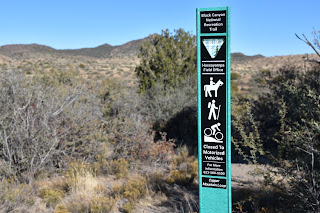
Green sign posts mark the trail

 
Emery Henderson trailhead on New River Road

Without obvious lures, the vultures come anyway. Riding up drafts, the carrion-eating scavengers make lazy loops and investigative swoops often enough to suggest, something below is dead.  Maybe a javelina, rabbit or coyote. 

An uncommon white burro on Biscuit Flat

What’s alive are the burros, expanding suburbs, a widening interstate, shooting range, prison complex, fairways, a municipal transfer station and the massive semiconductor manufacturing plant rising from desert that surrounds the dusty trail and its relics of the past.
Hikers must watch for toppled signs

Beginning at the north end of the segment at the Emery Henderson trailhead, the path heads south on a mix of singletrack, two-track and dirt roads.  The trail is signed throughout but is crisscrossed with trampled paths made by the burros and fading dirt roads that can be confusing. 

Cave Creek Mountains viewed from Biscuit Flat

Bradshaw Mountains on the north horizon

Hikers must take care at intersections to spot the next sign to stay on track. (Some signs were down at this writing but did not present a navigation problem).  At about the 2-mile point, the trail enters the sandy floodplain of New River and makes a rocky crossing through a tamarisk-choaked channel.
Mountain vistas on Biscuit Flat

 
Old trough on Biscuit Flat

Signs anchored by rock piles guide the way through the weedy waterway.  On the south bank, the trail heads up an embankment, passes a gate and begins a shade less walk through open desert.  The pop-pop of pistol fire from the nearby Arizona Game & Fish Department-managed Ben Avery Shooting Facility grows louder where the trail briefly shares space with the Valley-circling Maricopa Trail and crosses Deadman Wash.  The south trailhead is little more than a dirt pullout and gate along busy Carefree Highway. 
Saguaros on Biscuit Flat

If you parked a shuttle vehicle here, be sure to close the gate behind you to keep the legacy burros from wandering into 21st-Century traffic.

LENGTH: 5.9 miles one-way

RATING: easy

ELEVATION: 1,598 – 1,878 feet

GETTING THERE:

NORTH: Emery Henderson Trailhead: From Interstate 17 in north Phoenix, take the New River Road exit 232 and go 3.1 miles west to the trailhead on the right. The large parking area has space for trailers. There’s a restroom, but it was out of order at this writing.

SOUTH: Bob Bentley Trailhead: From Interstate 17 in north Phoenix, take the State Route 74 (Carefree Highway) exit 223 and go 1.8 miles west to the trailhead on the right. No facilities.

INFO & MAPS: Black Canyon Trail Coalition

https://bctaz.org/

WILD BURRO INFO

https://www.blm.gov/whb

https://www.blm.gov/programs/wild-horse-and-burro/herd-management/herd-management-areas/arizona/lake-pleasant

WILD BURRO ADOPTIONS

https://aci.az.gov/capabilities/wild-horse-burro-training-and-adoption/


Monday, November 28, 2022

Black Canyon Trail: Copper Mountain Segment

BLACK CANYON NATIONAL RECREATION TRAIL: COPPER MOUNTAIN SEGMENT

Ubiquitous yet largely invisible to the casual hiker, barn swallows play an interesting game of hide-and-seek with those who wander through their habitats.

Cattle graze near the Black Canyon Trail

The migratory species feeds in mid-air, capturing insects (they love flies, which explains their name) in acrobatic swoops over open terrain, rangeland and farms. 

Barn swallow nests in the SR 69 tunnel near the Big Bug trailhead

Similar to cliff swallows, the tiny birds build their nests in natural rock crevasses, caves and crags, but have discovered that human-made structures like highway tunnels, bridges, culverts and abandoned buildings are also suitable locations for their distinctive nests. 

Prescott Hiking Club members take a break on the Copper Mtn Segment

Plastered to ceilings and walls, the cup-shaped nests are made of dry bits of local grasses molded with mud and lined with feathers.  For observant hikers, the earth-toned cups-which mostly look like wads of mud flung onto ceilings-- can be spotted in overhead shadows in the concrete tunnels that usher trails under busy roads and freeways.

The tunnel under State Route 69 in the Yavapai County town of Mayer outside of Prescott is rife with nests as the surrounding landscape is dotted with farms, washes and open range where the swallows never hunger for a meal of insects.

A handsome longhorn regards hikes on the BCT

Said tunnel ferries trail users between the Big Bug and Copper Mountain segments of the Black Canyon National Recreation Trail, a 100+-mile historic route that runs between Phoenix and the Verde Valley.  While a walk through the tunnel is—at least for nature nerds—an interesting passage, there’s much more to love about the Copper Mountain segment. The trip begins at the Big Bug Trailhead, that's located about an hour's drive north of Phoenix,  by taking the left fork a few yards south of the restroom, passing through the tunnel and heading into wide open pastureland. Save for a few lonesome junipers, the scrubby, windswept terrain has little shade and even less to disrupt big mountain vistas including glimpses of the long mesas of the Pine Mountain Wilderness and the pine-covered Bradshaw Mountains. 
Copper Mountain Loop adds 8.7 miles to the hike

After passing a couple of ranch sites, the trail dives into the an unrelenting series of ups-and-downs.  At the 1.6-mile point, the trail meets the Copper Mountain Loop junction. 
Rock cairns mark the hilly route

The 8.7-mile add-on loop heads left for a twisting trip through the foothills below 5,026-foot Copper Mountain.
Open rangeland dominates the landscape

The loop reconnects with the Copper Mountain segment at the Russian Well Segment 3 miles north of the south junction.
Copper Mountain viewed from the trail

To stay on the main trail, head right and follow the route northward through drainages, gullies and grasslands where grazing cattle are nearly as pervasive as the swallows that dart among the cows and cacti diving for their dinners.
Pine Mountain Wilderness on horizon

LENGTH:

Copper Mountain Segment: 4.6 miles one-way ((.2 miles out-and-back)

Copper Mountain Segment with Loop: 15.1 entire loop plus access from trailhead

RATING: moderate

ELEVATION: 4,020 - 4,414 (1,265 feet accumulated elevation change)

GETTING THERE:

Big Bug Trailhead:

From Interstate 17 in Cordes Junction take exit 262 for State Route 69 heading north toward Prescott. Continue 4.2 miles to the signed turn off for the Black Canyon Trail on the left.

FACILITIES: vault toilet

INFO & MAPS:

Black Canyon Trail Coalition

https://bctaz.org/copper-mountain-loop/


ABOUT THE PRESCOTT HIKING CLUB

https://www.prescotthiking.com/


INFO ABOUT CLIFF & BARN SWALLOWS

https://azdot.gov/adot-blog/nesting-birds-are-protected-during-construction


Monday, August 22, 2022

High Desert Trail

HIGH DESERT TRAIL

Black Canyon City

Bradshaw Mountains seen from High Desert Trail

Tethered to both a kiddie playground a backcountry historic trail, High Desert Park in Black Canyon City doubles up as an approachable community gathering space and gateway to the rugged canyonlands of Central Arizona.
Blooming barrel cactus on High Desert Trail

Dubbed a “Desert Gem” by the High Desert Helpers, Inc., the 501(3)(c) non-profit that manages the park and the High Desert Trail within it, the Yavapai County site packs a massive amount of fun into its 89.1-acre parcel.
Kings Canyon Overlook on the "blue" loop

The park is situated west of Interstate 17 among the suburbs of Black Canyon City, Rock Springs and the foothills of the Bradshaw and New River Mountains.

Swing sets, restrooms, water, picnic tables, grills, sports facilities and community center anchor the family-friendly plot while a total of 2.7 miles of outdoor trails offer non-intimidating ways to get some exercise.

A rabbit hops through a cholla forest

The High Desert Trail has two parts. The main “blue” trail is a 1.7-mile loop and the 0.3-mile “yellow” trail (also known as Joedy’s Trail) that may be used for a shorter loop option.

"Tablelands" stand out on the High Desert Trail

The hike begins at a shade pavilion with maps and interpretive signs describing local wildlife. Heading west for a counterclockwise hike is the preferred plan as it takes on the climbing section of the trail early on. Initially the trail moves through a cholla forest that’s part of the park’s 0.8-mile original nature trail that has been lassoed into the blue perimeter loop.

Junction of the "blue" and "yellow" trails

Hike begins in High Desert Park in Black Canyon City

 Rustic wood signs placed along the route identify native plants such as jojoba, barrel cactus and saguaros.  Right from the get go and throughout the hike, gorgeous mountain views and a tableland of flat topped mesas peek through cholla forests and thickets of diverse desert vegetation.
Desert senna blooms April - October

Quartz and basalt: part of the area's complex geology

Rusty artifacts on the "yellow" trail

The trail’s appeal is augmented with benches placed at scenic spots and two spectacular overlook points. A short spur trail leads to Kings Canyon Overlook, a stony edge on the far west end of the blue loop trail that hangs over the deep gorge of Black Canyon.
Monsoon rains coax the green out of ocotillo

At the south end of the perimeter loop, the Rock Springs Overlook peers over the severe cuts of the Agua Fria River channel, and the famous Rock Springs CafĂ©, pies and all. 
Rock Springs scenic overlook

The "yellow" trail cuts through the main "blue" loop

Never quite escaping the subdued rattle and hum of Interstate 17, the loop’s east leg dips downhill to meet a connector path that leads to a popular trailhead for the  Black Canyon National Recreation Trail—a long-distance, non-motorized historic route that goes from Phoenix to the Verde Valley. The final leg swings north through classic high desert eco zones and saguaro-lined ridges replete with a sampling of the quartz outcroppings, metamorphic stone slabs and volcanic ejecta that contribute to the area’s complex geological footprint, completing a fun and informative trek lodged between freeway and wilds.
Spectacular mountain views dominate the hike

LENGTH: 2.1 miles (blue and yellow trails)

RATING: moderate

ELEVATION:  2,024 – 2,153 feet   

GETTING THERE:

19001 Jacie Lane, Black Canyon City.

From Interstate 17, take the Black Canyon City/Rock Springs exit 242. Turn left at the stop sign, then right at the Old Black Canyon Highway junction. Continue a short distance  to Jacie Lane, turn left and follow the road into the park.

PARK HOURS: Dawn to dusk daily

FACILITIES: restrooms, water, picnic tables & grills, sports facilities, kiddie playground

INFO:

Yavapai County Parks

yavapaiaz.gov/facilities/yavapai-county-parks/high-desert-park

High Desert Helpers, Inc.

highdeserthelpers.org/park/