Find A Trail. Start Your Search Here:

Showing posts with label Sierra Vista. Show all posts

Monday, October 11, 2021

Miller Canyon

MILLER CANYON

Miller (L) and Carr (R) Peaks seen from Miller Canyon

Arizona’s isolated mountain ranges known as “sky islands” are like no other places on earth.  Whether explored by car, like a drive up the Swift Trail to Mount Graham in the Pinaleno Mountains near Safford or a by foot in the Santa Catalina range in Tucson, the vertical journeys take travelers from sweltering desert valleys to cool alpine climes over just a few, very steep miles.

Oaks arch over the lower end of Miller Canyon

Some of the most interesting sky island destinations are in the Huachuca Mountains located near Sierra Vista in the Coronado National Forest in southeastern Arizona. 

Aspens glow in autumn gold below Miller Peak

Rich in both biodiversity and human history, the chain of ragged peaks and crests that jut abruptly from the desert floor are laced with dozens of hiking trails that wind through breezy grasslands, streambeds, canyons, mineral-imbued escarpments and exposed pinnacles for myriad exploratory opportunities.
Hike is in the Miller Peak Wilderness area

One of the easiest to get to is the Miller Canyon Trail No. 106.

Massive boulders line the trail in Miller Canyon


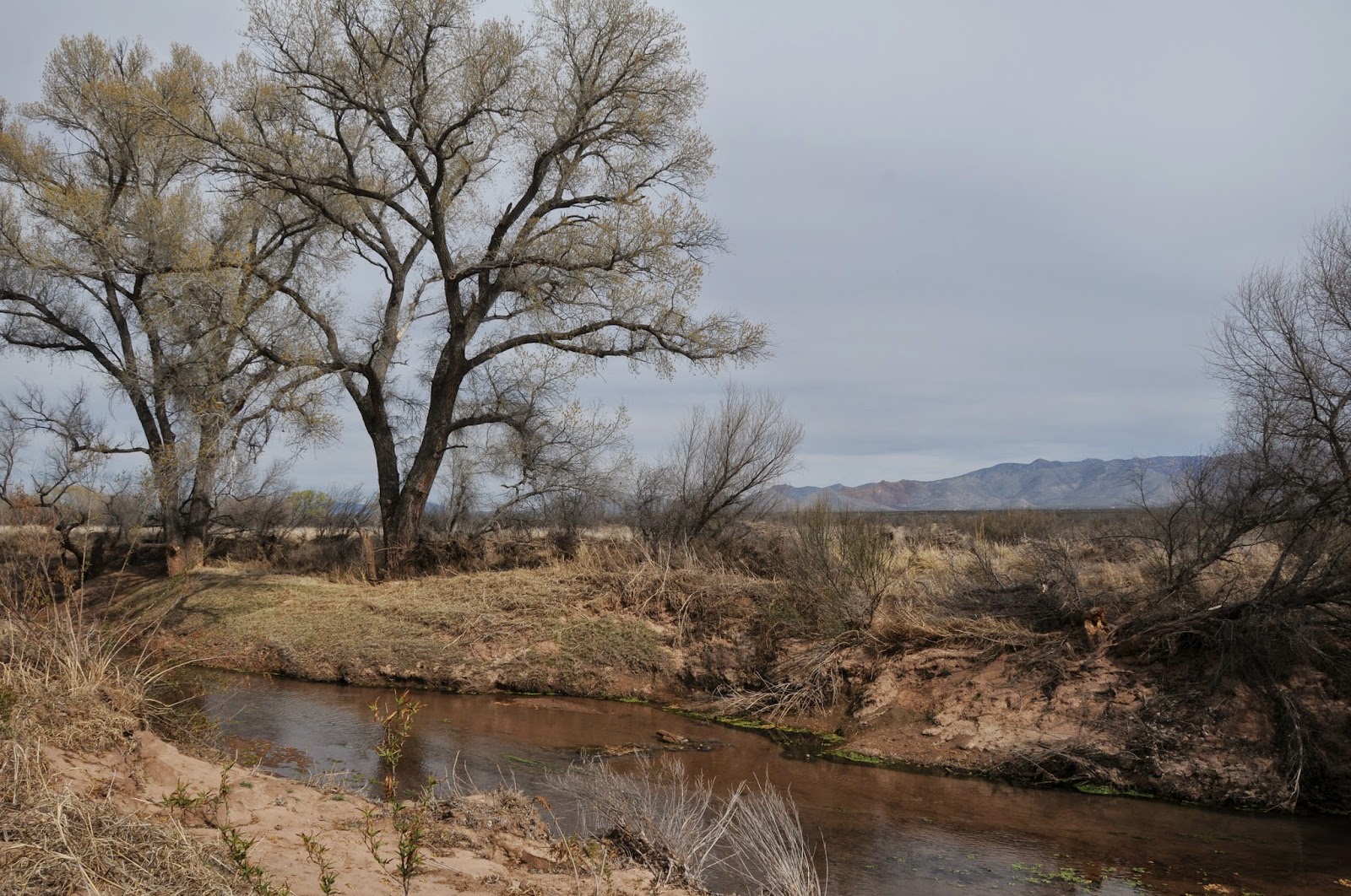
The 3.5-mile route begins by circumventing a slice of private property before heading out on a former mining road.  Within a few yards from the trailhead, views of the San Pedro Valley and the Mule Mountains around the town of Bisbee peek out from a fringe of oak trees and high desert scrub and cacti.

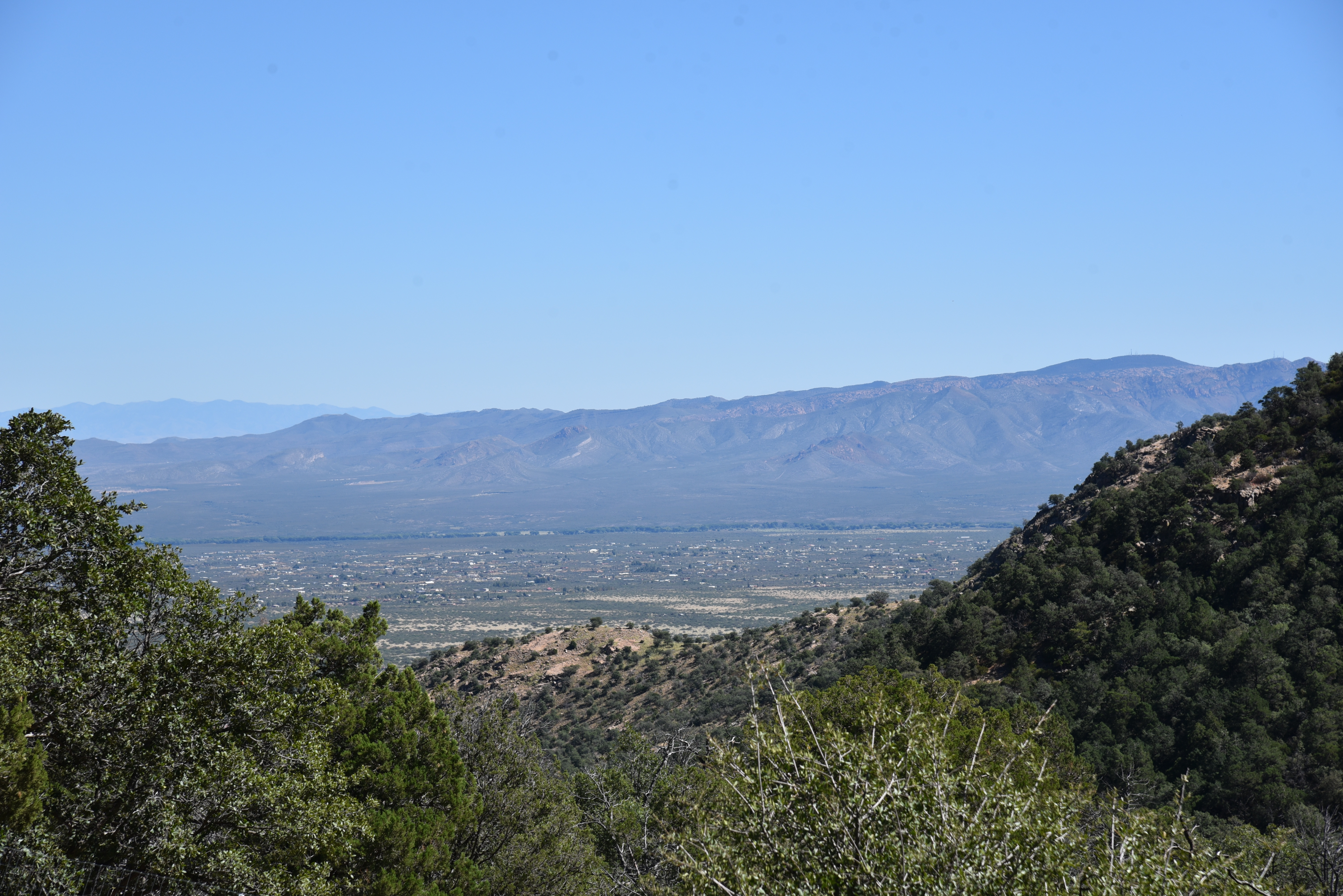
View of the San Pedro Valley from the trail

Pines and Douglas fir trees shade the upper trail

 This little tease of vistas is the last glimpse offered before the route enters the Miller Peak Wilderness area and slips into a riparian zone at the head of the canyon. 
Trail climbs from desert scrub to alpine aspens

Shaded by gigantic sycamore and walnut trees, the green oasis is fed by an intermittent stream that flows from springs and runoff originating high in the hills above.  The path gradually leaves the high desert vegetation zone and moves into a wetter, canyon-bound corridor of big-tooth maples and soaring canopies of arching oaks. 
The area has dozens of connecting trails

The trail crosses the streambed several times as it works its way uphill, hugging the edge of the sliver-thin canyon cluttered with flood debris and boulders. 
Bigtooth maples clutter a drainage

Some of the crossings expose rusty 19-century pipes that were once used to funnel water to nearby towns.  As the trail gains elevation and contracts from wide dirt road to thin footpath, pine and Douglas fir trees dominate the forest, keeping the trail nice and shady for a good part of the way.
Desert and forest biozones collide in Miller Canyon

The climbing is steady but not too difficult until around the 1.5-mile point where the first set of switchbacks herald the start of the serious lung workout ahead.  This is about where relics from defunct mining operations begin showing up in oxidized heaps off the trail. 
The trail crosses several drainages

Look for gears, a boiler and miscellaneous parts disintegrating among abandoned digs. 
Climbing gets steep on the switchbacks

A second set of switchbacks make a final, more aggressive ascent, passing by distinctive Bathtub Spring to meet the Crest Trail No. 103 on an aspen-dotted ridge between Carr and Miller Peaks.
Defunct mining equipment decorates the trail

Now clear of the thick tree cover and confines of the canyon, hikers get a second shot at gorgeous mountain and valley vistas. 
Looking into Mexico from Miller Peak summit

The Crest Trail marks the end of the Miller Canyon Trail, however, it also provides access to the spur trails that ascend both peaks.  
Sycamore trees shade the lower trail

From the junction, it’s another 1.3 miles to 9,230-foot Carr Peak or 2.3 miles to 9,466-foot Miller Peak. Miller Peak, which is located just 4 miles from the Mexico border, holds the distinction of being the southernmost high peak in the United States and is a must-do for mountain-obsessed Arizona hikers.

LENGTH: 7 miles round trip

With Miller Peak: 11.4 miles round trip

With Carr Peak: 9.4 miles round trip

RATING: difficult

ELEVATION: 5,750 – 8,525 feet, Miller Canyon Trail only.

5,750 – 9,466 feet with Miller peak

5,750 – 9,230 feet with Carr Peak

GETTING THERE:

In Sierra Vista, go 9 miles south on State Route 92 to Miller Canyon Road (Forest Road 56) on the right.  Continue 2.5 miles on FR 56 to the Miller Canyon trailhead at the end of the road.  Forest Road 56 is a narrow dirt road with some rough spots.  While carefully driven sedans can get through, a high-clearance vehicle is recommended.  Hike begins near the stop sign.

INFO:

Coronado National Forest

https://www.fs.usda.gov/recarea/coronado/recarea/?recid=25496

Learn more about sky islands:

https://skyislandalliance.org/the-sky-islands/

Monday, October 26, 2015

JOE'S CANYON-YAQUI RIDGE

PASSAGE 1
Arizona National Scenic Trail
Start of the Arizona Trail at the U.S.-Mexico border

If you're reading this, you might be a hiker who has been motivated to take a good long trek by recent movies like Wild and A Walk in the Woods . While these inspiring films romanticize long distance hiking, it's important to do your homework and manage your expectations before hitting the trail.
Here in the Southwest, the obvious draw for a marathon hike is the 817-mile Arizona Trail.
Like many people with a day job whose long-term plans include hiking the entire route from Mexico to Utah, I've been chipping away at the miles in opportunistic grabs and passage-long chunks.
Turns out, this bit-by-bit style is the way most hikers approach the Arizona Trail. Sirena Dufault, AZT Gateway Community Liaison says," You don't have to hike the entire AZT to enjoy it. It's a "choose your own adventure", where you decide how much of a challenge is comfortable for you. Hikers who have completed the trail range from age 19 to folks in their 70s. Some have done it in 21 days while others section hike it for a decade or more." Shawn Redfield, AZT Trail Director concurs. "A through- hike is nothing more than a bunch of section hikes done in series with resupply breaks in between. Preparation is critical, though. There is a small portion of hikers who are not prepared and as the popularity of long distance hiking grows, fueled by recent movies based on it, this translates into hikers who become a danger to themselves and the people who will come to help them."
Redfield adds that research and conditioning for a though-hike can take months and that it's vital to understand the AZT's special challenges of water scarcity, heat, elevation change and remote terrain where rescue is not an option. (Become a member of the of AZT Association to get access to tons of current trail information, water data and opportunities to speak with others who have conquered the route: http://www.aztrail.org/membership/join.html).

On October 24th, I stood at the U.S.-Mexico border where a simple sign denotes the beginning of the AZT. It took me 12 years to get there. Having hiked parts of Passage 1 from Montezuma Pass, through Miller Peak Wilderness (with a side trip to the 9,466' peak) and on to Parker Canyon Lake, this last mile was one of several blaring holes on my progress map. Prior attempts had been rained out, burned out or thwarted by schedule conflicts, so I vowed to bite the bullet and hike rain-or-shine to bridge this gap by the end of 2015. Rather than starting at the traditional Montezuma Pass trailhead, I chose to approach from the Coronado National Monument Visitor Center by hiking 2.4 miles on the Joe's Canyon Trail then 1-mile south on Yaqui Ridge Trail (AZT) to the border. This exceptional trek begins with a 1,400 foot ascent up a rugged drainage to Smuggler's Ridge, a knife-edge saddle with see-forever views overlooking the Mexican State of Sonora. The final mile makes a 600 foot decent to a border monument that marks the beginning (or end) of Arizona's most epic journey. Next up in my gap-plugging adventure: the Mazatzal Divide.
LENGTH: 6.8 miles roundtrip
RATING: moderate
ELEVATION: 5,006' - 6,493'
GETTING THERE:
From Tucson, travel south on Interstate 10 to State Route 90 Exit 302 and go 25 miles south to Sierra Vista. Connect with State Route 92 and continue 16 miles to S. Coronado Memorial Drive and follow it 4.7 miles (road becomes E. Montezuma Canyon Road) to the Coronado National Memorial Visitor Center (open 8 a.m. to 4 p.m. daily. Closed Thanksgiving and Christmas). Trail begins a few yards up the road beyond the center. Parking is free. Restrooms.
INFO:
Coronado National Memorial:
MORE PHOTOS:

Monday, February 16, 2015

SAN PEDRO RIVER TRAIL

SAN PEDRO RIVER TRAIL
San Pedro Riparian National Conservation Area
San Pedro River 

From its headwaters in Sonora Mexico to the confluence with the Gila River near Winkelman, the San Pedro River flows 140 miles north through 57,000 acres of riparian wildlife habitat surrounded by scrub and sprawling grasslands of the Sonoran and Chihuahuan deserts. Cradled between the high peaks of the Huachuca Mountains and the ore-rich hills around Bisbee, the river is one of the last free flowing waterways in the Southwest.

Over its lacy course, the unbridled river unfolds in idiosyncratic oxbows, linear pools, marshes and mesquite-cluttered floodplains giving a glimpse of what the area might have looked like to ancient inhabitants.

The 27-mile San Pedro River Trail runs adjacent to the water and a web a spur paths leading to the muddy banks and pebble-strewn sandbars add myriad opportunities for viewing some of the 350 species of birds, 80 species of mammals, 68 kinds of reptiles and amphibians and 2 species of native fish that reside in a tangled forest of cottonwood, willow and ash trees.

Numerous trailheads and backcountry camping areas are spread long the trail's length making for easy car shuttle, day hike or backpack outings.

The well-signed route is peppered with sites that chronicle the area's human history. There's a Clovis Paleo-Indian culture locale (11,000-8,000 B.C.), petroglyph gallery, mammoth kill pit, remnants of Spanish and Mexican colonial explorations and the foundations of territorial ranching and mining outposts. Taking in the entire scope of SPRNCA is a multi-day venture, but for a quick day trip or to learn more about the conservation area, a good place to start is at the San Pedro House trailhead. Here, knowledgeable volunteers from the Friends of the San Pedro River host guided hikes and are on hand to help optimize your itinerary. This is also the stepping out point for a trek along the San Rafael del Valle section of the route that culminates 8 miles upstream at the Hereford Bridge trailhead.
LENGTH: 27 miles one-way
or 8 miles one-way for the San Rafael del Valle section
RATING: easy
ELEVATION: 3762' - 4071'
FACILITIES: Restrooms, bookstore, picnic tables at San Pedro House. Restroom at Hereford Bridge.
FEES: No trailhead fees. Backcountry camping permits are $2 per person per day.
GETTING THERE:
From Phoenix, take Interstate 10 east toward Tucson. Continue to the AZ90 Fort Huachuca/Sierra Vista exit #302. Follow the AZ90 signs through Sierra Vista, then:
SAN PEDRO HOUSE TRAILHEAD:
From Sierra Vista, continue east on AZ90 to milepost 328 and turn right (south) at the sign just before the bridge.
HEREFORD BRIDGE TRAILHEAD:
From Sierra Vista, continue east on AZ90 to Moson Road (traffic light just past milepost 325), turn right and continue 7.6 miles to Hereford Road. Turn left, go 4.6 miles and turn right at the sign just past milepost 8 before the bridge. Roads are paved up to the 0.1-mile access roads which are good gravel.
INFO & MAPS:
San Pedro Riparian National Conservation Area, (520) 439-6400
San Pedro House Trails System: (520) 458-3559
Friends of the San Pedro River
MORE PHOTOS:

Saturday, February 7, 2009

MILLER PEAK


MILLER PEAK Coronado National Forest, Sierra Vista Located just a few miles from the Mexican border, Miller Peak is the southern most mountain summit in the United States. The 9,466-foot high point of the Huachuca range is the product of a “super volcano” created by the Pacific continental plate sliding under the North American plate. Millions of years of cataclysmic geological events have transformed the landscape and left behind some of the most complex geography in the country. The lower trail passes by several abandoned mine shafts that now provide shelter for colorful lizards as well as undocumented Mexican nationals as they attempt to avoid detection by border patrol agents and the surveillance device that hovers over the area. The vegetation and geology changes continually along the way; passing through grasslands, forests and cliffs of marble before emerging onto an exposed ridge for the final climb to the limestone summit where views of southeastern Arizona’s basin and range topography transcend international boundaries. NOTE: Mexican nationals frequently use this route to cross into the USA. So, you may run into them or stumble upon their litter-strewn campsites. In my experiences, they usually run away when they encounter hikers. NOTE: the trail sustained substantial damage from the 2011 Monument Fire. LENGTH: 10.6 miles roundtrip RATING: difficult ELEVATION: 6,440 - 9466 feet GETTING THERE: From Phoenix, take I-10 past Tucson and connect to Highway 90 south to Sierra Vista. From Sierra Vista, follow Highway 92 south for 14 miles to the turn off for the Coronado National Monument (FR 61) and continue past the visitor center and up the winding unpaved road to the Montezuma Pass lookout. The hike begins on the Crest Trail located to the north east of the parking lot.
INFO: http://www.fs.fed.us/r3/coronado/forest/recreation/trails/crest.shtml