White
Horse Hills
 |
| The mouth of the north pass at White Horse Hills |
Within the
pass that cuts through the pyramid-shaped pinnacles of the White Horse Hills,
voices carry. But, voices are rare in the barren cluster of vertical mounds
located below the north face of the San Francisco Peaks 20 miles north of
Flagstaff in Coconino National Forest.
This is not
the kind of place hikers drool over visiting, it’s allure draws more curiosity
seekers than hard-core trekkers, especially since it competes with nearby Passage
34 of the Arizona Trail. Inquiring minds might well find amusement on the
obscure dirt road that shows up on topographic maps as a oversimplified line
connecting Forest Roads 514 and 418.
 |
| A storm brews above Saddle Mountain (left) |
 |
| Kendrick Mountain seen from FR 9219M |
 |
| Painted Desert views stand out on the route |
But the
reality of hiking the deceptively straight forward course of Forest Road 9219M,
which runs down the center of the lumpy conglomerate, is a bit more
complicated.
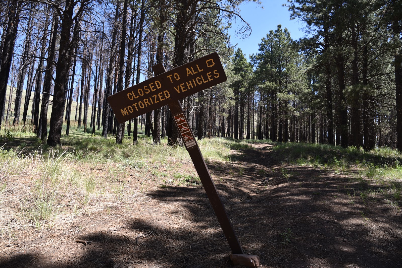
The
section of FR 9219M that ascends the mountain pass is now closed to motorized
traffic and its point-to-point length is only 2.8 miles, yet for those without
a good sense of direction, picking out the overgrown path can be a challenge.
Still, with two options to explore the area, expert and novice hikers alike can
experience this unusual landform.
 |
| Ponderosa pines shade segments of both routes |
The
North Route
 |
| View from the high pass of White Horse Hills |
The
easiest route begins at Forest Road 514. From a trailhead that’s shared with the
Arizona Trail, follow Forest Road 9006R for a half-mile to Forest Road 9219M.
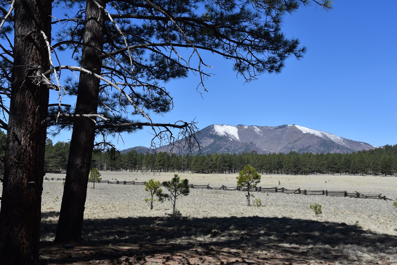
Veer right and hike the dirt two-track as it makes an mild 400-foot climb
through patches of pines and shadeless meadows. Views along this nondescript
backroad are astonishing. Dozens of volcanic landforms including 8,880-foot
Saddle Mountain and 10,418-foot Kendrick Mountain fill the horizons while hazy
glimpses of the Painted Desert and the rim of the Grand Canyon roll out to the
northeast.
 |
| The route shares a trailhead with the Arizona Trail |
Straight
ahead, Arizona’s highest peaks that top out at 12,643 feet, cast shadows on the
destination: the White Horse Hills. Also known as Marble Mountain, the
geological curiosity is a dome laccolith, a volcanic feature that forms when subterranean
magma pushes up layers of older rocks from below, sort of like a blister that
never breaks the surface. Described by
geologist John V. Bezy in A Guide to the Geology of the Flagstaff Area,
the multi-peaked massif formed around 850,000 years ago.
 |
| There's lots of solitude in the White Horse Hills |
 |
| A faint trail ascends to the top of the pass |
Thousands
of years of erosion and recent wildfires have shaped the terrain into a desolate
yet oddly appealing pocket of stark rhyolite hills and exposed layers of ancient
sediments, previous volcanic flows and ragged outcroppings of Redwall limestone
that were changed into marble by the heat of rising magma. At the 1.5-mile
point, the road hike ends in a patch of Ponderosa pines at the mouth of the
mountain pass where a barbed wire fence and a toppled sign bar motorized travel
into the hills. There’s no gate and no easy way to get through the fence. As
it’s important to never cut or alter fences on forest lands, I called this
scenic spot the turnaround point and set out to explore the hills from the
south.
 |
| Thistle are plentiful along the routes |
 |
| White Horse Hills is a dome laccolith volcanic feature |
The
South Route
Although
hiking the hills from the Forest Road 418 access point is more difficult, it
gets you into the guts of the laccolith. A short but steep and slippery climb on
a disintegrating road leads to a landing where the road seems to disappear
entirely. To find the fading track, look ahead to spot a barely discernable
road cut between two conical peaks, the highest of which reaches 9,065 feet.
Follow this path 300 feet uphill to the highpoint saddle—a dizzying perch
surrounded by sheer bluffs, broken clefts and boulder-filled ravines. Through
the V-shaped gap in the pass situated at 8,738 feet, flatlands dotted with
cinder cone volcanoes and the contrasting green pastures of Kendrick Park are
visible 1,000 feet below. From this point, the path becomes clearer, but still
tricky in places, and can be spotted snaking across the eastern (to the right)
slopes below. Carefully work your way down the incline and walk toward the
barbed wire fence (8,062 feet) at the 1.3-mile point. Again, unless you can
squeeze under the wire without causing damage, return the way you came.
 |
| Common mullien thrive in meadows below the hills |
 |
| White Horse Hills sit at the base of San Francisco Mountain |
 |
| Wildfires and erosion have shaped the White Horse Hills |
 |
| Southern access point to White Horse Hills |
 |
| The eroded innards of White Horse Hills |
LENGTH:
From the
North to the fence: 3 miles round trip
From the
South to the fence: 2.6 miles round trip
RATING: easy or difficult depending on
route
ELEVATION:
North
access: 7,647 – 8,062 feet
South access:
8,062 – 8,738 feet
GETTING
THERE:
North
Access FR 514:
From
Flagstaff, go 21 miles north on U.S. 180 to Forest Road 514 (Kendrick Park
Road). Turn right and continue to just past the 3-mile marker at Kelly Tank and
park in the dirt lot on the right at the beginning of Forest Road 9006R. This
is directly across from an Arizona Trail gate.
South
Access FR 418:
From
Flagstaff, go 19.5 miles north on U.S.
180 to the north access for Forest Road 151 (Hart Prairie Road) located past
milepost 235. Turn right and continue 1.6 miles to Forest Road 418, veer left
and go 2 miles to a small dirt turnout just past a 2-mile post where there’s a
“closed to motorized use” sign on the left. Parking is limited to turnouts
along the road. Do not block private driveways.
Access
roads to both trailheads are rough dirt suitable for all carefully driven
vehicles.
INFO: