Find A Trail. Start Your Search Here:

Showing posts with label Skyline Regional Park. Show all posts

Friday, January 6, 2023

Javelina Summit Trail

JAVELINA SUMMIT TRAIL
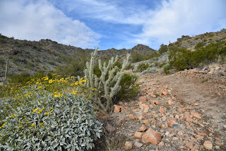
Brittlebush colors the Tortuga Trail


One of four difficult-rated summit hikes in the Skyline Regional Park in Buckeye, the Javelina Summit doesn’t scrimp on thrills.  The 0.9-mile-long trail spools off connecting routes in the park’s far east end. 

View from the Javelina Summit Trail

While it’s “just” a 745-foot climb from trail base to summit, that accounts for less than half the story.
Javelina Summit (right) viewed from Tortuga Trail

Getting to the 2,200-foot mountain highpoint involves using three trails and logging over 1,700 feet of accumulated elevation change.
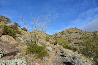
Hike begins on tehe Quartz Mine Trail

The rollercoaster-style trek starts from the main trailhead area with a 1.6-mile hike on the Quartz Mine Trail. About a half mile in, first peeks at the destination loom on the horizon. The prominent ridgeline rising over foothills and valleys looks imposing. And irresistible!
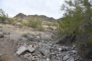
Beginning of the Javelina Summit Trail

The undulating path winds through washes and slopes below ragged ridges and stone outcroppings before making an ascent to a saddle where the Tortuga Trail spins off to the east.
Brittlebush are plentiful in Skyline Regional Park

The Tortuga Trail leg of the hike takes back much of the elevation gained with a smooth downhill on long lazy switchbacks. At the half-mile point, the route encounters its final segment, the 0.9-mile Javelina Summit Trail.
View of the White Tank Mountains

It's here where the real work begins. While the lower quarter mile feels just moderate and has a few level bends, the climbing becomes an unrelenting uphill haul with loose rock and a fair amount of exposure. The trail is well engineered but still very steep and precipitous as it clamors along a knife-edge sharp, rocky backbone. Persistence and careful footwork pay off on the tiny summit.

Rock outcropping on Tortuga Trail


Javelina Summit Trail is steep and edgy.

The airy pinnacle displays 360-degree vistas of the southern White Tank Mountains, the distant profile of Downtown Phoenix, the Sierra Estrella Mountains and sprawling desert plains.

LENGTH: 5.8 miles round trip (out and back hike)

RATING: difficult

ELEVATION: 1,312 – 2,200 feet (over 1,700 feet of accumulated elevation change)

GETTING THERE:

Skyline Regional Park, 2600 N. Watson Road, Buckeye.

From Interstate 10 in Buckeye, take the Watson Road exit 117 and go 2 miles north to the park. Roads are paved.

HOURS: Sunrise to sunset daily

DAY USE FEE: none

FACILITIES: restrooms, picnic ramadas, camping

INFO:

Skyline Regional Park

https://www.buckeyeaz.gov/community/skyline-regional-park

Monday, January 3, 2022

Crest Summit

CREST SUMMIT

Mine site on the Quartz Mine trail

Situated in at the southern end of the White Tank Mountains, Skyline Regional Park in Buckeye offers an enticing mix of hiking, biking and equestrian trails.  
Big Valley views from Crest Summit

T
he 8,700-acre park has nearly 20 miles of interconnected trails that wrap around a stronghold of mountain peaks, scoured washes and lofty ridgelines. 
Crest Summit trail is short but very steep

With trail choices that range from barrier-free interpretive strolls to difficult, vertigo-inducing climbs, there’s something for everybody in this West Valley recreation hub. 
Quartz Min trail passes through washes

While all the park trails frame outstanding vistas, there’s one edge-teetering route that skims the roof of the park and even ties in an optional summit side trip.  
Lichens color rock outcrops in Skyline Regional Park

The circuit, which uses the Quartz Mine, Lost Creek and Skyline Crest trails, wanders through the park’s east sector with a sequence of twists, dips and ascents that provide continual panoramic views. 
Challenging Skyline Crest trail traces a ridgeline

Begin on the Quartz Mine trail near the number 3 picnic ramada.  Head east (go left) follow the moderate single track through gullies and washes as it descends along stony escarpments above desert plains. 
Steep switchbacks on Skyline Crest trail

At the 1.4-mile point, the route meets the Skyline Crest junction. For this trip, continue uphill on Quartz Mine. Now steeper and more precipitous, the trail curves north, topping out near a mound of chipped white stone spilling from what appears to be a filled in prospect—the Quartz Mine. 
Trail menu at Skyline Regional Park

The trail traverses a ridge for another 1.1 miles to where it connects with the Lost Creek trail. Turn left, hike less than a half-mile and hang another left onto the Skyline Crest trail.  This leg of the circuit is a real treat. Rated difficult, the rocky, undulating path hugs a knife-edge ridgeline with steep drop offs and jaw-dropping views all around.  After a mile, a set of switch backs winds downhill to land hikers on a saddle where the optional Crest Summit trail presents an optional add-on.  
Park trails are well signed

The short, vertical side trip tacks on only 0.34-mile to the hike, but the additional 200 feet of elevation gain rolls out in aggressive, straight-up style.  The extra effort pays off with unobstructed, 360-degree vistas of the Sierra Estrella Mountains to the northeast, Gila Bend Mountains in the southwest and the Big Horn Mountain Wilderness and the Hassayampa Plain in the northwest.  
Quartz chunks line the trails

From this high-point lookout, the trail descends through a saguaro-cluttered ravine to reconnect with the Quartz Mine Trail where hikers retrace their steps to the trailhead.

LENGTH: 5.94 miles as described here

RATING: difficult

ELEVATION: 1,345 - 2,130 feet

GETTING THERE:

2600 N. Watson Road, Buckeye.

From Interstate 10 in Buckeye, take the Watson Road exit and continue 2 miles north to the park. Roads are paved.  There are restrooms, water, picnic ramadas and camping by reservation at the trailhead.

HOURS: sunrise to sunset daily

INFO & MAPS:

Skyline Regional Park

https://www.buckeyeaz.gov/community/skyline-regional-park/about-the-park

Monday, November 12, 2018

PYRITE TRAIL

PYRITE TRAIL
The Pyrite trail traverses several ridges & high passes.
One of the most striking features of Skyline Regional Park’s Pyrite Trail is its quiet atmosphere.  The fresh-cut route is one of the newest trails in the 8700-acre park located 2 miles north of Interstate 10 in Buckeye. 
Sierra Estrella Mountains on the far horizon.
The moderate-rated path begins 1.4 miles from the trailhead and can be harnessed into several loop hike options.  Exploring the park’s western edge, the trail spins off the heavily-travelled Granite Falls-Chuckwalla-Turnbuckle circuit and heads into a cloistered wilderness of sound-stifling mountain peaks and scoured washes.
Creosote bloom along the park trails.
 
View from a high pass on Pyrite Trail.
The muffled sounds of wind, wings and scampering critters dovetail nicely with the desert solitude.
Washes and mountains muffle noise.
Like a great actor in an even better play, the silence here is the character that anchors the storyline without disrupting the plot.  The “plot” of this adventure is how the trail mitigates a 700-foot climb to a climatic summit by way of deceptively intimidating switchbacks.
Milky quartz spills from fractured cliffs.
Just under a mile into the trail, a set of climb-calming zig-zags take on a ragged ridgeline of mineral-stained volcanic and metamorphic rocks.  Although the switchbacks look imposing from a distance, the climbing is only a moderate slog. 
The final set of switchbacks visible below a peak.
On the way up the ridge, chunks of milky quartz that somestimes occurs with pyrite-- an iron sulfide mineral commonly known as "fools gold"--cascade down the escarpments settling in shiny heaps at the bases of barrel cacti and cholla. As the trail gains elevation, views to the south feature the peaks of the Sierra Estrella Mountains and the sprawling Gila River drainage basin. After roughly a quarter-mile, the trail comes to a pass where the foothills and valleys of the southern White Tank Mountains roll out to the north. Ahead, another set of switchbacks creep up a steeper ridge with several sheer drop offs and scenic vista points. 
Chuckwalla Trail return route visible in the valley below.
Pyrite Trail ascends the ridgeline in the center of photo.
The slightly more vertical and precipitous segment culminates at an airy gap overlooking the park’s trail-rich midsection (those squiggly lines below are the return routes), green farmlands to the southwest and a glimpse of the remainder of the trail as is snakes up a bluff on a scary-looking edge to the trail’s highpoint.  Again, it’s not as bad as it looks.
Switchbacks appear more difficult than they are.
Desert lavender grows in washes along the trail.
At the top, the optional 0.6-mile roundtrip Pyrite Summit spur trail wanders out onto a queasy lookout point for rewarding 360-degree vistas.  From the highpoint, the trail then makes a 0.4-mile descent to connect with the Chuckwalla Trail where heavier foot traffic and swooping bikes mark the end of the nature-insulated hush. For a 6.7-mile roundtrip hike, go right at the junction and follow the signs back to the trailhead or use the park maps to build a longer trek.
Trailhead in distance seen from Pyrite Trail.
LENGTH: 6.7-mile loop (as described here)
RATING: moderate
ELEVATION: 1500 – 2200 feet
GETTING THERE:
Skyline Regional Park, 2600 N. Watson Road, Buckeye.
From Interstate 10 in Buckeye, take the Watson Road exit 117 and go 2 miles north to the park. Roads are paved.
Pyrite Trail spins off busier park trails.
There are restrooms, campsites and picnic areas at the trailhead. No day use fees. Camping is by reservation only.
HOURS: Trails open daily from sunrise to sunset. Gates close at 10 p.m.
INFO & MAPS:

Sunday, September 4, 2016

NEW TRAILS AT SKYLINE REGIONAL PARK

NEW TRAILS AT SKYLINE REGIONAL PARK
Skyline Crest Trail

Attention hikers, be on the lookout for new trails in the coming weeks! The West Valley's newest hiking destination is getting ready to roll out fresh dirt just in time for fall hiking season. By the end of September 2016, Skyline Regional Park in Buckeye will have added 5 new trails for a total of 17 miles of non-motorized routes. Since opening in January, the 8,700 acre mountain preserve located just north on Interstate 10 has become a busy hub for hiking, riding, camping and picnics. The park also hosts regular stargazing events and educational programs that focus on native vegetation and animals. The interconnected system of trails offers something for everybody. From flat, easy strolls to quad-busting climbs to dizzying high points. Already on the map are the Quartz Mine, Skyline Crest and Lost Creek trails. Tie these three route together and you've got one magnificent loop hike with a short climb up Crest Summit for sweet views of the surrounding desert. The Skyline Crest Trail is a new personal favorite because it traces a knife edge ridgeline that offers some mild exposure, a good climb and a perpetual feast of changing scenery. With cooler weather just around the corner, these new routes will be welcome additions to the growing repertoire of West Valley hiking attractions.
Quartz Mine Trail
HIKE DIRECTIONS:
Begin on Quartz Mine located at the picnic ramada on the south side of the trailhead parking lot. Follow the QM signs 2.6 miles to Lost Creek (LC) Trail. Turn left and hike 0.4 mile to Skyline Crest, turn left go 1 mile to the optional 0.17-mile slog up to the summit. Do it or skip it then hike 0.3 mile back to QM and retrace your steps back to the trailhead.
Check the park website for news of new trail unveilings.
Trail junctions are marked with location maps
LENGTH: 6.14 miles
RATING: moderate-difficult
ELEVATION: 1400' - 2100'
HOURS: sunrise to sunset daily
Free admission. Restrooms\
GETTING THERE:
2600 N. Watson Rd. Buckeye.
From Interstate 10 in Buckeye, take the Watson Road exit 117 and go 2 miles north to the gatehouse. Turn left at the stopping and follow the signs to the trailhead. Roads are paved and sedan-friendly dirt.
Quartz Mine Trail
INFO & MAPS:
Fall Programs:

Monday, January 11, 2016

TURNBUCKLE TRAIL

TURNBUCKLE TRAIL
Skyline Regional Park, Buckeye
Turnbuckle Trail links to Valley Vista Trail for a summit climb
Buckeye Mayor Jackie Meck was spot-on when he quoted Andy Warhol during the grand opening ceremony of Skyline Regional Park. The 20th-century artist famous for his paintings of soup cans and celebrities said, "I think having land and not ruining it is the most beautiful art that anybody could ever want." Perhaps Warhol's spirit was riding shotgun on the mini track hoe that blazed the trails in this 8,600-acre West Valley outdoor recreation hub that was official rolled out on January 9, 2016. That's one possible explanation as to why the trail layout features so many beautifully framed vistas and organic vignettes. Much like a perfectly executed brushstroke or acrobatic back flip, the system is fluid and comfortable in its skin. The "skin" consists of the pristine washes and foothills of the southern White Tank Mountains. The dirt paths wrap around the terrain like whispers revealing secrets contained within area's natural elements without ever getting in the way. 
Although it's located just 2 miles north of Interstate 10, the blissfully quiet site has a wild yet accessible feel to it.
The 3-mile, moderate-rated Turnbuckle Trail is the longest of the seven Phase I routes. Like most hikes in the park, it begins with a stroll across a graceful, oxidized bridge spanning Mountain Wash. It loops around a prominent mountain peak and connects with Valley Vista Trail for an optional 0.33-mile, difficult climb to the summit. This short hiker-only trek involves some steep, narrow sections with drop offs.
So far, 6 miles of trails for hiking, biking and horseback riding are complete. Eleven more miles are on deck to open by September of this year. Mayor Meck concluded the opening ceremonies by describing future plans for even more trekking routes and enhanced facilities promising the crowds, "You ain't seen nothin' yet."
LENGTH: 4 miles
RATING: moderate-difficult
ELEVATION: 1,500' - 2,300'
FACILITIES: Restrooms, picnic tables, campsites
FEES: None for day use. Camping is by reservation only.
GETTING THERE:
2600 N. Watson Road, Buckeye
From Interstate 10 in Buckeye, take the Watson Road exit and go 2 miles north to the park. Roads are paved and
sedan-friendly dirt.
INFO:
MORE PHOTOS:
https://www.facebook.com/media/set/?set=a.10203790815329582.1073742059.1795269672&type=1&l=d21f7072cf

Wednesday, December 30, 2015

GRAND OPENING of SKYLINE REGIONAL PARK

GRAND OPENING of SKYLINE REGIONAL PARK
Buckeye
This Red-tail hawk was released into the park in June
Hikers, the big day has arrived. Grand Opening ceremonies for Skyline Regional Park in Buckeye will be held on Saturday, January 9, 2016. This West Valley park adds miles of new trails in the area south of the White Tank Mountains. The festivities will include wildlife exhibits, tours, hikes and giveaways. So, come on out and give this amazing project a proper debut.

WHEN: Saturday, January 9, 2016
TIME: 10 a.m. to 2 p.m.
WHERE: 2600 N. Watson Road, Buckeye. From Interstate 10, take the Watson Road exit and go 2 miles north to the park.
INFO:

Thursday, June 11, 2015

SKYLINE REGIONAL PARK

SKYLINE REGIONAL PARK GROUNDBREAKING CEREMONY
Buckeye
Area mayors and state legislators break ground
UPDATE: grand opening date will be Jan 9, 2016.
Brace yourselves hikers: a new West Valley hiking destination is on schedule to open in November or December 2015. The official groundbreaking ceremony for Skyline Regional Park was held on Wednesday, June 10th. Mayors and state legislators representing surrounding towns and districts
turned the dirt in view of a crowd of outdoor enthusiasts, members of the business community and homeowners from nearby neighborhoods. In addition to the photo opp ceremony, Wild at Heart native bird rescue was
on hand to release a rehabilitated Red-tailed hawk into her new home.
Located just a half mile north of Interstate 10, the 8,700 acre Buckeye park will initially have 14 miles of non-motorized use trails with more planned as development phases roll out.
Another rich feature of the park will be its connectivity with residential communities, adjacent recreation areas like White Tank Mountains Regional Park and the Greater Phoenix circumnavigating Maricopa Trail.
LOCATION:
The entry gate will be located a half-mile north of Interstate 10 on Watson Road (exit 117) in Buckeye.
INFO: City of Buckeye
MORE PHOTOS:

Monday, February 23, 2015

SKYLINE REGIONAL PARK

SKYLINE REGIONAL PARK to BREAK GROUND THIS SPRING
Buckeye
Future site of Skyline Regional Park

After years of public meetings, environmental assessments and negotiations with land management agencies, Skyline Regional Park in Buckeye is about to become a reality. Situated in mountainous, geologically complex terrain north of Interstate 10, construction on the the 8,675-acre recreational site will begin sometime in April/May. The park will be developed in phases with long term goals that include expansion of trails, building additional facilities and working toward connectivity with Maricopa County Parks and the Valley-circumnavigating Maricopa Trail. When the park opens this year, there will be paved access roads, gatehouse, developed trailhead, parking, horse staging area, picnic ramadas, restroom and camping sites along with an environmental education programming area. A 133' long by 14' wide bridge will span a gaping desert wash to connect hikers, equestrians and bikers to 14 miles of existing trails. Another 14 miles of trails are in the planning stages. The non-motorized use routes will range in challenge level from barrier-free to difficult and each will be surrounded by breathtaking Sonoran Desert plants and wildlife. Deer, javelina, desert fox, raptors and the Sonoran Desert Tortoise live among the park's rich stands of ironwood, Palo Verde and mesquite trees that shade colorful spreads of wildflowers, native vines and blooming cacti. From the park's high points, big sky views beg to be savored, which is why a special spot perched on a yawning mountain saddle will be designated for interpretive star gazing events.
The park will be open from sunrise to sunset daily. Initially there will be no fees to enter the park, but that may change over time. Check back here for park updates, opening day announcement, location details and trail reviews. Until then, you can read up on the park's history and future plans by clicking on the links below.
White Tank Mountains Conservancy
http://www.wtmconservancy.org/
Sonoran Institute: