Find A Trail. Start Your Search Here:

Showing posts with label LaBarge Narrows. Show all posts

Friday, November 16, 2018

LaBARGE NARROWS

LaBARGE NARROWS
LaBarge Narrows in the Supes.
Hike begins near Canyon Lake.
LaBarge Creek route.
Not for the novice hiker, this combination hike and cross-county exploration leads to a breathtaking, secluded box canyon with that harbors a cloistered riparian ecosystem in the Superstition Wilderness near Canyon Lake.
Hiker at the base of Narrows walls.
The adventure follows Boulder Canyon Trail #103 along a desert ridge above Canyon Lake Marina before making a steep descent to where LaBarge Creek flows across the trail at the 2.9-mile point.
LaBarge Creek terrain.
Boulder Trail crosses the stream and veers right, but to get to the box canyon, leave the trail, veer left and follow the creek bed heading southeast. (Note: this route may be impassible after heavy rains.) From this point on, the hike is a cross-country boulder scramble.
Heading down Boulder Trail.
Do not attempt this hike if you are not in shape or lack basic route-finding skills.  
Battleship Mtn. flanks the rough route.
Save some energy for the hike out.
Inside the Narrows
The destination appears as a prominent pyramid-shaped outcropping upstream--use that as your guide. As the route traverses the rugged sycamore-and-bear-grass-lined washes in the shadow of blocky Battleship Mountain, which flanks the western edge of the watercourse, the passage gets progressively tougher until, at the entrance to the “narrows”, the canyon is choked with massive quartz-encrusted monoliths.
Boulders at the Narrows entrance.
Strong hikers will have no trouble picking through the rocks to reach the goal. Within the towering walls of the narrows, golden Velvet ash trees dot the shores of tiny pools like windswept beacons of light. Autumn foliage color usually lasts through mid-December here unless frost turns the leaves prematurely brown.
Rough route is not for novice hikers.
Darting flocks of canyon wrens, chattering cardinals and roosting hawks find food and shelter among the cattails, reeds and willows that feast on the precious waters of LaBarge Creek.
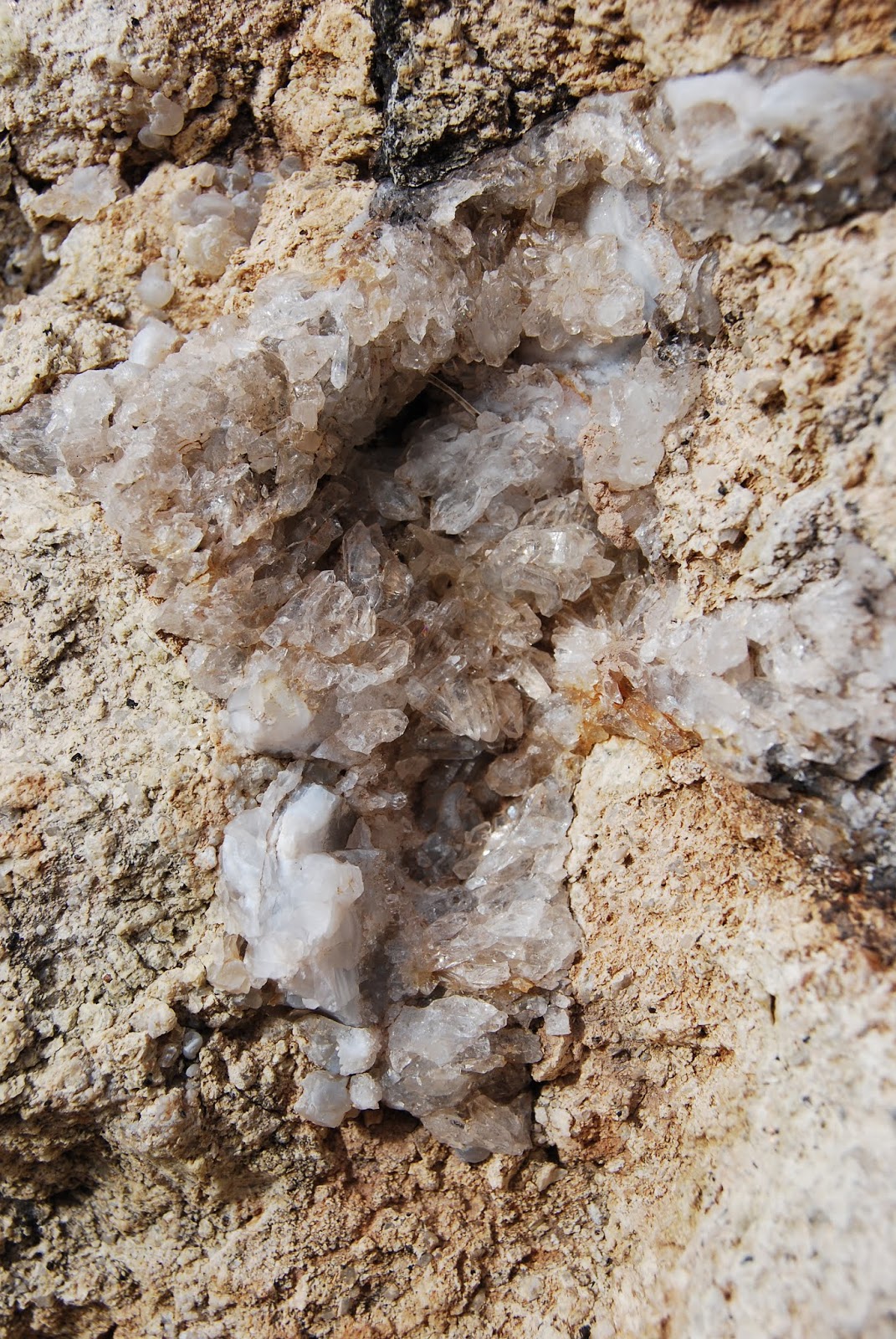
Quartz crystals embedded in boulders.
Depending on water levels, you can hike through the twisting, rocky corridor as far as you like but consider your time wisely as the return trip back up the canyon will feel worse and take longer than you’d expect. The second bend within the narrows at roughly the 4.7-mile point makes for a good turnaround point leaving plenty of time to slog your way out with daylight to spare.
LENGTH: 9.4 miles out-and-back
RATING: moderate-difficult
ELEVATION: 1,600 – 2,400 feet
GETTING THERE: From U.S. 60 in Apache Junction take the State Route 88 (Idaho Road) exit. Turn left at the off-ramp light and continue on SR 88 for 15 miles to the Canyon Lake Marina between mileposts 210 and 211. A Tonto Pass is not required if you park in the designated hiker parking area. The trail begins at the sign for Boulder Canyon Trail #103 across the road.
Battleship Mtn (L) and Weavers Needle (C) from Boulder Trl
Canyon Lake seen from Boulder Trail.
INFO:
Tonto National Forest, Superstition Wilderness

Sunday, January 3, 2010

LaBARGE NARROWS

LaBARGE NARROWS Superstition Wilderness


 Who needs the Grand Canyon when we have the LaBarge box canyon right in our own backyard? This hike starts out on the popular Boulder Trail and then goes cross-country over rugged terrain to a scenic box canyon. The off-trail segment is rife with obstacles requiring much boulder scrambling and creek hopping and thus is NOT for the novice hiker. But, the extra effort pays off at the end of the trail where the soaring stonewalls of “the Narrows” plow straight up to the sky on all sides. HIKE DIRECTIONS: from the trailhead, follow Boulder Trail roughly 3 miles to where the trail crosses LaBarge Creek. Here, head left (east) and follow the wash for another 1.5 miles to the Narrows. NOTE: the route to the Narrows may not be passable in wet years or after heavy rains. LENGTH: 9.4 miles round-trip RATING: moderate-difficult ELEVATION GAIN: 600 feet (1,500 accumulated—mostly on the way out) GETTING THERE: From Phoenix, take US60 east to Apache Junction. Take Highway 88 (Idaho Road) exit and turn left at the light. Continue on Highway 88 for approximately 15 miles to the Canyon Lake Marina. The trailhead is across the road from the marina parking lot. A Tonto Pass is NOT required as long as you park in the designated trail parking area.

Tuesday, September 16, 2008

LaBARGE NARROWS

LABARGE NARROWS: Superstition Wilderness Not for the novice hiker, this combination hike-cross-county exploration leads to a breathtaking, secluded box canyon with a tiny, riparian eco-system. The adventure follows Boulder Canyon Trail #103 along a desert ridge above Canyon Lake Marina to the 2.9-mile point where the main trail turns right. From there, leave the trail and bush whack down into the creek canyon. Here, the hike becomes a cross-country boulder scramble. The destination appears as a prominent pyramid-shaped outcropping upstream—use that as your guide. As the route traverses the rugged sycamore-and-bear-grass-lined washes, the going gets progressively tougher until, at the entrance to the “narrows”, the canyon is choked with massive quartz-encrusted monoliths. However, hikers in good shape will have no trouble picking through the rocks to reach the goal. Within the towering walls of the narrows, golden Velvet ash trees dot the shores of tiny pools like windswept beacons of light. Darting flocks of canyon wrens, chattering cardinals and roosting hawks find food and shelter among the cattails, reeds and willows that feast on the precious waters of LaBarge Creek. LENGTH: 9.4 miles out-and-back RATING: moderate-difficult ELEVATION: 1,600 – 2,400 feet GETTING THERE: From Phoenix, take Highway 60 east to Apache Junction to the Highway 88 (Idaho Road) exit. Turn left at the off ramp light and continue on Hwy-88 for approximately 15 miles to the Canyon Lake Marina between mileposts 210 and 211. Park in the designated trailhead spaces in the east section lot, near the highway. A Tonto Pass is NOT required. The trail begins at the sign for Boulder Canyon Trail #103 across the road.