


BLACK HILL TRAIL
Scottsdale
McDowell Sonoran Preserve
Mount Ord seen from Black Hill trail
Desert
mountains everywhere. That’s the
atmosphere on the Black Hill Trail.

Cholla (L) and Granite (R) mountain
Tethered to the recently upgraded Fraesfield trailhead in the north
sector of the Scottsdale McDowell Sonoran Preserve, the smooth and easy path is
steeped in mountain views both near and far.
Bees gather pollen from a buckwheat shrub
The
1.9-mile route, which also part of the 315-mile Valley-circling Maricopa Trail,
takes off from a shaded trailhead rest area where an artful metal sign
identifies the many peaks, mesas and buttes visible from the trail. 
Black Hill trail traces Fraesfield Mountain
Take a moment to appreciate the landmark names
and their places in the landscape.
Once
something has a name, it’s no longer just an inconsequential encounter or a hazy
outline on the horizon, but a real thing-- a character per say-- in your personal
explorations. 
Desert marigolds add pops of color to the trail
They become like good friends
you’re always happy to meet again and again.
Yuccas are plentiful along the route
Like all
trails in the 30,580+-acre north Valley preserve, Black Hill is well-signed, immaculately
maintained and designed to guide trail users through some of the area’s most
gorgeous vegetation and geological formations.
The 4-mile out-and-back hike begins with a brush by a chain of rounded
flanks that comprise 3,055-foot Fraesfield Mountain. 
Saddle Mountain (C) stands out on the horizon
Following an old dirt road, the trail wanders
through classic Sonoran Desert vegetation dominated by turpentine bushes,
cholla, yuccas, mesquite trees and colorful spots of wildflowers. 
A "Mushroom rocks" sculpture galley
Following a short traipse through sunny
rangeland, the route makes a mild uphill climb to where views of distant
mountain ranges and peaks appear over acres of palo verde trees and enormous
saguaro cactuses. 
Four Peaks viewed from the trail
Look for the familiar
forms of Four Peaks (7,657 feet), Weaver’s Needle (4,554 feet), The Flatiron
(4,656 feet), Mount Peeley (7,011 feet) and Mount Ord (6,529 feet) as well as
other landmarks named on the trailhead interpretive sign. 
Remnants of defunct ranch operations line the route
The far-off stony peaks are countered with
equally impressive, trailside rock formations. The mini massifs---often called
“mushroom rocks”-- take on bizarre shapes with chock stones and slipped slabs
heaped in a sort of natural outdoor sculpture gallery.
Trailhead signage names distant peaks 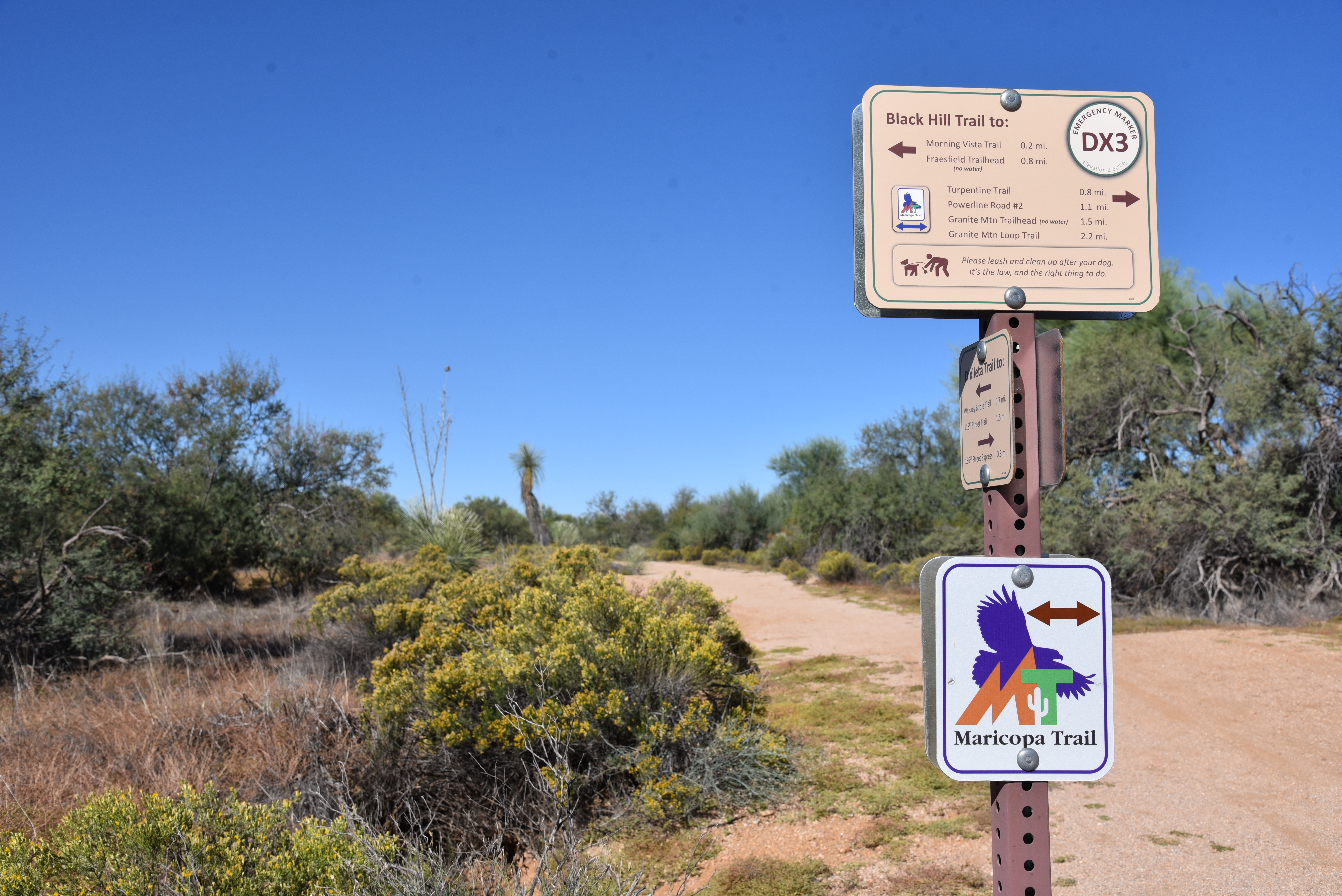
Black Hill trail is also part of the Maricopa Trail
Throughout
the hike, the craggy heaps of Cholla and Granite mountains hover to the north
with acres of green desert flora huddled at their bases. The Black Hill trail ends at the junction with
the popular Granite Mountain trail where it’s easy to pick up a connecting path
to extend the hike for more mountain immersion and a chance to test your peak-naming
memory.
A giant saguaro stands sentry over the trail 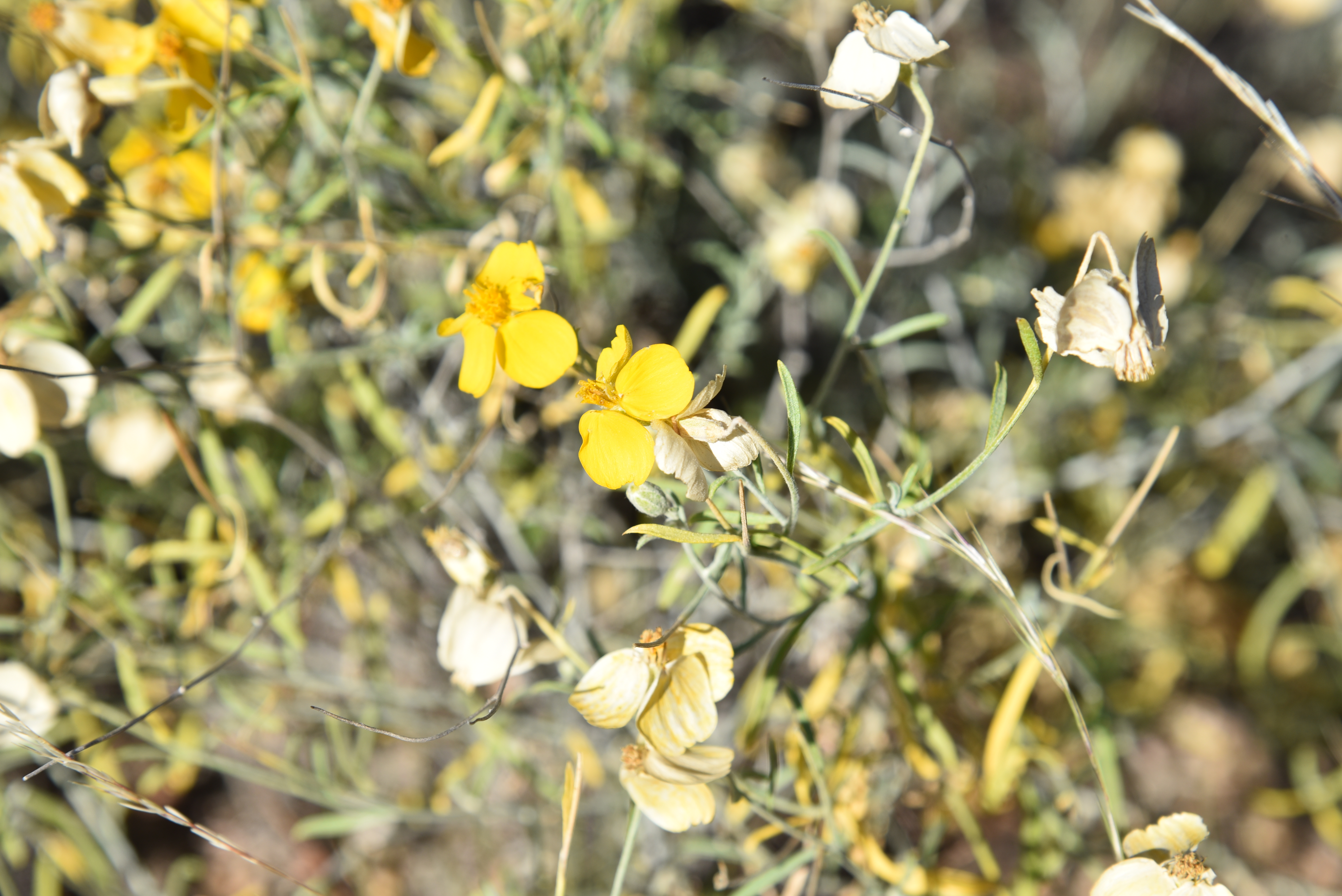
Paper flowers bloom sporadically year-round
LENGTH: 4 miles roundtrip
RATING: easy
ELEVATION: 2,514 – 2,667 feet
GETTING THERE:
From Loop 101 in Scottsdale, take the Princess/Pima exit 36 and go 6.5 miles north on Pima to Dynamite Blvd./Rio Verde Dr. Turn right and go 5.6 miles to the trailhead on the left. There's a restroom but no water at the trailhead. Preserve hours are sunrise to sunset daily.
INFO:
https://www.scottsdaleaz.gov/preserve
