BLACK CANYON NATIONAL RECREATION TRAIL
Drinking Snake Segment
 |
| Windmill near Dripping Spring |
I love snakes. Snakes are
great. If it weren't for snakes, rodents would probably be the
dominant species on Earth and we'd all be speaking ratish. So,
naturally, a trail named Drinking Snake would jump off the map
and onto my must do list. But, like many hikers, running into a snake
on the trail sends a chill up my spine. One of the biggest concerns I
hear from hikers is the fear of snake encounters. Various theories
culled from both credible science and the crusty archives of
pseudo-psychiatry offer divination into the angst of ophidiophobia.
First, there's a global assumption that all humans fear snakes. This
has been exploited by therapists and Hollywood alike. For instance,
if you say you're not afraid of snakes on the analyst's couch or in a
job interview or, you may be pegged as a liar. Then there's the
movie, Snakes on a Plane with
its
preposterous restroom
viper attack scene. In a more credible arena, scholarly
writings suggest that natural selection may have favored those who
learned to avoid snakes. Basically, people who ran lived to reproduce
and go hiking. This idea is supported by reports of lunkheads who
pick up rattlesnakes for ill-fated photo ops.
After the initial snake
encounter adrenaline rush runs its course, it's then possible to
appreciate the beauty of serpents and their role in the environment.
And yes, the Drinking Snake Segment of the Black Canyon Trail is as good a place as any for herpetological hoopla. This 4.8-mile stretch of the 78-mile route that runs from Phoenix to Mayer cuts through foothills and grasslands fed by Big Bug and Antelope Creeks. In addition to transient water, the creeks provide a rich habitat for the tasty critters snakes love. Mice, squirrels, lizards, rabbits, birds and other snakes are all on the menu. But, from a snake's perspective, anything that's not food (hikers, dogs, livestock) is a waste of venom. Trekkers who are aware of their surroundings and give serpents their space are in little danger. Although there are rattlers along this trail, you're more likely to run into innocuous species like garter, king and gopher snakes. Additionally, the vipers are less active in cold weather which is also the best time to hike this exposed route. The hike begins with a walk on Forest Road 9218A where you'll pass a gate then turn left where the road splits at the 0.3-mile point. After another 0.3-mile, the trail becomes a singletrack and continues 2.4 miles to a scenic windmill and water tank above Dripping Spring Canyon. From here, you're back on a Jeep road for the final 1.8-mile haul to the Antelope Creek Segment.
And yes, the Drinking Snake Segment of the Black Canyon Trail is as good a place as any for herpetological hoopla. This 4.8-mile stretch of the 78-mile route that runs from Phoenix to Mayer cuts through foothills and grasslands fed by Big Bug and Antelope Creeks. In addition to transient water, the creeks provide a rich habitat for the tasty critters snakes love. Mice, squirrels, lizards, rabbits, birds and other snakes are all on the menu. But, from a snake's perspective, anything that's not food (hikers, dogs, livestock) is a waste of venom. Trekkers who are aware of their surroundings and give serpents their space are in little danger. Although there are rattlers along this trail, you're more likely to run into innocuous species like garter, king and gopher snakes. Additionally, the vipers are less active in cold weather which is also the best time to hike this exposed route. The hike begins with a walk on Forest Road 9218A where you'll pass a gate then turn left where the road splits at the 0.3-mile point. After another 0.3-mile, the trail becomes a singletrack and continues 2.4 miles to a scenic windmill and water tank above Dripping Spring Canyon. From here, you're back on a Jeep road for the final 1.8-mile haul to the Antelope Creek Segment.
 |
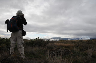
| Above Dripping Spring Canyon |
LENGTH: 4.8 miles one-way
RATING: easy
ELEVATION: 3,932' –
4,220'
GETTING THERE:
Spring Valley Trailhead:
From Interstate 17, take the
Bloody Basin Road exit 259, go 3.3 miles west (Crown King Road,
Forest Road 259) to the ghost town of Cordes, turn right (north)
Antelope Creek Road (County Road 74) and continue 3 miles to the
trailhead on the left at Forest Road 9218A. Roads are sedan-friendly
dirt/gravel.
INFO:
Black Canyon Trail Coalition
Living with Venomous
Reptiles:
Snake Bite First aid:
Snake Avoidance Training for Dogs:
MORE PHOTOS:


