Find A Trail. Start Your Search Here:

Wednesday, June 19, 2013

Some Kaibab National Forest trails temporarily closed


HIKING TRAILS ON BILL WILLIAMS MOUNTAIN TO CLOSE JUNE 19, 2013
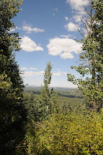
View from Bill Williams Mountain summit

Fire season is in full-swing and again this year, due to extremely dry conditions and escalating fire dangers, Kaibab National Forest will close public access to the Bill Williams Watershed beginning at 8 a.m. Wednesday June 19. This temporary closure will be in effect until conditions improve enough to reduce the risk of human-caused fires.
Closure boundaries are between 4th St/CR73 (Perkinsville Road) on the east, FR122 to the south, FR 108 on the west and I-40 to the north. This means that the hiking trails on and directly around Bill Williams Mountain including Benham Trail , Bixler Saddle and the Bill Williams Trail are off limits until further notice. Additionally---if we do not get monsoon rains soon, Arizona national forests may be temporarily closed to public entry.  So, always do you homework before heading out for a summer hike.
INFO:
Kaibab National Forest Fire Information Line: 928-635-8311


Tuesday, June 18, 2013

Hike above Arizona's plateau lake country


HUTCH MOUNTAIN-GOOSEBERRY SPRING
Coconino National Forest 

A quiet little place with a surprisingly in-your-face outdoor experience, the Hutch Mountain trail showcases amazing views of Northern Arizona’s plateau country. This adventure consists of two parts: the visit to the tower and the trail hike. To find the trail, start at the gate near the parking area and hike up the dirt road for .12 mile to a point where the road swerves sharply to the right. From here, you’ll see the unmarked trail heading downhill. Along the trail, big views of Anderson Mesa dominate the first half-mile before the steep, narrow path dips into a shadowy canyon embellished with rich red earth and bold green swaths undergrowth splattered with blood-red berries and lemony daisies. The path ends at Gooseberry Springs campsite---a grassy depression in an airy mountain valley where there’s a spring that flows nearly year-round. To visit the tower, hike back up the trail to the main road, go left and continue uphill. Built in 1936, the 31-foot-tall tower hovers over a blanket of close-knit forests of fir, spruce and pine trees that melt into Northern Arizona’s volcanic highlands. 

LENGTH: 4 miles roundtrip RATING: moderate ELEVATION: 8,535 – 8,000 feet DRIVING DISTANCE FROM PHOENIX: 180 miles one-way GETTING THERE: From Phoenix, go north on I-17 to exit 339, Lake Mary Road (FR3). Go 33 miles south on Lake Mary Road to Forest Road 135 near milepost 311. Go 2.6 miles on FR 135, bear left at an unsigned junction and then left again onto Forest Road 135B. Go 2 miles on FR 135B to the parking area where an access gate sometimes bars vehicles from driving to the tower. No worries, though. Hikers can continue beyond the gate on foot. A high clearance vehicle is required. INFORMATION: Flagstaff Ranger District, Coconino National Forest: (928) 526-0866 


Monday, June 17, 2013

Fire restrictions at Secret Canyon & Loy Canyon trails

SECRET FIRE TEMPORARILY CLOSES TWO POPULAR SEDONA TRAILS
Coconino National Forest
Secret Canyon area

The lightning-caused Secret Fire which ignited on Saturday June 15th  is burning 30 south of Flagstaff in the Red Rock Secret Mountain Wilderness.  As of this morning it is 40 percent contained, however access to the Loy Canyon, Secret Canyon and other trails in the immediate area are temporarily closed. Although it's usually too hot to hike there this time of year, be sure to check with the forest service before planning a visit to the area.
INFO & MAP:
http://www.fs.usda.gov/detail/coconino/news-events/?cid=STELPRDB5424426