Find A Trail. Start Your Search Here:

Showing posts with label Blowout Wash Trail System. Show all posts

Tuesday, September 24, 2024

Blowout Butte

BLOWOUT BUTTE

Blowout Butte viewed from Campus Trail

Situated at the core of the Blowout Wash Recreation Area in Cottonwood, Blowout Butte cuts an impressive silhouette on the Verde Valley skyline of Central Arizona.  

Limestone flanks the Blowout Butte Trail

The conical mound of crumbling limestone in Prescott National Forest puts a shine on the 15+miles of non-motorized trails that swirl about its base. 
Mingus Mountain towers over Blowout Wash Area

The particular slice of forest is a pocket of water-scoured high desert hills and ravines bolstered by a ridgeline of pine-covered highlands that include 7,818-foot Mingus Mountain and Woodchute Wilderness. 
Limestone outcroppings on the Limestone Trail

The singletrack trails take advantage of the area’s undulating space between mountains and valleys with long, edgy traverses interspersed with wash crossings and canyon crawls.
Summit of Blowout Butte

While the site is largely shadeless, a smattering of junipers and rock outcroppings cast just enough shade for comfortable hiking almost year-round.
Crucifixion-thorn shrubs dominate the terrain


The best perks of the 15+-mile system are its connectivity and excellent signage. This makes getting around and customizing hikes a cinch.   

For first time visitors and regulars alike, climbing Blowout Butte is a must-do trek.  Getting to the prominent peak involves a short, effortless walk with barely over 100 feet of base-to-summit elevation gain. 

Campus Trail crosses Blowout Wash

From the Blowout Wash main trailhead, the route starts out with a short hike on the Campus Trail 559.  At the half-mile point the route veers right onto the Blowout Butte Trail 556. 
Fenceline Trail at the edge of Prescott NF

The half-mile trail begins with a level swing around the butte before taking on a couple of easy switchbacks that lead to a loop path that circles the high point.  The tiny summit, fringed with Crucifixion-thorn shrubs and cacti, is unremarkable except as a platform for viewing 360-degree vistas.  Views of Sedona’s red rocks, the San Francisco Peaks in Flagstaff, the Mogollon Rim and the vineyards and riparian corridors of the Verde Valley roll out around the pyramid-shaped mound. For the return trip, the trail descends to meet the Limestone Trail 554. After a few yards, the Fenceline Trail makes a 0.3-mile loop detour tracing the post-and-wire boundary of the national forest before reconnecting with Campus Trail.
Verde Valley vistas on Blowout Butte Trail

Here, hikers may head left to get back to the trailhead or consult the maps that are posted at every junction to design longer or more challenging treks.
Map signs at junctions guide the way

LENGTH: 2.5 miles as described here

RATING: easy

ELEVATION: 3,713 – 3,932 feet

GETTING THERE: From Interstate 17 north of Camp Verde, take the Cornville Road/County Road 30 exit 293. Continue 17.7 miles west on Cornville Road, which will turn into Mingus Avenue and then Forest Road 493, to the Blowout Wash Recreation Area trailhead on the right. For reference, the trailhead is 1.5 miles south of the Cottonwood airport. Roads are paved except for a short section of rough dirt that’s suitable for all vehicles. There are no fees or facilities at the trailhead.

INFO: Prescott National Forest

https://www.fs.usda.gov/recarea/prescott/recreation/recarea/?recid=84363&actid=50


Monday, May 8, 2023

Higher Learning-Extra Credit Loop

HIGHER LEARNING-EXTRA CREDIT LOOP

Blowout Wash Trail System is well signed

Situated in the foothills below Mingus Mountain a couple of miles south of the Town of Cottonwood, The Blowout Wash Recreation Area trail system offers an airier alternative to crowded Sedona-area hike destinations. 

Yucca bloom on the Extra Credit Trail

The 15+-mile system in Prescott National Forest is made up of flowing singletrack loops that are easy to customize for both challenging day hikes and easy strolls. 
View of Mingus Mountain from Bullseye Trail

The loops run through a scenic mix of  high desert terrain. 
Barestem larkspur bloom March - May

The varied terrain and microclimates of water-scoured washes, a chiseled stone-walled canyon, edgy ridgelines and high desert grasslands are the backbone and soul of this always entertaining non-motorized maze.  An excellent, moderate-rated introduction to the area links up four trails for a tour of some of the system’s sweet high point vistas. 
Desert Four O'Clock bloom April - September

Beginning at the main trailhead along Forest Road 493, the loop begins with a 0.2-mile walk on Blowout Canyon Trail. 
Trail cut visible on knoll from Higher Learning

Right out of the chute, the hike delivers amazing 360-degree vistas, dominated by 7,818-foot Mingus Mountain in the west and the sprawling Verde Valley to the north. 
Thistle frame a view on Extra Credit Trail

The route then veers right onto the Bullseye Trail where it begins a leisurely mile-long climb through a corrugated landscape dotted with junipers, common hop trees, velvet ash, yucca and cacti.
View of Sedona Red Rocks from Bullseye Trail

At 1.2 miles, the circuit connects with the Higher Learning Trail. 
Bear grass on the Higher Learning Trail

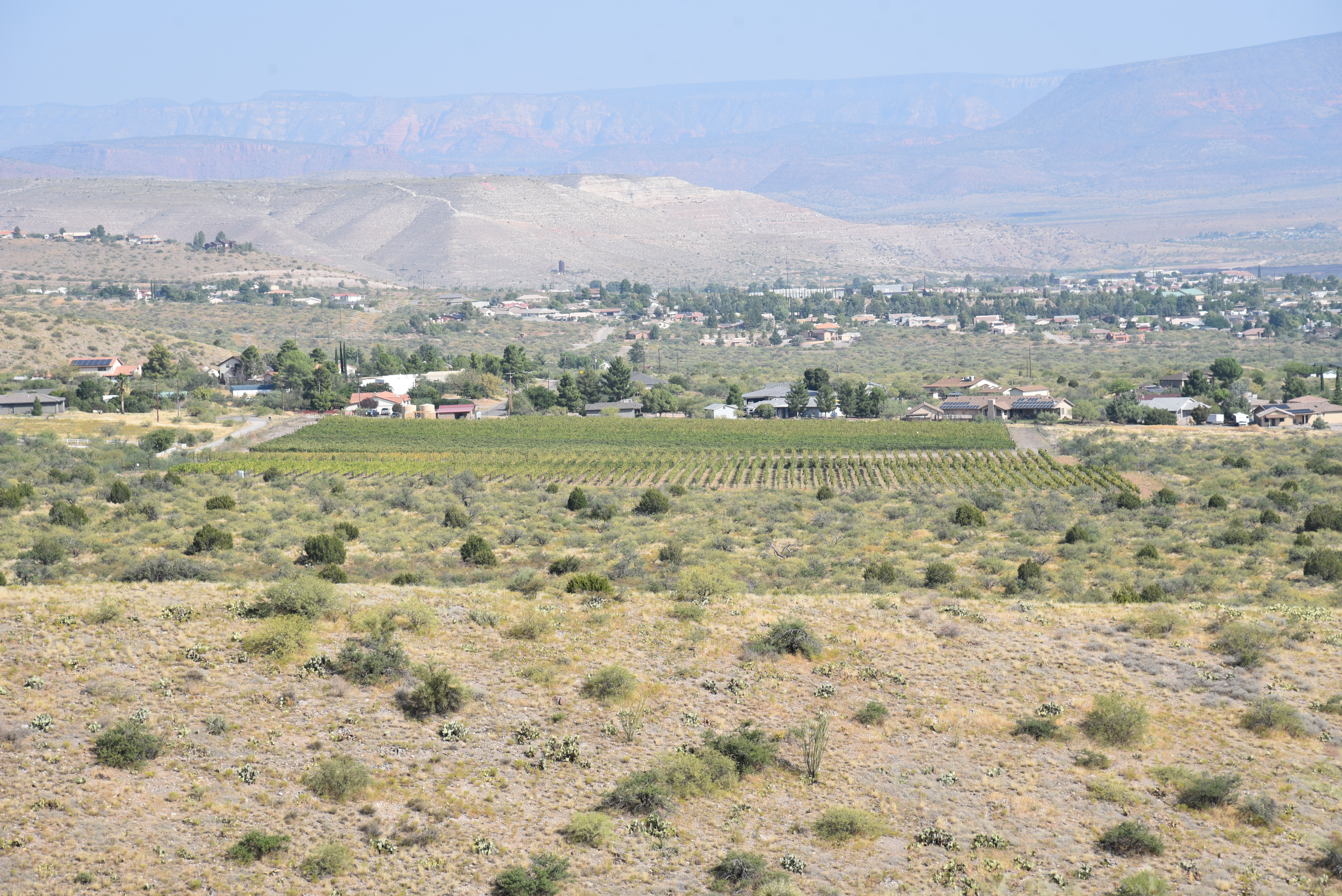
This segment offers the best views of Sedona Red Rocks, the twisting, green channel of Oak Creek and the geometric layout of vineyards in the valley below.
Strawberry hedgehog cactus bloom March - May

But the views are temporarily swallowed up where the trail slides into a minor canyon before swinging back uphill.
Silverleaf nightshade bloom April - November

Higher Learning Trail ascends a ridgeline

The hike encounters a breezy lookout point at the Extra Credit Trail junction-- a treeless ridgeline with a fringe of yucca and prickly pear cactus anchoring an expansive grassland flush with wildflowers like Barestem larkspur, sego lilies, Four O'Clock, antelope horns, tufted evening primrose, silverleaf nightshade, thistle, prickly poppies, Blackfoot daisies, scarlet beeblossom and miniature wool star--to name a few. 
Range ratany shrubs bloom April - October

At the junction, hikers may opt for a longer, 6.7-mile loop by continuing straight ahead, or a 4.9-mile-miler by turning left at the sign. Either way, Higher Leaning reconnects with the Extra Credit Trail that makes an easy, half-mile descent to reconnect with the Blowout Canyon Trail.
Scarlet beeblossom bloom April - September

Along the Blowout Canyon segment, peeks at the steep-walled, eponymous canyon and an impressive community of ocotillo and blooming cactus enter the fray.
A short trail climbs Blowout Butte

Over this half-mile leg, distant mountain peaks hover over the southern horizon while flowering shrubs like range ratany vie for attention underfoot.  Back at the Bullseye Trail junction, the route doubles back to the trailhead where a colorful map kiosk shows the entire trails system layout and more ways to enjoy the quieter side of Verde Valley hiking. 
Blowout Wash trailhead

Wing-like seeds on a common hoptree


LENGTH:

Short Loop: 4.9 miles

Long Loop:  6.7 miles

RATING:

Short Loop: moderate

Long Loop: moderate

ELEVATION:

Short Loop:  3,806 – 4,318 feet (926 feet of accumulated elevation change)

Long Loop: 3,806 - 4,675 feet. (1,129 feet of accumulated elevation change)

GETTING THERE:

From Interstate 17 north of Camp Verde, take the Cornville Road/County Road 30 exit 293. Continue 17.7 miles west on Cornville Road, which will turn into Mingus Avenue and then Forest Road 493, to the Blowout Wash Recreation Area trailhead on the right. For reference, the trailhead is 1.5 miles south of the Cottonwood airport. Roads are paved except for a short section of rough dirt that’s suitable for all vehicles.There are no fees or facilities at the trailhead.

INFO:

Prescott National Forest

https://www.fs.usda.gov/recarea/prescott/recreation/recarea/?recid=84363&actid=50

Monday, September 21, 2020

Blowout Wash Trail System

BLOWOUT WASH TRAIL SYSTEM

Bear grass & ocotillo on the Bullseye trail #557


Occupying a hilly slice of high desert below the east flanks of Mingus Mountain, the new Blowout Wash trail system is shaping up to become a prime Verde Valley hiking destination.

The remediation project is a multi-agency collaboration of local, state and federal land agencies working together to improve recreational opportunities in the section of Prescott National Forest southwest of Cottonwood.  

View from Campus trail #559

Before trail construction began in 2019, the wash-riddled foothills that are surrounded by popular recreation hubs in Sedona, Jerome, Dead Horse Ranch State Park and the Woodchute-Mingus Mountain complex of routes, the area was rife with wildcat user-created paths, shooting and dumping that was disrupting the ecosystems and decimating native vegetation. 
The Bullseye-Campus loop was completed in early 2020

Cacti and grasslands on Bullseye trail #557

The destructive anything-goes arena is gradually being replaced with sustainable, non-motorized trails that reduce erosion, protect natural assets and promote responsible use.
Vineyards of the Verde Valley seen from Bullseye trail

Sacred datura bloom Apr-Nov along Blowout Wash 

While a map at the trailhead teases with an overview of planned trail development, a little loop that was completed in early 2020 provides a tasty tidbit of what’s to come.

Right from the trailhead, the fresh-cut nature of the Bullseye Trail #557 and the Campus Trail #559 that pair up for a short tour of the area is apparent.  Behind the parking area kiosk, brand new sign posts mark the beginning of the system’s inaugural loop.  To get the climbing part of the hike done first, head left on trail #557.  The loopy single track that’s open to hikers, equestrians and mountain bikers heads west before making a twisting ascent of a ridgeline. 

Fruits on Silverleaf nightshade follow purple blooms

The path wanders among junipers, mesquite and crucifixion thorn trees occasionally ducking into drainages and washes where spots of cottonwoods and Arizona walnut trees sink roots deep into the water table.  Taking on the long switchbacks that lead to the hike’s high point, the trail hangs on the edge of the ridge showcasing amazing views of Mingus Mountain, and the emerald corridors of the Verde River and Oak Creek. 
Limestone pebbles spill over Campus trail #559

After a few dips and bends, the trail tops out on a ocotillo-and-bear grass cluttered knob with big views of the red rocks of Sedona and the green grids of vineyards in the valley below.  From this high vantage point, the trail begins a downward spiral through cacti-studded grasslands. At the 2.2-mile point, the route meets the back end of the loop where trail #559 spins off to the north and heads toward the Yavapai College Verde Valley Campus.  To complete the loop, head east (go right) and follow #559 through a flatter landscape marked by rugged washes and a swing by a prominent pyramid-shaped mound with white limestone chunks spilling from its slopes. 
Mingus Mountain rises over Bullseye trail #557

Along this passage, you’ll notice white flag tape tied to trees and shrubs as well as rocks blocking access to old roads and unauthorized paths. 
A shady passsage on Campus trail

Campus trail makes several drainage crossings

Crucifixion thorn trees bear spiked, egg-shaped fruits

Mesquite trees provide sporadic shade along the route

Please leave the flags in place and avoid crossing barriers as these are part of future trail development efforts. One more short uphill segment completes the loop that gives a glimpse at an emerging trail system and the taking back of a formerly neglected corner of national forest.

LENGTH: 3.3 mile loop as described here

RATING:  easy

ELEVATION:  3,706- 4,031 feet

GETTING THERE:

From Interstate 17 north of Camp Verde, take the Cornville Road exit 293 heading west (go left).

Continue 17.7 miles on Cornville Road (aka County Road 30) which will turn into Mingus Avenue and then Forest Road 493 to the large Blowout Wash trailhead.  For reference, the trailhead is 1.5 miles south of the Cottonwood Municipal Airport. Roads are paved up to the last half mile where FR 493 is a dirt/gravel track suitable for all vehicles.

INFO:

Prescott National Forest

https://www.fs.usda.gov/main/prescott/home