Find A Trail. Start Your Search Here:

Friday, January 6, 2023

Javelina Summit Trail

JAVELINA SUMMIT TRAIL

Brittlebush colors the Tortuga Trail


One of four difficult-rated summit hikes in the Skyline Regional Park in Buckeye, the Javelina Summit doesn’t scrimp on thrills.  The 0.9-mile-long trail spools off connecting routes in the park’s far east end. 

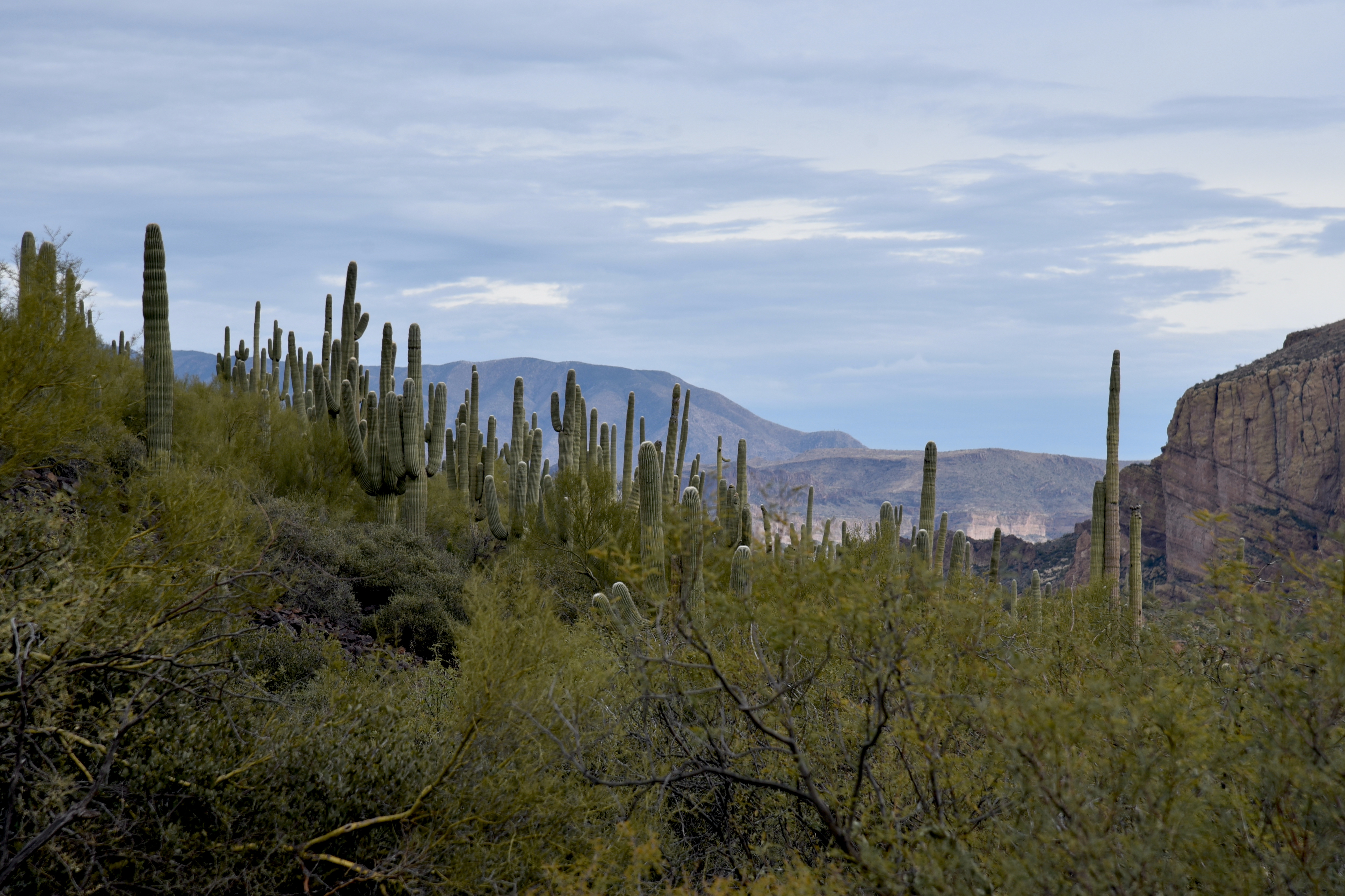
View from the Javelina Summit Trail

While it’s “just” a 745-foot climb from trail base to summit, that accounts for less than half the story.
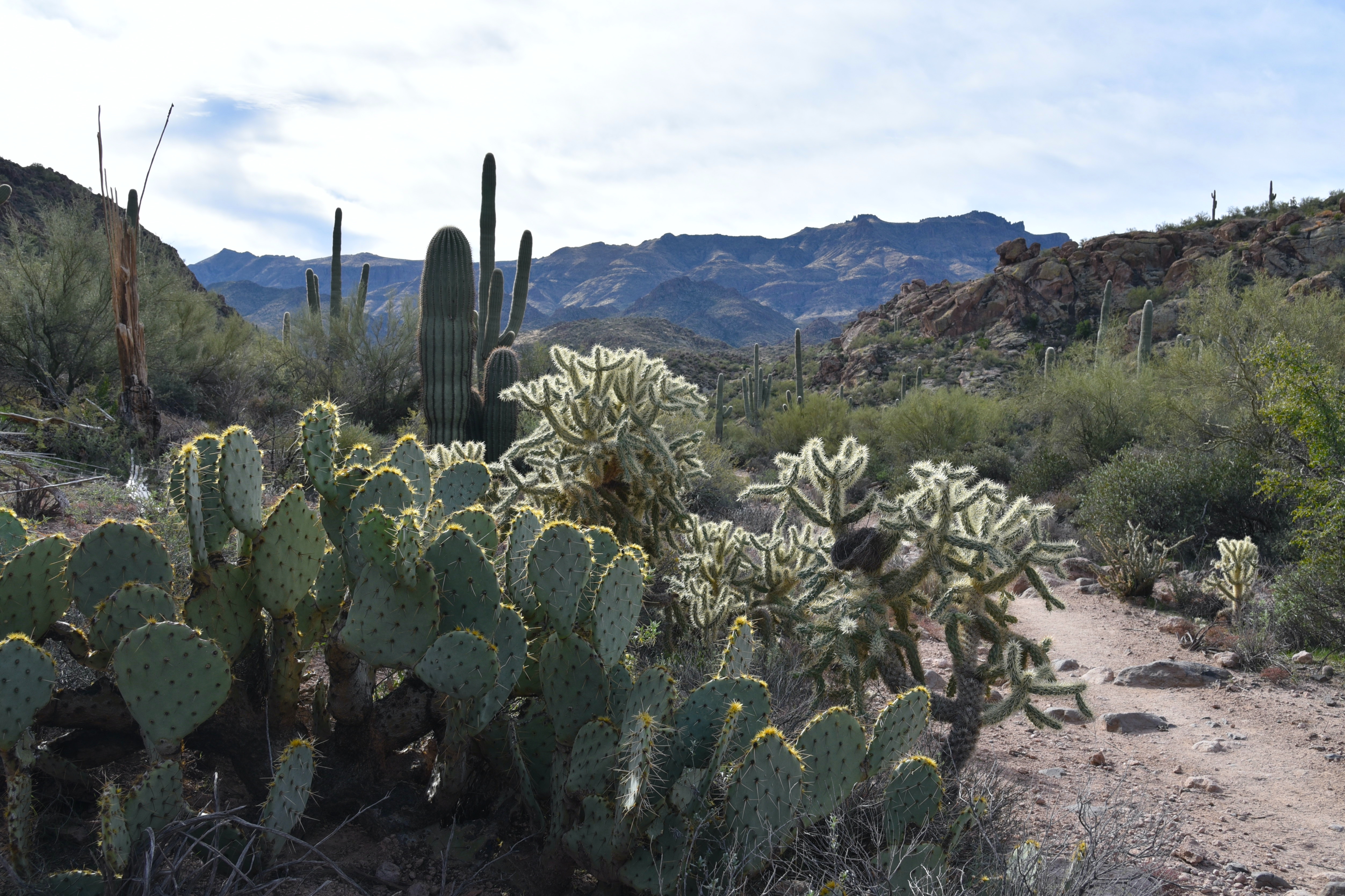
Javelina Summit (right) viewed from Tortuga Trail

Getting to the 2,200-foot mountain highpoint involves using three trails and logging over 1,700 feet of accumulated elevation change.
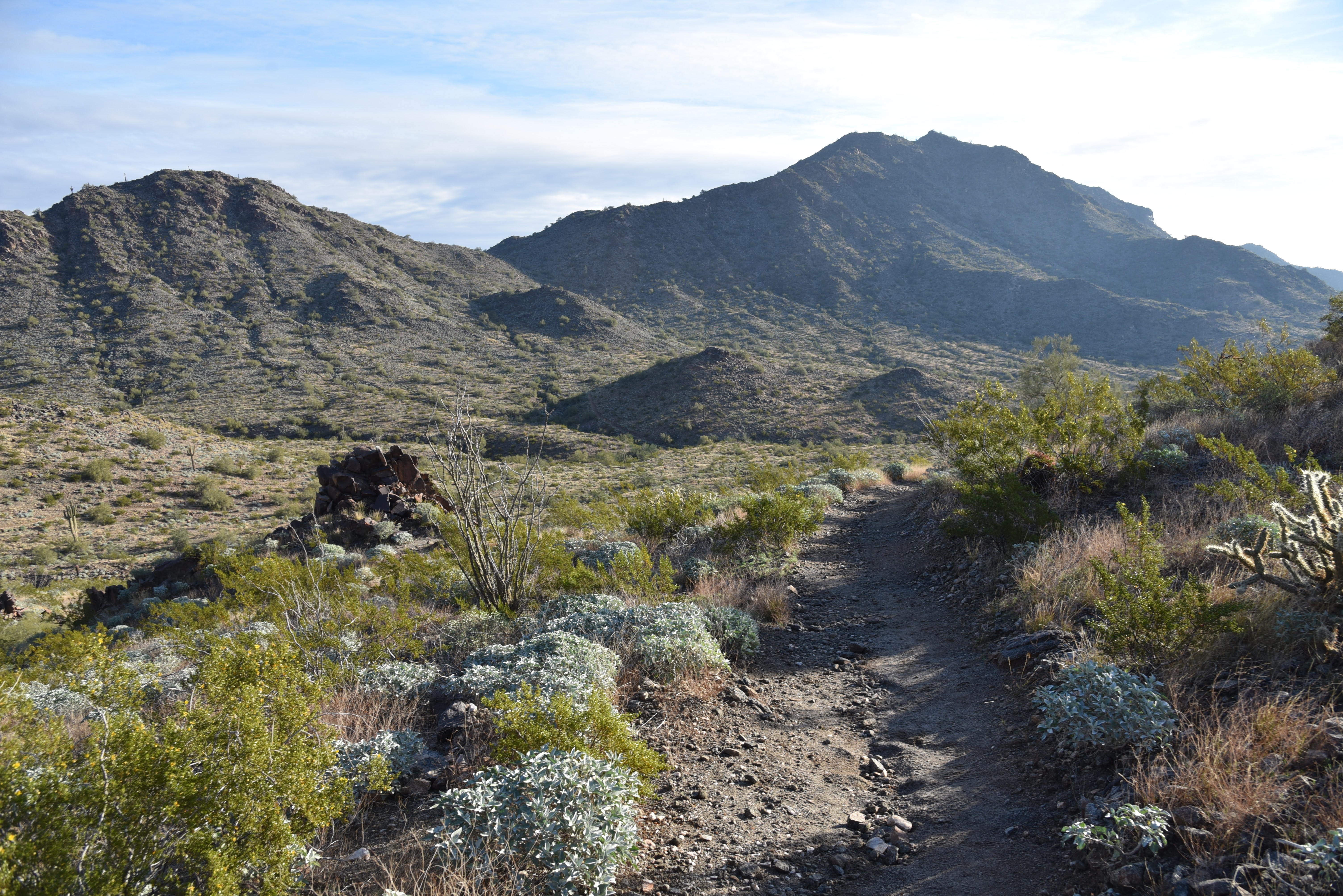
Hike begins on tehe Quartz Mine Trail

The rollercoaster-style trek starts from the main trailhead area with a 1.6-mile hike on the Quartz Mine Trail. About a half mile in, first peeks at the destination loom on the horizon. The prominent ridgeline rising over foothills and valleys looks imposing. And irresistible!
Beginning of the Javelina Summit Trail

The undulating path winds through washes and slopes below ragged ridges and stone outcroppings before making an ascent to a saddle where the Tortuga Trail spins off to the east.
Brittlebush are plentiful in Skyline Regional Park

The Tortuga Trail leg of the hike takes back much of the elevation gained with a smooth downhill on long lazy switchbacks. At the half-mile point, the route encounters its final segment, the 0.9-mile Javelina Summit Trail.
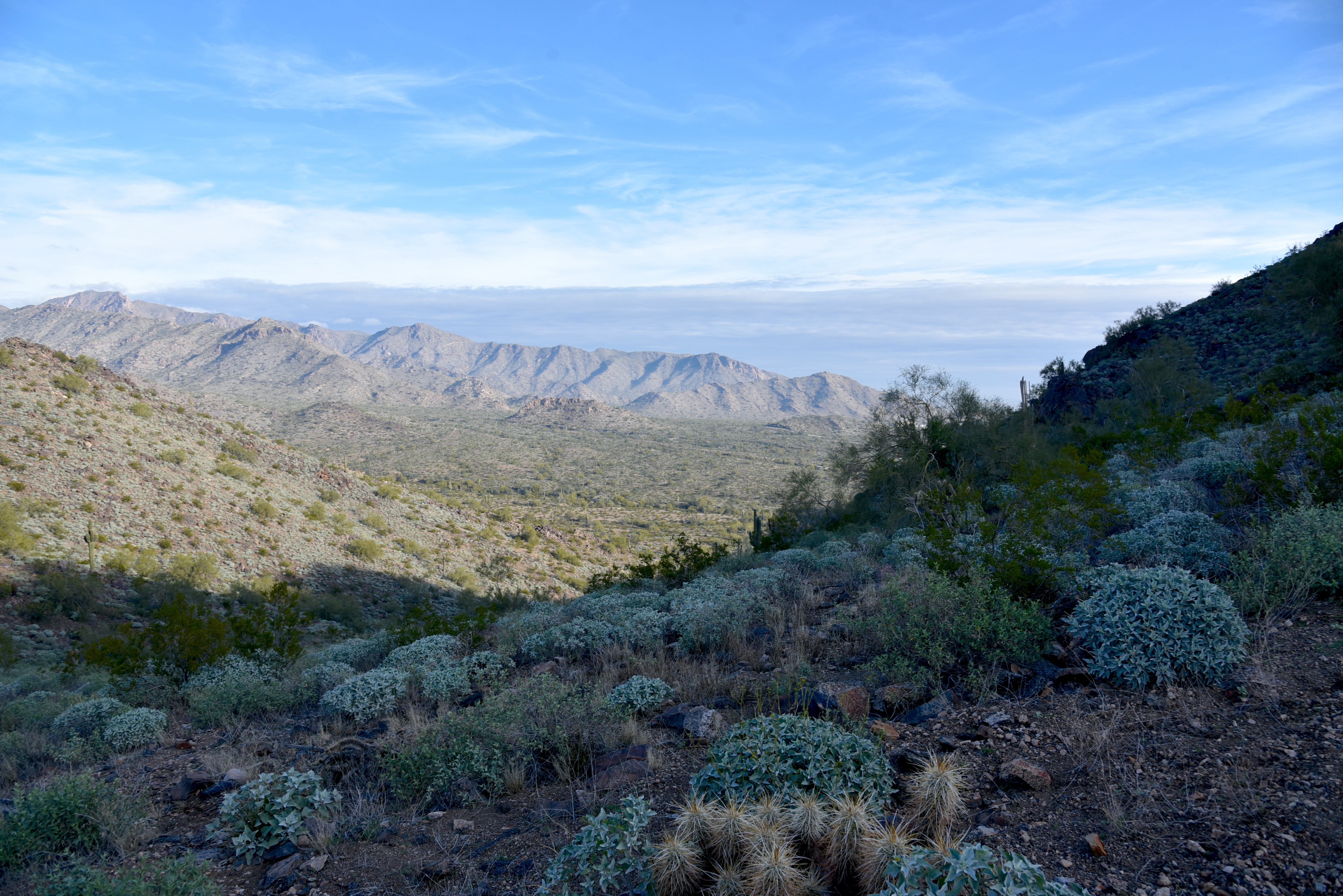
View of the White Tank Mountains

It's here where the real work begins. While the lower quarter mile feels just moderate and has a few level bends, the climbing becomes an unrelenting uphill haul with loose rock and a fair amount of exposure. The trail is well engineered but still very steep and precipitous as it clamors along a knife-edge sharp, rocky backbone. Persistence and careful footwork pay off on the tiny summit.

Rock outcropping on Tortuga Trail


Javelina Summit Trail is steep and edgy.

The airy pinnacle displays 360-degree vistas of the southern White Tank Mountains, the distant profile of Downtown Phoenix, the Sierra Estrella Mountains and sprawling desert plains.

LENGTH: 5.8 miles round trip (out and back hike)

RATING: difficult

ELEVATION: 1,312 – 2,200 feet (over 1,700 feet of accumulated elevation change)

GETTING THERE:

Skyline Regional Park, 2600 N. Watson Road, Buckeye.

From Interstate 10 in Buckeye, take the Watson Road exit 117 and go 2 miles north to the park. Roads are paved.

HOURS: Sunrise to sunset daily

DAY USE FEE: none

FACILITIES: restrooms, picnic ramadas, camping

INFO:

Skyline Regional Park

https://www.buckeyeaz.gov/community/skyline-regional-park

Wednesday, January 4, 2023

Second Water Trail

SECOND WATER TRAIL

Mountain vistas on Second Water Trail


Garden Valley, on the western edge of the 160,200-acre Superstition Wilderness, is one of those places that sears vivid images into the memories of those who trek through it. 

Chain fruit cholla in Garden Valley

Rife with otherworldly scenes of desert life in an environment sculpted out of ancient volcanic ash, the area’s story arc spools out from violent origins, cataclysmic geological events, erosion and resurgence.

Globemallow bloom year-round in Garden Valley

Between 25 and 15 million years ago the craggy backcountry was a roiling cauldron of molten rock and white-hot ash that eventually collapsed on itself forming a series of depressions called calderas.  The grand scale “super-volcano” activity was like what’s incubating beneath Yellowstone National Park right now.

Flatiron (center left) seen from Second Water Trail

Ringed by mesas, mountain ranges and bizarre pillars and piles of solidified ash or “welded tuff”, the yawning basins have settled into a quiet old age marked by a slow-motion epoch of falling apart.

Four Peaks viewed from Second Water Trail

 The Second Water Trail offers an approachable option for exploring this haunting hinterland of rugged terrain and mysterious tales of hidden gold caches and lost souls.
Lush desert plants on Second Water Trail

Beginning at the First Water trailhead that’s located roughly 45 miles from Downtown Phoenix near Apache Junction, Trail No. 236 is accessed by following the Dutchmans Trail 0.3-mile to the first signed junction.
Hackberry Mesa (left) rises over Second Water Trail

Twisting over slickrock and sections of crumbling stone, the trail bends northeast, flanking scoured gorges above the course of First Water Creek.
Petrified volcanic ash in First Water Creek

 
Recent wildfire damage has left spots of charred cholla and scarred saguaros, but expansive views of the Goldfield Mountains, Superstition ridgeline, the Flatiron and iconic Weaver’s Needle remain as breathtaking as ever.
White bladderpod blooms Jan - May

 
The trail swings by the junctions for Black Mesa and Hackberry Spring trails which may be used to build longer loop hikes.
Rugged terrain along Second Water Trail

Second Water trail continues through a series of rocky uphill segments that land hikers in the heart of Garden Valley—a sprawling flatland dominated by chain fruit cholla, prickly pear cacti, jojoba, mesquite, hackberry shrubs and fields of wildflowers.
Desert vegetation in Garden Valley

Superstition Ridgeline on the horizon

This once botanically lush plateau took a major wildfire hit, but many survivor specimens and green sprouts pushing out from deadwood hint at recovery.
Weaver's Needle stands out over Second Water Trail

Here, the massive forms of Hackberry Mesa, Four Peaks and the mountains around Canyon Lake to the north begin to stand out on the horizon. Plant life grows more robust as the route starts a spiral down into a reedy, damp gorge where it intersects the Boulder Canyon Trail, the turnaround point for the hike.

Jojoba shrubs and saguaros on Second Water Trail

A major geological upheaval notwithstanding, the slow-burn erosion and superficial smudges incurred regularly on the Second Water Trail are barely perceivable over a single human lifetime.
A rocky ascent on Second Water Trail


Fires, rock falls, flood displacements and seasonal transitions are like costume changes in a long-running show with ear worm tunes that hijack the mind but somehow never get old.

Saguaros clutter a ridge above Boulder Canyon

LENGTH: 7 miles round-trip (out-and-back hike)
RATING: Easy-Moderate
ELEVATION: 1,940 to 2,420 feet (878 feet of accumulated elevation change)

GETTING THERE:

From Phoenix, go east on US 60 to exit 196 for Idaho Road (State Route 88). Turn left and follow Idaho to SR88, turn right and continue to First Water Road (Forest Road 78), which is located about a half mile past the entrance to Lost Dutchman State Park (between mileposts 201 and 202) and is signed for First Water Trailhead. Turn right and go 2.6 miles to the trailhead. Forest Road 78 is maintained dirt with some potholes and washboard sections passable by carefully driven sedan.

INFO: Mesa Ranger District, Tonto National Forest

https://www.fs.usda.gov/recarea/tonto/recarea/?recid=35525