DIPPER-APOLLO-PLUTO-SPACEWALK CIRCUIT
 |
| Impressive monolith on the Pluto Trail |
Flagstaff has a long and colorful association with astronomy and space exploration. Notable mentions include the discovery of Pluto from the Lowell Observatory by Percival Lowell in 1894. And in the 1960s, the Apollo astronauts trained in the Cinder Hills area to test procedures in volcanic craters that resembled the lunar landscape prior to landing on the real thing in 1969.
 |
| Apollo Trail winds through volcanic boulders |
Additionally, Flagstaff has the distinction of being named the first International Dark Sky City in 2001.
 |
| A hairpin curve on the Dipper Trail |
That’s a big deal because the city’s policies on limiting nighttime light pollution have many benefits including improving human health, protecting sensitive wildlife and ecosystems and maintaining clear skies for stargazing and studying the universe.
 |
| Mountain vistas on the Spacewalk Trail |
(Learn more at darksky.org)
In homage to the Northern Arizona city’s outer space heritage, a new maze of trails in the Mount Elden-Dry Lake Hills (MEDL) area was opened to the public in August.
 |
| Wildlife browse sand sage August - November |
 |
| New MEDL trails connect with Rocky Ridge Trail |
Part of the Schultz stacked loop system, located just a few miles north of downtown, the new Dipper, Apollo, Pluto and Spacewalk trails tie into the previously unveiled Big Bang Trail.
 |
| Pluto Trail passes a recovering burn scar |
They also add toned muscle to Old Standard backbone routes like Rocky Ridge, Sunset, Brookbank and Upper Oldham Trails.
 |
| Mt. Elden seen from the Apollo Trail |
Built by Coconino National Forest and Arizona Conservation Corps with the assistance of local volunteers, the trail names slap a celestial sugar coating on a decidedly terrestrial domain.
 |
| Wildflower meadow on Spacewalk Trail |
While the area’s high elevation and slightly lower O2 levels might give lowlanders (if you’re from Phoenix, you’re a lowlander) a mini case of the woozies, the trail designs minimize the impact. These new routes are not of the old school straight-up-and-down ilk that seem engineered to make you feel like a looser.
 |
| Ancient alligator juniper on the Dipper Trail |
These scenic paths capitalize on natural landscape contours, using sweeping switchbacks to ease climbs and tight hairpin turns to propel trail users around ravines and gullies.
 |
| Paintbrush color sunny spots March - September |
 |
| The looped trails are easy to customize |
To explore this new hub, begin at the Schultz Creek Trailhead, which was relocated away from the course of Schultz Creek this summer, with a short walk on the Chimney Trail to connect with the Rocky Ridge Trail.
 |
| San Francisco Mountain seen from Dipper Trail |
The route follows Rocky Ridge for 0.7 miles to where the Apollo Trail heads left. The 0.3-mile connector path twists among lichen-encrusted volcanic boulders and sporadic tree cover, serving up appetizer views of what’s to come.
 |
| Sunflower meadows below the Dipper Trail |
At the 1-mile point, Apollo intersects the Dipper Trail. For this trip, the route heads right taking on an edgy segment where enormous alligator junipers frame mountain vistas and glimpses of downtown Flagstaff before exposing first peeks at the sky-scraping silhouette of 12,633-foot San Francisco Mountain.
 |
| Mixed conifer woodlands on Pluto Trail |
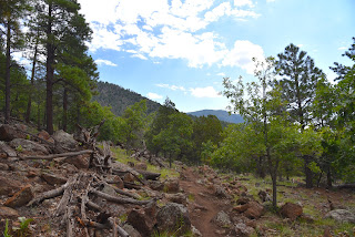
Immediately beyond the mountain preview, Dipper meets the Pluto trail at the 1.8-mile point. Pluto is another capillary-type route of about a third of a mile that runs between the Dipper and Spacewalk trails. The tightly coiled path jogs around a recovering burn scar and a prominent monolithic stone outcropping, then connects with the Spacewalk Trail. Great views of the peaks can be had by heading left at the junction.
 |
| Purple locoweed bloom June - September |
 |
| Narrowleaf tick clover bloom July - September |
The easy singletrack meanders for a half-mile through wildflower meadows and mixed conifer woodlands before bumping into the Big Bang Trail, the turnaround point for this exploratory trip. However, a quick map consult will show a full menu of loop options for longer or shorter hikes.
LENGTH: 4.66 miles out-and-back
RATING: moderate
ELEVATION: 7,160 – 7,765 feet (964 feet of elevation change)
GETTING THERE: Schultz Pass Trailhead: In Flagstaff, go 3 miles north on U.S. 180 (Humphreys Street) and turn right on to Schultz Pass Road (Forest Road 420). Continue 0.5-mile on FR 420 and make a hard left at the Elden Look Road (Forest Road 577) and go another half-mile to the parking area on the left. There are no fees or facilities at the trailhead.
INFO: Coconino National Forest
https://www.fs.usda.gov/recmain/coconino/recreation


