Posts
Posts


SECRET SLICKROCK CIRCUIT
 |
| Water pools on the Secret Slickrock Trail |
It’s a rare hike that packs in as much over-the-top awesomeness as the Secret Slickrock trail. Short in length but serving up a generous dose of Sedona scenery, the 0.4-mile route with outlets on Chavez Ranch Road and Red Rock Crossing Road appears on maps as if it goes nowhere in particular.
 |
| Bradshaw Mountains view on Secret Slickrock |
In fact, it goes everywhere without going too far. That might sound like a contradiction, but the trail’s position high above Oak Creek is a unique eye-candy platform.
 |
| Drainage crossing on Ramshead Trail |
On paper it reads like a touristy step-out, but when tied into a longer trek using the Carroll Canyon Area Trails network, it’s a confectionary capstone.
Located at the end of a paved street in west Sedona opposite a popular roadside overlook, the Secret Slickrock trail is not so secret.
 |
| Extend the hike using Carroll Canyon Area trails |
Marked only by a blink-and-you’ll-miss-it trail sign that competes with the marquee attraction across the road, it’s low key presence doesn’t scream epic journey. But, like an icy shower, this one wastes no time delivering the shock factor.
 |
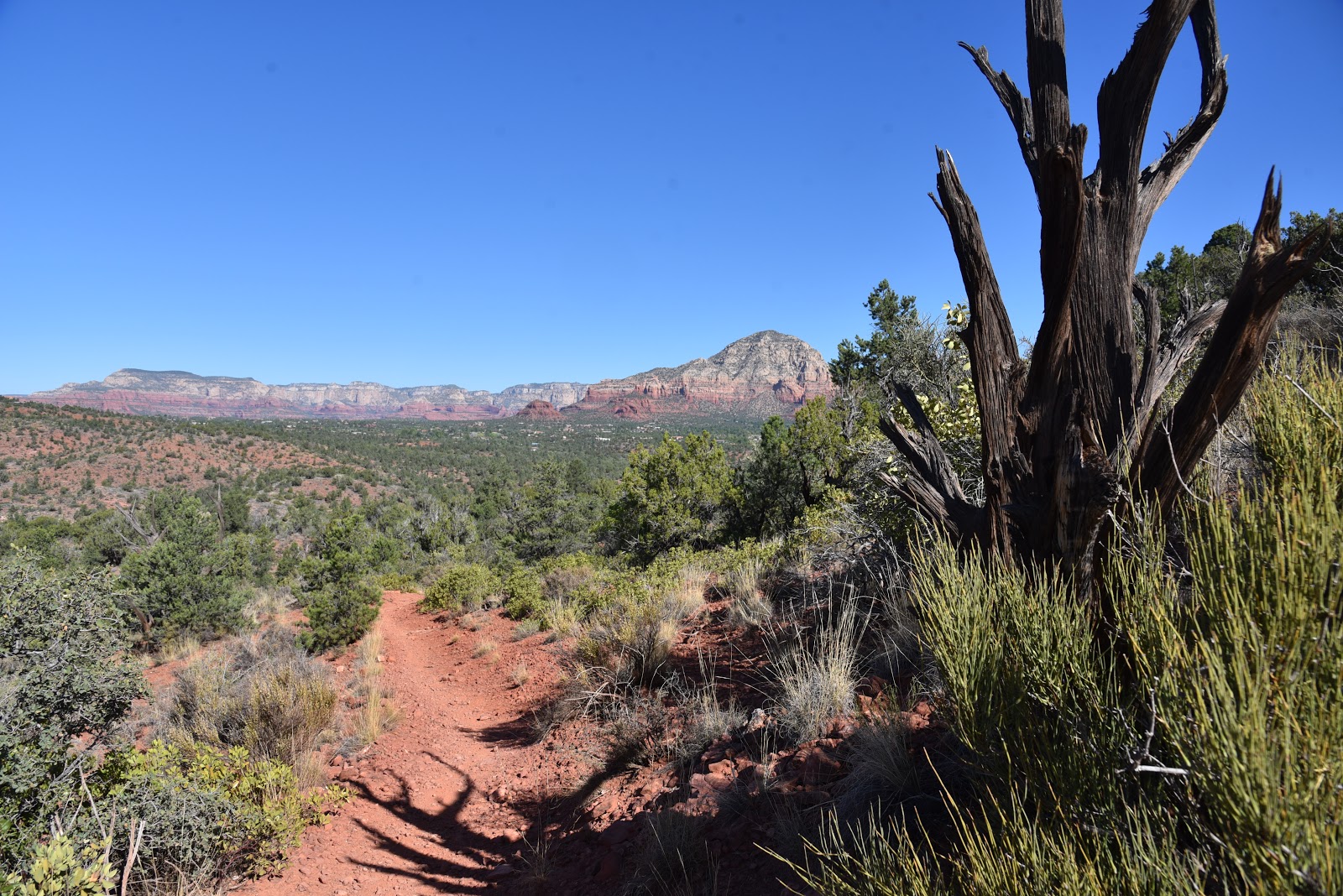
| Bear Mountain seen from the Ridge Trail |
 |
| Red rocks and gullies on Ramshead Trail |
However, scenic climaxes such as this one are best experienced with a little foreshadowing. By looping it up with the Coconino National Forest Old Post, Ramshead and Ridge trails, the journey is a slow burn to the in-your-face final act.
 |
| Go either way at the Ridge Trail junction |
Beginning at the Old Post trailhead, which is little more than a dirt turn out, the circuit heads north to connect with the Ramshead trail. Ramshead rolls out the teases with peeks at Cathedral Rock, the distant Bradshaw Mountains and the leafy course of Oak Creek and its floodplains.
 |
| Scenic overlook opposite the Secret Slickrock trailhead |
The trail crosses a road and continues up russet sandstone ledges to meet the Ridge Trail junction where hikers may go either right or left to get to Secret Slickrock. For this trip, go left, hike 0.4 mile and head right and trudge 0.1-mile up paved Chavez Ranch Road to the scenic overlook parking area.
 |
| High desert flora on the Secret Slickrock Trail |
The overlook serves as the hike’s penultimate moment.
 |
| A fugitive cairn (center right) on Secret Slickrock |
A bare rock ledge hangs over Oak Creek and the Crescent Moon Picnic Area that’s world famous for its access to one of the most photographed sites in the Southwest, the towering spires of Cathedral Rock reflecting into the river. While the spot is great for making pretty pictures, the big show happens across the road where junipers shade the sign for the Secret Slickrock trail. A brief section of level trail opens up views of Sedona’s chiseled land forms all around before encountering an abrupt edge where a steep staircase-like trail marks the descent to a massive stone platform.
 |
| Autumn color along Oak Creek seen from Secret Slickrock |
The open air, bald stage is home to a convergence of blue sky, red rock towers and the tree-cluttered course of Oak Creek flowing below.
 |
| Cathedral Rock viewed from Secret Slickrock |
 |
| Capitol Butte viewed from Secret Slickrock |
The tiny paradise is a microcosm of everything Sedona. It has reflecting pools like the remote and difficult Cow Pies Trail without the effort to get to them. Heavenly views of iconic vortex Cathedral Rock looming over Oak Creek, without the crowds. A mix of cactus-and- yucca-studded high desert grasslands and 360-degree mountain vistas all in one place.
 |
| Maps like this one are posted at trail junctions |
Closing up the loop hike can be tricky because the trail disappears on the slickrock. Only fugitive basket cairns mark the sketchy route that descends to reconnect with the Ridge Trail. The trail is there, but route-finding and attention to uneven footing are required for those looking upgrade from the 5-cent tour.
 |
| Grasslands and mountains on Secret Slickrock |
LENGTH: 5 miles round trip as described here
RATING: moderate
ELEVATION: 3,955 – 4,185 feet
GETTING THERE:
Old Post Trailhead:
From the State Route 179/89A traffic circle in Sedona, go 4 miles west (toward Cottonwood) on SR 89A to Upper Red Rock Loop Turn left and continue 1.8 miles to Chavez Ranch Road (Forest Road 216A), turn left and go 0.1 mile to the Old Post trailhead on the left.
To drive to the Secret Slickrock trailhead, continue on Chavez Ranch Road to the trailhead located a few yards past the Forest Road 788A junction at a road gate. The trail begins across from the parking apron and forest service kiosk.
INFO:
Coconino National Forest
https://www.fs.usda.gov/recarea/coconino/recarea/?recid=72089