Find A Trail. Start Your Search Here:

Showing posts with label Arizona Cypress Trail. Show all posts

Monday, January 26, 2026

OK-Dawa-Arizona Cypress Loop


OK-DAWA-ARIZONA CYPRESS TRAIL LOOP
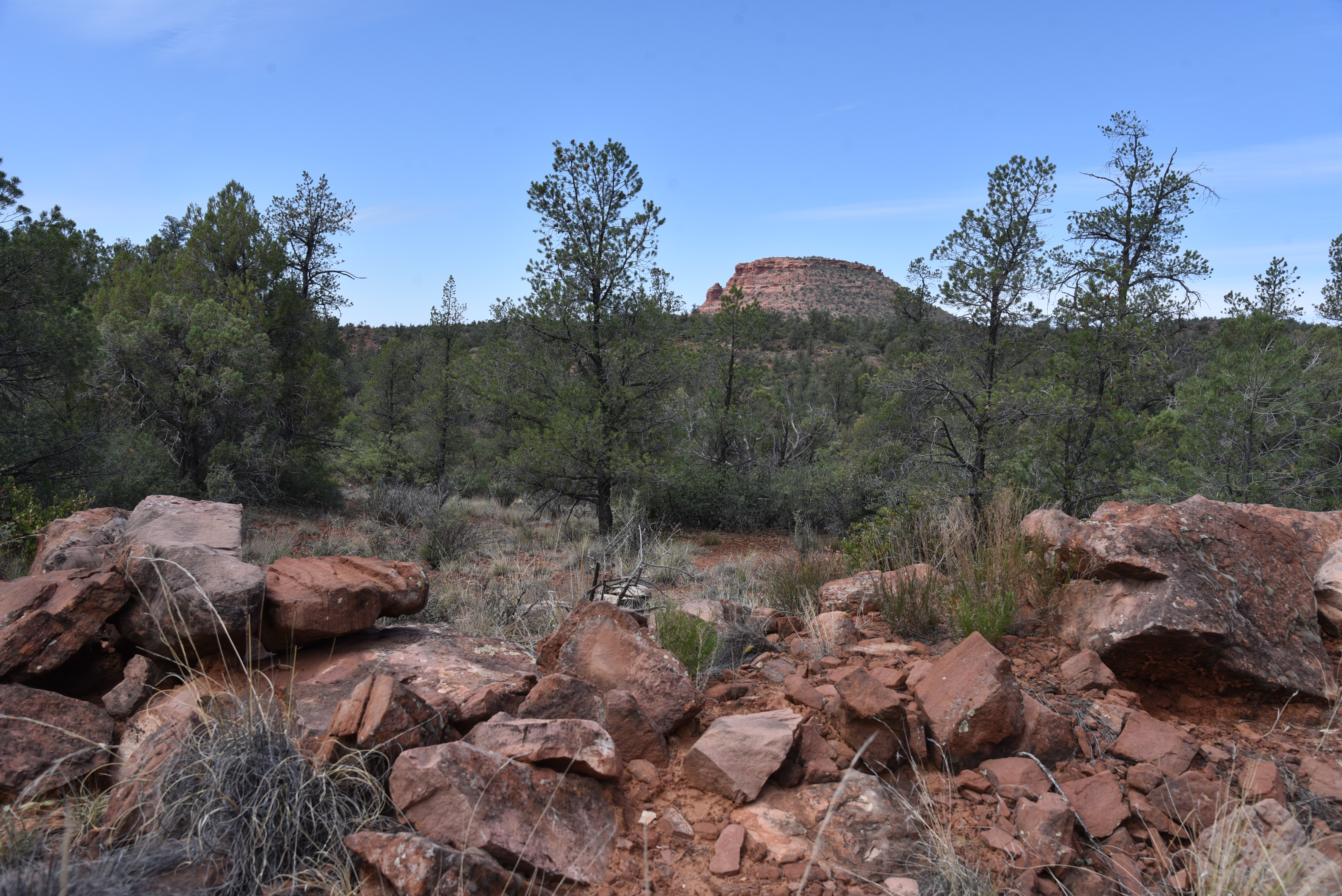
Mescal Mountain seen from Dawa Trail

Best tip for hiking in Sedona—learn to appreciate the little trails. Many of Red Rock Country’s lesser-used routes offer easy access, no fees and surprisingly available parking.

Arizona Cypress Trail

The Upper Dry Creek Area Trails are a great place to start exploring the joys of under-the-radar hiking.  
Sycamores in Dry Creek

Easy to access off Dry Creek Road and Boynton Pass Road in West Sedona, the maze of short, interconnected trails wind through classic high desert ecozones, mingling with the jumbled corridor of Dry Creek and scoured drainages.  Excellent map signs placed at all trail junctions make finding your way around so easy.
Bear Mountain seen from OK Trail

One scenic loop to try uses the OK, Dawa and Arizona Cypress trails. The simple-to-follow routes are neither secret nor hidden. They’ve been around for decades, existing in relative quiet not far from the famously popular Bear Mountain, Fay Canyon and Devils Bridge trails.  
Doe Mtn (L) and Bear Mtn seen from Dawa

Starting from the blink-and-you’ll miss-it OK Trailhead, a short access path dives into juniper-cypress forests with glimpses of Doe Mountain on the western skyline.  At the first junction, pick up the Dawa Trail (Dawa is Hopi for moon) heading west. Evidence of this trail’s former life as a dirt road pops up intermittently as it jogs between sunny meadows and deep woods. Sometimes wide, sometimes a narrow footpath.
Shaggy bark on an AZ Cypress tree

The trail makes a gradual climb to a scenic high point where views of Bear Mountain, Mescal Mountain, and the Cockscomb formation stand out in an arc of rusty stone. At the 0.8-mile point, veer left at a junction to stay on the Dawa trail as it twists down to meet the leafy corridor of Dry Creek.
Dawa Trail crosses Dry Creek

AZ Cypress Trail

Lush with manzanita and flowering shrubs, yucca and mesquite, there’s plenty of shade between breaks in the tree cover that frame mountain and wide valley views.
Chimney Rock seen from Dawa Trail

Just past a crossing of the creek, pick up the Arizona Cypress Trail (go left again), which parallels the creek.  True to its name, the route is flush with the eponymous shaggy barked conifer with distinctive geometric seed pods.
Map kiosk at the OK Trailhead

For the final leg, follow the OK Trail back to the first junction and backtrack to the trailhead where a kiosk shows an overview of the many hike options available to hikers who love solitude, options and a good leg stretch. 

LENGTH: 2.7-mile loop

RATING: easy

ELEVATION: 3,339 – 4,539 feet

GETTING THERE:

OK TRAILHEAD: From the State Route 179/89A traffic circle in uptown Sedona, go 3.2 miles west (go left) on SR 89A to Dry Creek Road.  Follow Dry Creek Road 2.8 miles to Boynton Pass Road, turn left and continue 0.5-mile to a small parking area on the left.  There’s room for 3-4 cars. A Red Rock Pass in not required at this trailhead. 

NOTE: The Sedona Shuttle does not serve this trailhead.  For info on how to use the FREE shuttle to access popular trailheads Thursday – Sunday, visit https://sedonashuttle.com

Monday, May 13, 2024

Arizona Cypress Trail: An Old Favorite

ARIZONA CYPRESS TRAIL

Scaled AZ cypress cones

Hitting a never hiked trail for the first time is always a thrill.  New views, unfamiliar terrain, and the fun of navigating an untested route are big draws for those who crave fresh outdoor experiences.  And then there are the familiar “go-to” routes. 

Trail crosses Dry Creek several times

Like polar opposites, one serves up a rush of adventure while the other is like the comfort food of hiking.  While untried adventures will always woo us, many of us hikers spend more time in the comfort zone.
Blackfoot daisies bloom March - December

Whether hiked to train for a big trek or for long-term conditioning, comfort trails are those that are a combination of convenience, familiarity, and reliable experience.

Doe Mtn. (L) and Bear Mtn. from AZ Cypress trail

 Most hikers have a favorite—the one they return to time and again, with or without a salient explanation.
Upper Dry Creek Area Trails

The Arizona Cypress Trail in Sedona checks all the boxes for a no hassle go-to trail.

The classic Sedona trail can be access by way of a large parking area with emptiness probably perpetrated by the adjacent target shooting area.  The repellant trailhead noise is a tolerant hiker’s gain leading to light traffic and easy parking—a rare treat in Sedona.

Featherplume bloom March - June

The route immediately ducks into the forest where canyon walls absorb the intermittent pop-pop of gunfire.

AZ cypress trees along the trail

This trail’s sticking power is magical elixir of solitude (unusual for a trail located down the road from Devils Bridge) and sweet scenery wrapped around a desert waterway in the Upper Dry Creek Area Trails Coconino National Forest.  

Tufted Evening Primrose bloom Apr-Sep

It’s an easy 3.8-mile out-and-back hike on AZ Cypress. But there are plenty of ways to extend the trek. The trail links up with a looped maze of eight routes that use the old standard Girdner Trail as a backbone that runs south to connect with the Western Gateway trails.  
False toadflax blooms April - August

Several crossings of Dry Creek, traipses through wildflower meadows, manzanita thickets, and highpoint vistas showcasing familiar landmarks like Cockscomb, Capitol Butte, Doe Mountain, and Bear Mountain keep things interesting but the eponymous cypress trees alone are enough to keep this trail on auto rewind.
View of Cockscomb formation from AZ Cypress

Cupressus arizonica can grow up to 90 feet tall, but most are around 40-60 feet and it’s the only cypress native to the Southwest. The deep emerald conical-shaped trees thrive at elevations between 3,000- 6,000 feet, with a preference to drop roots along intermittent streams.  The attractive evergreen has a distinctive shedding shaggy bark and scaly blue-green leaves that emit a pleasant piney fragrance.  The tree’s most distinctive feature is the woody, walnut-sized scaled cones that look as if they might encapsulate some alien lifeform.

Ash trees in Dry Creek

Even when spent, the cones can cling to branches in eerie black clumps.  It’s not just the seeds that are tenacious--scientists studying pollen trapped in ancient packrat middens say the species has been around since prehistoric times, at least since the icy Pleistocene Epoch---a testament to its namesake trail’s steadfastness.

LENGTH: 3.8 miles round trip

RATING: moderate

ELEVATION: 4,309 – 4,416 feet

GETTING THERE:

Arizona Cypress Trailhead: From the State Route 179/89A traffic circle in Uptown Sedona, go 3.2 miles west (toward Cottonwood) on SR 89A to Dry Creek Road. Follow Dry Creek Road 2.7 miles to the turnoff for Forest Road 9589 (not signed) on the left. This easy-to-miss turnoff is located a few yards south of the Boynton Pass Road/Long Canyon Road “T” intersection.Continue 0.2-mile on FR 9589 (good dirt with a few potholes) to the end and the parking circle at the AZ Cypress trailhead.  NOTE: there is a target shooting pit near the trailhead, which might frighten dogs and horses. There are no fees or facilities at this trailhead.

INFO & MAPS

https://www.fs.usda.gov/recarea/coconino/recarea/?recid=71954&actid=50


Monday, August 1, 2022

Snake-Anaconda-AZ Cypress Loop

SNAKE-ANACONDA-AZ CYPRESS LOOP

High desert vegetation on the Anaconda Trail

If there’s such a thing as an underside of Sedona’s trail systems, it must be where the snakes are.

A velvet ash tree shades a crossing of Dry Creek

Reptilian only in their stealth and serpentine courses, the Anaconda and Snake trails are

tucked into the core of the Upper Dry Creek Area Trails which is about as close as one can get to an underside in Red Rock Country.

Agave are plentiful on the Anaconda trail

 
The two short singletracks serve as customizable legs for various linear and loop hike options in a hilly parcel of Coconino National Forest not far from the juggernauts of Bear Mountain, Devil’s Bridge and Boynton Canyon.
Juniper and prickly pear cacti on the Snake Trail

The trail duo is best accessed from the isolated AZ Cypress trailhead that sits like an ignored middle child about a mile north of the congested Dry Creek Vista trailhead on Dry Creek Road.

Beehive cactus on the Anaconda Trail

View of Red Rock Secret Mountain Wilderness

One way to try these twisting paths is to tie in with the AZ Cypress trail for a moderate-rated, 3.3-mile trek.
Mescal Mountain (center, red) seen from hike high points

The benefits of hiking in this woodsy pocket begin at the roomy trailhead that’s usually free of parking quagmires.  The circuit starts with a 0.1-mile hike to the AZ Cypress/Snake junction. 
Trails are well signed

The route is well signed throughout with directional and map signage. The half-mile Snake trail marks the beginning of a mild 650-foot climb up the east flanks of a knoll above the Dry Creek drainage area. 
Doe Mountain (left) and Bear Mountain

Willows at a crossing of Dry Creek

Gradually, fantastic views of Mescal Mountain and the colorful rock formations of Red Rock Secret Mountain Wilderness peek out over a sea of junipers, fir and cypress trees. The edgy route bends to the south, exposing views of iconic Lizardhead, Chimney Rock and Courthouse Butte before connecting with the Anaconda trail. 
Shady passage of AZ Cypress Trail along Dry Creek

Over its 1.7-mile length, Anaconda lives up to its name with relentless kinks, bends and sinuous curls that land hikers at the loop’s highest points overlooking the Cockscomb formation, Doe Mountain, Bear Mountain and the distant double mesas of Wilson Mountain to the northeast. The hike’s apex territory is dominated by classic high desert vegetation. Cacti, manzanita, yucca, agave and a smattering of mesquite trees thrive among scrub oak and junipers. 
Most of the climbing happens on the Snake Trail

Heading due west, Anaconda trail stairsteps down red earth ledges to meet the AZ Cypress trail, the final leg of the hike, at the edge of Dry Creek. 
Yellow menodora bloom April - September

Now in a moister microclimate, the environment shifts from sunny and spiny to shady and succulent.  Tracing the creek for its entire 1-mile length, AZ Cypress trail is like a green tunnel replete with massive tree cover with water loving species like willows, velvet ash and sycamores tossed in for variety.
Mountain lion? Measured about 5" high.

The narrow path clings to shelves above the ephemeral waterway which flows after rains and during snowmelt season.  While this Eden-like scene undoubtedly includes actual snakes, encounters are rare. Like anywhere in Arizona, hikers probably walk by a few snakes on every trail, oblivious to their presence. Preferring to hide in brush and under rocks during the day, snakes value their peace and quiet--not unlike hikers who gravitate to places like this.
Cockscomb formation seen from Anaconda Trail

LENGTH: 3.3-mile loop

RATING: moderate

ELEVATION: 4,329 – 4,678 feet

GETTING THERE:

From the State Route 179/89A traffic circle in Uptown Sedona, go 3.2 miles west (toward Cottonwood) on SR 89A to Dry Creek Road. Follow Dry Creek Road 2.7 miles to the turnoff for Forest Road 9589 (not signed) on the left. This hidden turnoff is located a few yards south of the Boynton Pass Road/Long Canyon Road “T” intersection.

Continue 0.2-mile on FR 9589 (good dirt with a few potholes) to the end and the parking circle at the AZ Cypress trailhead. 

INFO:

Coconino National Forest
https://www.fs.usda.gov/recarea/coconino/recreation/hiking/recarea/?recid=71954&actid=50

Monday, May 24, 2021

Dawa Loop

DAWA LOOP

“Where’s Fay Canyon,” the bewildered couple asked of me on the Cockscomb Trail.  “Across the road from the trailhead,” I replied.

Conifers shade a crossing of Dry Creek

With the faint aroma of marijuana drifting from their air space, they added, “Thanks, that’s the trail we want. This one stinks.”

Stinks?  Being one who picks her fights, I let the offhanded dis roll, bid them a good day and continued hiking on one of the best “stinky” trails in Sedona.

View of Doe Mountain from Cockscomb Trail


While Fay Canyon and the many other classic trails like Doe and Bear Mountains located along Boynton Pass Road in northwest Sedona are terrific, so are the dozens of routes that mill around the canyon-riddled landscape below the iconic big-name draws. 

Barberry shrubs bloom Apr-Jul

Offering quieter, less congested tours of Sedona’s spectacular scenery, the trails that explore the woody terrain around Dry Creek serve up myriad high-desert hike options. 
New Mexico locust bloom May-July

Like many Red Rock Country trails, the cluster south of Doe Mountain are short, interlaced and designed for easy customization. 

The route crosses Dry Creek several times

The Ok Trail traces a ledge above Dry Creek

Excellent map signs posted at trailheads and along the trails make it easy to plan a hike to suit individual preferences.  There are no bad choices.  None stink.  One circuit to try uses the Cockscomb, Dawa, Ok and Arizona Cypress trails for an interesting lollipop loop.  From the Fay Canyon trailhead, head out on the Cockscomb Trail. 
Tufted evening primrose bloom Apr-Nov

This 0.9-mile tether trail passes through sunny meadows and rolling hills with great views of Doe Mountain to the west and Mescal Mountain on the northeast horizon. where At the signed Dawa Trail junction, veer left to begin the first leg of the hike’s loop segment. 
Cockscomb formation seen from Dawa Trail

Here, mountain views begin to recede as vegetation thickens with pinon pines, cypress and New Mexico locust towering over prickly barberry shrubs. The first of several crossings of Dry Creek, which usually lives up to its name, comes just before the 1.7-mile point, where the route turns right onto the Ok Trail.  Over its shady, 0.2-mile length, the Ok Trail traces the ledges above the creek before it meets the Arizona Cypress Trail. 
A late-blooming Strawberry hedgehog cactus

At the junction sign, continue straight ahead, past a huge Arizona Walnut tree to where the trail makes another crossing of the creek.  Strewn with colorful river rocks and tumbled pebbles, the creek channel here includes a ragged wall of scoured red earth.
Desert four o'clock bloom Apr-Sept

 
Engelmann's prickly pear cacti bloom Apr-Jun

Living up to its name, the Arizona Cypress Trail is lined with hundreds of the eponymous shaggy-bark conifers, including a massive, decaying specimen just past the creek cross. 
Mescal Mountain (center) seen from Dawa Trail

It takes at three-person chain to hug the trunk of the not-quite-totally-dead tree.  Look closely and you’ll see a few living branches sprouting from the last viable sapwood of the ancient tree.  
Narrowleaf penstemon bloom Jun-Aug

This mostly viewless leg of the route parallels the creek for a half-mile, then reconnects with the south arm of the Dawa Trail.  As the path climbs out of the creek channel, it unpacks a fresh set of vistas.  
The Arizona Cypress Trail lives up to its name

To the southeast, the familiar forms of Courthouse Butte, Capitol Butte and Chimney Rock stand out above green canopies.  Gradually, the close-knit creekside greenery gives way to exposed ridges where cacti, wildflowers and blooming shrubs thrive in red-tinged soils.  
Teeny-weeny Miniature wool star bloom Mar-Jun

In just under a mile, the route returns to the first Dawa Trail junction, where you’ll retrace your steps on the Cockscomb Trail back to the trailhead or use the map signs to add more miles.
Map signs make navigation easy

LENGTH: 4.2-miles

RATING: easy

ELEVATION: 4,334 – 4,569 feet

GETTING THERE:

Fay Canyon Trailhead.

From the State Route 179/89A traffic circle in Sedona, veer left and go 3.2 miles on SR 89A to Dry Creek Road. Turn right and continue 4.5 miles on Dry Creek Road to the Boynton Canyon Road intersection, turn left onto Boynton Pass Road and go 0.5-mile to the trailhead on the left. There’s a restroom at the trailhead. A Red Rock Pass is not required.

INFO:https://www.fs.usda.gov/recarea/coconino/recarea/?recid=54974