Find A Trail. Start Your Search Here:

Showing posts with label kid hikes. Show all posts

Wednesday, June 22, 2022

Keyhole Sink

KEYHOLE SINK

Keyhole Sink surrounds a moist seep area

Not too far off Old Route 66 a few miles east of the town of Williams, a cloistered box canyon with vertical stone walls encircles a depression where water sometimes cascades over the cliffs and pool at the base of the pine-shaded oasis. 

The woodsy approach to Keyhole Sink

The sounds of tree frogs, birds, and scampering squirrels bite through a soundtrack of wind rustling through aspen canopies.  The moist, cool place vibrates with a life essence that transcends the moment.  It’s like walking through a sort of time capsule set on perennial-fill mode.
A petroglyph panel at Keyhole Sink

The Kaibab National Forest site’s ample forage grasses, water and quiet isolation made this a perfect spot for wildlife to congregate, feed, drink, and--oh yeah--be stalked.  

Aspen saplings on the Keyhole Sink Interpretive trail

From roughly 1,000 years ago, ancestral Native American hunters documented their experiences at this enchanting hideaway by pecking images of deer, bear and other local wildlife into the folds and panels of cliff faces that are the weathered remains of ancient lava flows.   Today, hundreds of the images are visible on the volcanic escarpments.
Keyhole Sink is a wildlife oasis

Dense galleries depict a vibrant, and resource-rich environment.  While the meaning and utility of the petroglyphs is best known to the makers, present day viewers may immerse in the pure beauty of the etchings and extrapolate the notes of celebrations, observations, and maybe just the plein air sketches they may have depicted.  Regardless, it’s clear that Keyhole Sink remains a living, breathing microcosm of life in the forest. 
Visitors must be front-line protectors of this heritage site

A short, interpretive trail and a descriptive brochure available online, guide visitors through the woodsy outdoor classroom.

Sadly, there’s a history of vandals defacing the rock art. Restoration involves hundreds of volunteer hours, thousands of dollars, and years of work with no guarantees of fully rehabilitating the artfacts.  Why this happens in a place that is sacred to modern Native American tribes is beyond comprehension. The place is not a “ruin”, it’s an ancestral homeland.

Although Keyhole Sink is monitored by Arizona site stewards, visitors must be the front-line protectors. As with all heritage sites, respect the irreplaceable artifacts. Do not touch or otherwise alter the rock art, stay on designated trails, pack out all trash, and leave what you find so that future generations may appreciate this Arizona point-of-pride.

LENGTH: 2 miles round-trip

RATING: easy

ELEVATION: 7,100 – 7,000 feet

GETTIGN THERE: From Flagstaff, go 16 miles west on Interstate 40 to the Parks exit 178. Connect with Historic Route 66 and go 4 miles west (left) to the Oak Hill Snow Play Area on the left. The trailhead is located across the road from the parking lot at a signed gate.

INFO:

Kaibab National Forest

https://www.fs.usda.gov/recarea/kaibab/recarea/?recid=11678


Wednesday, May 11, 2022

Wildlife Watching in Dead Horse Ranch State Park

DEAD HORSE RANCH STATE PARK LAGOONS

Mingus Mountain reflects in a lagoon at DHRSP

Wildlife watching in Dead Horse Ranch State Paris a hit-or-miss prospect.

Great blue herons are easy to spot at DHRSP

It’s a definite maybe for a river otter sighting, odds are good to spot a Great blue heron and certainly a red-winged blackbird, and observant watchers might spy a fast-moving California kingsnake. 
Limestone cliffs flank a lagoon at DHRSP

All bets are off though, for catching a gray fox climbing a tree.  
Diverse habitats at DHRSP attract wildlife

Still, a walk through the park that melds a semi-arid high desert climate with a humid riverside riparian habitat yields animal encounters both common and rare.
Silverleaf nightshade bloom along the lagoon trails


Situated on the north banks of a tree-lined bend of the Verde River, Dead Horse Ranch State Park has more than 20 miles of hiking trails. 

Keep wildlife wild. Observe from a distance.

Vociferous red-winged blackbirds thrive among reeds

The park trail menu has options for hikers of all ability levels including the ADA-accessible Canopy Trail, easy lagoon loops, and access to more challenging Coconino National Forest routes like 15.8-mile Lime Kiln Trail and Raptor Hill.  With easy access from Old Town Cottonwood, shaded paths in the Verde Valley park offer a quick escape from summer heat.  

Under a canopy of cottonwood, walnut, and willow trees, three level, multi-use, accessible trails loop around the park’s lagoons that draw river water by way of the historic Hickey irrigation ditch.

Globemallow add spots of orange to the trails

Open to hikers, bikers and leashed dogs, the wide, groomed tread of the loops is welcoming to strollers and other mobility devises making them family-friendly choices for exploring the water-centric site.   
River otters, waterfowl, deer and amphibians live in the park

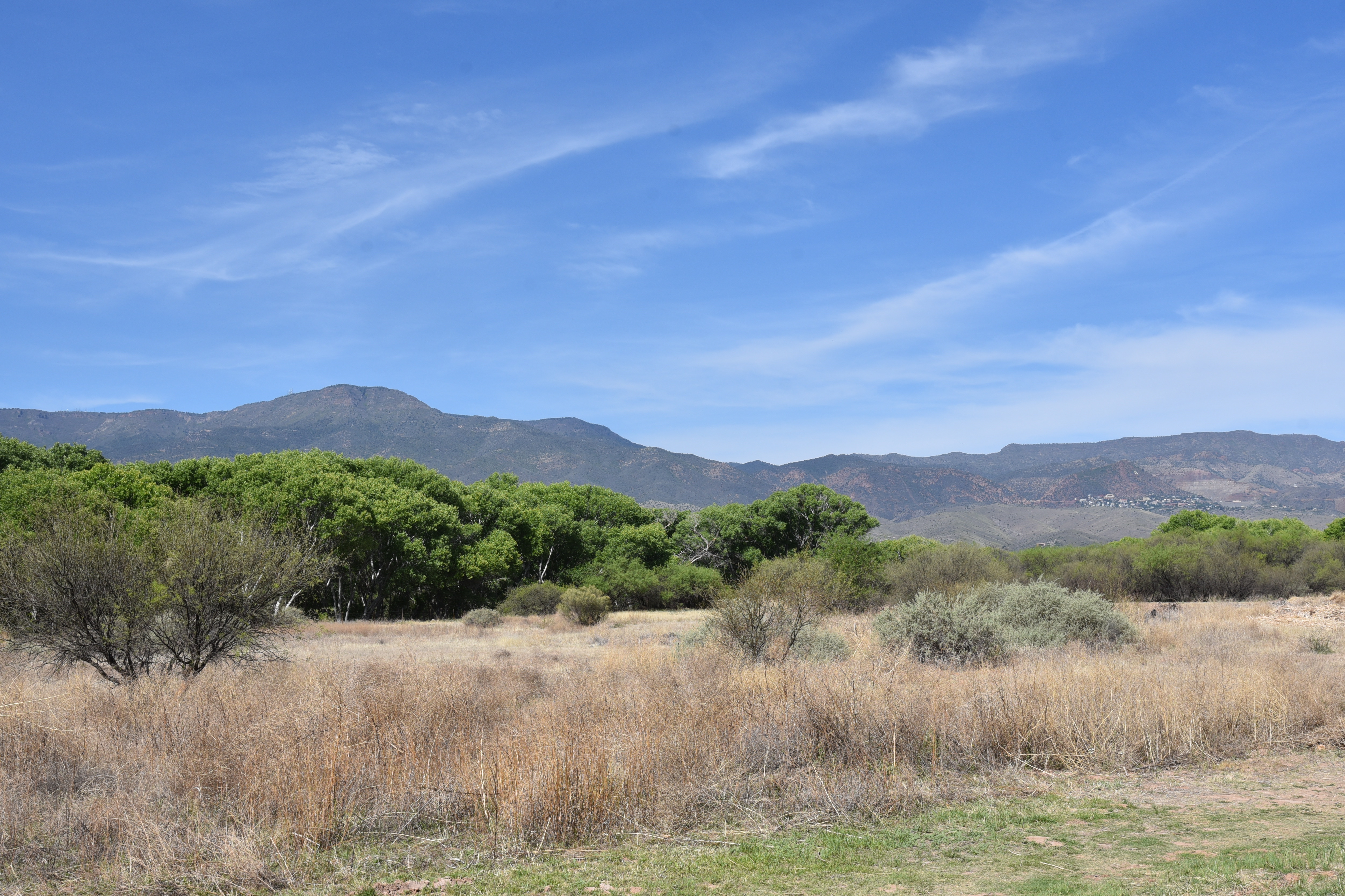
A walk around the reedy, birdy ponds that capture mirror images of distant Mingus Mountain and a nearby wall of layer cake limestone reveals an oasis-like environment that abuts both a shady river corridor and arid mesquite scrubland. 

Benches and picnic tables placed around the lagoons provide comfortable places for observing wildlife in their natural environments. 

Lagoon trails are easy and accessible

AZ black walnut trees shade the lagoon trails

For best results, consult the Arizona Game & Fish Department’s Wildlife Viewing Tips. And remember to keep wildlife wild by not feeding or disrupting their habitats.

LENGTH: 1.9 miles total for lagoon loops

RATING: easy-accessible

ELEVATION: 3,300 feet

GETTING THERE:

675 Dead Horse Ranch Road, Cottonwood.

From Main Street in Cottonwood, go south on 10th Street and follow the signs to the park.

DAY USE HOURS: 7 a.m. – 7 p.m.

FACILITIES:

Visitor center, camping, cabin rentals, ramadas, fishing, restrooms, horseback rides

FEE: $7 daily fee per vehicle

INFO & MAPS:

https://azstateparks.com/dead-horse/

TIPS FOR OBSERVING WILDLIFE:

https://www.azgfd.com/wildlife/viewing/

Monday, November 29, 2021

Camino Campana

CAMINO CAMPANA

Camino Campana was dedicated on 10-31-21


Desert pop quiz!  What’s metarhyolite?  How many entrance holes are in a packrat midden? What’s the function of a “nurse plant”?  In what ways do dead saguaros benefit the environment?  Stumped? 

Chris & Dawn Vandell of Ftn Hills walk their dog Vinny

To learn the answers to these questions and much more, take a stroll on the Camino Campana in the Scottsdale McDowell Sonoran Preserve. 
Pablo Moyano of Mesa inspects a geology display

The trail is named for Kathryn “Sam” Campana who has been an advocate for environmental issues, a Scottsdale elected official, non-profit executive, arts advocate, volunteer and mover-and shaker in the planning and development of the preserve.  The 0.74-mile, barrier-free interpretive path which loops through breezy desert at the base of Fraesfield Mountain is outfitted with beautifully-illustrated signs and interactive displays. 
Leashed dogs are welcome on preserve trails

Each of the 11 educational stops along the route explores a different aspect of the surrounding landscape.  Hikers will learn about geology, bird nests, human history, archeology, wildlife and plants.  The wide, stroller and wheel chair accessible trail is perfect for those with mobility challenges or wrangling kids while restrooms and shade at the trailhead round out the family-friendly amenities.  
An ersatz mountain lion stalks its prey

The trail also has a surprise lurking in the mesquite that gives hikers a momentary fright. 
A harmless coachwhip snake slithers for cover.

Who lives here? There's a sign for that.

Look for a metal silhouette of a mountain lion stalking its prey that looks startling real from a distance. 
Seven-month-old Vinny strikes a pose.

Dedicated on October 31, 2021, the meandering loop unwinds its instructive gems with intuitive panache.  A kiosk about washes leans over a wash, a sign directing visitors to look to the sky sits below a hillside popular with raptors and a strategically-placed view station with a postcard-style frame and adjacent selfie stand presents an irresistible opportunity to document the trip. 
The Camino Campana is wide and barrier-free

LENGTH: 0.74 mile loop

RATING: easy, barrier-free

ELEVATION: 2,540 ft

GETTING THERE:

Fraesfield trailhead:

13400 . Rio Verde Dr., Scottsdale.

From Loop 101 in Scottsdale, take the Princess/Pima exit 36 and go 6.5 miles north on Pima to Dynamite Blvd./Rio Verde Dr.  Turn right and go 5.6 miles to the trailhead on the left.  There are restrooms but no water at the trailhead.

PRESERVE HOURS: Sunrise to sunset daily. Check website for exact times.

INFO:

https://www.scottsdaleaz.gov/preserve


Monday, August 12, 2019

Fain Park Trails

FAIN PARK TRAILS
Shoreline Trail traces the edge of Fain Lake
A grotto on Lynx Creek
There's much to see and do at Fain Park.
A Great blue heron wades in Fain Lake
Juniper and scrub oaks shade the hillside trails
Observation deck above the dam has great views
Huge cottonwood trees thrive around the water
Tucked into a ravine between industrial parks and subdivisions five miles downstream from Lynx Lake in Prescott Valley, Fain Lake offers a diverse menu of outdoor recreation opportunities. 
Lynx Creek Loop is a core route in the 6-trail system.
The lake is the center piece of a 100-acre park that’s named for the Fain family—one of the original settlers in the area—who donated the land to the Town of Prescott Valley in 1997. The tiny oasis located less than a mile off busy State Route 69 provides easy access to fishing, gold panning, picnicking and hiking while embracing its multi-faceted heritage and natural resources with educational components.  The mineral-rich, creek-side property has been explored, hunted, mined and homesteaded since prehistoric times. 
Silverleaf nightshade blooms along the trails
The discovery of gold in the nearby Bradshaw Mountains in the mid 1800s brought on a boom of mining activity and several historic artifacts and buildings from this profitable era are preserved in and around the park. 
A restored stamp mill in the park's mining artifact display 
Noteworthy among the many points of interest is a collection of defunct mining equipment on display along the Lynx Creek Loop Trail.
Old fence on the Calvary Trl frames views of Glassford Hill 
Relics including rusty gears, cogs, jacks and a magnificently-restored stamp mill---a kind of crushing machine used in the processing of ore— are outfitted with signs that explain their function in the laborious pursuit of extracting gold from rock and water. The hills above the 3-acre lake are outfitted with a convoluted system of loopy trails.  Two primary routes—the Lynx Creek Loop and the Cavalry Trail combine for a 1.6-mile circumference tour while the Canyon, Chapel, Overlook and Shoreline trails provide scenic detours.
A bridge spans a finger cove on Fain Lake.
Although there are no official mileages given for the secondary trails, my GPS recorded 3.6 miles for the entire system. 
A sacred datura plant on the Lynx Lake Loop trail
The trails wind among scrubby highlands, slender canyons, leafy backwaters behind the lake’s dam, calm shorelines, a created waterfall and stony grottos along Lynx Creek.  Although the trails are well-marked, seasonal flooding and washouts can make certain areas inaccessible, but the system’s interconnected layout makes it easy to circumvent the sporadic obstacles. 
Lush riparian habitats along the Calvary Trail
The popular community fishing lake is stocked regularly with rainbow trout (except in July and August) by Arizona Game and Fish Department. A fishing dock, bridge, dam observation platform, picnic ramadas, restrooms and a barrier-free lakeside path round out the family-friendly amenities of this compact gem.
View from the Overlook Trail in Fain Park
LENGTH: 3.6 miles
RATING: easy - moderate
ELEVATION: 4954 - 5133 feet
GETTING THERE:
2215 N. 5th Street, Prescott Valley.
From State Route 69 in Prescott Valley, go 0.1-mile south on Prescott East Highway to 2nd Street.  Turn left and go 0.1-mile to 5th Street, turn right and continue 0.4 mile downhill to the park. Park hours are 7 a.m. to 10 p.m. October – March and 5 a.m. to 10 p.m. April – September.
INFO: Prescott Valley Parks and Recreation Dept.
-->

Monday, April 29, 2019

Kendrick Park Watchable Wildlife Trail

Kendrick Park Watchable Wildlife Trail
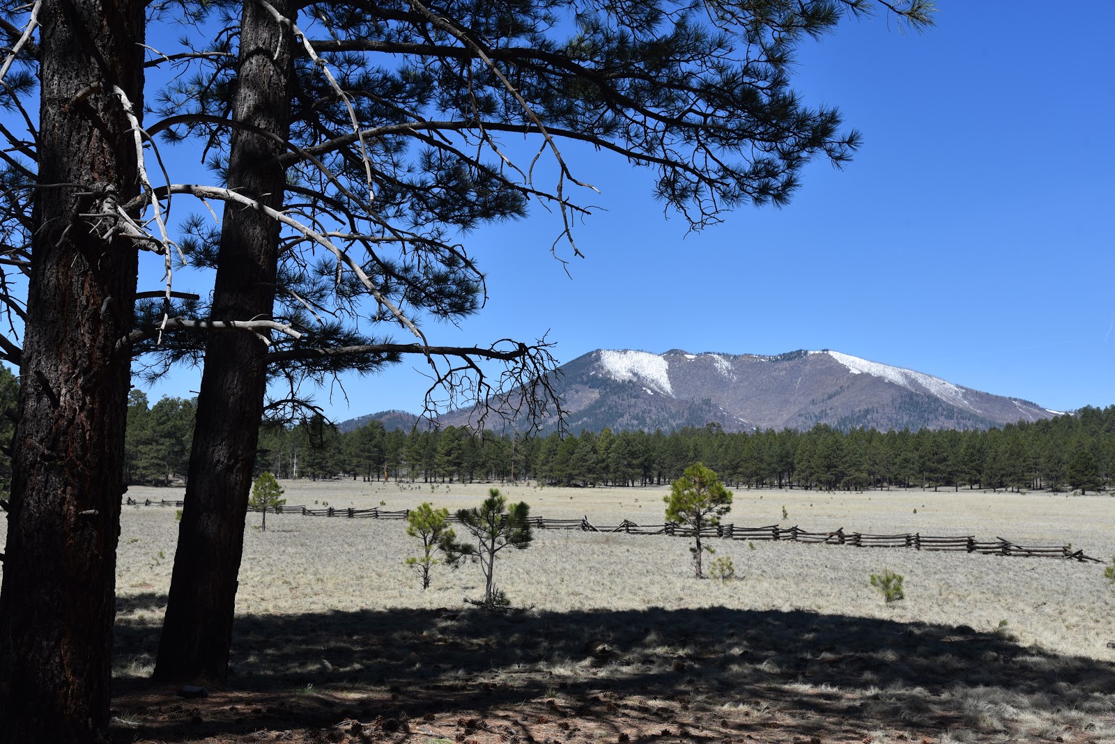
Kendrick Peak seen from Kendrick Park
To young children, traveling the stretch of U.S. 180 that runs between Flagstaff and the south rim of the Grand Canyon can feel like being trapped in a careening container with few sights that appeal to kiddie sensibilities.
A  Ponderosa pine tree provides cover for wildlife viewing
Electronic devise-enabled distractions only last so long before cries of ‘are we there yet’ and ‘I have to go potty’ demand a break from the drive that flows between pine forests and the desert plains of the Colorado Plateau. 
Aspen regeneration project along the outer loop.
The fix is a stop at Kendrick Park Watchable Wildlife Trail.  Complete with walking paths and a restroom, the site that sits on 2000 acres roughly 20 miles north of Flagstaff offers a chance to stretch legs, decompress and maybe learn a thing or two.   The U.S. Forest Service property has two short loop trails that explore biologically diverse spaces in alpine meadows, pine woodlands and aspen glens with excellent views of the San Francisco Peaks (12,633 feet) and Kendrick Peak (10,418 feet).  The quarter-mile short loop is paved and suitable for strollers and wheelchairs while the 1.2-mile outer loop follows a flat dirt trail. 
The San Francisco Peaks soar to 12,633 feet.

Many teaching moments punctuate the hike.
Both paths are outfitted with interpretive signs that describe fascinating facts about the area’s plants, animals and history. 
Two easy loop trails explore the property.
The compact system is packed with points of interest. An abandoned potato field, corral and campsite document some of the surprising ways people have used the land in the past.  Along the outer loop, an aspen recovery area at the edge of sprawling grasslands and signs that explain how wildfires have impacted the landscape illustrate the complex forces that continually shape the delicate ecosystems.  Of course, the big draw here is the opportunity for real-time wildlife viewing.  To optimize your chances of seeing animals wandering in their natural habitats, experienced viewers recommend the following tips.
Fremont barberry grows along the trails.
The outer loop passes through a beautiful aspen grove.
The family-friendly 0.24-mile short loop is barrier-free.
Signs invite visitors to immerse in the experience.
Interesting relics at an abandoned camp site.
• Plan your timing. Wildlife is most active at dawn and dusk.
• Be invisible. Stay quiet, wear neutral colors and avoid using scented products like perfume, lotion and strong laundry additives.
• Be patient.  Sit quietly behind a tree or rock and wait for animals to appear.
• Observe from a distance. Keep wildlife wild by giving them their space. Never harass, feed, or handle wildlife.
When explored quietly and with respect, the trails at Kendrick Park extend a rest stop into an entertaining, educational tour of a northern Arizona wildlife stomping ground with tantalizing backstories and myriad mini lessons built in.
LENGTH: 1.5 miles for two loop trails
RATING: easy, the short loop (.25-mile) is barrier-free
ELEVATION: 7862 - 7915 feet
GETTING THERE:
From Flagstaff, go 20 miles north on U.S 180 to the trailhead located between mileposts 235 and 236 on the west side of the road.
There is a restroom, but no water at the trailhead.
INFO:
Arizona Watchable Wildlife Experience:
Coconino National Forest:
--> -->