Find A Trail. Start Your Search Here:

Showing posts with label Kachina Peaks Wilderness. Show all posts

Wednesday, September 12, 2018

Autumn Comes Early on Flagstaff's Abineau-Bear Jaw Loop


ABINEAU-BEAR JAW LOOP
Aspens line Waterline Road on Abineau-Bear Jaw Loop.
With fall foliage season right around the corner, I’m already feeling the tug of the Abineau-Bear Jaw Trail.  Its location high on the north flanks of Flagstaff’s San Francisco Mountain means it’s one of the first places to show Autumn color.  Anxious hikers who can manage the rugged, 1,870-foot, thin-air climb in the Kachina Peaks Wilderness can get a jump start on aspen overload.
San Francisco Peaks seen from Abineau Canyon.
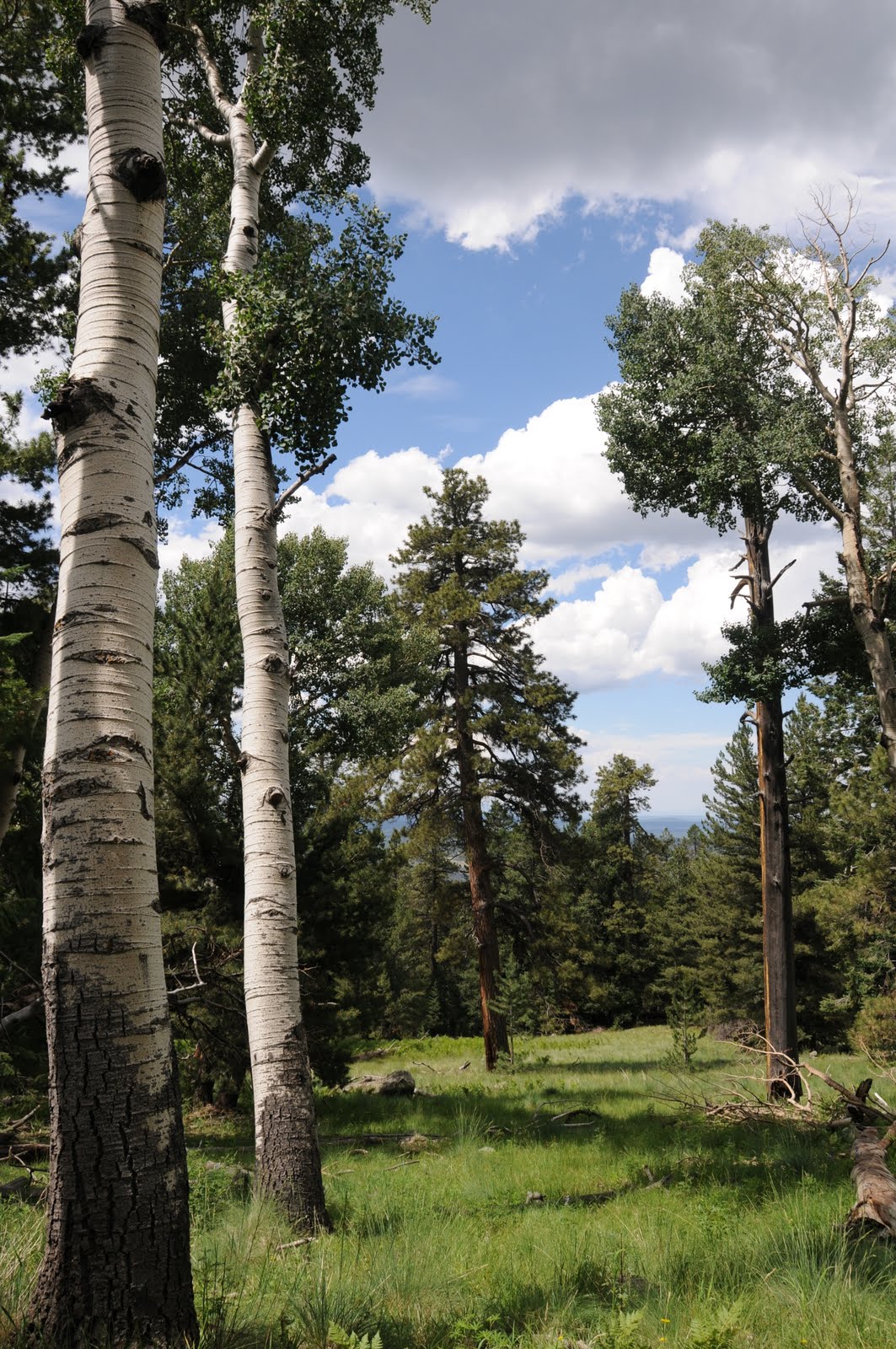
Aspens abound on the Abineau-Bear Jaw Loop
A short access path leads to a junction where the loop begins. You can go either way, but using the Abineau Canyon leg for the uphill climb affords the best views of the peaks without having to stop and turn around all the time.
Aspen color peaks early in Abineau Canyon
Abineau Canyon's deep woods.
View from the top of Abineau Canyon.
Damp and chilly, the moss-laced mixed conifer woodlands of Abineau Canyon is reminiscent of the alpine forests of Colorado—dense and claustrophobic in its immensity. Canyon winds rattle leaves from the aspens that sway among the dominant Ponderosa and limber pines, corkbark fir, spruce and Douglas firs creating golden cascades and crunchy drifts of spent foliage.
Aspen leaves collect on conifers.

Colorful Bear Jaw Canyon.
The 2-mile Abineau segment tops out on an exposed ridge beneath 12,633-foot Humphreys Peak, which is often snow-capped by early October.  Below, the cinder-cone dotted flatlands of the San Francisco Volcanic Field and the pastel wilds of the Painted Desert stretch out to the horizon. Next, you’ll catch a breather on the 2.1-mile walk along Waterline Road.  Wrapped in towering aspens, the wide dirt route and its easy tread is a real treat to hike. Without having to huff-an-puff, it’s easier to enjoy the surreal beauty of the white-barked forest, lemony canopies and mountain vistas. This is also prime habitat for blue grouse and the vociferous Clark's nutcracker. If you’re lucky, you might spot them swooping among the trees. Keep an eye out for a wooden sign for Bear Jaw Canyon on the left. This easy-to-miss turn off marks the start of the loop’s 2.3-mile descent.  A bit more open and less steep than Abineau, this twisting downhill passage is an enchanting trip through a ravine-riddled gorge. Near the bottom of the trail, sweet meadows harbor acres of fading ferns and the frazzled remains of summer wildflowers.  This is a hike I do almost every year and it never gets old.

Meadow near the trailhead. 
LENGTH: 7.2-mile loop
RATING: difficult
ELEVATION: 8,530-10,400 feet
BEST TIME FOR FAL COLOR: Late September-Early October
GETTING THERE:
From Flagstaff, go north on US180 (Fort Valley Rd.) to milepost 235.2 and turn right onto Forest Road 151 (Hart Prairie Road, north access). Continue 1.6 miles on FR 151 and connect to Forest Road 418. Drive 3.1 miles on FR418 to Forest Road 9123J (signed for Abineau-Bear Jaw), turn right and go 0.6 mile to the trailhead. Dirt/cinder roads are rutted but passable by carefully driven sedans. 
FLAGSTAFF FALL FOLIAGE UPDATES:
https://www.flagstaffarizona.org/leafometer/
INFO:

Monday, September 19, 2016

FAVORITE FLAGSTAFF FALL COLOR HIKES

FAVORITE FLAGSTAFF FALL COLOR HIKES
Autumn is just weeks away and the first tiny blotches of fall foliage color have already begun to tease of what's to come on Flagstaff's San Francisco Mountain. Many hiking trails on the slopes of Arizona's highest peaks make for ideal fall foliage viewing. The quaking aspen color spectacle begins in the high elevations in late September then trickles down into the foothills lasting through October. Here are six top leaf peeping picks.
ABINEAU-BEAR JAW LOOP
Abineau-Bear Jaw Loop, Sept. 28, 2013
This rigorous 7.2-mile loop on the north face of the San Francisco Peaks takes you up to a scenic saddle through moss-draped, spruce-fir woodlands of Abineau Canyon and back down the aspen-cluttered gorge of Bear Jaw Canyon via a 2-mile connecting walk along Waterline Road. Elevation range is 8,530 to 10,320 feet.
Getting there:
From Flagstaff, go north on US180 (Fort Valley Rd.) to milepost 235.2 and turn right onto Forest Road 151 (Hart Prairie Road, north access). Continue 1.6 miles on FR 151 and connect to Forest Road 418. Drive 3.1 miles on FR418 to Forest Road 9123J (signed for Abineau-Bear Jaw), turn right and go 0.6 mile to the trailhead. Dirt/cinder roads are rutted but passable by carefully driven sedans.
INNER BASIN TRAIL
Inner Basin Trail, Sept. 28, 2012
Plan ahead and be prepared for crowds if you want to stroll among tight knit aspen groves high on the mountain's eastern face. Getting to this immensely popular trail involves a white knuckle drive on a curvy dirt road, but for those who dare to brave the congestion and hairpin turns, the hike is one to savor. The moderately difficult trail begins at 8,630 feet in Lockett Meadow with a mild but constant uphill walk through an enchanting white trunk forest capped in gold. Mid way through, the route enters a gaping basin, fringed in color and populated with tiny pump houses that manage the watershed that supplies the City of Flagstaff. The hike culminates with a final, steep slog up to 9,410 feet where it connects with Weatherford Trail. 
Getting there:
From Phoenix, travel north on Interstate 17 to the Interstate 40 junction in Flagstaff. Head east on I40 and connect with US89 north. Continue 17 miles north on US89 to Forest Road 420 at milepost 431.2 (across from the turnoff for Sunset Crater). Turn left here and veer left onto FR 552, following the signs 4.5 miles to Lockett Meadow. The good gravel roads are narrow and winding with steep drop offs and no guardrails. Sedans okay, drive slowly and watch those curves. Trailhead parking is just past the campground. Trailhead has restrooms and fee-based camping. The access road is subject to traffic management to control the mobs during peak color weeks. Expect delays.
KACHINA TRAIL
Kachina Trail, Oct. 8, 2011
One of the best places in Arizona to see aspens, this 5.2-mile (10.4 roundtrip) moderate trek wanders on the mountain's moist, southern edge between 8,790 and 9,290 feet in elevation. Abundant, year round precipitation feeds an understory of neck-high ferns that grow among volcanic boulders and some of the densest populations of aspens anywhere in the state.
Complementing the color frenzy are shallow lava caves, alpine meadows and scenic landings overlooking Flagstaff.
Getting there:
From Flagstaff, go 7.3 miles north on US 180 to Snow Bowl Road (Forest Road 516). Drive 6.6 miles up FR 516 to the signed turnoff for the large parking lot and trailhead on the right.
ARIZONA TRAIL PASSAGE #34
Arizona Trail, Oct. 7, 2013
If you've ever pulled over at Aspen Corner on Snowbowl Road to gawk at golden leaf canopies, you might want to stay a little longer and take an easy walk on the Arizona Trail. From the parking area, follow the trail four miles (one way) to Bismarck Lake for a wind-addled trek dominated by mountain breezes that rustle up golden, aspen leaf blizzards. Elevation range is 8,780 to 9,000 feet.
Getting there:
From Phoenix, travel north on Interstate 17 to Flagstaff. Connect with US180 and drive 7 miles north to Snowbowl Road and head 5.2 miles uphill to Aspen Corner. There's a parking apron on the left near a split rail fence.
ASPEN NATURE LOOP
Aspen Nature Loop, Oct. 15, 2010
An easy walk with breathtaking views, Aspen Nature Trail makes a 2-mile trip through breezy forests at the base of Humphreys Peak. Situated between 9,270 and 8,990 feet, the trail has all the benefits of hiking in high elevation autumn alpine paradise without strenuous climbing.
Getting there:
From Flagstaff, go 7.5 miles north on US180 to milepost 223, turn right onto Snowbowl Road and continue 6.2 miles to the Humphreys trailhead on the left. Hike begins on the northwest side of the parking lot. Roads are paved up to the parking lot.
LAMAR HAINES MEMORIAL WILDLIFE AREA
Lamar Haines, Oct. 11, 2013

This short and easy kiddie favorite is jam packed with enough points of interest to keep even the most antsy young ones entertained. Stashed along the margins of this woodsy, 1.6-mile loop trail are springs, petroglyphs and ruins of a homestead tucked into foothills that roll between 8,600 and 8,450 feet.
Getting there:
From Flagstaff, go 7.5 miles north on US180 to milepost 223, turn right onto Snowbowl Road and drive 4.2 miles to the Lamar Haines Memorial Wildlife Area trailhead on the right.

Sunday, September 29, 2013

ABINEAU-BEAR JAW FALL FOLIAGE HIKE


ABINEAU-BEAR JAW LOOP
Flagstaff
Abineau Canyon, Sept. 28, 2013

Coaxed by freezing night temperatures and the season’s first light dusting of snow, the aspens on the north face of Flagstaff’s San Francisco Peaks are turning to gold.  On Saturday, Sep. 28th, the trees above 10,000’ were well on their way to peak color while those lower on the mountain were just developing a faint, lemony tinge.  This means prime time for high elevation fall foliage hiking has arrived. Because of its cool, canyon bound location on the mountain, leaves saturate and drop early and quickly on the Abineau-Bear Jaw loop. So head out this week to enjoy this classic autumn trek.


LENGTH:  7.9-mile loop
RATING: difficult
ELEVATION:  8530' - 10,400'

Waterline Road: Sept 28, 2013

GETTING THERE:
Abineau Canyon, Sept. 28, 2013
From Flagstaff, travel north on US180 (Fort Valley Rd) to milepost 235.2 and turn right onto FR 151 (Hart Prairie Road, north access).  Continue 1.6 miles on FR 151 and connect to FR 418.  Drive 3.1 miles on FR418 to FR9123J  (signed for Abineau-Bear Jaw), turn right and go 0.6 mile to the trailhead.
Dirt/cinder roads are rutted but passable by carefully driven sedans.  Access via FR418 from 89A now requires 4x4 due to washouts.

INFO:  Flagstaff Ranger District, Coconino National Forest, 928-526-0866
MORE PHOTOS:

Tuesday, July 27, 2010

KACHINA TRAIL

KACHINA TRAIL Kachina Peaks Wilderness The mountains of Flagstaff are known to create their own weather. In summer, that means it rains almost every day around the peaks--spiking the air over the Kachina Trail with an earthy-sweet dampness. Benefiting from its auspicious location on the windward side of the mountain, this trail sprouts green in rainforest proportions. Aspen clusters mimic white out conditions and hip-deep swaths of frothy ferns tumble over the slopes in vivid emerald waves. Add to this already amazing hike--a cozy lava cave, terrific views and fields of lupines growing in manic abundance and it’s easy to understand why this hike ranks as one of Arizona’s best. HIGHLIGHTS: Sun-drenched alpine meadows, musty pine forests and interesting geology LENGTH: 10 miles roundtrip ELEVATION: 8,600-9,500 feet BEST SEASONS: April - October RATING: moderate DISTANCE FROM PHOENIX: 155 miles one-way GETTING THERE: From Flagstaff, go 7.3 miles north on US 180 to Snow Bowl Road (Forest Road 516). Drive 6.6 miles up  FR 516 to the signed turnoff for the large parking lot and trailhead on the right. INFORMATION: Peaks Ranger District, (928) 526-0866, http://www.fs.fed.us/r3/coconino/recreation/peaks/kachina-tr.shtml

Monday, September 22, 2008

HUMPHREYS PEAK

HUMPHREYS PEAK Coconino National Forest Wearing fleece jackets and warm gloves in the middle of summer might sound odd, but it’s de rigueur for hiking Arizona’s highest trail. Considered by many to be one of the best and most challenging hikes in the state, the trail is usually quite crowded. The Humphreys Peak trail ascends the rocky slopes of Arizona’s only strato volcano that towers over the town of Flagstaff and the surrounding Coconino Plateau. As the trail gains elevation, plant life declines until only weather-tortured bristlecone pines cling tenaciously to the harsh talus, and above tree line, (11,400 feet) even the sturdy pines die out. On the blustery and barren 12,633-foot summit, there’s a windbreak shelter made of lava rocks that makes a good place to escape the chill, pull on your gloves and enjoy the experience of Arizona’s only tundra environment. An overnight stay in Flagstaff to acclimate to the altitude is recommended for Valley dwellers. LENGTH: 9 miles round trip RATING: difficult ELEVATION: 9,283-12,633 feet GETTING THERE: From Phoenix, go north on Interstate 17 to Flagstaff. Once in Flagstaff, drive north on U.S. 180 for 7 miles to Forest Road 516 (Snowbowl Road) and continue for 7.4 miles to the lower parking lot. The trailhead is at the north end of the lot. The paved roads are accessible by sedan.
INFO:
https://www.fs.usda.gov/recarea/coconino/recreation/ohv/recarea/?recid=55108&actid=50