


 Posts
Posts


BIG BANG TRAIL
 |
| San Francisco Peaks seen from Big Bang Trail |
Being loved to death is a slow and complicated process. Whether self-inflicted or enabler enriched, initially, it feels good. But before long, the halo wears off and reality pitches a swift, hard slap. It’s kind of like scarfing down tacos five nights a week only to wake up one morning “surprised” with a love handle hangover.
 |
| The first mile of Big Bang Trail is easy |
Swapping out tacos for unauthorized trail building, this is a good analogy for what has been happening in Flagstaff’s Mount Elden/Dry Lake Hills (MEDL) area for decades.
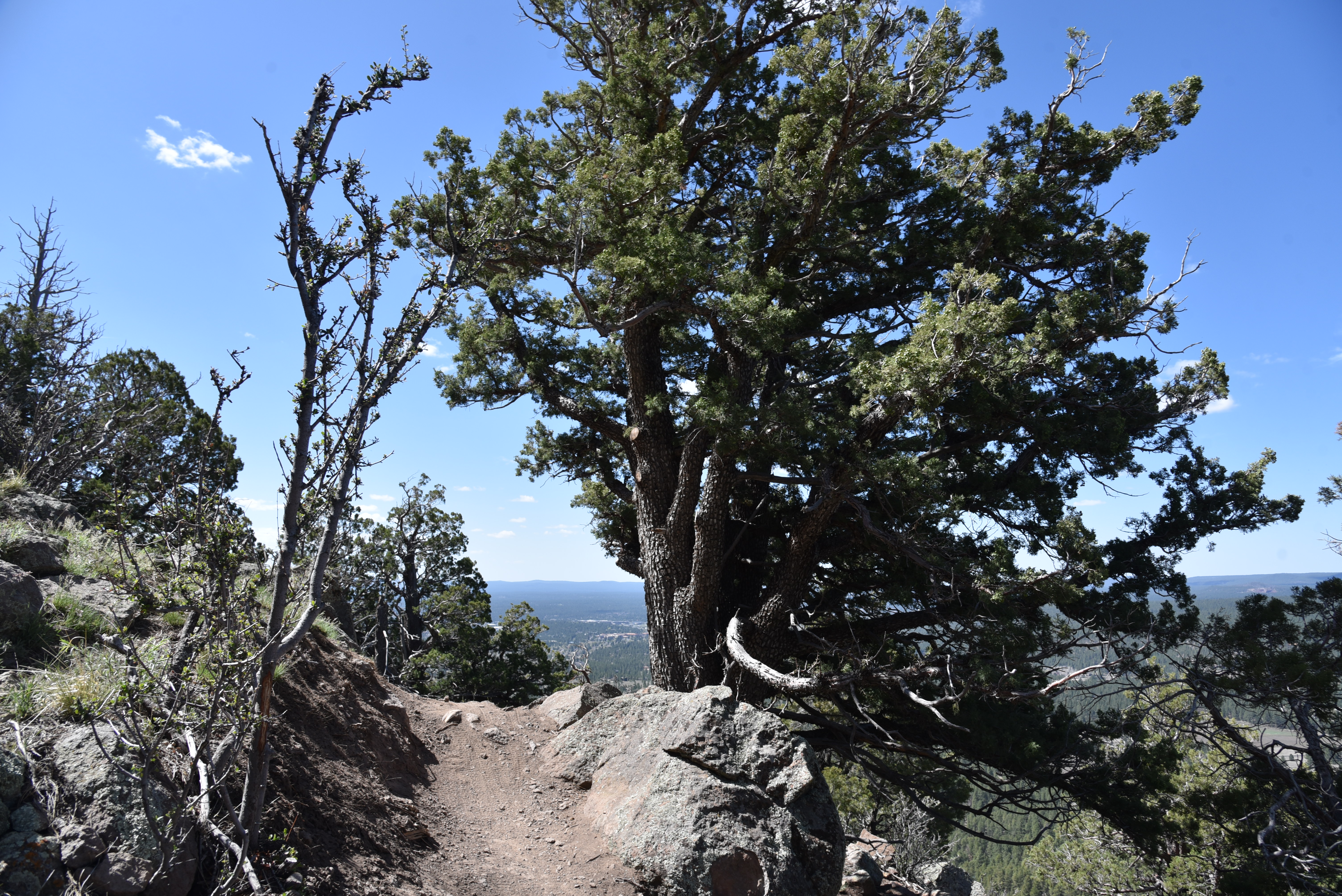 |
| An alligator juniper anchors a bend in Big Bang Trail |
While it might feel good to buck the system and blaze user-created paths, they cause environmental damage, disrupt wildlife and can lead to trail users getting lost or injured. This should come as no surprise to any outdoor enthusiast. While the slap has been stinging for quite some time, it’s only been in the last few years that efforts to rehabilitate the popular recreation area have materialized.
 |
| Schultz Creek flows near the trailhead |
The MEDL trail system, which includes popular old-standards like Brookbank, Sunset, Oldham and a segment of the Arizona National Scenic Trail, was originally dedicated in 1987.
 |
| Wing Mountain and Kendrick Peak on horizon |
Because of its proximity to town, multiple access points and scenic qualities, the MEDL area in Coconino National Forest suffered from deteriorating conditions due to overuse, a confusing maze of unauthorized “social or wildcat” trails and recent human-caused wildfires. The negative impacts on natural resources were palpable. Now, a joint effort between the forest service and local outdoor organizations is taking action to mitigate the damage, disperse pressure off the old standards and improve sustainability in the area.
 |
| Much of the trail hugs exposed edges |
One of the first of the new breed of routes to be completed is the Big Bang Trail.
 |
| Creeping barberry blooms April - June |
The 4.4-mile singletrack is outstanding not only for its smart design but also for its panoramic vistas, oscillating levels of difficulty and variety of terrain. The serpentine path climbs over 1,200 feet along the natural contours of the Dry Lake Hills northeast of 9,299-foot Mount Elden.
 |
| Mount Elden seen from Big Bang Trail |
The trail may be accessed from the Schultz Creek trailhead by following the Rocky Ridge Trail (also part of the Arizona National Scenic Trail) 0.2-mile to the signed junction. The first mile takes it easy, twisting among Ponderosa pines, alligator junipers and oaks with glimpses of 8,578-foot Wing Mountain standing out to the west. Spots of damage from the 2010 Schultz Fire and the 2022 Pipeline Fire are evident along the way as are slash piles and other signs of restoration efforts.
 |
| Boulders line a section of the Big Bang Trail |
Where the route makes a northeast bend, views of the San Francisco Peaks that soar to over 12,000 feet, break through the cover of a mixed-conifer forest. Right about where the mountains views show up, the trail becomes moderate in difficulty, dodging boulders with hairpin turns.
 |
| Fendler rose scent the trail June - August |
Next, the route takes on a more aggressive, edgy ascent along stony cliffs with steep drop offs overlooking Flagstaff. As the coniferous forest thins and gradually morphs into a drier, more exposed mountain clime. Views of 10,428-foot Kendrick Peak pop out on the northwest horizon and Sedona’s 7,122-foot Wilson Mountain can be seen to the south.
 |
| Flagstaff visible below the Big Bang Trail |
Right around where it meets the 8,000-foot point, the trail bends north among sun-loving cliff-rose shrubs, yucca, and scrub oak, hitting its highest point and concluding the major climbing before winding through woodlands and meadows to its terminus at the Brookbank Trail.
 |
| Big Bang spins off the Rocky Ridge Trail |
If the Big Bang Trail is any indication of what’s in store for MEDL as trail realignments, and more connectivity roll out, hikers, bikers and equestrians can look forward to a greatly improved recreational experience. And if trail users heed the slap and stick to designated trails instead of disrupting natural resources, this environmentally-sound system will last for generations.
 |
| Mixed conifir forests frame the San Francisco Peaks |
LENGTH: 9.2 miles roundtrip/out-and-back
RATING: moderate-difficult
ELEVATION: 7,147 – 8,404 feet
GETTING THERE:
Schultz Pass Trailhead:
In Flagstaff, go 3 miles north on U.S. 180 (Humphreys Street) and turn right on to Schultz Pass Road (Forest Road 420). Continue 0.5-mile on FR 420 and make a hard left at the Elden Look Road (Forest Road 577) and go another half-mile to the parking area on the right.
There are no fees or facilities at the trailhead.
2023 ROAD CLOSURES:
During 2023, the Schultz Creek restoration project, which will mitigate damage to the Schultz Creek watershed caused by the 2022 Pipeline Fire, will result in temporary road and trail closures in the area. During construction, Schultz Pass Road beyond the Coconino National Forest boundary will be closed to motorized vehicles, but will remain open to hikers, bikers and equestrians. There’s limited parking at the forest boundary located a few yards south of the Schultz Creek trailhead, and more parking at the “Schultz Y” at the corner of Schultz Pass Road and Elden Lookout Road. Phase 1 will begin on May 22 and run through June. Phase 2 will happen in late 2023.
FOR NEWS & UPDATES:
https://www.fs.usda.gov/detail/coconino/news-events/?cid=FSEPRD1106239


