


MARGS DRAW TRAIL
Margs Draw Trail is in Munds Mtn Wilderness
One of the most amazing things about hiking in Sedona is that, from many trailheads, it’s just a few steps from pavement to paradise.
The central
Arizona destination known for its red rock formations and creek-side
attractions is a cluster of low-slung buildings, two-lane roads and structural
color schemes that nix the glitz. 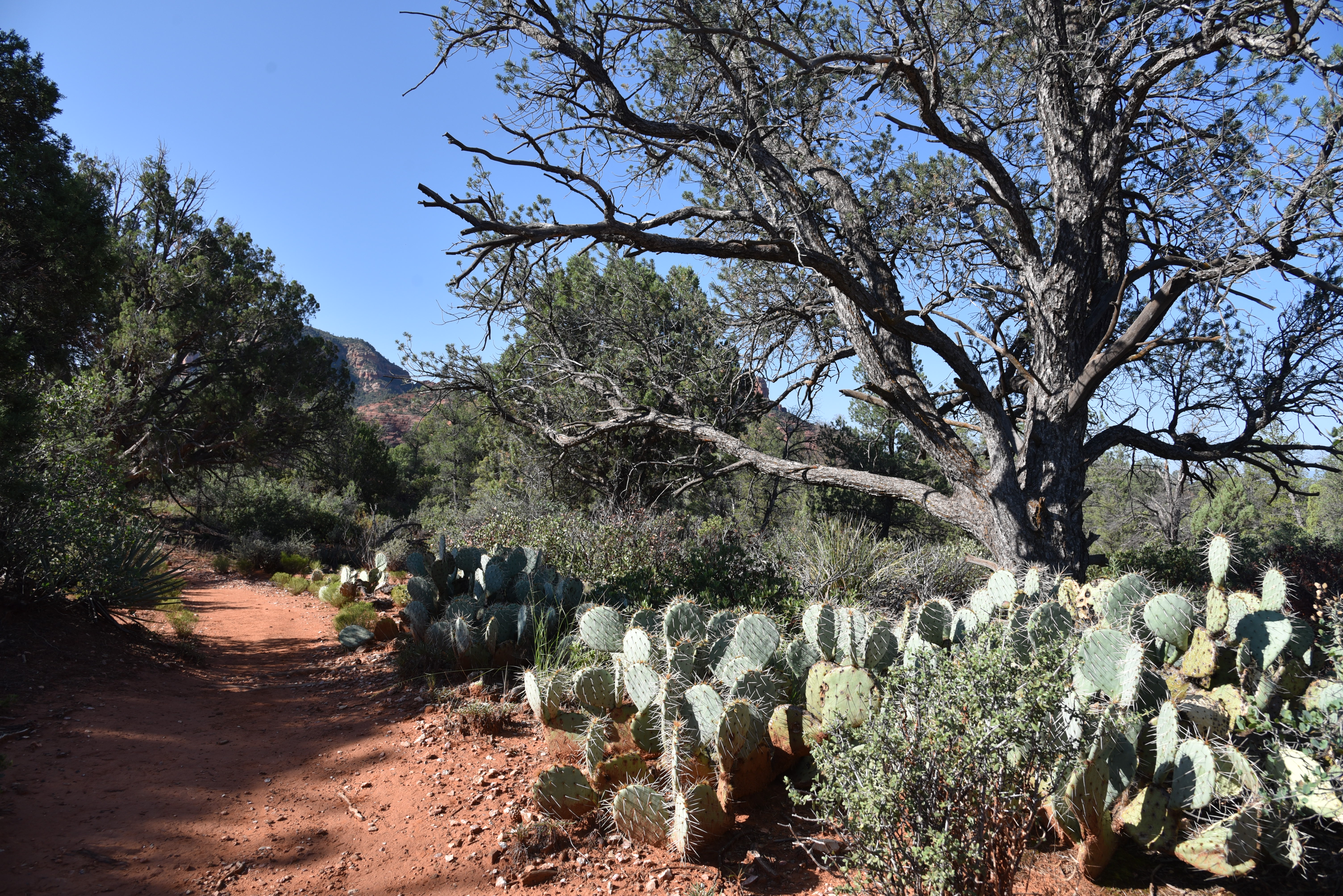
High desert vegetation on Margs Draw Trail
Even fast-food giant McDonald’s acquiesces to
the mood by swapping out its signature neon golden arches for a recessed teal
roadside logo. The
freeway-and-high-rise-free zone allows Sedona to settle in with a minimally
disruptive footprint among the high desert hinterlands of Red Rock Secret
Mountain and Munds Mountain Wilderness Areas. 
A sandstone ledge over Margs Draw 
The deep gorge of Margs Draw
Although
tame by wilderness standards, Sedona’s easy-access trails provide excellent
ways for just about anybody to experience protected areas where only foot
traffic and equestrian travel is allowed. One old standard to try is the Margs Draw
Trail.
Prickly pear cactus thrive in sunny spots on the trail
Located
close to the city center, the out-and-back route is easy to follow, has three
convenient access points and links up with other trails at both ends for longer
hikes. 
The trail is within the Munds Mountain Wilderness
Beginning at the north end of the
2-mile straight-shot route, the hike follows a short access path from the
Schnebly Hill trailhead before crossing a road and stepping into the Munds
Mountain Wilderness Area. 
Arizona cypress trees shade parts of the trail
The
north-south running trail traverses foothills below the chiseled pinnacles
surrounding 6,834-foot Munds Mountain. A
brim of weather-sculpted sandstone pillars bolsters the trail’s eastern
edge. 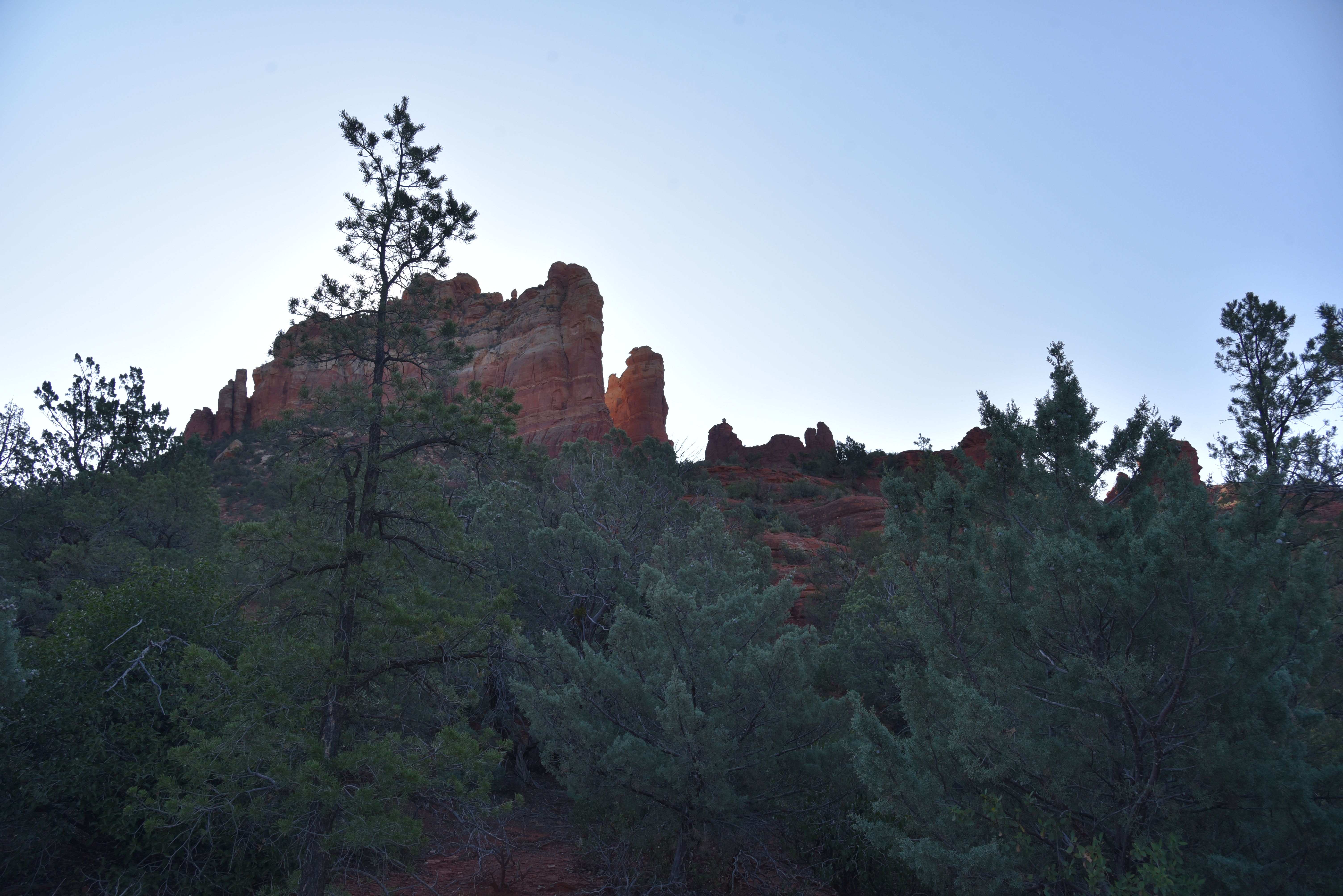
Snoopy Rock (center) is a highlight of the hike
Within the first half-mile, the
iconic Snoopy Rock formation that resembles the beloved Peanuts cartoon canine
reclining, belly-up on his doghouse appears on a ridge overhead. 
Jagged pillars of Munds Mountain Wilderness
Jogging among cypress woodlands, sunny ledges
and rocky drainages, the trail also showcases views of Chimney Rock, Wilson
Mountain and Capitol Butte. At the
half-way point, there’s a junction for the Sombert Lane trailhead which can be
used to create a shorter version of this hike.

Capitol Butte (far right) seen from the trail
About a 0.2-mile from the junction, the trail meets the gorge of Margs
Draw. 
Easy access at the urban-forest interface

Blackfoot daisies bloom March- December
The deeply
incised channel is marked by a curved sandstone overhang hovering over a slickrock
passage dotted with cottonwood trees and pools of water left by monsoon
rains. 
Sacred datura bloom April - November 
Sweet-smelling wilderness woodlands
Moisture funneled through this
major drainage feeds a colorful collection of pollinator-attracting wildflowers
and blooming shrubs. Soon, the prominent
profiles of Twin Buttes and distant glimpses of the mountains and mesas of
Prescott National Forest comes into view. 
Crucifixion-thorn bloom May - August
A final downhill dip ends at the Broken Arrow trailhead where hikers may
double back or use the map kiosk to continue to the loopy, piggy-named trails
orbiting Twin Buttes. 
Flat-topped Wilson Mountain seen from the trail
LENGTH: 4.4 miles roundtrip
RATING: easy
ELEVATION: 4,231 – 4,451 feet
GETTING THERE:
North, Schnebly Hill Trailhead
From traffic circle located at the Oak Creek bridge on State Route 179 in Sedona, turn right onto Schnebly Hill Road and go one mile to the trailhead on the left. Roads are suitable for all vehicles. There is a restroom at the trailhead. FEE: A Red Rock Pass or equivalent is required. There is a permit kiosk at the trailhead.
Midway, Sombart Lane Trailhead
From State Route 179 about a mile before the traffic circle over Oak Creek, turn right onto Sombart Lane and continue 0.2-mile to the parking area. Hike the 0.2-mile access path to the trail. No fee or facilities.
South, Broken Arrow Trailhead
From State Route 179 1.4 miles south of the SR179/89A traffic circle, turn right onto Morgan Road and continue 0.5-mile to the trailhead. No fee or facilities.
INFO:
Coconino National Forest
https://www.fs.usda.gov/recarea/coconino/recreation/hiking/recarea/?recid=55206&actid=50