Find A Trail. Start Your Search Here:

Showing posts with label Schultz Fire. Show all posts

Monday, July 15, 2019

Little Elden Trail to Schultz Tank

LITTLE ELDEN TRAIL TO SCHULTZ TANK
FIRE NOTICE: August 6, 2019. This area is now back OPEN for use following the Museum Fire closure. Wildflower season is in full bloom in Flagstaff’s Dry Lake Hills area.
San Francisco Peaks dominate the northern vistas.
Yellow Columbine bloom in moist areas on Little Elden Trl.
Recent forest logging and clearing operations that had closed many of the trails that meander through the diverse terrains of the Coconino National Forest north of 9299-foot Mount Elden are gradually finishing up and several paths are now open.
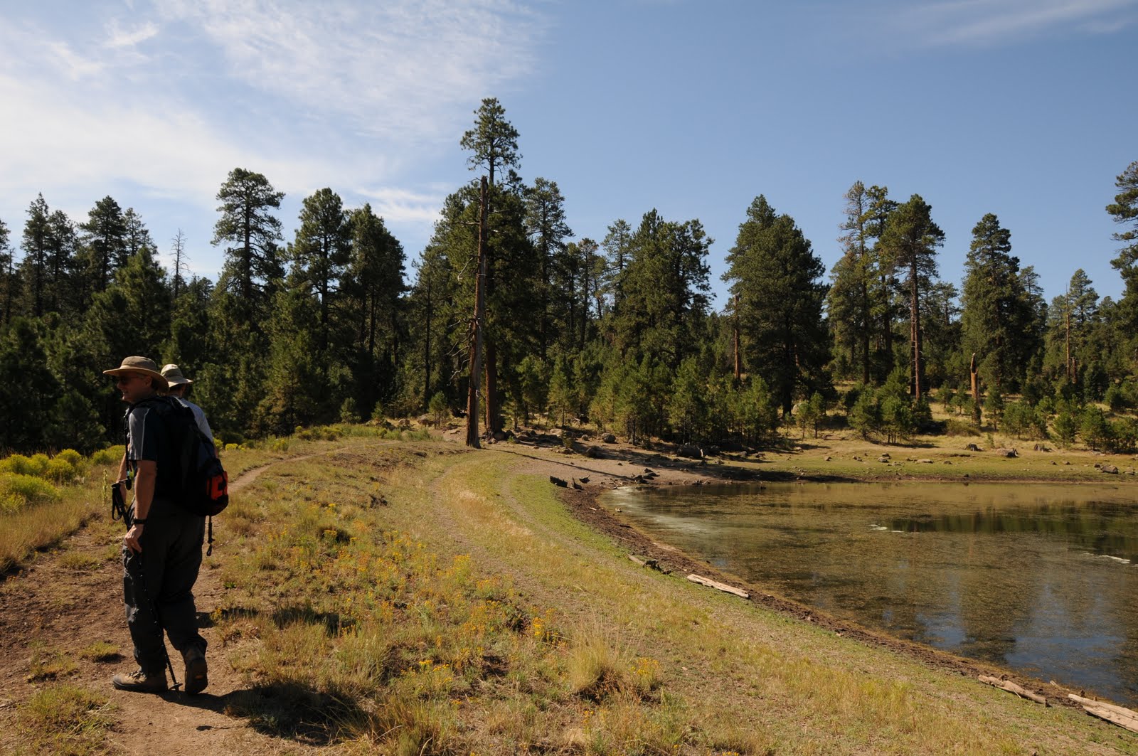
Stormy San Francisco Peaks reflected in Schultz Tank.
One particularly productive wildflower trail that’s outside of the closure area is the Little Elden Trail to Schultz Tank.  This multi-faceted gem traces the north flanks of 9018-foot Little Elden Mountain through a mix of deep, mixed-conifer woodlands, aspen glens, sunny meadows and a variety of blooming plant communities.
Western blue flax grows in sunny meadows along the route.
From the trailhead, follow the 0.3-mile access path to the Little Elden Trail which doubles as part of the Arizona Trail Passage 32. The route heads right (west) at the sign and begins with a shady walk among pines and firs with a smattering of aspens tucked into clearings. Where the trail crosses drainages, plots of rich-green ferns swaying over the narrow footpath gently brush the shoulders of passing hikers. Roughly 0.8-miles in, reminders of the 2010 Schultz Fire begin to appear in the form of charred logs and gangly snags.
The spur path to Schultz Tank.
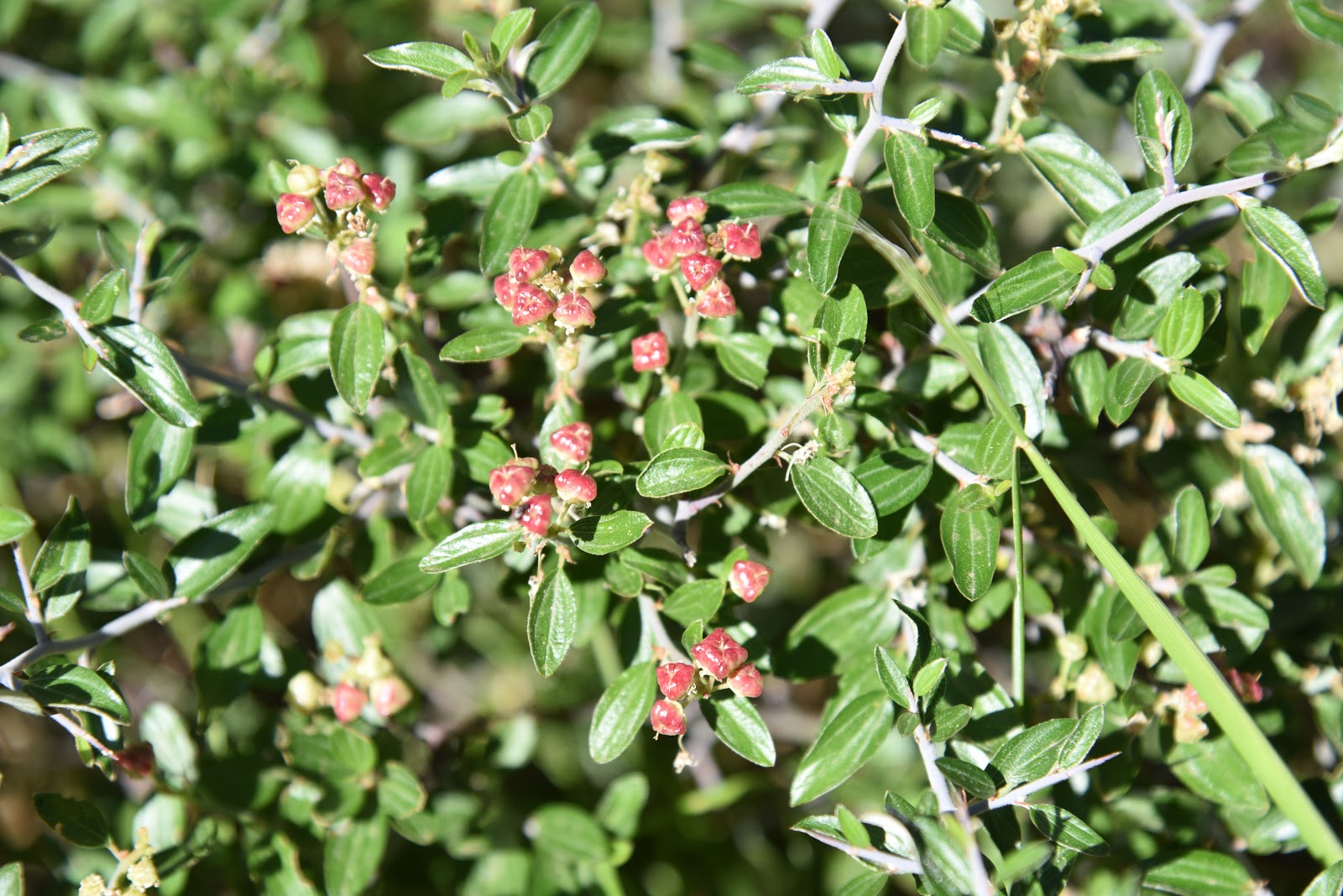
Ripe berries on a Fendler's ceanothus shrub.
A woodsy corridor near the beginning of the hike.
Soon, the devastating effects of the human-caused blaze that burned 15,075 acres over 10 days and also caused massive, monsoon-driven erosion come into full view.  Although only a short section of the trail passes directly through the fire scar, evidence of its havoc on the landscape  are clearly seen in the surrounding hills. The formerly dense pine-oak forests that defined the trail’s mid-section were toasted down to ash. Nine-years removed from the fire, this section is now a sprawling meadow flush with wildflowers and brambles that have taken root among blackened, matchstick-like stumps. The loss of the tree cover has revealed previously obscured views of O’Leary Peak and Sunset Crater to the northeast and the scorched edge of the Kachina Peaks Wilderness to the northwest.  The recovering meadows of hip-high grasses foster a botanical garden of blooming plants and shrubs.
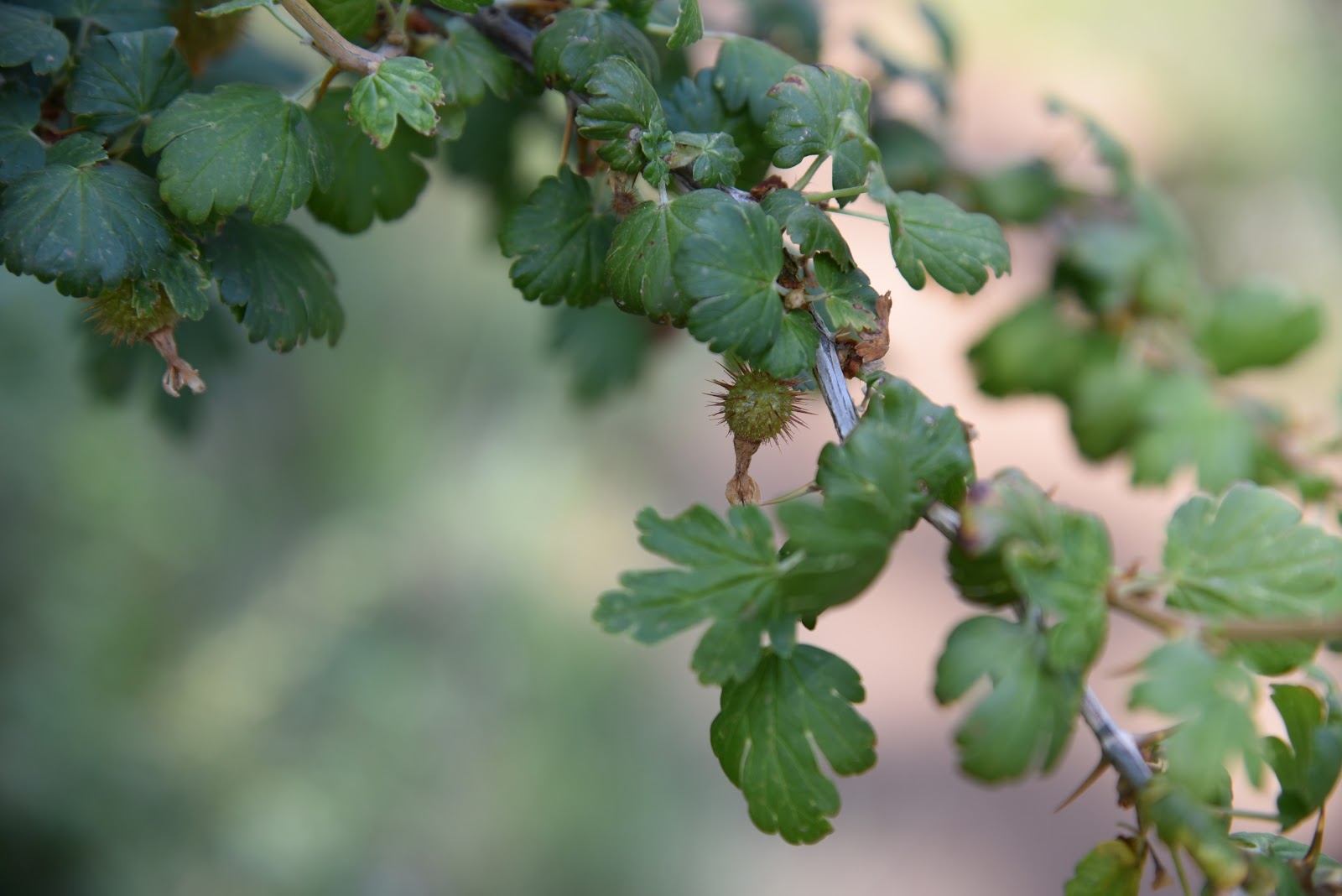
Thorny fruits on a gooseberry shrub.
Look for fruity raspberry shrubs and the frothy cream-colored blooms and dark fruits of blueberry elder tree that grow sporadically in bright fields.  Delicate Western blue flax twines around Fendler’s ceanothus bushes and acres of paintbrush, butter and eggs, thistle, mountain parsley, common mullien, lupines, purple locoweed, gooseberry shrubs and other sun-loving varieties splatter vivid colors on the forest floor.
O'Leary Peak and Sunset Crater on the northeast horizon.
Richardson's geranium pokes through a bramble.
New Mexican vervain thrive in exposed meadows.
Dense coniferous forests near Schultz Tank.
Pollinators are attracted to Fendler's ceanothus shrubs.
Silver lupine add splashes of color to alpine meadows.
After about a mile of exposed grassland hiking, the trail heads uphill and ducks into moist, canyon-bound woodlands in the drainage areas near Schultz Tank. This beautiful segment features slopes with sprouting aspen saplings as well as ravines cluttered with old-growth conifers draped in moss. The wetter micro climate here supports a whole other type of wildflower habitat.
Purple locoweed is a common plant along the trail.
An understory of spreading dogbane, yellow columbine, Richardson’s geranium, curly dock, wild roses and fragrant wild geranium grow profusely in damp slivers of space among roots, boulders and gigantic trees. 
Little Elden Trail is part of the 800+-mile Arizona Trail.
Immature blueberry elder fruits follow frothy white flowers.
The Little Elden Trail ends at a signed junction where several classic Dry Lake Hills routes take off in all directions.
Ferns grow shoulder-high along the Little Elden Trail.
If you want to create a longer loop hike, check with the forest service before heading out to be sure your selected trails are open for use.
Fire damage visible on the edge of Kachina Peaks Wilderness
Schultz Tank is the turn around point for the hike.
Otherwise, follow the signs 0.2-mile to Schultz Tank, meander around the peak-reflecting pool and popular recreation hub then return the way you came.
Wild bergamot grows in moist pine woodlands.
Pale lavender aspen fleabane attract insects.
The 2019 Schultz Fire burned over 15,000 acres of forest.
Aspen saplings take root in the burn scar of the Schultz Fire.
Juicy wild raspberries grown in drainage areas.
LENGTH:  5.6 miles out-and-back
RATING: 7180 - 8000 feet
ELEVATION: 7320 – 8000 feet
GETTING THERE:
In Flagstaff, go north on U.S. 89 to Forest Road 556 (Elden Spring Road, just past mile post 429) turn left and continue 2.4 miles to the Little Elden trailhead on the right. The hike begins at the trailhead kiosk.
INFO: Coconino National Forest
-->

Monday, October 24, 2016

LITTLE BEAR: UP FROM THE ASHES

LITTLE BEAR: UP FROM THE ASHES
Little Bear Trail, October 2016

Before the 2010 Schultz Fire charred much of the forest around Flagstaff's Dry Lake Hills, a stand of Big-tooth maples on Little Bear Trail filled a gorge overlooking cinder cone dotted plains. The sound of their whispering leaves bounced off nearby cliffs where the trail wound around one of a dozen or so switchbacks that ease the hike's 1,100 foot haul to connect with the upper trail system that flows over the slopes of Mount Elden. The maples tickled the edges of a stony ledge with broad views of O'Leary Peak and Sunset Crater jutting from stark, volcanic highlands. On really clear days, the pastel tints of the Painted Desert glint in the distance. This had been one of my favorite contemplative spots in Flagstaff.
Little Bear Trail , July 2009
Little Bear Trail took the brunt of the blaze, which reduced the once deeply wooded trail to charcoal and ash. A heavy monsoon season that followed added to the damage, so the forest service decided to shut the trail down due to safety concerns. Since the fire, I've often wondered if the smattering of maples and aspens along the route had survived. I'd have to wait six years for the answer. After intensive rehabilitation, the trail re-opened on October 20, 2016. Thanks to the efforts of countless volunteers, organizations and local businesses, the trail's treacherous, rocky terrain has been restored to again provide safe passage for non-motorized recreation. Eager to visit my favorite lookout ledge and maples, I hit the trail the day after it re-opened. Starting from the Little Elden trailhead, moderate fire damage appears in fits and starts. Patches of blackened snags interspersed among intact pine-oak woodlands, teased that the fire might not have been that bad. Then, it got worse.
The 2010 Schultz Fire damaged Little Bear Trail
At the Little Bear junction, a panorama of destruction takes center stage. The sight of barren foothills, charcoal matchsticks that had been Douglas firs and sun washed meadows where Gambel oaks once grew in profusion beneath old growth Ponderosa pines felt like a kick in the gut. Although much of the 3.4-mile route was unrecognizable, short segments of surviving forest and the brilliant trail restoration work lifted my spirits. My stony ledge lookout was there, but the pines that had framed it were gone, but hints of maple resurgence and piles of spent aspen leaves inspired me to keep moving. Near the trail's high point, it appears the fire ran out of energy, thus sparing the forest and a patch a spindly aspens abutting the Sunset Trail junction. All was not lost.
On the way down, I ran into a couple of hikers who had not experienced the route before the fire. "Isn't this a beautiful trail?" one of them blurted out. "Yes, and a beautiful day, too." the other gushed. On both accounts, it was.
Pine seedlings are part of the restoration
LENGTH: 8.6 miles (up and back)
RATING: difficult
ELEVATION: 7320' - 8430'
GETTING THERE:
In Flagstaff, go north on US 89 to Forest Road 556 (Elden Spring Road, just past mile post 429) turn left and continue 2.4 miles to the trailhead on the right. From the trailhead kiosk, follow the access trail 0.3 mile to the Little Elden (Arizona Trail) junction, go right and continue 0.6 mile to Little Bear Trail. Hike 3.4 miles uphill to the Sunset Trail. Turnaround here or consult maps to make a loop hike.
INFO & MAP: Coconino National Forest

Monday, May 16, 2016

OLDHAM TRAILS

OLDHAM TRAILS
Coconino National Forest, Flagstaff
Orange paint marks tress to save during 4FRI (Okay Orange)
The heat is on and with it comes the annual migration of Valley hikers to the cool forests of Northern Arizona. While trekking along high country trails, you might encounter trees bearing orange or blue paint blazes. These colorful codes are part of the Four Forest Restoration Initiative (4FRI), a planned 20-year effort to restore fire-adapted ecosystems in Kaibab, Coconino, Apache-Sitgreaves and Tonto National Forests through hand thinning, logging and prescribed burns.
Orange paint designates trees that will not be cut (and may also indicate treatment area boundaries) while blue marks those to be removed. An easy way to remember this: Okay Orange, Bye Bye Blue.
Scars of the 2010 Schultz Fire

Many Arizona forests are rife with unhealthy, tinderbox conditions. The major goals of 4FRI are to reduce fuels that contribute to unnaturally catastrophic wildfires, protect watershed resources, increase plant diversity and preserve wildlife habitats. The project is currently active in Flagstaff's Dry Lake Hills area. You can observe some of the prep work by taking a hike on the Oldham Trails. The tour begins in Buffalo Park with an easy half-mile walk north to the Lower Oldham/Arizona Trail junction. From here, follow the Arizona Trail signs.
Blue means cut. (ByeBye Blue)
Numerous, unmarked secondary trails run through the area and can be confusing. Oldham Trail runs to the east, nearest the mountain, but if you miss it, no worries---just keep heading north and you'll end up on Elden Mountain Road roughly 2.5 miles north of the park. Along the way, stop and contemplate the woodlands and see if you can figure out the logic behind the save/cut markings on the Ponderosa pine trees. Once on the road, signage improves and you can continue on to Upper Oldham or any of the Dry Lake Hills system trails. To keep with the theme of forest health, hike Upper Oldham Trail to Sunset Trail, turn right and walk 1.3 miles across a barren ridgeline to the summit of Mount Elden. Here, the devastation caused by the 2010 Shultz Fire is clearly visible on the mountain's flanks. This is exactly the kind of disaster the 4RFI is trying to prevent.
Logging activities in treatment areas may cause temporary trail closures, so be sure to check the forest service website before heading out.
Upper Oldham Trail
LENGTH:
All distances include the 0.5-mile park access trail.
Lower (Easy) Oldham: 2.5 miles one-way to Mt. Elden Road
Oldham #1: 3.2 miles one-way to Mt. Elden Road
Upper Oldham: 5.3 miles one-way
To Mount Elden: 6.6 miles one-way
RATING: easy - difficult
ELEVATION:
Lower Oldham: 7,040' - 7,380'
Oldham #1: 7,040' - 7,590'
Upper Oldham: 7,040' - 8,920'
Sunset Trail to Mount Elden: 8,920' - 9,299'
GETTING THERE:
From Route 66 in Flagstaff, go 0.6 mile north on Humphreys St. to Fort Valley Road (US180). Turn left and continue 0.3 mile to Forest Ave., turn right and continue 1 mile to the stop light at Gemini Drive. Turn left and follow the signs to Buffalo Park.
INFO: Coconino National Forest
INFO:
Four Forest Restoration Initiative


Monday, March 25, 2013

Volunteer to replant Schultz Fire burn area


From: "Magee, Brienne U -FS" <bmagee@FS.FED.US>
Date: March 25, 2013 2:18:43 PM PDT
To: <USDA-FS-NEWS@NEWSBOX.USDA.GOV>
Subject: SOUTHWESTERN-NEWS-RELEASE: Coconino National Forest Information
Forest Service hosting public volunteer events to help replant Schultz burn area


Flagstaff, AZ – The Flagstaff Ranger District is inviting volunteers to help replant approximately 2,500 ponderosa pine trees in the Schultz Fire burn area. Public volunteer events will be held on three Saturdays in April. Each event is limited to 50 volunteers; those interested should sign-up in advance by contacting Justin Loxley, Flagstaff District Volunteer Coordinator, at jdloxley@fs.fed.us or 928-527-8213.

When:
Saturday, April 6
Saturday, April 13
Saturday, April 20 (Earth Day Weekend!)

Events begin at 8:30 a.m. and will last until approximately 1:00 p.m.  Volunteers should arrive by 8:30 to attend the safety briefing and planting demonstration.

Where: The planting areas are located off of Schultz Pass Road (Forest Road 420), approximately 12 miles north of Flagstaff on Highway 89 and approximately 5 miles on forest roads.  The road should be suitable for most cars; however persons with low clearance vehicles are advised to drive carefully. Specific directions and details will be given at registration.

What to Bring: Sturdy shoes, long pants, gloves, hard hats or bike helmets if you have them, sunscreen, appropriate dress for the weather, snacks or lunch, and plenty of water. Planting tools will be provided by the Forest Service.

Who: Anyone eager to help with the Schultz Fire recovery efforts. Participants of all ages are welcome; minors must be accompanied by a parent/guardian.

For other general information on the Schultz burn recovery and restoration efforts, contact the Flagstaff Ranger District at 928-526-0866 or visit our website at www.fs.usda.gov/Coconino. 

###

Monday, June 11, 2012

The back way up Mount Elden


MOUNT ELDEN via UPPER OLDHAM TRAIL
Flagstaff
Heading out on the "catwalk"

Final approach to Mount Elden
There's more than one way to tackle Mount Elden.  The most popular route begins off US89 in east Flagstaff and climbs 2300 feet in a short, steep 3 miles.  This way is great for a thigh-burning workout, but also earns a pox upon its ambience due to its proximity to two major highways and views dominated by industrial complexes.  However, the west side of the mountain holds an alternative route that's less steep, better shaded and cloistered in woodland vistas stretching all the way to Williams. Except for the occasional car on adjacent FR557, there's nary a hint of civilization on the west route until it crests on the Sunset trail.  Here, the hike lands on a scenic saddle overlooking the railways and warehouses of east Flagstaff, then heads south up to Mount Elden.  This short path is a beautiful trek sandwiched between pine-fir forests on the right and steep drop offs on the left.  Soon after passing through a dense stand of young aspens, the trail leaves the woods to  teeter on a barren, knife-edge ridgeline scarred by the 1977 Radio Fire.  Depending on your point of view, this open-to-the-sky, catwalk-like segment is either profoundly gorgeous or viscerally depressing. Fire damage notwithstanding, the terrain is very interesting---massive lava boulders, juvenile aspens and blooming shrubs lend an air of resurgence to the otherwise bald tread.    Charred snags bleached grey by years of harsh weather coat the slopes like toppled matchsticks and a few remaining upright torched trunks stand sentry above a volcano-studded landscape.  Sunset Crater, Strawberry Crater, O'Leary Peak and the Bonito Lava flow are all visible from the exposed path that feels as if the patches of clumpy grasses and wild roses growing on its margins serve as the glue that keeps it from slumping into oblivion.  Also, the damage done by the June 2010 Schultz Fire is visible to the north.  After passing the wildfire vistas, the catwalk meets FR577 for the final slog to the microwave-and-cellular-tower-cluttered summit with a fire lookout and 360-degree views.
HIKE DIRECTIONS FOR WEST APPROACH AS DESCRIBED HERE:
From the Lower Oldham-Rocky Ridge trailhead, hike 0.2 mile north to the turn off for the Brookbank trail.  Veer right here on an unsigned path and hike 0.5 mile to the Upper Oldham trail junction.  Follow Upper Oldham 1.5 miles, cross FR557, and pick up Sunset trail.  At the sign for Sunset-Schultz Tank-Elden, go right and hike 1 mile to the summit of Elden Mountain.
View from Upper Oldham Trail

LENGTH: 6.4 miles roundtrip
ELEVATION: 7,380'- 9,300'
RATING: moderate
BEST SEASON: April - October
DISTANCE FROM PHOENIX: 147 miles one way
GETTING THERE:
West approach trailhead:
From Flagstaff, travel north on US180 to Shultz Pass Road (FR420) at milepost 218.6.
Turn right and go 0.5 mile, veer right onto Elden Lookout Road (FR557) and continue roughly 2.5 miles to the signed Lower Oldham-Rocky Ridge trailhead on the right. FR557 is maintained dirt, passable by sedan. NOTE: to shorten the hike, drive another mile up FR557 to the Upper Oldham trailhead where there's parking on the left across the road from the trail sign.
East approach trailhead:
From Flagstaff, travel east on US89 to just past the Flagstaff Mall at milepost 419.5. Turn at the Mt. Elden Trailhead sign.

INFO: Flagstaff Ranger District, Coconino National Forest, 928-526-0866
MORE PHOTOS:

Wednesday, July 21, 2010

SUNSET-LITTLE BEAR-LITTLE ELDEN LOOP

SUNSET-LITTLE BEAR-LITTLE ELDEN LOOP Coconino National Forest UPDATE: As of Oct 20, 2016, Little Bear Trail is BACK OPEN. The trail had been closed for 6 years due to damage from the June 2010 Schultz Fire.
Because there are so many fine trails in Flagstaff’s Dry Lake Hills, deciding which to hike can be difficult. This “three-fer” loop hike solves the dilemma. Combining a trio of crowd-pleasing trails, this route swings around high altitude hillsides in lazy-Susan-style for a smorgasbord of sights and varying levels of difficulty. Each trail embodies a unique collection of sweet spots and curiosities. Little Bear, one of the newest trails in the area, is a narrow cut on a steep slope wandering among fir forests, crumbing bluffs and stone escarpments overlooking Sunset Crater and the Painted Desert. Sunset Trail showcases glimpses of the San Francisco Peaks as it makes a substantial climb through mixed pine-oak forests and fragrant alpine meadows. Little Elden-- the easiest segment—heads northwest through fern-laden foothills and stands of spruce trees to complete the loop. HIKE DIRECTIONS: The hike begins on the Sunset Trail with a 1.6-mile uphill climb to the Little Bear Junction. Turn left (northeast) and head 3.5 miles downhill on Little Bear to the Little Elden junction. Go left (northwest) and hike 1.7 miles back to the trailhead. HIGHLIGHTS: undulating route with lots of variety LENGTH: 6.8 miles roundtrip ELEVATION: 7,200-9,000 feet RATING: difficult DISTANCE FROM PHOENIX: 155 miles one-way GETTING THERE: From Flagstaff, go north on US 180 to Shultz Pass Road (Forest Road 420) at milepost 218.6. Turn right and continue 5 miles on FR 420 to the Sunset Trailhead on the right. INFORMATION: Peaks Ranger District (928) 526-0866, www.fs.fed.us/r3/coconino/recreation/peaks/little-bear-tr.shtml

Thursday, July 1, 2010

SCHULTZ FIRE UPDATE

SCHULTZ FIRE IMPACT ON HIKING TRAILS JUNE 2010 UPDATE FOR COCONINO NATIONAL FOREST: Schultz Fire Closure Area Reduced Date: July 14, 2010 Contact: Coconino Supervisor's Office - 928-527-3600 Flagstaff, AZ —The Coconino National Forest is reducing the size of the emergency fire closure around the Schultz Fire area to allow more recreational access to areas that have been deemed safe. Though the new closure order is currently in effect, Forest Service personnel are in the process of repositioning the closure signs according to the new boundaries through today and should be finished by tomorrow. One of the greatest safety concerns within the fire area is the hazard of dead trees falling over, which will be a safety issue for a long time. In addition, because of the severity of the burn and lack of vegetation, loose rocks are rolling down the hillside posing a safety concern. The following trails and roads fall under the new reduced closure area: Schultz Pass Road (FR 420, from Schultz Pass to the north) Lockett Meadow Road (FR 552) Waterline Road (FR 146) Elden Springs Road (FR 556) Little Bear Trail Little Elden Trail Deer Hill Trail Inner Basin Trail Lockett Meadow Campground and Little Elden Springs Horse Camp Fire closures are implemented as standard fire operations procedure for public safety and firefighter safety. This modified closure to public access is in force until September 15, 2010 or later if necessary. The Closure Order and map is at http://www.fs.fed.us/r3/coconino/nepa/forest-orders/04-10-06-f.pdf. The U.S. Forest Service is still seeking information concerning the person or persons responsible for causing the Schultz Fire. To date, no arrests have been made in connection with the Schultz Fire. The Forest Service is offering a reward of up to $2,500 for information leading to the arrest and conviction of those responsible. The Schultz fire was caused by a campfire that was abandoned without being properly extinguished in the area of Schultz Tank, Little Elden Trail, and Forest Road 420. Please call the Schultz Fire Investigations hotline at (928) 527-3508 if you have any information. Fully contained as of June 30th, this 23-square-mile, human-caused blaze took out some great trails in Flagstaff's Dry Lake Hills area. However, many others were spared and plans are already in the works to re-vegetate the burned area before erosion takes its toll. Here's the run down on what trails are open and which are closed: OPEN AS OF JULY 1, 2010: • Elden Lookout Trail • Fatmans Loop • Sandy Seep • Humphreys Peak • Kachina Trail • Christmas Tree Trail • Brookbank Trail • Pipeline Trail • Upper and Lower Oldham Trails • Rocky Ridge Trail • Schultz Creek Trail • all of Fort Valley Trail system CLOSED INDEFINITELY: • Freidlein Prairie Road • Schultz Pass Road • Elden Lookout Road • Little Bear Trail • Weatherford Trail • Inner Basin Trail • Waterline Road-Tunnel Road • Sunset Trail (from Brookbank junction to Schultz Creek Trail) • Little Elden Trail (from Heart Trail junction to Sunset Trail) I'll be posting photos from our 2009 hikes in this area soon.

Thursday, July 2, 2009

BROOKBANK TRAIL

BROOKBANK TRAIL Coconino National Forest Built by an early Flagstaff settler to provide a route to the alpine meadows that define the upper reaches of the Dry Lake Hills, this old wagon route is a favorite destination for hikers, mountain bikers and horseback riders. Buried in deep layers of snow in winter, the bowl-shaped meadows become soggy, seasonal lakes in spring. Water lingers in these high-altitude ponds into early summer when they dry out and are transformed into a riot of wildflower color. On the sun-drenched summit plateaus, patches of aspens and whispy, thigh-high grasses frame peek-a-boo glimpses of the San Francisco Peaks. HIGHLIGHTS: Close to town, alpine meadows, conifer forests and up-close views of the San Francisco Peaks. LENGTH: 5 miles round-trip Rating: moderate ELEVATION: 7,700’ – 8,400’s Driving distance from Phoenix: 165 miles one-way GETTING THERE: From Flagstaff, travel 3 miles north on Highway 180 to Schultz Pass Road (Forest Road 420). Turn right on FR 420 and continue for roughly a mile, then veer left on Elden Mountain Road (Forest Road 557). Continue on FR 557 for 3 miles to the signed Oldham trailhead on the right. Park there and hike up the road about a tenth-of-a-mile to the Brookbank trailhead on the west (left) side of the road.

Wednesday, November 12, 2008

INNER BASIN

INNER BASIN TRAIL Coconino National Forest
The robust conifer forests that thrive in the inhospitable volcanic bowl of San Francisco Mountain can be partly attributed to an industrious and vocal bird called Clark’s Nutcracker. Easy to identify by their black-and-white feathers and sharp khaaa-khaaa-khaaa cry, the birds are consummate seed collectors. It’s common for them to store up to 100,000 pine seeds per season (many times more than they could possibly eat) in shallow underground caches. Uneaten seeds sprout and grow into trees--replenishing the birds’ food supply. The pine canopy above the Inner Basin trail is a favorite hang-out for the birds as they go about their “accidental environmentalism” by propagating the trees that slow erosion and protect an important source of water for the city of Flagstaff. Snowmelt from San Francisco mountain runs downhill and feeds springs in the Inner Basin (the collapsed crater of the 1.5 million-year-old volcano) below the peaks. As the pleasant mountain trail glides uphill, it passes several pump stations. You’ll want to tote an empty water bottle on this hike because at about the 9,400-foot point, there’s a pump house with a spigot that dispenses fresh, ice-cold spring water. Farther up the trail, another pump station has a covered viewing bench overlooking an aspen-framed alpine meadow which makes a good place to catch your breath along this high-altitude path. From there, the combination of a steep grade and thin air taxes the lungs as the path heads up to the 10,200-foot-point and the intersection with the Weatherford trail--the turnaround point for this hike. At the junction, you’ll want to linger a few moments to take in views of the surrounding Colorado Plateau where patches of trees damaged by wildfires and bark beetles are dwarfed by verdant old-growth conifers and spindly saplings—courtesy of Clark’s Nutcracker. LENGTH: 8 miles round-trip RATING: moderate ELEVATION: 8,800 – 10,220 feet GETTING THERE: From the junction of Interstates 17 and 40 just south of Flagstaff, go east on I-40 to the turnoff for Highway 89 north. Follow Highway 89 to just past milepost 431 (across from the entrance to Sunset Crater). Turn left onto Forest Road 552 and follow the signs to Lockett Meadow. Turn right at the Lockett Meadow sign and continue on FR-522 to the signed trailhead. The road is a winding dirt mountain road passable by sedan.
INFO:  Flagstaff Ranger Distict, Coconino National Forest
http://www.fs.fed.us/r3/coconino/recreation/peaks/inner-basin-tr.shtml