Find A Trail. Start Your Search Here:

Showing posts with label Tonto NF. Show all posts

Monday, January 10, 2022

Walnut Spring Canyon

WALNUT SPRING CANYON

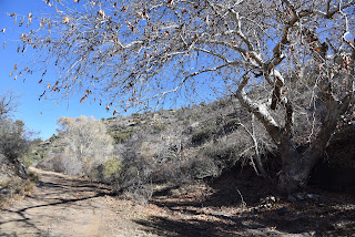
Cottonwoods herald the approach to Walnut Spring

There are more than seven springs in the Seven Springs Recreation Area.  The Tonto National Forest site which offers a picnic area, primitive camping and trailheads anchored by the Cave Creek Trail No. 4 is home to dozens of seeping water sources.

Humboldt Mountain rises over desert scrub

In addition to the eponymous Seven Springs, Maggie May, Mashakattee, Quien Sabe, Walnut, CP and Cottonwood springs spill water into the area’s creeks and washes.

Big vistas on the hike's high points

 
The route crosses Walnut Spring Canyon several times

A quick review of the national forest map reveals the locations of numerous other springs tucked into the mountainous backcountry north of Cave Creek.  While some of the springs are located along roads and trails, most trickle in oblivion among catclaw-riddled ravines.
The hike begins with a crossing of Seven Springs Wash

A lone sycamore grows in a moist pocket of Walnut Spring Canyon

 
Among the lot, Walnut Spring is easy to visit by hiking along a dirt two-track that roughly traces the gorge of Walnut Spring Canyon.  
A canyon-bound section of FR 1094

The trip begins on Forest Road 254 with an immediate crossing of Seven Springs Wash.  Right from the start, charred tree stumps stand as reminders of the 2005 Cave Creek Complex Fire and the 2020 Sears Fire, both of which took a heavy toll in the area.  Still, plenty of hardy junipers, sugar sumacs and cacti patches have survived and resurgent vegetation is gradually filling the charred voids.  At the 0.3-mile point, the road meets a cattle guard where the route splits.  Veer right onto Forest Road 1094, a rough route that’s open to motorized use, which serves as the trail for the remainder of the hike. 
Yuccas grow in a canyon cove

The road passes under some power lines where there’s a muddy wildlife water hole that reflects nice views of 5,175-foot Humboldt Mountain, the prominent, FAA “golf ball”-tower-topped peak to the east.  An easy ascent opens up vistas of the Cave Creek Mountains and the long, flat structure of New River Mesa to the west before the road meets the cut of Walnut Spring Canyon at the 1.2-mile point and begins a moderate descent to the first of several crossings of the sinuous, boulder-cluttered course.  Sheer rock faces with clinging cacti and yuccas dangling from damp crevasses gradually close in on the road and create shallow, sandy pools in abrupt bends.  The residual puddles foster a tiny community of water-loving sycamore, seep willows and cottonwood trees. 
A metal tank captures water from Walnut Spring

After a short traverse of the canyon floor, the road heads uphill, hanging close to the edge as it undulates through water-ravaged gullies and drainages.  The approach to Walnut Spring is heralded by a pair of cottonwood trees poking up through a tangle of junipers and a glassy slip of water running over the road.  At 2.6 miles, a metal tank tucked into a slim, heavily-wooded nook, captures Walnut Spring water through a quagmire of pipes and hoses.
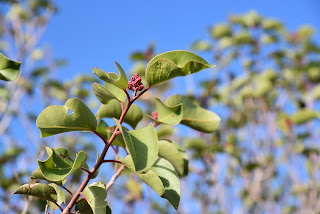
Sugar sumac grows along the route

  While the spring makes for a good turnaround point, a short stroll up to the ridge above it rewards with excellent mountain views of Bronco Butte and Butte Peak to the south.
New River Mesa on the west horizon

 
A view of the Cave Creek Mountains from FR 1094

To add length to the hike, consult the forest map for roads and trails open for exploration.
Cottonwood trees thrive around Walnut Spring

The road passes by a wildlife water hole

LENGTH: 5.34 miles roundtrip

RATING: moderate

ELEVATION: 3,440 – 3,946 feet (1,012 feet of accumulated elevation change)

GETTING THERE:

From the Loop 101 in Scottsdale, take the Pima/Princess Road exit 36 and go 13 miles north on Pima to Cave Creek Road.  Turn right (east) and go 11 miles on Cave Creek Road (a.k.a Forest Road 24 and Seven Springs Road) to Forest Road Road 254 on the right. For reference, this is about 1.5 miles south of the Seven Springs Picnic Area. Park in the dirt turnoff or, for those with high-clearance vehicles, there are several dirt parking aprons farther up FR254.  Access roads are a mixture of pavement and good dirt passable by passenger cars when dry. Two minor creek crossings on cement are require. Do not attempt after heavy rains as the roads and trails are prone to flooding.

INFO:

Tonto National Forest, Cave Creek Ranger District

https://www.fs.usda.gov/tonto

Tuesday, April 20, 2021

VIDEO: Maricopa Trail Restoration

 VIDEO: MARICOPA TRAIL RESTORATION


 Trail Restoration on the Granite Mountain-Bronco segment of the Maricopa Trail following the October 2020 Sears Fire.

https://www.youtube.com/watch?v=B0PnI-WQ0Os

Thursday, April 30, 2020

PYEATT DRAW

I'm posting my backlog of pre-pandemic hikes. Please observe all CDC health & safety recommendations and travel advisories while recreating on public lands. Ideally, stay close to home and away from congested trails until conditions are improved.
PYEATT DRAW Tonto National Forest.
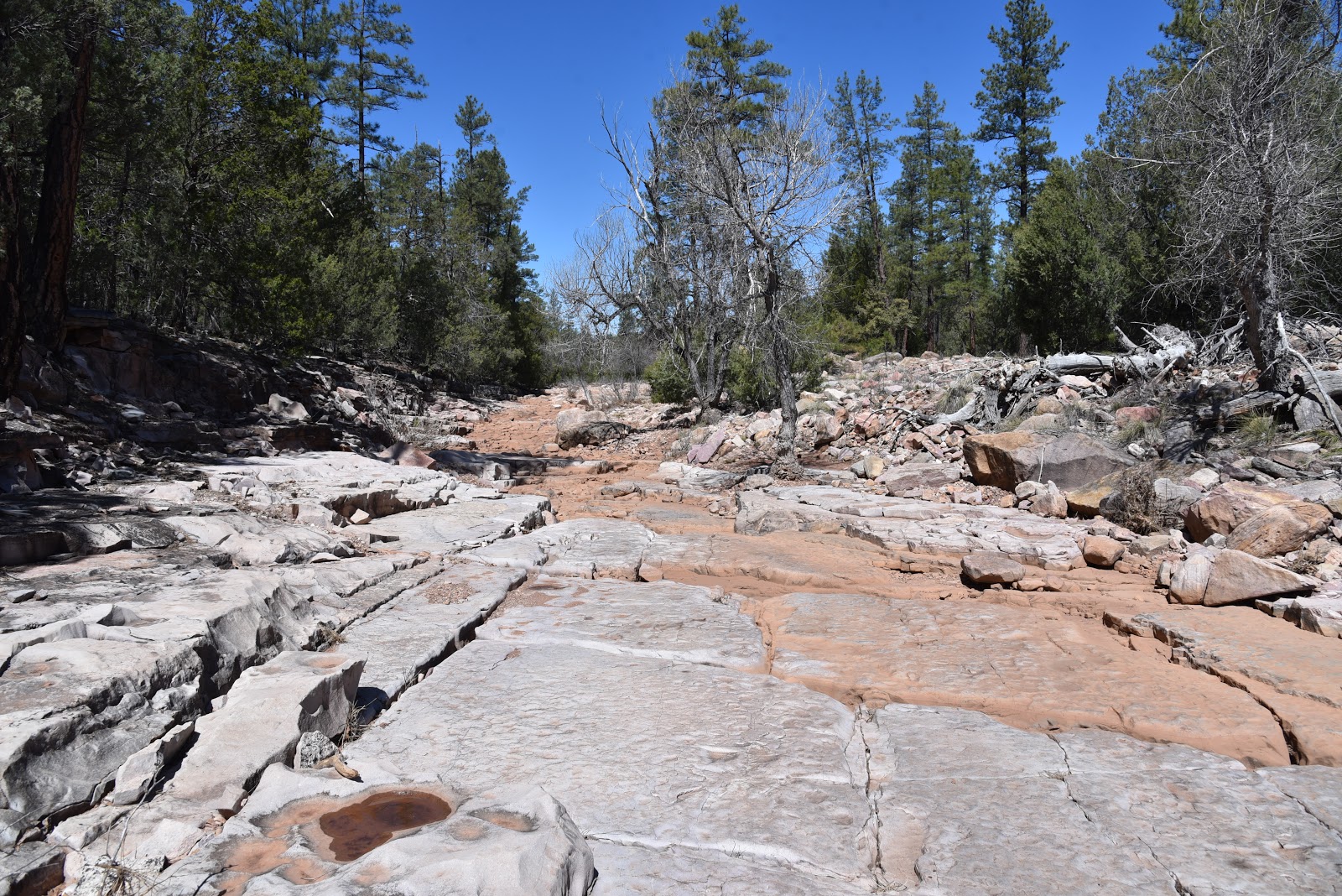
A slick rock passage in Pyeatt Draw
There are two ways to hike through Pyeatt Draw, the hard way and the easy way. 
The major drainage that spins off of Ellison Creek a few miles northeast of Payson near the popular Water Wheel recreation site is an entertaining mix of dirt passages, water-ravaged channels and obstacle-loaded corridors.
Rock ledges close in on Pyeatt Draw
Although the challenging woodsy route is mostly used by OHV enthusiasts, it’s scenic qualities and varying terrain offer hikers a quirky alternative to more traditional trails.
The ragged course is intertwined with a primitive forest road that traces the banks above the draw, crossing it several times. The trek begins at a dirt pullout where a sign for Forest Road 1595 marks the trailhead. Begin by hiking the rocky draw roughly 400 feet to where FR 1595 continues straight ahead. To take the hard way (as described here), veer left at the junction and follow the stream bed. For the easy way, stay on the road.  
A forest road that crosses the draw offers an easier path
An easy section of the rugged Pyeatt Draw route
Pyeatt Draw trailhead
Much of the hike passes through riparian vegetation
Except for some loose footing, the first 1.3-mile segment is relatively flat and simple to navigate. Hiking conditions in the pine-shaded, uneven gorge range from open flats and slick rock channels to jumbled, step-like sections where tiny waterfalls cascade over fractured terraces.
There's abundant wildlife in Pyeatt Draw
Willows, cottonwoods and alders cluster around shallow pools feed by an intermittent stream.
The mouth of Pyeatt Draw
Sandbars flush with footprints of Great blue herons, bobcats, deer, elk, and racoons show the importance of this lush waterway for wildlife.  
Bizarre geological features add interest to the hike
The area is prone to flash floods, so avoid this hike after heavy rains and when storms are forecasted. Right around the 1.3-mile point, the draw becomes noticeably narrower, more difficult to walk and profoundly beautiful. Massive blocks of stone with streaks of color and crystalline inclusions protruding from sheer cliffs now dominate the terrain.
Pyeatt Draw tests the skills of OHV users
The hike’s high point is a box canyon dubbed “the filter” by OHV users.  Cluttered with massive, angular boulders, the filter is the crux challenge for OHVs. On my most recent visit, a heavily-modified Jeep, attached to a winch was working its way up an impossible-looking staircase of head-high rock shelves while being guided by coaches on foot.  Hikers can bypass the motorized activity by scrambling over the less abrupt chute to the right. 
Views of the Mogollon Rim peek through the pines.
A few yards beyond the filter, the route ends where the draw meets a forest road at the 1.7-mile point. Simply backtrack from here and enjoy views of the Mogollon Rim you may have missed while picking through the quagmire on the way in.
The rough access road requires a high-clearance vehicle.
Water tumbles over blocky boulders in Pyeatt Draw
Willows flourish where water pools in Pyeatt Draw
LENGTH: 3.4 miles roundtrip to “the filter” and back
RATING: moderate
ELEVATION: 5,258 – 5,747 feet
GETTING THERE:
From the State Route 87/260 intersection in Payson, go 2 miles north on SR 87 and turn right on Houston Mesa Road.  Continue 4.9 miles, turn right on Pyeatt Draw Road (Forest Road 198)
and go 4.5 miles to an unsigned prominent drainage with a concrete culvert on the left and a sign for Forest Road 1595 on the right. Park in the dirt turnouts.
Pyeatt Draw Road is a rough dirt track with deep ruts, hairpin turns and a few steep drop offs. At least a high-clearance vehicle is required and a 4x4 if the road is wet.  There are several pullouts and dispersed campsites along the road where you can park and walk before the road gets too messy for your comfort level.
INFO: Tonto National Forest

Monday, July 22, 2019

See Spring

SEE SPRING
Water rushes from a crevice at the head of See Spring
On the jagged cliffs below the Mogollon Rim, dozens of springs dispense water that filters through the porous limestone escarpments.
The hike begins with an easy crossing of Christopher Creek 
The springs range in flow from steady trickles that drain into green seeps to icy founts that gush from solid rock, carving gullies and fostering thick forests.
  See Spring is one of the later. Its location half-a-mile off the See Canyon Trail along Christopher Creek in Tonto National Forest twenty miles east of Payson makes it a popular choice for a short day hike or add-on to the 2.5-mile mile artery route that climbs over 1700 feet to the top of the Rim.
There’s a local hiker adage that claims when trekking See Canyon, all you see is the canyon. This is mostly true, but, oh, what a canyon it is to behold. 
New Mexico locust grow in dense thickets on the trail.
Dense woodlands shade the See Canyon Trail
Right out of the chute, the trail delivers a rich palette of sights and sounds plus enough challenge (or not) to satisfy a full gamut of hiking styles. You don’t have to walk very far before becoming immersed in the perennial flow of Christopher Creek and the lush woodlands that thrive in its moist environs. 
Christopher Creek is a main feature of the trek.
Boxelder trees love the moist environs near See Spring
The journey begins with a brief walk on the Highline Trail. From the trailhead, follow the footpath to where a pair of white diamond symbols tacked to trees indicate where the route makes an easy crossing of the creek. On the opposite bank, walk a few yards and veer left at the See Canyon Trail junction. The next half-mile traces the stream through a mix of meadows and forests of New Mexico locust, boxelders and Ponderosa pines. Beneath the leafy canopy, healthy tangles of canyon grape vines mingle with insidious clumps of poison ivy--leaves of three, let it be.
Canyon grapes flourish in moist areas on the trail.
It’s smart to wear long pants on this hike to avoid getting an itchy rash.
Mountain vistas are sparse, but water features are plentiful
The path crosses several rocky drainages as it gently gains elevation to reveal glimpses of Promontory Butte, a major Rim land feature.  At the 0.8-mile point, head right at the See Spring Trail junction where the half-mile spur path swerves away from the creek and begins a moderate climb.  
Bigtooth maples filter sunlight on See Spring Trail
The “all you see” adage really hits home here as thick stands of Bigtooth maples, Gamble oaks, Alligator junipers, Arizona walnut and soaring Douglas and white firs choke the trail into a shady, slim passage obscuring all but sky and vegetation.  A few sets of switchbacks mitigate the 400-foot ascent that lands hikers in an enchanting natural water park setting.
Tree cover on the See Spring Trail
Roughly 1.3 miles from the trailhead, the first signs of the See Spring conglomerate of waterworks appear as jumbled ravines funneling crystalline streams.  Follow the faint footpaths another 0.2-mile and you’ll arrive at the spring source where water pours from rock crevices all around.
Golden-beard penstemons add brilliant color to the trek.
The splashy rhythms of water rushing over mossy boulders and flattened ferns complemented by bird calls and rustling leaves combine for a calming culmination of short trek with much to see. 
Scampering lizards are constant companions on the trail
See Canyon-See Spring junction
You're never far from water on this Mogollon Rim classic
See Canyon Trail traces Christopher Creek
Icy water spills from See Spring
Poison ivy. Leaves of three, let it be.
LENGTH: 2.6 miles roundtrip (5 miles with See Canyon Trail)
RATING: moderate
ELEVATION:  6106 – 6725 feet (7860 feet with See Canyon Trail)
GETTING THERE:
From Payson, go 20.2 miles east on State Route 260 to the Christopher Creek Loop exit, turn left and continue 1 mile to Forest Road 284 (across from the Tall Pines Market), turn left and go 1.6 miles to the trailhead. Access road is good dirt/gravel suitable for all vehicles. There’s a restroom at the trailhead.
INFO:


Monday, April 9, 2018

RESTORATION OF MARICOPA TRAIL SEGMENT 20 COMPLETE

RESTORATION OF MARICOPA TRAIL SEGMENT 20 COMPLETE
Tree burned in the 2005 Cave Creek Complex Fire
Wildfires can be as confusing and they are devastating.  Sometimes they roar through a forest in take-no-hostages fury while in other situations, they hopscotch over the land creating a random patchwork of destruction and untouched swaths. 
Strawberry Hedgehog cacti bloom March-April
The 2005 Cave Creek Complex Fire that swept through Tonto National Forest north of the Valley resulted in a combination of heartbreaking ruin and pockets of unscathed life.  One fluke is the survival of a stand of junipers along Cottonwood Creek, an intermittent stream below Quien Sabe Peak. A point of pride of the restoration efforts of the nearly 14 miles of fire damaged trails that connect the Bronco Trailhead at Seven Springs Road with Spur Cross Ranch Conservation Area is the mending of the route that passes by the  mile-long juniper haven that escaped the blaze.
Corrals at the Bronco Trailhead
 Heavy brush and debris was cleared away from the evergreen passage, enabling hikers to admire the trees instead of battling through scrappy thickets.
Stock Tank on Trail 245
Precious junipers
Sign showing partners in the trail restoration efforts
The reclamation work has been a years-long endeavor with numerous organizations and volunteers contributing time and materials. A major push that wound up this year put the finishing touches on the project.  From January through February crews from Maricopa County, Tonto National Forest and the American Conservation Experience completed four week-long hitches to repair Segment 20 of the Maricopa Trail which incorporates forest routes Bronco Trail #245 and Cottonwood Creek Trail # 247.
Sugar sumac
Crews camped and worked to clear brush, locate and restore historic cairns, repair tread and place trail markers at half-mile intervals along the route. Flagstaff-based American Conservation Experience is a non-profit organization for young adults ages 18-25 who are considering careers in land management, conservation or other outdoor fields.
False Toadflax blooms April -August
Participants serve 3-to-12 month terms under the tutelage of industry professionals. In addition to performing needed work, associates gain valuable knowledge and hands-on experience.  During the two-month Maricopa Trail restoration undertaking, crews repaired or built 170 drainages, fixed 10 water bars and built or fixed 23 cairns while clearing the trail of rocks and hazards.  Crews were assisted by The Backcountry Horseman Association of the East Valley which hauled in tools and food taking some of the load off the sweaty work.
A fire survivor grows strong
Thirteen years after the fire, the classic trails that run beneath desert mesas and peaks
are revitalized and gaining traction as must-do hiking destinations. The land surrounding the route is healing slowly but steadily.
Blooming barberry along the Maricopa Trail 
Dead trees bearing black scars of the blaze stand among emergent sprouts and spotty islands of survivor mesquite, sugar sumac, scrub oak, yuccas and blooming cacti.  Part of the joy of hiking this section of the Maricopa Trail is seeing how, with a little help from McLeod tools, rakes and human effort, the forest is bouncing back. 
Patches of junipers survived the Cave Creek Complex Fire
Although there may be fewer junipers, those that remain are cherished finds and reminders of the whims of Nature and our role in preserving irreplaceable resources.
The stock tank makes for a good day hike destination
A Crucifixion thorn tree frames mountain vistas
With major work in the in the rear-view mirror, the Maricopa Trail continues to grow and evolve into a world-class recreational hub. 
Scene on the Maricopa Trail
There’s still plenty to do and anticipate.
Major goals for the 300+-mile Valley-circumnavigating route include linking county parks, metropolitan areas, municipal trails and communities with a non-motorized, open space corridor that will protect natural and cultural resources from development.
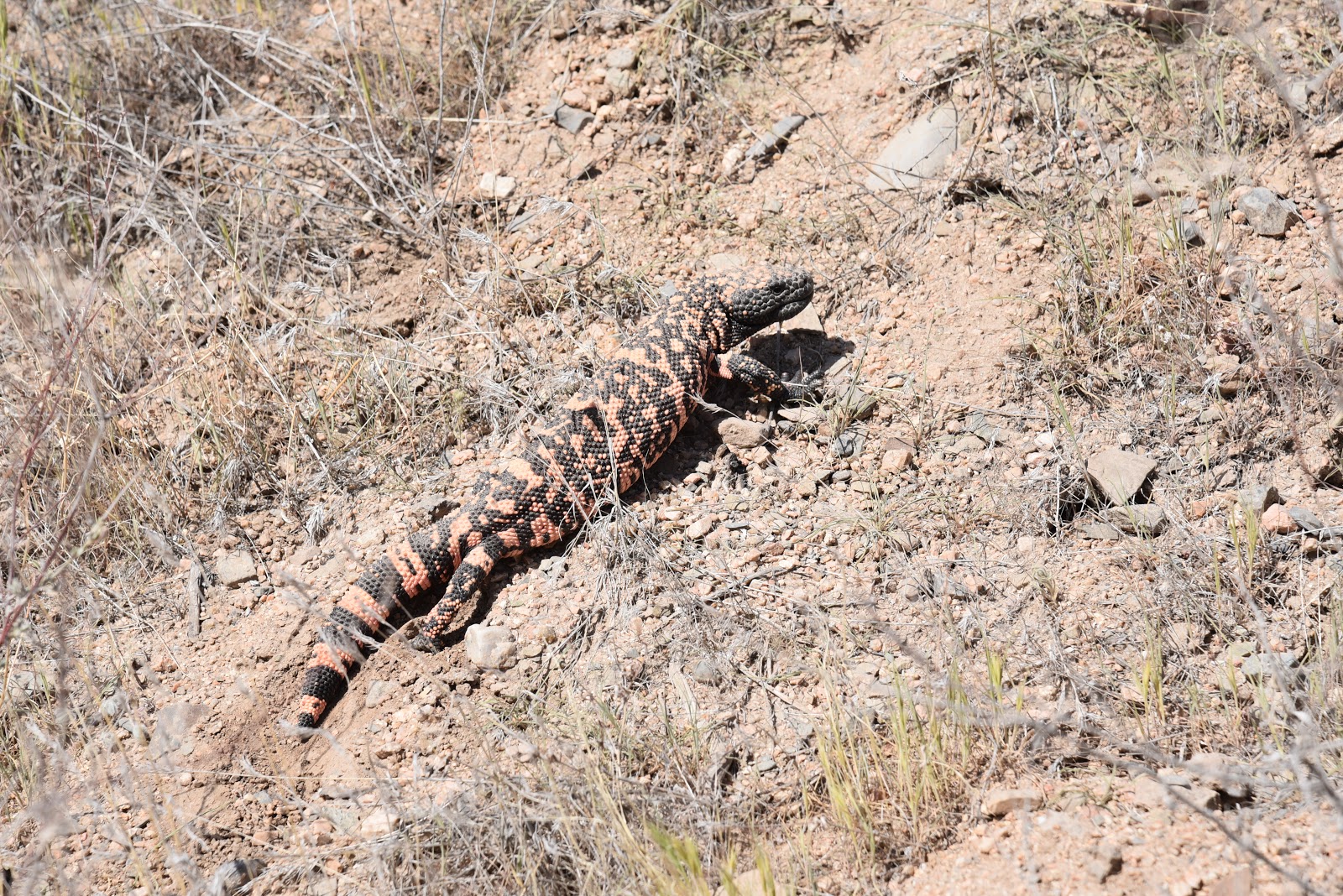
This Gila Monster was not interested in posing for a photo
Per Dwana Taylor, Maricopa County Parks and Recreation Public Information Officer, trail users can look forward to greater connectivity, new trailheads and spurs to the Hassayampa River Preserve and future Vulture Mountain Recreation Area in Wickenburg. 
Hikers on the Bronco-Spur Cross segment of the MT
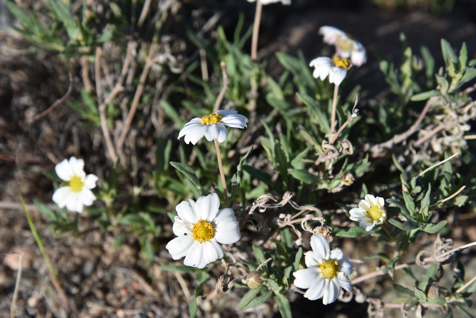
Even in dry years, Blackfoot daisies find a way to bloom
LENGTH: 13.6 miles one way (Bronco Trailhead to Spur Cross)
DAY HIKE OPTION:
Hike 2.6 miles on Trail 245 to the stock tank at the east fork of Bronco Creek. for a 5.2-mile round trip with an elevation range of 3,700 - 4,234 feet.
RATING: moderate
ELEVATION: 2,400- 4,224 feet
GETTING THERE:
Bronco Trailhead:
From the intersection of Cave Creek Road and Pima Road in Carefree, continue 11.6 miles north on Cave Creek Road which turns into Seven Springs Road/Forest Road 24 to the Bronco Trailhead on the left.  The last 3 miles of FR 24 is an all-weather gravel road suitable for passenger cars.  
INFO & MAP
American Conservation Experience