I'm posting my backlog of pre-pandemic hikes. Please observe all CDC health & safety recommendations and travel advisories while recreating on public lands. Ideally, stay close to home and away from congested trails until conditions are improved.
PYEATT
DRAW Tonto
National Forest.
 |
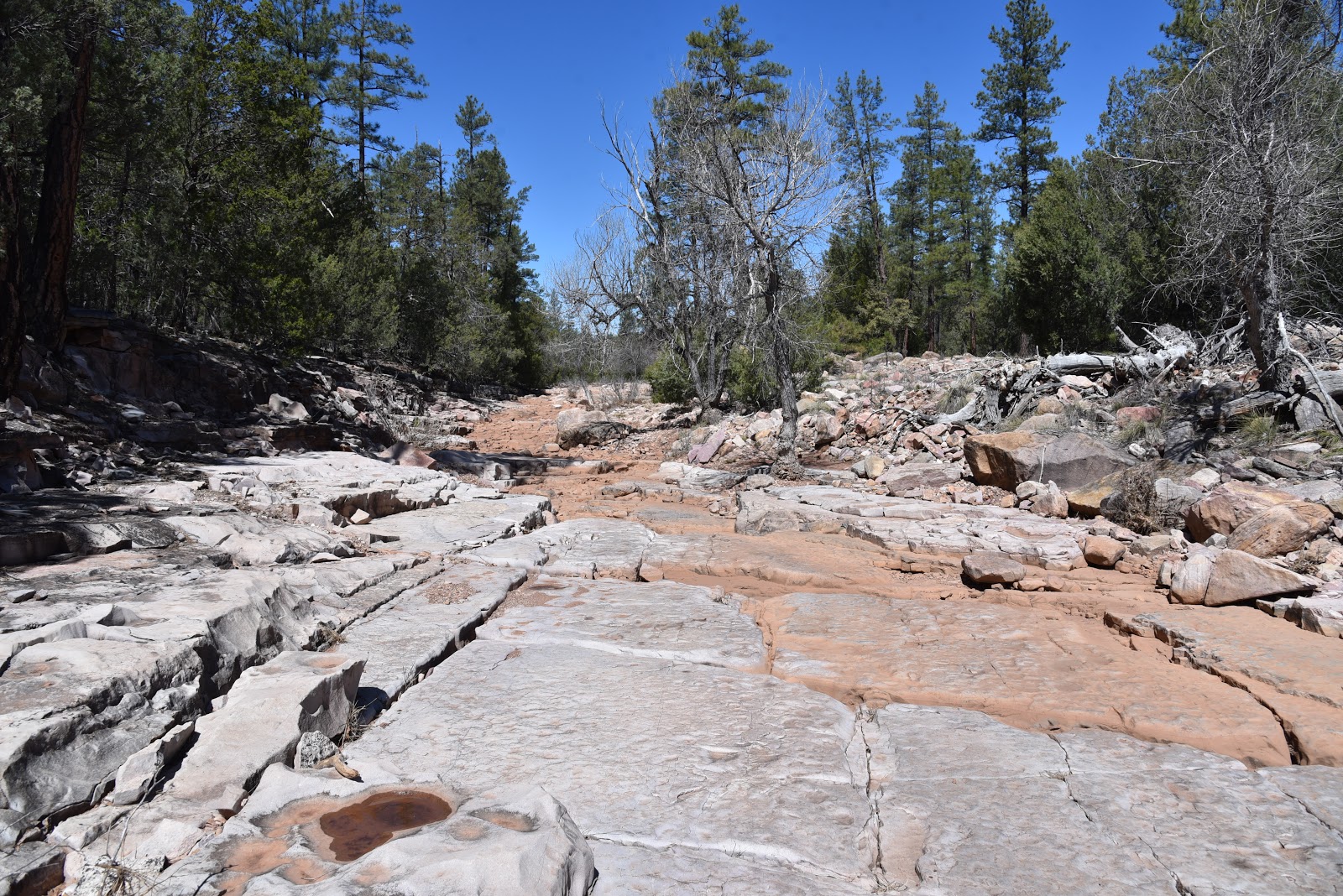
| A slick rock passage in Pyeatt Draw |
There are
two ways to hike through Pyeatt Draw, the hard way and the easy way.
The major
drainage that spins off of Ellison Creek a few miles northeast of Payson near
the popular Water Wheel recreation site is an entertaining mix of dirt
passages, water-ravaged channels and obstacle-loaded corridors.
 |
| Rock ledges close in on Pyeatt Draw |
Although
the challenging woodsy route is mostly used by OHV enthusiasts, it’s scenic
qualities and varying terrain offer hikers a quirky alternative to more
traditional trails.
The ragged
course is intertwined with a primitive forest road that traces the banks above
the draw, crossing it several times. The trek begins at a dirt pullout where a
sign for Forest Road 1595 marks the trailhead. Begin by hiking the rocky draw
roughly 400 feet to where FR 1595 continues straight ahead. To take the hard
way (as described here), veer left at the junction and follow the stream bed.
For the easy way, stay on the road.
 |
| A forest road that crosses the draw offers an easier path |
 |
| An easy section of the rugged Pyeatt Draw route |
 |
| Pyeatt Draw trailhead |
 |
| Much of the hike passes through riparian vegetation |
Except for
some loose footing, the first 1.3-mile segment is relatively flat and simple to
navigate. Hiking conditions in the pine-shaded, uneven gorge range from open
flats and slick rock channels to jumbled, step-like sections where tiny
waterfalls cascade over fractured terraces.
 |
| There's abundant wildlife in Pyeatt Draw |
Willows, cottonwoods and alders cluster
around shallow pools feed by an intermittent stream.
 |
| The mouth of Pyeatt Draw |
Sandbars flush with
footprints of Great blue herons, bobcats, deer, elk, and racoons show the
importance of this lush waterway for wildlife.
 |
| Bizarre geological features add interest to the hike |
The area is prone to flash floods, so avoid
this hike after heavy rains and when storms are forecasted. Right around the
1.3-mile point, the draw becomes noticeably narrower, more difficult to walk
and profoundly beautiful. Massive blocks of stone with streaks of color and
crystalline inclusions protruding from sheer cliffs now dominate the terrain.
 |
| Pyeatt Draw tests the skills of OHV users |
The
hike’s high point is a box canyon dubbed “the filter” by OHV users. Cluttered with massive, angular boulders, the
filter is the crux challenge for OHVs. On my most recent visit, a
heavily-modified Jeep, attached to a winch was working its way up an impossible-looking
staircase of head-high rock shelves while being guided by coaches on foot. Hikers can bypass the motorized activity by
scrambling over the less abrupt chute to the right.
 |
| Views of the Mogollon Rim peek through the pines. |
A few yards beyond the filter, the route ends
where the draw meets a forest road at the 1.7-mile point. Simply backtrack from
here and enjoy views of the Mogollon Rim you may have missed while picking
through the quagmire on the way in.
 |
| The rough access road requires a high-clearance vehicle. |
 |
| Water tumbles over blocky boulders in Pyeatt Draw |
 |
| Willows flourish where water pools in Pyeatt Draw |
LENGTH:
3.4 miles roundtrip to “the filter” and back
RATING: moderate
ELEVATION:
5,258 – 5,747 feet
GETTING
THERE:
From the
State Route 87/260 intersection in Payson, go 2 miles north on SR 87 and turn
right on Houston Mesa Road. Continue 4.9
miles, turn right on Pyeatt Draw Road (Forest Road 198)
and go 4.5
miles to an unsigned prominent drainage with a concrete culvert on the left and
a sign for Forest Road 1595 on the right. Park in the dirt turnouts.
Pyeatt
Draw Road is a rough dirt track with deep ruts, hairpin turns and a few steep
drop offs. At least a high-clearance vehicle is required and a 4x4 if the road
is wet. There are several pullouts and
dispersed campsites along the road where you can park and walk before the road
gets too messy for your comfort level.
INFO: Tonto National Forest


No comments:
Post a Comment