MORMON
LAKE LOOKOUT SITE
 |
| Gate on Mormon Lake Lookout road |
There are few certainties in life, but one fixed reality is, things fall apart. Whether a star dying in a spectacular super nova or the protracted disintegration of a favorite pair of shoes, sooner or later everything in the taxonomy of the natural world will expire. While we are dialed-in to the mundane disintegrations that go on right under our noses every day (oil in a car, paint on house, cells in our brains) the slow-burn of obsolescence and decay on mountain back roads reads more poetic than prosaic.
 |
| Cinder pit along FR 124C |
Perhaps because we don’t look at them every day, the breakdown of land forms and back woods human-made artifacts barely registers. And since we’re not scrambling to fix them, they exist as curiosities instead of problems.
 |
| Masonry box at Iowa Camp Spring |
A stroll along Forest Road 124C near Mormon Lake exposes several sites where falling apart happens with engaging style.
 |
| Pine thermopsis bloom April - July |
Located at the south end of the Arizona’s largest natural lake, FR124C in Coconino National Forest is a rough two-track open to motorized travel that traces the edge of Anderson Mesa in the plateau lakes region 25 miles south of Flagstaff.
 |
| View from the abandoned lookout site |
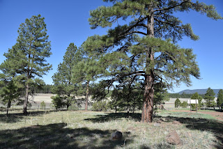
The road makes a moderate, steady climb heading toward an unnamed hill where the Mormon Lake fire lookout tower once stood. From the start, the route enters a forest dominated by ponderosa pines and gamble oaks, steering away from the whir of cars passing on Lake Mary Road. At the 0.3-mile point, a narrow side road on the left leads to a cinder pit that looks like a miniature version of Red Mountain, a collapsed cinder cone volcano north of Flagstaff. The pit, which is sometimes used by recreational shooters, is a long, broken cliff of volcanic rock with ashen hoodoos eroding out of a cascade of crumbling red cinders. Volcanic features like this one can form over weeks to years but take millions of years to break down as is happening here.
 |
| Summit views are sparse but breathtaking |
Beyond the pit, the road enters a higher eco-zone where Douglas, white and cork bark fir trees mingle with the pines. Between the branches, glimpses of Mormon Lake going through one of its cyclical breakdowns appears as a golden pasture where during wetter years, a shallow lake fills the bowl-like depression. As the forest grows thicker and the road becomes steeper, a pop of wildflower color gives away the location of the moist environment around Iowa Camp Spring. Take the non-motorized Forest Road 9474D detour and hike a few yards to visit the site and its stone-masonry spring box. Trees, shrubs and time are encroaching the historic artifact that looks as if it’s been a while since water flowed in more than a trickle from its rusted pipes. Around the point where the road reaches 7,600 feet in elevation, a small grove of aspen trees stands in a drainage on the right.
 |
| FR124B leads to the lookout site |
 |
| Fremont barberry blooms April - July |
Aspens have been in a decades-long decline in Northern Arizona. Stressed by insects, pathogens, drought, frost, browsing elk and dense forests that block sunlight, the trees that reproduce mostly by sprouting root systems that can be viable for up to thousands of years are not regenerating at a healthy rate. Forest scientists are trying to figure out what is causing the dieback and how best to manage the situation.
 |
| Rubble marks the location of the old fire lookout |
 |
| Mixed conifir woodlands along FR 124C |
At the 2.2-mile point, the road comes to a fork where Forest Road 124B, a non-motorized dirt road, swerves off to the right. This junction is signed, but the road number post is not easy to spot.
 |
| Aspens are in decline in Coconino NF |
FR124B leads to the abandoned lookout site, gaining 277 feet in just under a mile. Near the top of the hill, there’s a metal gate and a trail log marking the final 0.2-mile walk to the summit. On top, the views that can be found in the spaces between trees are sparse but breathtaking.
 |
| Mormon Mountain (right) seen from the trailhead |
A jumble of boulders hint at the recent decommissioning and demolition of the former Mormon Lake Lookout and cabin. The site was home to a wooden lookout built in 1915 that was replaced in 1927 with a 48-foot metal tower topped with a 7 x 7-foot cab.
 |
| Dry Mormon Lake (center) sen from FR 124C |
It’s unclear why the fire watch tower was abandoned, but the Hutch Mountain Lookout to the south seems a likely usurper.
 |
| Eroding hoodoos at the cinder pit site |
Judging from backhoe marks on boulders strewn on the site, the tower’s demise was planned, swift and clean, unlike the other falling apart things along the roads leading to it.
LENGTH: 5.9 miles round trip
RATING: moderate
ELEVATION: 7,109- 7,977 feet
GETTING THERE:
From Flagstaff, go 25.6 miles south on Lake Mary Road (County Road 3) to Forest Road 124C on the left past milepost 319. Park in the dirt turnouts.
INFO:


