Find A Trail. Start Your Search Here:

Showing posts with label White Horse Hills. Show all posts

Monday, July 31, 2023

Arizona Trail Passage 34: FR418 to Kelly Tank

ARIZONA TRAIL PASSAGE 34 SAN FRANCISCO PEAKS

Forest Road 418 to Kelly Tank

Aspens and pines on the Arizona Trail Passage 34

An Arizona “alpine start”-the pre-dawn trailhead call for a mountain hike- can be timed by the stars. Basically, if Orion has faded into the dawn, it’s already too late.

Hip-high ferns near Forest Road 418

The iconic winter constellation with its prominent three-star belt arcs over the night sky from December to late April.
Storm builds over the White Horse Hills

It then disappears for a few months before making its summer debut in the early morning hours of August. Visible low on the eastern horizon around 4 a.m., Orion the Hunter signals the hour Phoenix area day hikers must leave the Valley to beat high country monsoon storms. 
When thunder roars, go indoors.

There are three things to know about summer hiking on Arizona’s mountain trails. First, temperatures will be cooler, but fickle. Second, mountains make their own weather, often churning out thunder, lightning, high winds, and rain after 11 a.m. And finally, being caught on a mountain or in the open during a monsoon storm is a potentially deadly situation.  That’s why it’s smart to follow The Hunter’s lead and head out super early to be off peaks and into safety before noon.
Silverstem lupine bloom June - October

Per the National Weather Service, “When thunder roars, go indoors.” For more lightning safety education, visit: 
https://www.weather.gov/safety/lightning.

In addition to staying alive, early morning hiking has many benefits.  

Alpenglow on the Walker Lake cinder cone

The crack of dawn is the best time to observe wildlife and witness the syrupy amber “alpenglow” the sun paints on mountain slopes.
Kendrick Peak viewed from the Arizona Trail

The San Francisco Peaks Passage 34 of the Arizona National Scenic Trail is one worth setting the alarm to experience.  The Flagstaff area favorite runs for 35.3 miles between the Weatherford Trailhead at the south edge of the peaks to Babbitt Ranch in Coconino National Forest.
Monsoon clouds over the Arizona Trail

Along its mostly easy course, the trail cuts through aspen glens, dense coniferous forests, meadows, and juniper-studded rangelands.  The entire passage is hemmed in by mounds and craters of the San Francisco Volcanic Field, an 1,800 square mile swath of the Colorado Plateau with over 600 volcanic features.
A hiker photographs a scenic moment on the AZT

Arizona Trail gate at FR 514

Passage 34 rounds the slopes of 12,633-foot San Francisco Mountain ( the Humphreys Peak Trail goes to its summit), a dormant stratovolcano, and heads north through a maze of cinder cones and lava flows.  For a volcano-centric day hike, the segment of the passage that runs between Forest Roads 418 and 514 is a beauty.

The 6.8-mile out-and-back trek begins in a thicket of aspens on the northwest edge of San Francisco Mountain.  An understory of ferns, lupines, and tall grasses lap at the legs as hikers take on the gentle inclines. Within a half-mile, the trail parallels the Walker Lake cinder cone.

San Francisco Mountain viewed from AZ Trail

A hikeable road leads to the summit of Saddle Mountain

Standing at over 8,400 feet, its pine-fleeced crater contains a shallow pond. The swampy pool is not visible from the trail, but a nearby dirt road leads to its innards. To the east, the weathered peaks of the White Horse Hills rise over Deadman Wash.
Western yarrow blooms June - September

The mostly treeless, isolated volcanic landforms top out at 9,065 feet with a choppy fringe of Ponderosa pines huddled at their bases. 
Elk leave "antler rub" scars on aspen trees

As this hike approaches its turnaround point at Forest Road 514, the tree cover thins out opening views of  10,418-foot Kendrick Peak to the west and 8,864-foot Saddle Mountain straight ahead. Both have trails to their summits. At hike’s end across from Kelly Tank, an Arizona Trail gate  marks the route’s transition into more arid terrain where junipers, brush and wide-open spaces commandeer the viewscape. Still, the mountain-borne lightning storms that happen on a near daily basis in summer are something to monitor and avoid.  An alpine start helps.

Gathering storm over the White Horse Hills

LENGTH: 6.8 miles out-and-back

RATING: easy

ELEVATION: 8,300 – 7,721 feet

GETTING THERE:

SOUTH ACCESS: FOREST ROAD 418 TRAILHEAD:

From Flagstaff, go 19.5 miles north on U.S.180 to the northern entrance  for FR151 (Hart Prairie Road) just past milepost 235.  Turn right and continue 1.6 miles to FR418. 

Continue 1.1 miles on FR418 to a dirt parking apron on the right. Hike begins on the north side of the road. Forest roads are maintained dirt suitable for most vehicles.

NORTH ACCESS: KELLY TANK TRAILHEAD:

From Flagstaff, go 21 miles north on U.S. 180 to Forest Road 514 (Kendrick Park Road) at milepost 236.6. Turn right and continue to just past the 3-mile marker at Kelly Tank and park in the dirt lot on the right at the beginning of Forest Road 9006R. This is directly across from an Arizona Trail gate.

Forest roads are maintained dirt suitable for most vehicles.

INFO & MAPS:

https://aztrail.org/explore/passages/passage-34-san-francisco-peaks/

Monday, July 13, 2020

White Horse Hills


White Horse Hills
The mouth of the north pass at White Horse Hills
Within the pass that cuts through the pyramid-shaped pinnacles of the White Horse Hills, voices carry. But, voices are rare in the barren cluster of vertical mounds located below the north face of the San Francisco Peaks 20 miles north of Flagstaff in Coconino National Forest.
This is not the kind of place hikers drool over visiting, it’s allure draws more curiosity seekers than hard-core trekkers, especially since it competes with nearby Passage 34 of the Arizona Trail.   Inquiring minds might well find amusement on the obscure dirt road that shows up on topographic maps as a oversimplified line connecting Forest Roads 514 and 418.
A storm brews above Saddle Mountain (left)
Kendrick Mountain seen from FR 9219M
Painted Desert views stand out on the route
But the reality of hiking the deceptively straight forward course of Forest Road 9219M, which runs down the center of the lumpy conglomerate, is a bit more complicated.
The section of FR 9219M that ascends the mountain pass is now closed to motorized traffic and its point-to-point length is only 2.8 miles, yet for those without a good sense of direction, picking out the overgrown path can be a challenge. Still, with two options to explore the area, expert and novice hikers alike can experience this unusual landform.
Ponderosa pines shade segments of both routes
The North Route
View from the high pass of White Horse Hills
The easiest route begins at Forest Road 514. From a trailhead that’s shared with the Arizona Trail, follow Forest Road 9006R for a half-mile to Forest Road 9219M. Veer right and hike the dirt two-track as it makes an mild 400-foot climb through patches of pines and shadeless meadows. Views along this nondescript backroad are astonishing. Dozens of volcanic landforms including 8,880-foot Saddle Mountain and 10,418-foot Kendrick Mountain fill the horizons while hazy glimpses of the Painted Desert and the rim of the Grand Canyon roll out to the northeast.
The route shares a trailhead with the Arizona Trail
Straight ahead, Arizona’s highest peaks that top out at 12,643 feet, cast shadows on the destination: the White Horse Hills. Also known as Marble Mountain, the geological curiosity is a dome laccolith, a volcanic feature that forms when subterranean magma pushes up layers of older rocks from below, sort of like a blister that never breaks the surface.  Described by geologist John V. Bezy in A Guide to the Geology of the Flagstaff Area, the multi-peaked massif formed around 850,000 years ago. 
There's lots of solitude in the White Horse Hills
A faint trail ascends to the top of the pass
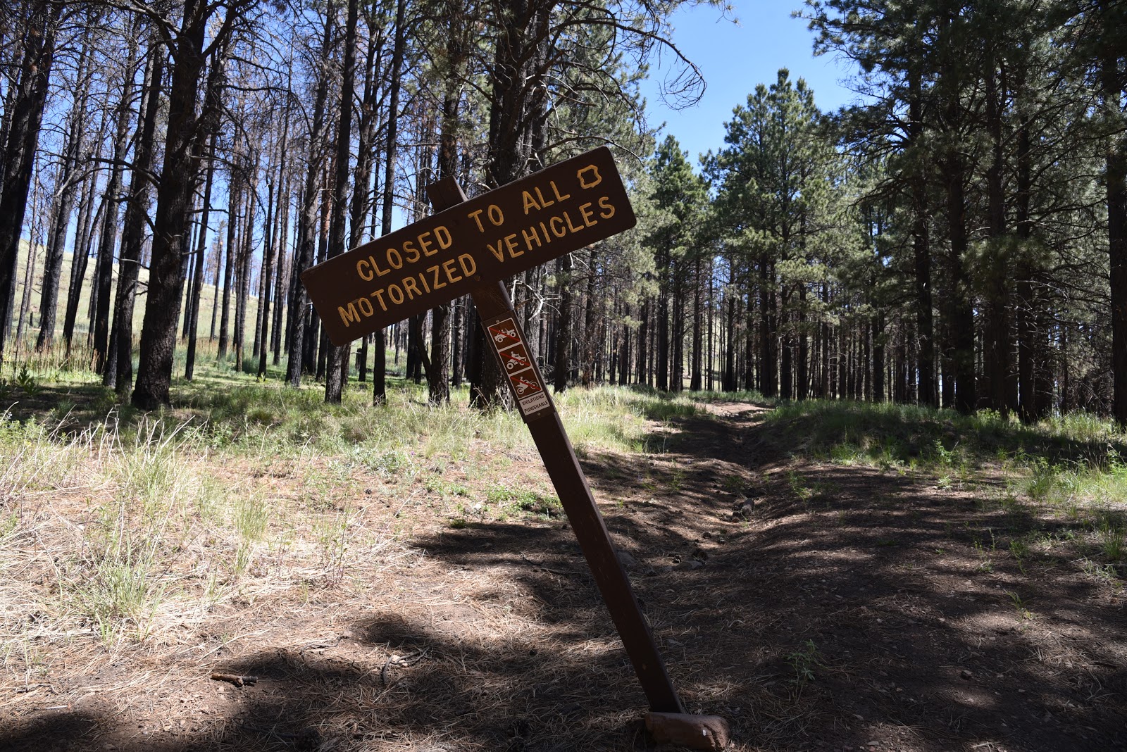
Thousands of years of erosion and recent wildfires have shaped the terrain into a desolate yet oddly appealing pocket of stark rhyolite hills and exposed layers of ancient sediments, previous volcanic flows and ragged outcroppings of Redwall limestone that were changed into marble by the heat of rising magma. At the 1.5-mile point, the road hike ends in a patch of Ponderosa pines at the mouth of the mountain pass where a barbed wire fence and a toppled sign bar motorized travel into the hills. There’s no gate and no easy way to get through the fence. As it’s important to never cut or alter fences on forest lands, I called this scenic spot the turnaround point and set out to explore the hills from the south.
Thistle are plentiful along the routes
White Horse Hills is a dome laccolith volcanic feature
The South Route
Although hiking the hills from the Forest Road 418 access point is more difficult, it gets you into the guts of the laccolith. A short but steep and slippery climb on a disintegrating road leads to a landing where the road seems to disappear entirely. To find the fading track, look ahead to spot a barely discernable road cut between two conical peaks, the highest of which reaches 9,065 feet. Follow this path 300 feet uphill to the highpoint saddle—a dizzying perch surrounded by sheer bluffs, broken clefts and boulder-filled ravines. Through the V-shaped gap in the pass situated at 8,738 feet, flatlands dotted with cinder cone volcanoes and the contrasting green pastures of Kendrick Park are visible 1,000 feet below. From this point, the path becomes clearer, but still tricky in places, and can be spotted snaking across the eastern (to the right) slopes below. Carefully work your way down the incline and walk toward the barbed wire fence (8,062 feet) at the 1.3-mile point. Again, unless you can squeeze under the wire without causing damage, return the way you came.
Common mullien thrive in meadows below the hills
White Horse Hills sit at the base of San Francisco Mountain
Wildfires and erosion have shaped the White Horse Hills
Southern access point to White Horse Hills
The eroded innards of White Horse Hills
LENGTH:
From the North to the fence:  3 miles round trip
From the South to the fence: 2.6 miles  round trip
RATING: easy or difficult depending on route
ELEVATION:
North access: 7,647 – 8,062 feet
South access: 8,062 – 8,738 feet
GETTING THERE:
North Access FR 514:
From Flagstaff, go 21 miles north on U.S. 180 to Forest Road 514 (Kendrick Park Road). Turn right and continue to just past the 3-mile marker at Kelly Tank and park in the dirt lot on the right at the beginning of Forest Road 9006R. This is directly across from an Arizona Trail gate.
South Access FR 418:
From Flagstaff,  go 19.5 miles north on U.S. 180 to the north access for Forest Road 151 (Hart Prairie Road) located past milepost 235. Turn right and continue 1.6 miles to Forest Road 418, veer left and go 2 miles to a small dirt turnout just past a 2-mile post where there’s a “closed to motorized use” sign on the left. Parking is limited to turnouts along the road. Do not block private driveways.
Access roads to both trailheads are rough dirt suitable for all carefully driven vehicles.
INFO: