CINDER TANK & HUNTING TANK
 |
| Hunting Tank off Forest Road 80 |
Two water holes, two canyons, two roads and some excellent views. That’s the draw for this largely ignored double-header backroads trek.
 |
| Basalt cliffs along FR 80 in Coconino National Forest |
Using a pair of forest roads in the Beaver Creek Watershed a few miles west of Stoneman Lake, the who-knew hike is easy to access off paved Stoneman Lake Road (Forest Road 213) but is disguised by nondescript signs that give no clues to the good stuff they hide.
 |
| Western blue flax (which can be white) on FR 80 |
 |
| View of Rattlesnake Canyon from FR 80 |
Located where Arizona’s Central Highlands meet the edge of the Colorado Plateau roughly 35 miles south of Flagstaff, Forest Roads 9241E and 80 wind through a landscape of canyons, volcanic features, and acres of golden pastureland.
 |
| Smoke from the Crooks Fire hangs over Bradshaw Mountains |
 |
| FR 80 traces the lip of Rattlesnake Canyon |
The allure of this under-the-radar slice of Coconino National Forest oozes from its hybrid high-desert-meets-tall-pines environ that muddles the picture postcard “house vistas” of both Sedona and Flagstaff.
 |
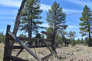
| Corral at Hunting Tank |
 |
| Hikers take in the views at Hunting Tank |
 |
| Cinder Tank attracts wildlife in Coconino NF |
The first leg of the circuit begins at Forest Road 9241E. Identified as a “short route” on the Coconino National Forest Motor Vehicle Use Map, the road is essentially just a gated parking area. A ring of boulders blocks entry to the trail--a fading two-track that’s open to foot traffic and equestrian use. The weedy road traces the edge of a finger gulch at the far northeast end of Rarick Canyon, dropping steadily to where it meets a wildlife water hole.
 |
| Point where cinder tank road fades out |
Tinged red by a wall of decaying volcanic stone and the trampling of elk, bobcats, skunk, racoons and domestic livestock, Cinder Tank marks the beginning of a short segment of shady Ponderosa pine forest that stands in contrast to the juniper scrubland that defines much of the area.
 |
| Narrowleaf yerba santa blooms April - August |
Beyond the tank, the road gets rougher as it heads up an embankment to emerge on an airy mesa with views of 7,307-foot Apache Maid Mountain and glimpses of the layered landforms around Sedona peeking through stands of Utah serviceberry shrubs and tangles of Gamble oaks.
 |
| Utah service berry blooms April - May |
The road vacillates between an obvious two-track and a barely there footpath before being swallowed whole by grasses and shrubs at the 1.3-mile point. The weed-choaked dead end makes for a good turn round point.
Part two of the circuit begins about a half-mile farther east on Stoneman Lake Road at Forest Road 80 where there’s a gate, cattleguard and a sign commemorating the Chaves Historic Trail, an important, centuries-old travel corridor between Prescott and Winslow.
 |
| View of Sedona from cinder tank road |
Forest Road 80 is a 9.2-mile seasonal road that’s open to motorized use for high-clearance vehicles. The south end of the rough, narrow road also serves as a scenic hiking route.
 |
| Tall pines shade the road above cinder tank |
From the parking area, the road heads north descending easily to an unsigned junction roughly 0.2-miles in. The right fork heads to a rustic corral and a sizable water hole called Hunting Tank. It’s a scenic detour of just over a half mile roundtrip and well worth a visit.
 |
| Finger gorge of Rarick Canyon on right |
From the junction, FR80 dips into a finger cove of Rattlesnake Canyon then climbs to the lip of the gorge’s northeastern reaches.
 |
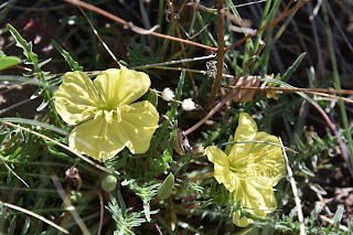
| Yellow evening primrose bloom April - June |
 |
| Gamble oaks in a meadow near cinder tank |
High point vistas include Alligator juniper-framed looks at the Bradshaw Mountains to the west and glimpses into the sinuous, stony corridor of Rattlesnake Canyon below.
 |
| The road above cinder tank |
After topping out on a breezy mound where traffic on Interstate 17 can be seen whizzing by to the north, walls of sheer basalt and pillars of contorted volcanic ejecta close in on the road as it parallels the ever-shallowing canyon to where it levels off just yards from the freeway at the 2-mile point.
 |
| Apache Maid Mountain seen from FR9241E |
While FR 80 continues north for another 7+ miles, the canyon head serves as a fine turnaround point for sampling one of the many scenic routes that make up the 380,000+ miles of the National Forest Road System.
CINDER TANK ROAD
LENGTH: 2.7 miles roundtrip
RATING: moderate
ELEVATION: 6,091 – 6,237 feet
GETTING THERE:
From Interstate 17 drive 19 miles north of Camp Verde and take the Stoneman Lake exit 306. Head east (go right) at the bottom of the off ramp and follow Stoneman Lake Road (Forest Road 213) 4.3 miles to Forest Road 9241E on the right where there’s a gate and cattle guard.
FOREST ROAD 80 & HUNTING TANK
LENGTH: 3.5 miles roundtrip as described here
RATING: moderate
ELEVATION: 6,000 – 6,234 feet
GETTING THERE:
From the Cinder Tank Road parking area, continue 0.4-mile east on Stoneman Lake Road to the parking area for Forest Road 80 on the left.


