SUGARLOAF CIRCUIT
 |
| Coffeepot Rock (left) from Sugarloaf Summit |
How sweet do you take your hikes; one lump or two? The choice is yours in Sedona’s North Urban Trails System.
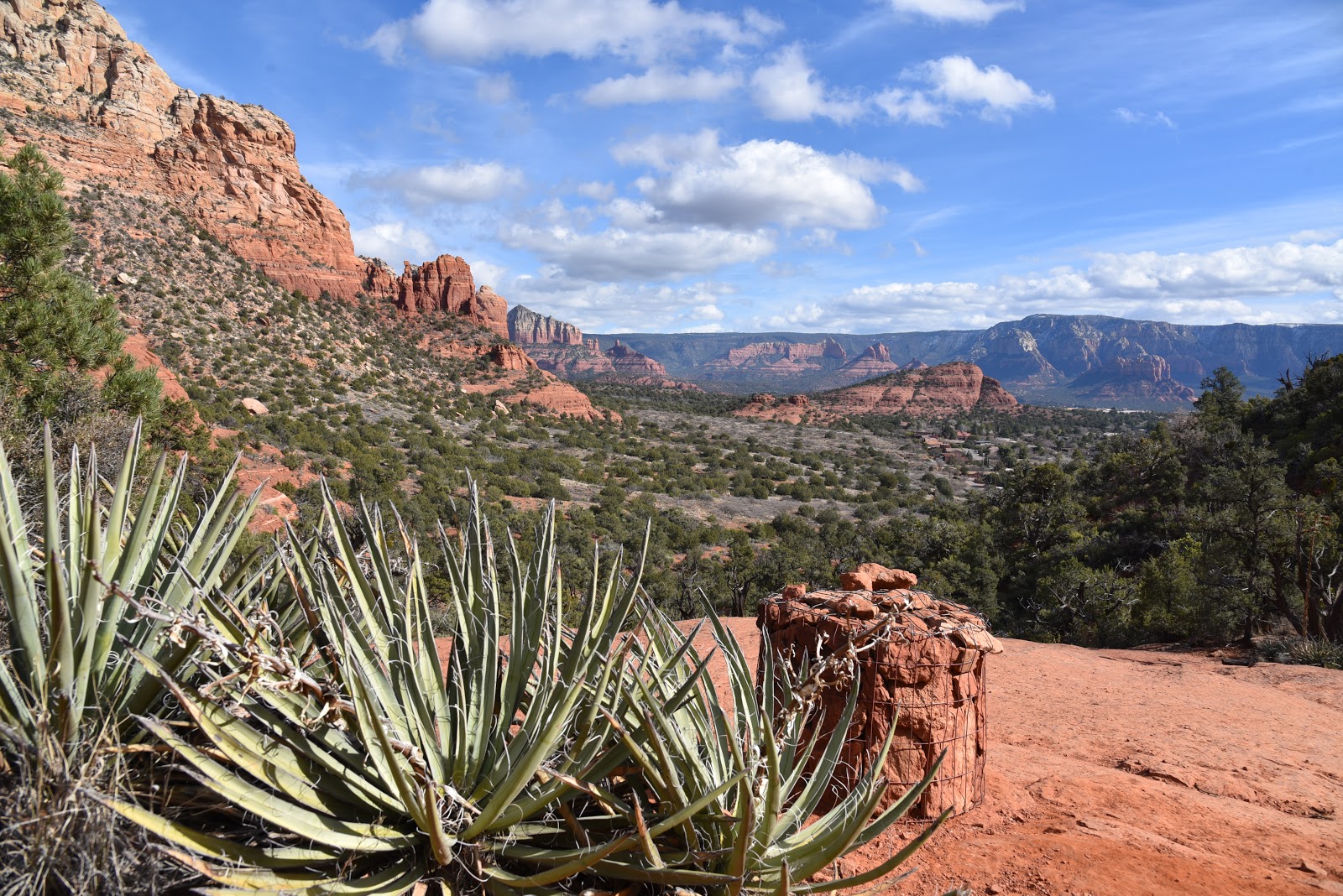
 |
| Chimney Rock seen from Andante Trail |
Boasting two confectionery hill climbs that can be done either alone or as a barbell-shaped double loop, the system also showcases many iconic Red Rock Country landforms and great mountain vistas. Located just 3 miles west of Uptown Sedona, Sugarloaf and Little Sugarloaf, two russet sandstone lumps that sit below 6,355-foot Capitol Butte (a.k.a. Thunder Mountain), anchor a network of scenic suburban paths less than a mile north of busy State Route 89A.
 |
| Little Sugarloaf seen from Thunder Mtn Trail |
While neither loaf climb is particularly difficult, each has its own character.
Several trailheads offer easy access to the system, but for this double-header, start at the Thunder Mountain trailhead off Dry Creek Road. To tackle the more difficult climb first, follow the Lower Chimney Rock trail 0.1-mile, head left at the Thunder Mountain junction and continue hiking on Lower Chimney Rock. The hulking mound of 4,872-foot Little Sugarloaf looms to the south as the trail makes an easy ascent to its base. Although Little Sugarloaf is not as tall as its companion to the east, it’s the wilder of the two.
 |
| Sedona's North Urban Trails System, East |
The climbing starts at the Chimney Rock Pass/Summit junction where the route makes a steep, exposed 222-foot crawl up the mountain’s north face. The narrow, rough-hacked, 0.2-mile summit path hangs close to the edge for unobstructed views of the Sedona area and distant Mingus and Woodchute Mountains across the sprawling Verde Valley. When done ogling the sights, descend to the junction and head left to follow Lower Chimney Rock for 1 mile tour around the base of the hill. You’ll pass the trailhead and then pick up the Thunder Mountain trail heading east (right) where amazing up-close looks at iconic Chimney Rock stand out above crumbling russet sandstone walls. Soon, the buff-colored flanks of Capitol Butte come into view and the trail dips into one of the route's many deeply wooded drainage areas before emerging at the Andante trailhead. Follow the Andante trail 0.6-mile to where it reconnects with the Thunder Mountain trail, then follow the signs to the Sugarloaf Loop and Summit trails.
 |
| Urban landscape viewed from Sugarloaf |
Compared to Little Sugarloaf, hiking up 4,911-foot Sugarloaf “regular” is a walk in the park.
 |
| It's a steep, edgy climb up Little Sugarloaf |
The 0.2-mile trail is wide and well-worn, ascending 201 feet straight up the middle with no precipitous exposure or very steep spots. A series of slickrock passages and natural red-rock stairs glide hikers up the hill, revealing a decidedly urban landscape below.
 |
| Route traces the sandstone walls of Capitol Butte |
To the west, streets and houses roll out in familiar grids while to the north, the form of Coffeepot Rock protrudes from a rock jetty off of Capitol Butte. On the bald, pine-and-yucca- rimmed top, views stretch south for glimpses of Courthouse Butte and Airport Mesa.
 |
| High desert vegetation on Sugarloaf hill |
 |
| Capitol Butte (right) is a commanding presence |
Descend and make a 0.7-mile swing around Sugarloaf Loop before retracing your steps back to the trailhead.
 |
| The route crosses several drainage areas |
LENGTH: 5.3 miles
RATING: moderate
ELEVATION: 4,560 - 4,911 feet
GETTING THERE:
Thunder Mountain Trailhead:
From the State Route 179/89A traffic circle in uptown Sedona, go 3.2 miles west (toward Cottonwood) on SR 89A to Dry Creek Road. Follow Dry Creek Road 0.5-mile, turn right on Thunder Mountain Road and continue 0.6-mile to the trailhead on the left. There are no fee or facilities at this trailhead.
May also be accessed by the Andante Drive and Sugarloaf trailheads.
INFO: Coconino National Forest
North Urban Trail System, East
https://www.fs.usda.gov/recarea/coconino/recreation/hiking/recarea/?recid=72038&actid=50