Find A Trail. Start Your Search Here:

Showing posts with label West Wing Mountain. Show all posts

Tuesday, November 1, 2022

Paloma Regional Preserve

PALOMA REGIONAL PRESERVE

An ironwood tree frames views on Compass Rose Trail

Bounded by two desert waterways, a CAP canal, freeways, isolated mountains and the geometric grid of cul-de-sac communities, Paloma Regional Preserve is an island of natural outdoor space. 

Mountain vistas on Multi-Use Path A

The ephemeral character of desert rivers creates seasonal shows of monsoon surges that fade into trickling rivulets and residual pools, all along, feeding swaths of lush greenery in otherwise dry, prickly places. A walkable tour of this critical cycle is on display on the trails of the preserve.
Mesquite trees on the New River Trail

The mostly-flat block of open space straddles the floodplain of New River,  in Peoria, east if the Agua Fria River.

New River Dam bolsters the south end of the preserve

The preserve is anchored by Paloma Community Park which opened in 2020. The amenity-rich site has playgrounds, a dog park, restrooms, sports fields and picnic ramadas. Access to the preserve hiking trails begins at a gate near the dog park where Multi-Use Path A heads east away from the barking commotion.

Speckled Rattler trail leads into Westwing preserve

Wide and sunny, the path serves as a gateway to the preserve’s 12+ miles of trails that also link with the Westwing and Eastwing Mountain Preserves as well as Sonoran Mountain Ranch Park. 
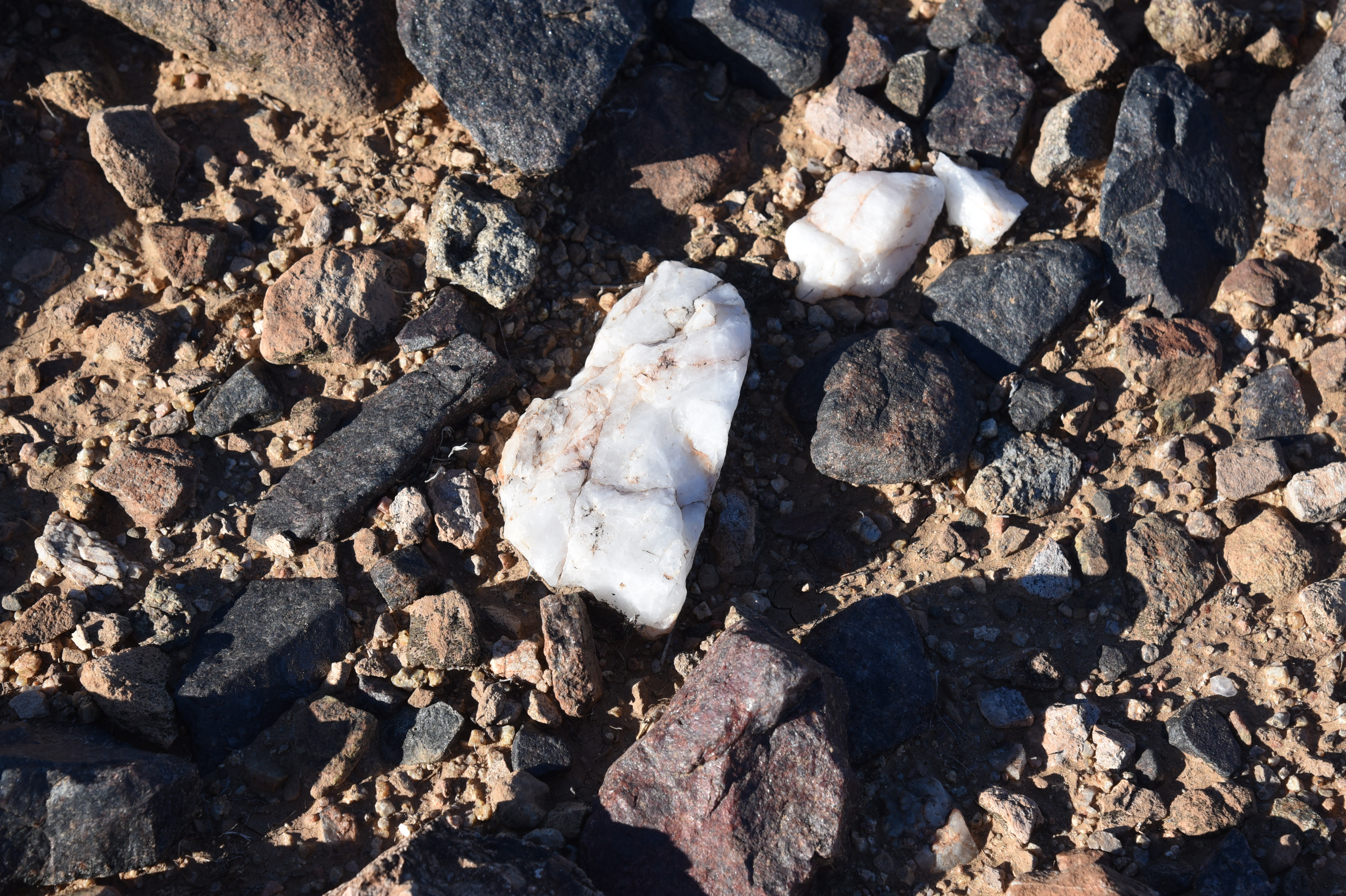
Interesting geology on the New River Trail

With a backdrop of mountain vistas and acres of saguaros, the path soon enters the floodplain of New River.  Mudflats, sandy drainages and water-scoured channels fringed with mesquite and palo verde trees clinging to embankments speak to the power of running water. At the 1.1-mile point, Multi-Use Path A encounters its first major junction where it meets the New River Trail-- a multi-use pathway that runs from Bethany Home Road in Glendale to Pinnacle Peak Road in north Phoenix and serves as a main artery running north-south through the preserve.  
Friendly advise at the trailhead gate.

Park maps available online and well-signed junctions with QR codes and emergency help locator decals, make getting around and staying safe a cinch. While each trail offers excellent hiking, the not-to-miss route on the menu is the Compass Rose Trail. 
View from Multi-Use Path A

The 1.42, moderate-rated path ascends a knoll overlooking the New River Dam for sweet views of the river’s course through the landscape. 
View of New River Mesa & Skull Mesa from Compass Rose

The extra height also opens up views of the Cave Creek Mountains to the northeast and the Sierra Estrella Mountains to the south. From the high point, the brilliant connectivity of the preserve trail system is obvious. The grid of trails below hint at the dozens of options for completing short loop hikes or long distance treks in and around this distinctly desert-water-centric environment.
New River floodplain bisects the preserve

LENGTH:  12+ miles of interconnected trails

RATING: easy - difficult

ELEVATION:  1,369 – 1,550 feet

TRAIL HOURS: sunrise to sunset daily

PARK HOURS: 6 a.m. – 10:30 p,m. daily
FEE: none

GETTING THERE:

Paloma Community Park Trailhead
29799 N Lake Pleasant Pkwy, Peoria.

From Interstate 17, take the Loop 303 exit 221 and continue west to Lake Pleasant Pkwy.

Turn left (south) and go 1 mile to the park entrance on the left.

Trailhead is at the gate at the end of the road near the dog park.

HIGHWAY CONSTRUCTION NOTE:

As of this writing, the Loop 303 exit was closed. Use State Route 74 (Carefree Highway) as an alternative. Take the SR74 exit 223B and head 6 miles west to Lake Pleasant Pkwy. Turn left and go 3.5 miles south to the park entrance on the left.

INFO & MAPS:

City of Peoria

https://www.peoriaaz.gov/home/showpublisheddocument/26718/637774189542300000


Monday, April 11, 2016

CALDERWOOD BUTTE

PEORIA CALDERWOOD BUTTE PRESERVE
City of Peoria
Calderwood Butte
The City of Peoria's long incubated land preservation effort has spawned quadruplets. Four beautiful mountain-centric preserves--East Wing, West Wing, Sunrise and little sister, Calderwood Butte--have been saved from development, built out with trails and are being nurtured for future generations of recreational enthusiasts. All are located within burgeoning suburban communities lodged between Interstate 17 and the Agua Fria River. For hikers, the three "big sisters" offer excellent routes with challenging climbs, tiered loops and easy options. On the other hand, to those unfamiliar with it, Calderwood Butte gives the impression of exactly what you'd expect of a stereotypical baby of the family--a fussed over, coddled, hyper-protected spoiled soul surrounded by toys. Its short length and the fact that it's swaddled among manicured yards and swimming pools causes some to shrug it off as too wussy to try. These misconceptions do not apply to the actual hiking experience. Sure, it's a short hike and yes, the trail is primped and trimmed; but with not one, but two high-point clambers, walks beneath sheer cliffs and 360-degree views, this compact trek is a satisfying journey. From the 99th Avenue trailhead, the path makes an immediate ascent into the chiseled clefs of the oblong butte. Flowing switchbacks wind around jagged pinnacles that hover over mountain vistas, flood plains and the distant skyline of Downtown Phoenix. The only thing "spoily" about this tiny trek will be your regret for not hiking it sooner.
Overlooking Agua Fria River

LENGTH: 1.2-mile loop
RATING: moderate
ELEVATION: 1,390' - 1,686'
GETTING THERE:
99th Avenue Trailhead:
From Interstate 17 in north Phoenix, take the Loop 303 exit 221 and go 7.2 miles west to Lake Pleasant Parkway exit 131. Turn left (south), drive 3.3 mile to Jomax Road, turn right, go 0.3 mile to 99th Ave., turn right and continue 0.3 mile to the paved parking area on the right. There's a picnic table, trash can and dog waste bag dispenser, but no other facilities.
Jomax Parkway access:
From 99th Ave. continue 0.6 mile west on Jomax Rd., veer right at Jomax Parkway and continue 0.2 mile to the trail cut. From here, it's roughly a mile to the loop. There's limited parking along the road. No facilities.
INFO:

Monday, November 9, 2015

SUNRISE MOUNTAIN TRAIL

SUNRISE MOUNTAIN TRAIL
City of Peoria
Looking east from Sunrise Mountain

Who knew that a suburban trail toggled to a kiddie playground could offer a respectable hike?
Sunrise Mountain Trail does just that with a three-tiered system of loops wrapping around a chain of peaks jutting above a sea of residential communities in Peoria. The trail begins at WestWing Park where colorful swings and slides are complemented with restrooms, drinking water and plenty of parking.
One of the beautiful things about this system is that it's set up with both easy and difficult options
designed in a way that makes short work of customizing treks to suit individual preferences.
Although the first tier is rated easy, some climbing is required to reach the half-mile point where the first of several junction posts points the way for a moderately-challenging summit route or an easier slope-clinging circuit.
The route graduates to moderate-rated tier two with a series of ups-and-downs among granite outcroppings and breezy stands of palo verde trees. The roller coaster style trail never stays flat for long, wobbling between highpoint vistas and low slung saddles. After a steep descent off a cactus speckled ridge, tier three takes off on a difficult -rated swing around the flanks of the mountain's eastern most knob. An optional side trail makes the hike's final ascent to a 1,840-foot stub hovering over a landscape of freeways, subdivisions and distant mountain views.
LENGTH: 4.6-miles out-and-back including access trail
RATING: easy-difficult
ELEVATION: 1,270' -1,840'
GETTING THERE:
From Phoenix, go north on Interstate 17 to Loop 303 exit 221. Turn left (west) and continue 7 miles to Lake Pleasant Parkway exit 131, turn left (south) and go 2.3 miles to WestWing Parkway, turn left and go 1 mile to WestWing Park on the right. Trailhead is accessed via a 0.1-mile dirt road that leaves from the far east end of the parking lot. A large boulder plaque on a crest near WestWing School marks the start point.
INFO & MAPS:
City of Peoria

Sunday, December 14, 2014

EAST WING MOUNTAIN TRAILS


EAST WING MOUNTAIN TRAILS
Peoria Sonoran Mountain Ranch Preserve

If you’re new to hiking or looking for a way to build stamina, this cluster of West Valley trails offers three options ranging from easy to difficult. Although none of the trails stray very far from suburban backyards, the difficult-rated summit loop gains enough elevation to provide a good workout backed by excellent scenic views.  The trail is very well constructed with hairpin switchbacks and staircase-like rock slabs that make climbing the steep chutes manageable for even novice hikers.  The trek is a surprisingly quiet journey, and save for the occasional yapping of the local Yorkshire terriers guarding their patios, the soundtrack is one of breezes through Palo Verde trees and the hum of wind-rustled saguaro needles.
LENGTH: 2.4 miles 
RATING: moderate-difficult
ELEVATION: 1,476’ – 1916’
FACILITIES: restrooms, picnic tables, playground, drinking fountains
GETTING THERE:
Sonoran Mountain Ranch Park, 7098 W. Miner Trail, Peoria.
From Phoenix, go north on I-17 to Happy Valley Road exit 218. Go 5 miles west on Happy Valley Road to 67th Avenue, turn right and drive 2.8 miles (road becomes Pyramid Peak Pkwy.) to Sonoran Mountain Ranch Road.  Veer left and go 0.5 mile to Chalfen Blvd., turn left, continue 0.1 mile to Miner Trail and follow the signs to Sonoran Mountain Ranch Park. From the post near the restrooms, hike 0.15 mile south on Chalfen to the official trailhead. Do not park along residential streets.
INFO: City of Peoria
https://www.peoriaaz.gov/trails

Sunday, October 19, 2014

WEST WING MOUNTAIN TRAILS


WEST WING MOUNTAIN TRAILS
City of Peoria

Every town and city in the Valley has its popular workout trail where the hordes converge for their daily dose of sweat and grind. Examples are Camelback Mountain in Phoenix and, Scottsdale's Pinnacle Peak. Not to be left out of the fitness frenzy, Peoria's trek of choice is West Wing Mountain. Unlike its neighbors, which offer one option---moderately difficult, straight up-and-down trudges-- this system of loop trails offers you a choice of difficult and extreme options. Although the trails are well maintained and not too steep, the difficult rating is likely because of the slick rock and loose scree underfoot.
The mountain is actually an undulating ridgeline with trails wrapping up and around scenic viewpoints and a high summit.  Rising above a Northwest Valley suburban domain of kids and cul-de-sacs, the trails dodge among crusty cliffs and barrel cactus showcasing ever-improving views as the routes gain elevation. At the top of the extreme loop, views of a sea of terra cotta roofs nuzzling up to the mountain’s base and West Valley mountains form a 360-degree panorama beyond a familiar landscape of freeways and shopping malls.
LENGTH:  3.4 or 3.5 miles (including 0.2-mile access trail from the park)
RATING: difficult
ELEVATION: 1400'- 1903’
GETTING THERE:
From Phoenix, go north on I-17 to Loop 303 exit 221 .  Turn left (west) and continue 7 miles to  Lake Pleasant Parkway exit 131, turn left (south) and go 2.3 miles to West Wing Parkway, turn left and go 1 mile to West Wing Park on the right.  Trail begins at the far west side of the parking lot. Although there are numerous access points from residential streets, The City of Peoria wants hikers to park at the West Wing Park lot.
INFO: City of Peoria, 623-773-7120
West Wing Neighborhood Park
27100 N. West Wing Parkway, Peoria