

 SEVENMILE GULCH #9854
Prescott National Forest
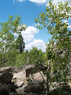
Meandering in the forested woodlands above Prescott Valley, the Seven Mile Gulch trail delivers a variety of panoramic views. The shared-use trail is open to hikers, bikes, motorcycles and ATVs, and the rocky route is wide enough to accommodate the traffic. The hike begins with an easy stroll through a forest of Ponderosa pines, walnut, mahogany and a vigorous undergrowth of vines and wildflowers including hefty clumps of electric-orange skyrocket penstemones. After a short stretch, the path emerges from the woods and begins climbing up sun-drenched rolling hills. Among the acres of manzanita shrubs, Sacred Datura vines with their showy, white trumpet flowers bask in the sunlight while delicate prickly poppies thrive in shadier spots. The open section of the trail levels out at about 6,400 feet of elevation and serves up 360-degree views. To the north, the San Francisco Peaks stand out on the horizon and the bright blue swath of Lynx Lake shimmers in a ravine to the east. After that, the route continues to climb through scrub oak and pinon pine to the 6,700-foot junction with the Watershed Trail #299—the turnaround point for this hike.
LENGTH: 6.2 miles round-trip
RATING: moderate
ELEVATION GAIN: 1,160 feet
GETTING THERE:
From Phoenix, travel north on I-17 for the Cordes Junction interchange. Go west on Highway 69 toward Prescott. Just before entering town, go left (south) on Walker Road (Country Road 57) and continue for 2 miles to the “Sevenmile” trailhead. Roads are paved all the way. No facilities.
INFORMATION: (928) 771-4700 or fs.fed.us/r3/prescott


 APACHE VISTA Apache-Sitgreaves National Forest UPDATE: This trail has been damaged by the WALLOW FIRE, June 2011. Check with the forest service for updates. Hovering over the town of Springerville in Arizona’s White Mountains, the Apache Vista Trail #617 showcases outstanding high-country scenery. Situated at 9,000 feet in elevation, the gentle path traipses through wide-open alpine meadows along the edge of a deep, forested canyon. Cool summer temperatures and ample rain foster profuse growths of multi-colored wildflowers and towering old-growth conifers. It’s no accident that the trail has the word “vista” in its name. Expansive views of volcanic fields and river gorges that stretch all the way into New Mexico are this trail’s signature attraction. LENGTH: 5.2 miles round-trip RATING: easy ELEVATION GAIN: 50 feet GETTING THERE: From downtown Eagar, go west on Highway 260 for roughly 3 miles to the Highway 261 junction. From there, turn left (south) on Highway 261 and continue for 7.2 miles to the trailhead on the left. INFORMATION: www.fs.fed.us/r3/asnf (928) 333-4372


