JAVELINA SUMMIT TRAIL
 |
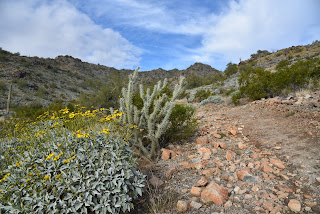
| Brittlebush colors the Tortuga Trail |
One of four difficult-rated summit hikes in the Skyline Regional Park in Buckeye, the Javelina Summit doesn’t scrimp on thrills. The 0.9-mile-long trail spools off connecting routes in the park’s far east end.
 |
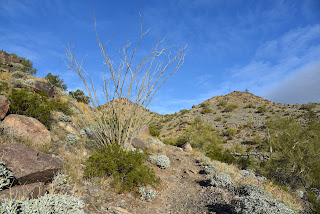
| View from the Javelina Summit Trail |
While it’s “just” a 745-foot climb from trail base to summit, that accounts for less than half the story.
 |
| Javelina Summit (right) viewed from Tortuga Trail |
Getting to the 2,200-foot mountain highpoint involves using three trails and logging over 1,700 feet of accumulated elevation change.
 |
| Hike begins on tehe Quartz Mine Trail |
The rollercoaster-style trek starts from the main trailhead area with a 1.6-mile hike on the Quartz Mine Trail. About a half mile in, first peeks at the destination loom on the horizon. The prominent ridgeline rising over foothills and valleys looks imposing. And irresistible!
 |
| Beginning of the Javelina Summit Trail |
The undulating path winds through washes and slopes below ragged ridges and stone outcroppings before making an ascent to a saddle where the Tortuga Trail spins off to the east.
 |
| Brittlebush are plentiful in Skyline Regional Park |
The Tortuga Trail leg of the hike takes back much of the elevation gained with a smooth downhill on long lazy switchbacks. At the half-mile point, the route encounters its final segment, the 0.9-mile Javelina Summit Trail.
 |
| View of the White Tank Mountains |
It's here where the real work begins. While the lower quarter mile feels just moderate and has a few level bends, the climbing becomes an unrelenting uphill haul with loose rock and a fair amount of exposure. The trail is well engineered but still very steep and precipitous as it clamors along a knife-edge sharp, rocky backbone. Persistence and careful footwork pay off on the tiny summit.
 |
| Rock outcropping on Tortuga Trail |
 |
| Javelina Summit Trail is steep and edgy. |
The airy pinnacle displays 360-degree vistas of the southern White Tank Mountains, the distant profile of Downtown Phoenix, the Sierra Estrella Mountains and sprawling desert plains.
LENGTH:
5.8 miles round trip (out and back hike)
RATING: difficult
ELEVATION: 1,312 – 2,200 feet (over 1,700 feet of accumulated elevation change)
GETTING THERE:
Skyline Regional Park, 2600 N. Watson Road, Buckeye.
From Interstate 10 in Buckeye, take the Watson Road exit 117 and go 2 miles north to the park. Roads are paved.
HOURS: Sunrise to sunset daily
DAY USE FEE: none
FACILITIES: restrooms, picnic ramadas, camping
INFO:
Skyline Regional Park


No comments:
Post a Comment