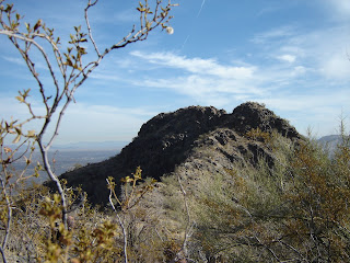


 ALTA-BAJADA LOOP South Mountain Park Phoenix The Alta trail is a rugged, edgy, uphill climb to an exposed ridgeline. Once on the ridge, the trail rambles like a roller coaster ride with lots of loose rock under foot. Near the end of the trail, look for the spur paths that lead to the summit of Maricopa Peak--for a nice, but optional side trip. Once over the spine of the mountain, the trail heads steeply downhill and ends at the 4.5-mile point near the San Juan Lookout and ramada. From there, connect with the National Trail and follow it for 1.5 miles, cross San Juan Road and then pick up the Bajada Trail which winds for 3.2 miles through desert and rugged washes before it ends back at the trailhead. LENGTH: Alta: 4.8 miles, Bajada: 3.2 mile. ADD 1 mile for the road hike to the trailhead (9 miles roundtrip total loop). RATING: difficult ELEVATION: 1,280' - 2,430' GETTING THERE: From Phoenix, follow Central Avenue south to where it enters the park. From the park entrance, continue on the main road for almost two miles and then turn right onto San Juan Road. Follow San Juan Road for about a half mile and park at the gravel lot near the 2.5-mile marker. The trail starts across the road. NOTE: DUE TO A ROAD CLOSURE, YOU MUST NOW PARK AT THE JUNCTION OF SAN JUAN ROAD AND SUMMIT ROAD. TO REACH THE TRAILHEAD, HIKE UP SAN JUAN ROAD FOR JUST OVER A HALF MILE. UPDATE 2011: San Juan Road is open to vehicles the first weekend of every month for easy access to the Alta, Bajada and National trails. The road is closed to motor vehicles all other times.
INFO: City of Phoenix Parks & Recreation
http://phoenix.gov/parks/trails/locations/south/hiking/index.html


1 comment:
I started at the traffic "triangle" where San Juan, Stephen Mather, and Telegraph Roads all come together. 0.7 miles more or less through a winding portion of Bajada takes you to an intersection with San Juan Road and the signs to Alta. Alta is no joke. I am not exaggerating this--if you are not fully physically prepared, don't even try it. The ascent is a monster, and the narrow, sharp-rock-filled trails are not forgiving on the feet. When you finally get to the "top" you will start heading West, where you will experience some ups and downs for a few miles, before you begin a RAPID descent to the valley floor. Don't even think about running this--the rocks are treacherous, and in some places you will need to employ the "buttocks" method to descend. When you reach the San Juan Lookout parking lot bear hard left and start a pretty decent downhill, again on the sharp and unforgiving rocks. The map says this portion stretches 1.7 miles but it feels like more after the ascent and descent you've just experienced. Cross San Juan road again, you'll hit the Bajada trail after passing a covered "rest" area. Head left on the Bajada Trail over some pretty tough desert. On the map it looks flat--it is not. It is a pretty continuous ascent from West to East. You will see San Juan road to your left the entire way, so no worries about your getting lost. 2 miles after the covered area you will hit the Alta/Bajada intersection and close the loop. I went back the way I came along Bajada, thus finishing 10.2 miles. They say Alta is the toughest singular trail on South Mountain and they are not kidding. I force-march 10-15 miles every weekend and this one took it out of me. Bring plenty of water and expect travel times to be greater than normal; the inclines and declines wipe away any sense of "normalcy" in terms of how far you will hike and how fast.
Post a Comment