Find A Trail. Start Your Search Here:

Thursday, April 28, 2022

Podcast: Hiking Etiquette

ARIZONA STATE PARKS & TRAILS (AWESOME) PODCAST

Listen to Season 3 Episode 6 where I chat about hiking etiquette and cool AZ trails.

Hiking Etiquette with Mare Czinar

https://azstateparks.com/podcast


How can you care for the trails when you pull on your boots and go for a hike? Arizona hiking aficionado Mare Czinar joins us on this episode of the episode to discuss!

Mare has been hiking all over the state for more than 30 years and has reviewed 1000+ trails. She shares her favorite places to hike, and the ways you can mindful of the trails, nature, and other hikers.

Check out the projects where Mare contributes, and read her interview in Phoenix Home & Garden magazine where she discusses her guide "The Hike Book" (volumes 1 and 2). 

• Director of Production & Outdoor Writer at Cities West Media: PHOENIX  and Phoenix Home & Garden magazines

• Contributing writer to "Hike of the Week" in USA Today/Arizona Republic, and dog hikes in Pets & People magazine

• Author of ArizonaHiking.blogspot.com and PHOENIX magazine, "The Hike Book" volumes 1 and 2

• Founder of Arizona Hiking, a 30,000-member Facebook group  

• Member of Arizona State Committee on Trails (ASCOT)

Tuesday, April 26, 2022

NEW Trail Ambassador Opportunity

BECOME A TRAIL AMBASSADOR FOR MARICOPA COUNTY PARKS

Spur Cross Ranch Conservation Area


Maricopa County Parks has just created a new volunteer position– “Trail Ambassador”.  The Trail Ambassador will observe trail conditions and report needed repairs to staff, provide guidance to trail users, and reinforce proper trail etiquette and  Leave No Trace principles.  Hikers, bikers, and equestrians can serve as Trail Ambassadors.

Maricopa County Parks are located across the Valley, so there’s one near you!

• Cave Creek Regional Park, Cave Creek

• Spur Cross Ranch Conservation Area, Cave Creek

• White Tank Regional Park, Waddell

• Estrella Mountain Regional Park, Goodyear

• Lake Pleasant Regional Park,

• McDowell Mountain Regional Park, Fountain Hills

• San Tan Regional Park, Queen Creek

• Usery Mountain Regional Park, Mesa

• plus, the Maricopa Trail connects them all!


TO LEARN MORE ABOUT THIS NEW OPPORTUNITY

CONTACT:

Bill Klewer

Volunteer Coordinator

602-506-9512

Bill.klewer@maricopa.gov


Monday, April 25, 2022

Little Horse Trail to Chicken Point

LITTLE HORSE TRAIL to CHICKEN POINT

View of Cathedral Rock from Little Horse Trail

There are myriad reasons why the Little Horse Trail No. 61 is one of the most popular hiking routes in Sedona.  

Cliff-rose emit a pungent fragrance April- Sept.

Epic vistas, connectivity with the Bell Rock Pathway system of trails, iconic rock formations and rich botanical diversity combine for a classic Red Rock Country trek.
Featherplume bloom March - June

 
Little Horse Trail culminates at Chicken Point

The well-known and heavily-travelled path in Coconino National Forest really draws the crowds and finding parking at the trailhead can be a challenge, especially on weekends. 
Fragrant cliff fendlerbush bloom March - June

The recently introduced Sedona Shuttle service offers a convenient solution to parking quagmires at many of Sedona’s most beloved trails, including this one. So, grab a seat and avoid the headaches as well as the trailhead parking fee.
Smell Gregg's ceanothus March - May

Springtime is the optimal window to experience Little Horse in its full-blown wildflower color storm.

Situated just outside of Munds Mountain Wilderness Area, the hike begins with a 0.3-mile walk on the wide Bell Rock Pathway where views of Cathedral Rock tower above vivid russet cliffs to the west. This sunny segment is fringed with globemallow, antelope horns, blackfoot daisies, sego lilies, evening primroses and fuzzy fleatherplume shrubs.  Head left at the signed Little Horse junction and follow the trail as is descends into a steep-walled drainage.

Evening primrose bloom April - September

 
Scenic point over a gorge on Little Horse Trail

Once through the stony corridor, the trail begins a steady uphill climb on staircase-like sandstone slabs, twisting among blooming cliff-rose shrubs that emit a pungent fragrance that most folks either love or hate. This polarizing aroma competes with the softer lilac notes of the Gregg’s ceanothus bush and the subtle orange bouquet of cliff fendlerbush. 
Antelope horns bloom April - August

Waxy yucca flowers blooms April - July

The desert blooms provide olfactory distractions worthy of taking a moment to breath in.   Ducking among pockets of cypress, pinon and fir, breaks in the tree cover frame views of Chapel of the Holy Cross plus the iconic Madonna and the Nuns, Bell Rock and Courthouse Butte rock formations before meeting the turnoff for an optional side trip up to Chicken Point.  The not to be missed spur path flanked by yucca and gangly agave stalks culminates on a rounded sandstone mound bolstered by striated, weather-worn spires and views that extend to the distant Bradshaw Mountains.
Sandstone spires surround Chicken Point

A stream of visitors doing handstands and yoga poses on a stone outcropping is the closing act at trail’s end. 
Globemallow color the trail April - September

Sego lilies can be white or pink and bloomApril - July

LENGTH: 3.6 miles roundtrip

RATING:  moderate

ELEVATION: 4,240 – 4,400 feet

GETTING THERE:

From Interstate 17 north of Camp Verde, take the Sedona-Oak Creek exit 298 for State Route 179. Continue on SR 179 to milepost 308.9 (3.6 miles south of the SR 179/89A traffic circle in Sedona)  and turn right into the Little Horse trailhead parking lot. There is a restroom at the trailhead. You can park either at the trailhead or at the North SR 179 Park & Ride and take the Sedona Shuttle for free.

FEE: A Red Rock Pass or America the Beautiful Pass is required to park.

There is a self-serve permit kiosk at the trailhead.

https://www.fs.usda.gov/recarea/coconino/recreation/recarea/?recid=54892

INFO & MAPS:

COCONINO NATIONAL FOREST

https://www.fs.usda.gov/recarea/coconino/recarea/?recid=55336

SEDONA SHUTTLE

https://sedonashuttle.com/

Tuesday, April 19, 2022

2022 Fire Season Off to a Blazing Start

Crook Fire Closure Area 4-19-22

 KNOW BEFORE YOU GO.

Please check for fire restrictions and active incidents before heading out for a hike.  It's important RESPECT CLOSURES & RESTRICTIONS so first responders can do their jobs without the added pressure of violator interference.

GET ACTIVE FIRE INFO HERE:

https://inciweb.nwcg.gov/

Monday, April 11, 2022

Forest Road 502 to East Verde River

FOREST ROAD 502 to EAST VERDE RIVER

A calm bend in the East Verde River near Payson

From sweeping mountain vistas, to rolling, juniper-dotted rangeland and a leafy river canyon, a walk along Forest Road 502 delivers a packed agenda over its short, hilly course. 

View of North Peak from FR 502

Adopted by the Tonto Recreation Alliance, a non-profit, volunteer partner of Tonto National Forest that works to keep hundreds of miles of forest trails open and maintained for motorized off-road use, the dirt two-track a few miles west of downtown Payson offers a quick, lightly trafficked route to the East Verde River.
High desert valley vistas abound on FR 502

Sego lilies bloom Apr - July

Located a few miles south of Tonto Natural Bridge State Park east of Pine Creek, the road, which is open to hikers, equestrians and OHV use is a sweet find for those who appreciate a simple trek peppered with many points of visual interest.
You might encounter livestock on FR 502


From a dirt pull out along Doll Baby Ranch Road, the hike begins by passing through a barbed wire gate (close it behind you) where visitors are immediately smacked with breathtaking views of  Mazatzal Wilderness peaks including 7,449-foot North Peak, the northernmost  prominent peak in the Mazatzal Range.

Goodding's verbena blooms Feb - Oct

Barberry shrubs bloom Feb- May

The road veers left at an unsigned fork at the 0.1-mile point. After that, all junctions are signed “502”.  As the road makes an easy push through sunny juniper-pinon open range, views of a landscape rife with landforms with imagination-stoking names like Polles Mesa, Whiterock Mesa, White Hills, Horsethief Bench, Limestone Hills and Pilot Knob roll out in all directions.
Milkvetch is a common spring bloomer

Majestic land forms all around.

The largely unshaded route is flanked by a fringe of flowering shrubs, yucca and a colorful understory of classic high-desert wildflowers including delicate sego lilies, purple Goodding’s verbena, milkvetch, Blackfoot daisies and flame-red paintbrush. 

Velvet ash trees huddle around East Verde River

At just over the one-mile point, the road begins a series of gradual ups-and-downs that land hikers at the East Verde River. The final,  descent into the river canyon is somewhat rocky and steeper, but not too difficult.
Paintbrush bloom Mar - Sep

The road meets the water at 1.8 miles where hikers may explore along the rocky banks and spindly velvet ash trees to spy trout swimming in deep pools.
Trailhead on Doll Baby Ranch Road

Road ups and downs total over 780 feet in elevation change

While the river makes for a good turnaround point, hikers may consult the Tonto Recreation Alliance downloadable maps to extend the trip by way of several connecting roads.
Blackfoot daisies bloom Mar- Dec


LENGTH: 3.6 miles roundtrip (to the river and back)

RATING: moderate

ELEVATION: 3,717 – 4,058 feet (781 feet of accumulated elevation change)

GETTING THERE:

From State Route 87 in downtown Payson, go 6.3 miles west (go left at the light) on Main Street which will turn into Country Club Road and then Doll Baby Ranch Road (FR 406) to the trailhead on the right.  Park in the dirt turn outs by the gate and the “502” sign.

INFO & MAPS:

Tonto Recreation Alliance

tralaz.org


Tuesday, April 5, 2022

Black Canyon Trail: Windmill Valley Segment

BLACK CANYON NATIONAL RECREATION TRAIL: WINDMILL VALLEY SEGMENT

Cactus close in on the Black Canyon trail near Lake Pleasant

Registering somewhere between a honk and a howl, the vocalizations of the feral burros that roam around Lake Pleasant are as gritty and unbridled as the beasts themselves.

Wild burros roam the Windmill Valley segment

Sturdily built and resilient,
the desert-adapted, North African imports first arrived in Arizona in the 1600s carrying supplies with Jesuit priests.
Bradshaw Mountain vistas early in the hike

Valued for their strong backs and hardy work ethic, the burros soon found additional employment with prospectors. During boom times, they hauled ore but when the mines went bust, they either wandered off or were released into the wild where they thrived in the arid territory. 
Cholla cactus bloom April through May

Make no mistake, these docile-looking vegetarians are not to be messed with. Unlike their cousins the horse, these rough-around-the edges members of genus Equus are hardly the type to stride elegantly before feathered fascinators at a racetrack.

They can be scrappy and so it’s smart to observe them from a distance. Hikers can almost bet on seeing the free-roaming wild donkeys, that average about 350 pounds when full grown, in the Bureau of Land Management’s Lake Pleasant Herd Management Area which is located 25 miles north of Phoenix, west of Interstate 17, north of Carefree Highway (State Route 74) and northeast of the lake.

Desert snow blooms March through May

American carrot grows in a fire scar along the route

Much of the Black Canyon National Recreation Trail passes through this swath of Upper Sonoran Desert in the hilly backcountry of the Agua Fria River watershed.
Mesquite trees color a wash bright green

New River Mountains viewed from a high point

The 3.5-mile Windmill Valley segment, which is just a few miles east of the lake, is a scenic trek that winds through prime burro habitat. 
Bladder sage bloom March through June

The hike begins across the road from the Table Mesa trailhead with an easy walk among huge saguaros with majestic views of the Bradshaw Mountains to the north and a flank of flat-topped mesas near the north coves of Lake Pleasant.
Brilliant magenta Strawberry hedgehog cactus

Table Mesa (far right) seen from the trail

The trail quickly descends into a wash area and fire scar.  Torched trees and ashen cacti stumps belie an understory of resurgent shrubs and wildflowers. It’s in this short section of trail where the most species are found.

Buckwheat is a common find February through June

Look for desert marigold, chia, owl clover, desert snow, scorpion weed, globemallow, woolly daisy, white ratany and frilly American carrot.
White ratany blooms April through October

Beyond the fire damage, the trail traces a network of washes, bouncing between ridges and drainages as it gradually climbs 500 feet.  High points showcase vistas of the New River Mountains, Table Mesa and acres of scrubland where springtime color breaks in colorful cactus blooms, golden brittlebush, buckwheat and rare specimens of bladder sage.
Wide open rangeland on the Black Canyon Trail

The remainder of the route twists around stone pinnacles, rolling hills and rangeland ending at the Doe Springs Segment 7.7 miles (on trail)  north of the Emery Henderson trailhead on New River Road.

Low growing woolly daisies bloom Feb - May

While the Doe Springs junction makes for a good turnaround point, hikers can opt to customize the hike length by way of a car shuttle or tying in with the popular Boy Scout Loop for a more rigorous out-and-back trek through burro land.
Miniature wool star bloom March - June


LENGTH: 3.5 miles one-way

RATING: moderate

ELEVATION: 1,921 – 2,450 feet

GETTING THERE:

Table Mesa Trailhead. From Interstate 17, 36 miles north of Phoenix, take the Table Mesa Road exit 236.  At the end of the off ramp, turn left, go a few yards, and then veer right onto Frontage Road (the unsigned west end of Table Mesa Road).  Continue to the large “Table Mesa West” sign, turn left, and continue to the Table Mesa trailhead at kiosk No. 5 on the right, 3.1 miles from I-17.   To reach the start of the hike, walk a few yards farther down Table Mesa Road to the BCT sign on the left.

Roads are maintained dirt/gravel, suitable for all vehicles.

NOTE: While the Black Canyon Trail is not open to motorized travel or shooting, the surrounding area is popular with OHV riders and recreational shooters. Dust and noise may be noticeable.

INFO: Black Canyon Trail Coalition https://bctaz.org


Tuesday, March 29, 2022

Goldwater Lake Park

GOLDWATER LAKE PARK

A leafy inlet on Upper Goldwater Lake

Maybe the ducks are on to something. 

Waterfowl glide on Upper Goldwater Lake

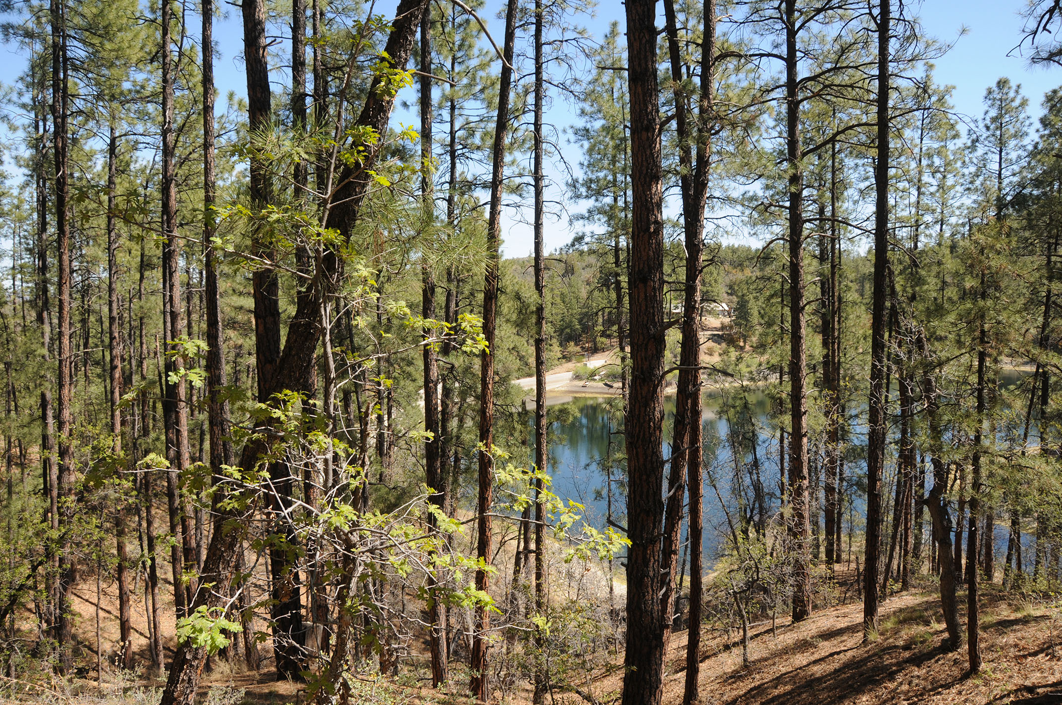
Whether gliding among reeds or preening and sunning on a pine-shaded jetty, the waterfowl seem to have mastered the art of taking it easy at Goldwater Lake. 
Goldwater Lake Park trail connects with Prescott Circle Trail

It’s a noteworthy cue. After all, isn’t kicking back what a day at the lake should be all about?  The City of Prescott Goldwater Lake Park is home to two smallish bodies of water: Upper and Lower Goldwater lakes. Both lakes are contained by dams on Bannon Creek in the Granite Creek watershed just a few miles south of Prescott’s historic downtown Whisky Row district.
Take it easy at Goldwater Lake Park

Dam on Bannon Creek contains Upper Goldwater Lake

The park is a popular destination for fishing, kayaking, picnicking and hiking.  A 2.37-mile loop trail circles both lakes, but at this writing, the connector trail between the Upper and Lower lakes is closed for construction and additional day use facilities will be installed around the Lower lake in the near future.

A boggy inlet on Upper Goldwater Lake

However, the Lower lake may still be seen by way of the connecting Prescott National Forest Goldwater Lake Trail No. 396 which is part of the 56-mile Prescott Circle Trail.
Willow catkins bloom in a moist riparian zone

Lower Goldwater Lake viewed from Prescott Circle Trail

The Upper lake hike can be done as out-and-back segments for a total of 2.7 miles. Surrounded by pine-oak woodlands with a fringe of water-loving willows, cottonwoods, boxelders, the alpine lake attracts swarms of waterfowl and wild birds.

Wild candytuft is a springtime bloomer

 
Waterfowl lounge on a pine-shaded jetty

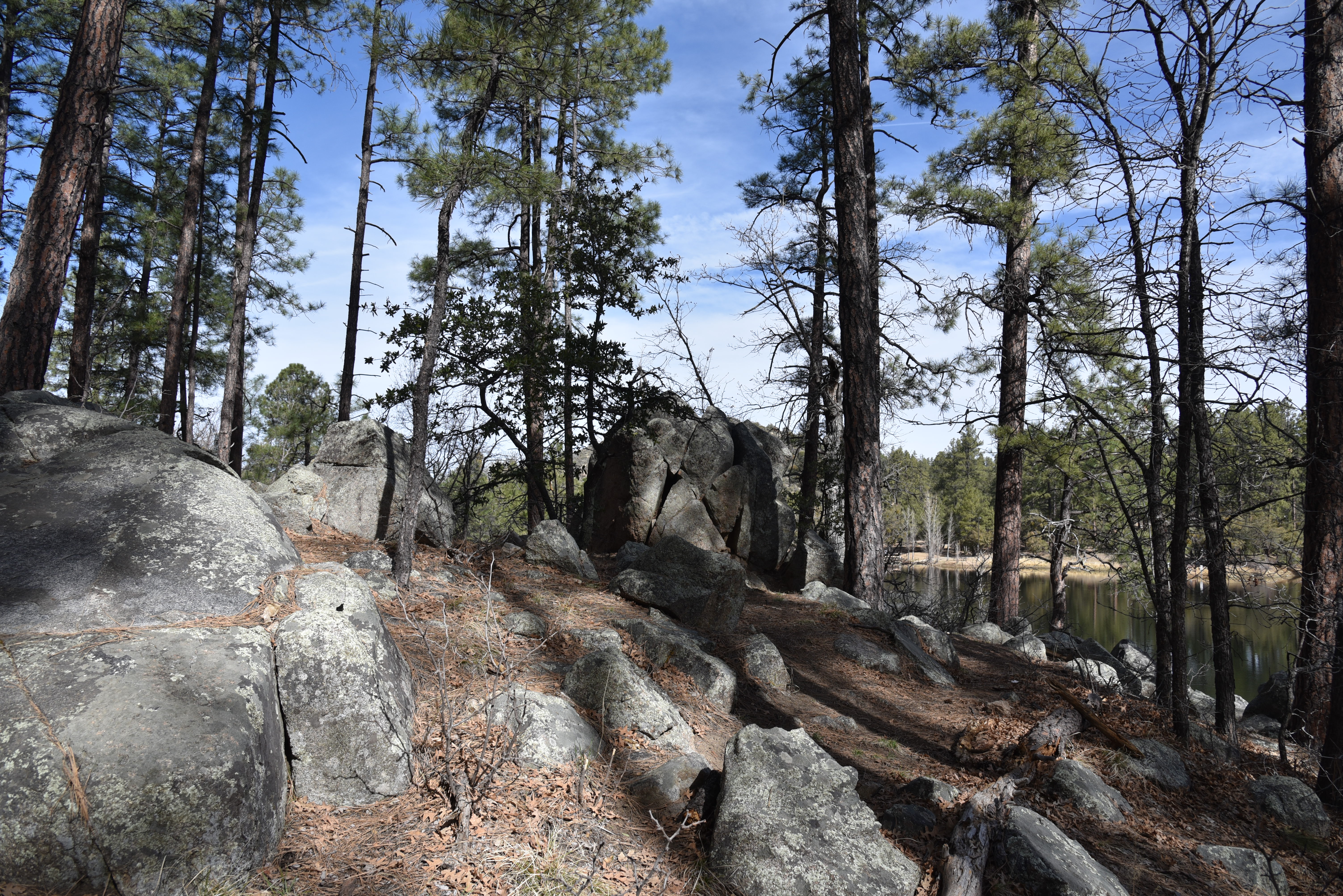
The trail follows the shore on a serpentine route that traces scenic finger coves, inlets and peninsulas passing through shaded, boulder-lined forests and moist riparian zones.
The lake is a productive bird watching site

 
The lake is popular for fishing and boating

This is a hike to take at a leisurely pace with eyes and ears tuned to the tree canopy and cattail reeds swaying in boggy inlets.  It’s there where a cacophony of bird songs, including the distinctive cry of red-winged blackbirds, and a supporting cast of paddling ducks advance the theme of wallowing in a lazy day at the lake.
A boulder-lined passage of trail around Upper Goldwater Lake

LENGTH: 2.7 miles out-and-back (Upper Goldwater Lake only). When completed, the 2-lake loop trail will be 2.37 miles.

RATING: easy-moderate

ELEVATION: 5,882 – 6,004 feet

GETTING THERE:

2900 S. Goldwater Lake Rd., Prescott.

From State Route 69/Gurley Street in Prescott, go 3.4 miles south on Senator Highway, turn left at the Goldwater Lake Park sign and follow the road to the parking area.

FEE: $3 daily fee per vehicle

SPRING HOURS: 7 a.m. – 8 p.m. (hours vary by season)

FACILITIES: restrooms, picnic ramadas, boat launch, fishing docks, playground, watercraft rentals.

No swimming allowed.

INFO:

City of Prescott

https://www.prescott-az.gov/recreation-area/goldwater-lake/