Find A Trail. Start Your Search Here:

Tuesday, March 29, 2022

Goldwater Lake Park

GOLDWATER LAKE PARK

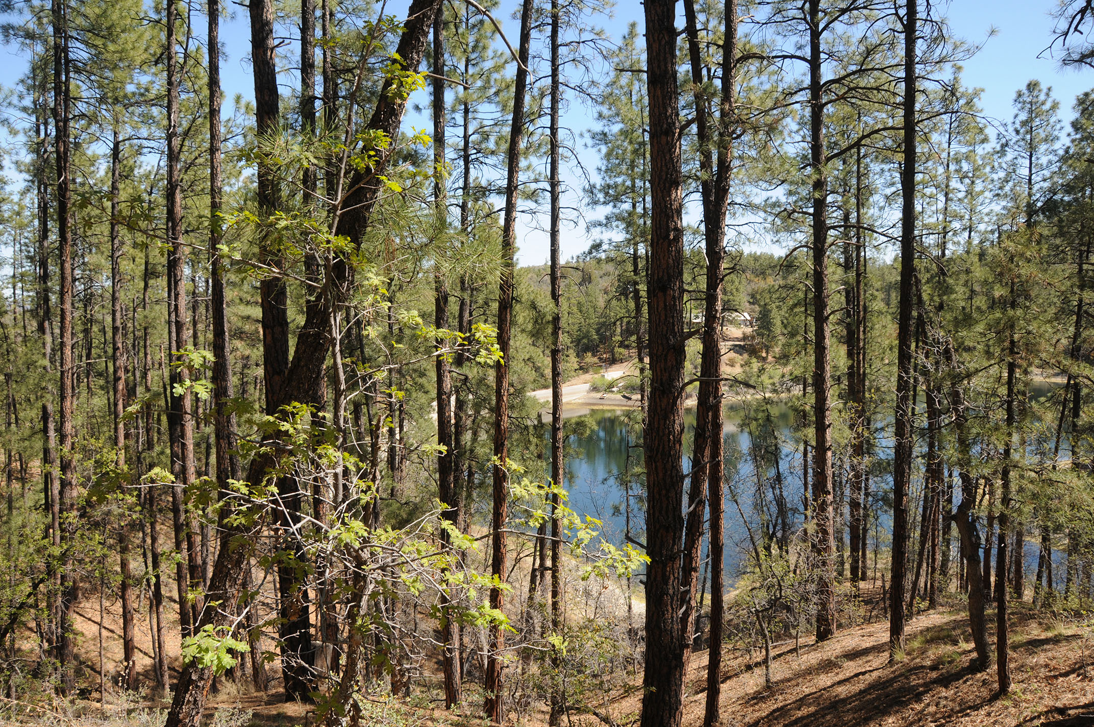
A leafy inlet on Upper Goldwater Lake

Maybe the ducks are on to something. 

Waterfowl glide on Upper Goldwater Lake

Whether gliding among reeds or preening and sunning on a pine-shaded jetty, the waterfowl seem to have mastered the art of taking it easy at Goldwater Lake. 
Goldwater Lake Park trail connects with Prescott Circle Trail

It’s a noteworthy cue. After all, isn’t kicking back what a day at the lake should be all about?  The City of Prescott Goldwater Lake Park is home to two smallish bodies of water: Upper and Lower Goldwater lakes. Both lakes are contained by dams on Bannon Creek in the Granite Creek watershed just a few miles south of Prescott’s historic downtown Whisky Row district.
Take it easy at Goldwater Lake Park

Dam on Bannon Creek contains Upper Goldwater Lake

The park is a popular destination for fishing, kayaking, picnicking and hiking.  A 2.37-mile loop trail circles both lakes, but at this writing, the connector trail between the Upper and Lower lakes is closed for construction and additional day use facilities will be installed around the Lower lake in the near future.

A boggy inlet on Upper Goldwater Lake

However, the Lower lake may still be seen by way of the connecting Prescott National Forest Goldwater Lake Trail No. 396 which is part of the 56-mile Prescott Circle Trail.
Willow catkins bloom in a moist riparian zone

Lower Goldwater Lake viewed from Prescott Circle Trail

The Upper lake hike can be done as out-and-back segments for a total of 2.7 miles. Surrounded by pine-oak woodlands with a fringe of water-loving willows, cottonwoods, boxelders, the alpine lake attracts swarms of waterfowl and wild birds.

Wild candytuft is a springtime bloomer

 
Waterfowl lounge on a pine-shaded jetty

The trail follows the shore on a serpentine route that traces scenic finger coves, inlets and peninsulas passing through shaded, boulder-lined forests and moist riparian zones.
The lake is a productive bird watching site

 
The lake is popular for fishing and boating

This is a hike to take at a leisurely pace with eyes and ears tuned to the tree canopy and cattail reeds swaying in boggy inlets.  It’s there where a cacophony of bird songs, including the distinctive cry of red-winged blackbirds, and a supporting cast of paddling ducks advance the theme of wallowing in a lazy day at the lake.
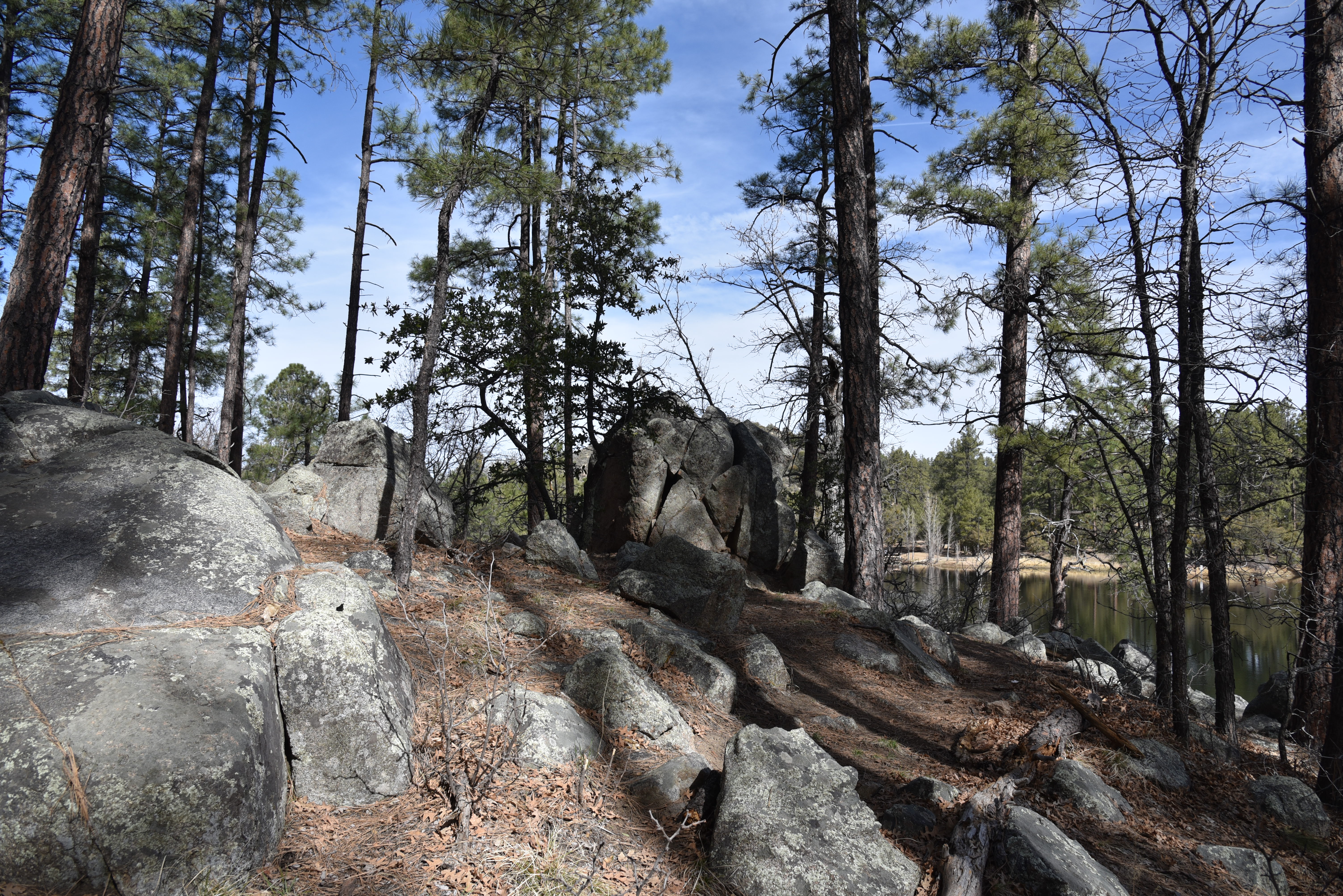
A boulder-lined passage of trail around Upper Goldwater Lake

LENGTH: 2.7 miles out-and-back (Upper Goldwater Lake only). When completed, the 2-lake loop trail will be 2.37 miles.

RATING: easy-moderate

ELEVATION: 5,882 – 6,004 feet

GETTING THERE:

2900 S. Goldwater Lake Rd., Prescott.

From State Route 69/Gurley Street in Prescott, go 3.4 miles south on Senator Highway, turn left at the Goldwater Lake Park sign and follow the road to the parking area.

FEE: $3 daily fee per vehicle

SPRING HOURS: 7 a.m. – 8 p.m. (hours vary by season)

FACILITIES: restrooms, picnic ramadas, boat launch, fishing docks, playground, watercraft rentals.

No swimming allowed.

INFO:

City of Prescott

https://www.prescott-az.gov/recreation-area/goldwater-lake/


Tuesday, March 22, 2022

Lost Dog Wash Trail

LOST DOG WASH TRAIL

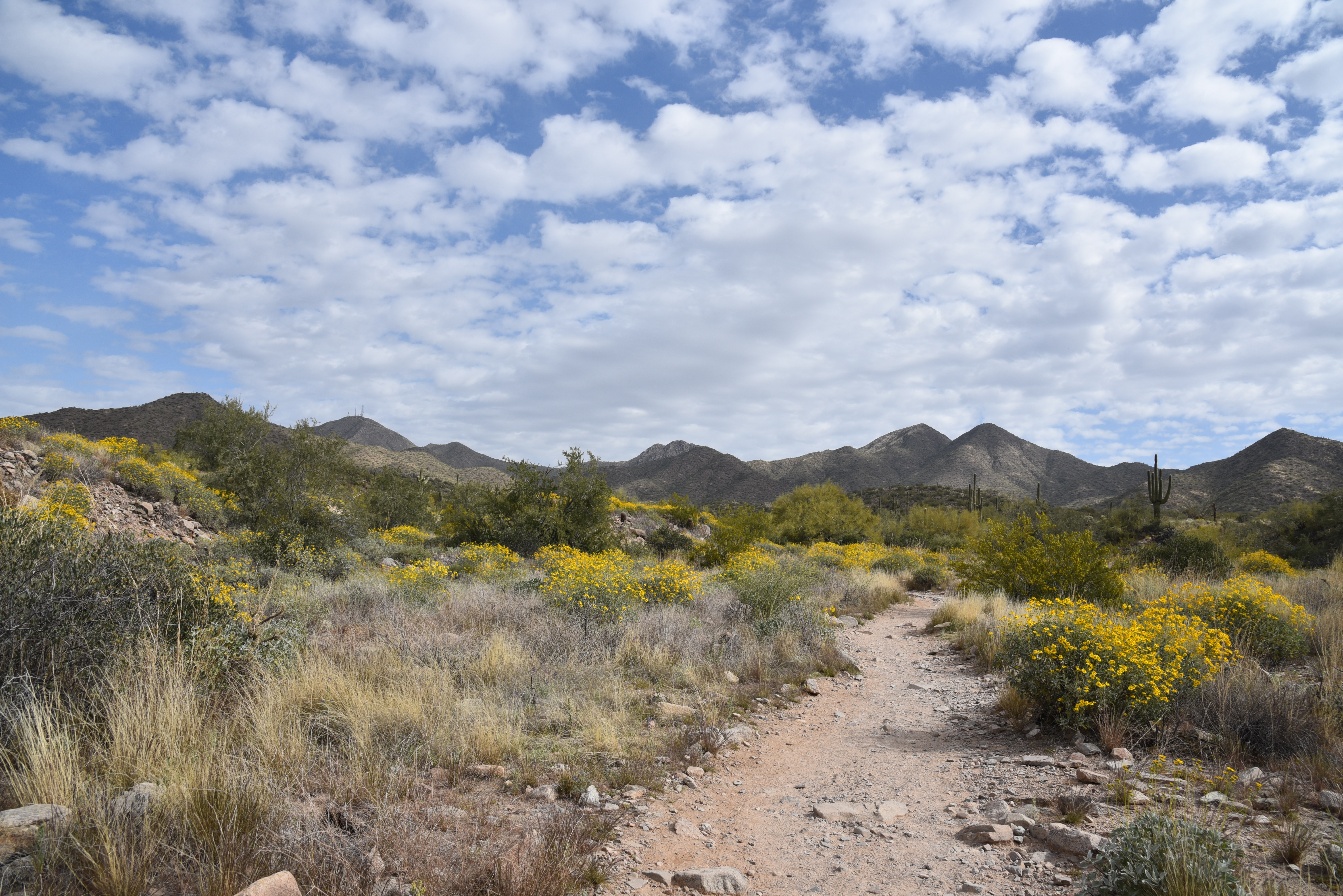
Yellow brittlebush bloom along Lost Dog trail

With ample winter rain, the desert in springtime can be an enchanting place.

Brittlebush entwined in cholla

Moisture coaxes the color out of myriad wildflowers, blooming shrubs and trees.
Desert hyacinth "blue dicks" bloom Feb. - May

Chuparosa blooms sporadically in washes year-round


While this past winter offered sporadic showers, it wasn’t quite enough to deliver a “super bloom” year. Yet, even in drier conditions, wildflowers still manage to make a moderate showing in the wash-riddled hills of Scottsdale’s McDowell Sonoran Preserve.
Lost Dog Wash trail winds through McDowell Mountain foothills

 
Desert chicory blooms Feb. - May

The preserve’s southern region is a study in the power of water and the Lost Dog Wash Trail gives a tour of how flash floods and storm runoff have shaped the foothills of the McDowell Mountains range in the northeast Valley.
Scorpionweed grows among shrubs and blooms Feb. - May

A Northern mockingbird serenades hikers

Delicate Desert wishbone blooms Mar.- Oct.

In addition to carving the terrain into a landscape of corrugated gullies, ravines, and ragged washes, running water that pools in disturbed soils and rock crevasse stokes colorful blooms year-round.

Brilliant magenta strawberry hedgehog cacti bloom Mar.-Apr.

Although the showy blooms are sparse this year, the trail is flanked by numerous specimens.
Sweeping views on the Taliesin Overlook

Lupine, scorpionweed, desert chicory, chuparosa, fiddleneck, desert hyacinth and wolfberry shrubs make a fair showing among acres of hardy and prolific brittlebush.
Wolfberry shrubs thrive in moist drainage areas


The moderate-rated Lost Dog trail makes a steady ascent alternating between palo-verde-lined washes and open fields punctuated with huge saguaros and ironwood trees. 

Vegetation thrives along Lost Dog Wash

Throughout the hike, views the McDowell Mountains and 3,969-foot, antenna-topped Thompson Peak dominated the eastern horizon. As the route gains elevation, the distinctive tip of Red Mountain peeks out above an urban-suburban valley. 
Coiled fiddleneck bloom Mar. - May

At the 2-mile point, a short spur path leads to Taliesin Overlook, a scenic ledge with views of the north and west valley. 
Thompson Peak stand out over a wash-riddled landscape

Cholla buds about to flower

The rolling terrain of McDowell Sonoran Preserve

The trail continues downhill for another half mile to meet the Quartz Trail which connects with the preserve’s popular Gateway Area.  Many hikers make the overlook their turnaround point for a quick workout and walk through a natural desert botanical garden.
Big sky views on the approach to Taliesin Overlook

LENGTH: 2.6 miles one way or 4 miles roundtrip to the overlook and back

RATING: moderate

ELEVATION:  1,755– 2,092 feet

FACILITIES: restrooms, water, shade ramadas, horse hitching posts 

HOURS: sunrise to sunset

GETTING THERE:

LOST DOG WASH TRAILHEAD:

12601 N. 124th St., Scottsdale.

From the Loop 101 in Scottsdale, take exit 41 for Shea Blvd., turn east (right) and go 4.2 miles to 124th Street. Turn left (north) on 124th Street and go 1 mile to where the road dead-ends at the trailhead.

INFO & MAPS

https://www.scottsdaleaz.gov/preserve


Thursday, March 17, 2022

Tumamoc Hill

TUMAMOC HILL

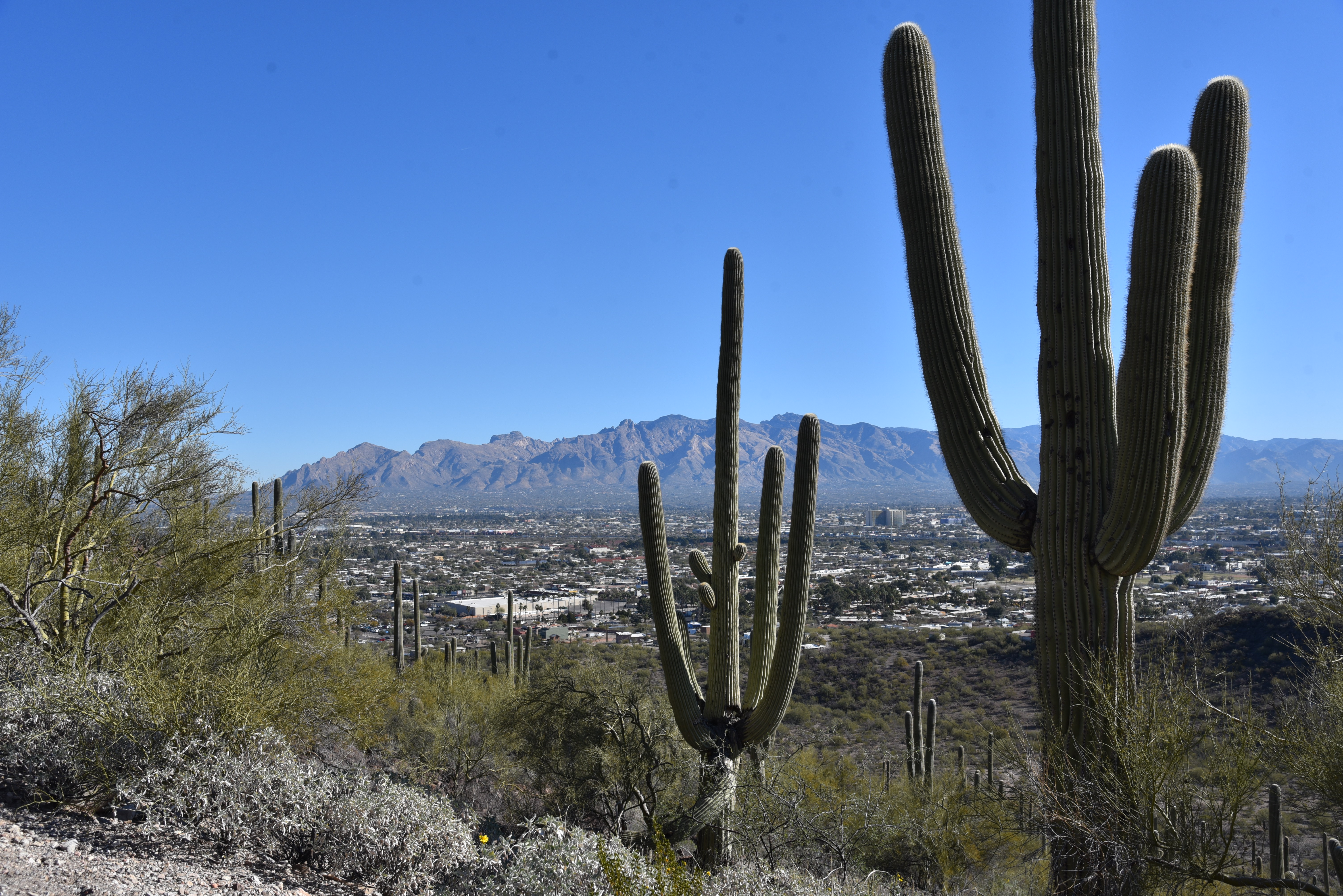
View of Santa Catalina Mountains from Tumamoc Hill

Just about everybody putting one foot in front of the other on Tumamoc Hill does so with a goal in mind, and the volcanic mesa just off Interstate 10 in Tucson holds enough interest to satisfy the physical and mental aims of its assorted visitors. Among the thousands who trudge up the distinctive  3,107-foot mound each year are casual walkers, spandex-clad runners, sightseers and families pushing strollers.  

See-forever views on Tumamoc Hill summit

In terms of popularity, the road/trail within the  860-acre University of Arizona ecological preserve rivals the likes of iconic Phoenix trails like Camelback Mountain and Piestewa Peak in visitation.
Tumamoc Hill is a wildlife sanctuary

The hill’s magnetic quality can be attributed to numerous factors. It’s close to town, easy to access and the approachable paved trail offers a moderate workout packed with educational opportunities.

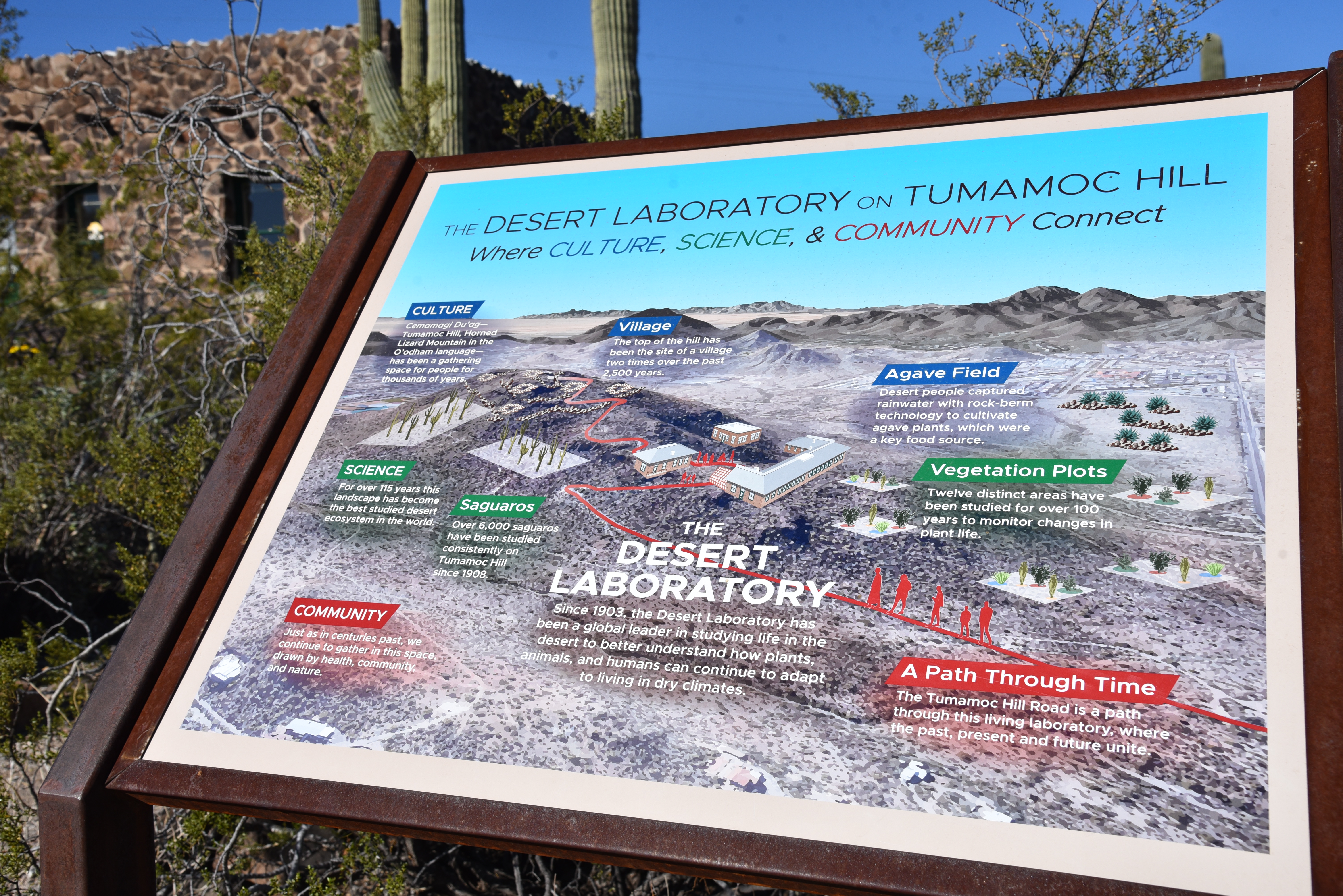
Designated a National Historic Landmark in 1975, the U of A Desert Laboratory which sits on a saddle halfway up the hill, is dedicated to ecological preservation and is a center of research, education and finding science-based solutions to challenges faced in the Sonoran Desert.

Tumamoc Hill is home to U of A Desert Laboratory

Visitors interested in augmenting their hike can download the Tumamoc Tour app. It’s an hour-long audio-video companion for smart devices that serves as a virtual docent that expounds upon on the history, ecology, archeology and native wildlife and plants encountered along the way up the hill.  

Colorful brittlebush color the hill's volcanic slopes

Even without the app, strategically-placed interpretive signs illustrate key points of interest such as the Agave Heritage Garden and an overview of the Desert Laboratory complex. 
Tumamoc Hill is an outdoor classroom

One sign explains that the name Tumamoc Hill derives from the Tohono O’odham language and means “Horned Lizard Mountain”.  Specifically, the eponymous reptile is the Regal Horned Lizard, which is the only species that lives on the hill, is an apt ambassador for the dozens of animals that thrive within the sanctuary.
The second half of the hike is steep

The 1.5-mile serpentine road hike that ascends the hill’s north face begins its 700+-foot climb on an easy grade.

An app and signs provide teaching moments

  The going gets demonstrably steeper beyond the Desert Laboratory site where  hikers can refill water bottles, take a break at benches placed at scenic overlooks or make use of the portable restrooms.  Beyond the laboratory, the road turns upward on a series of switchbacks that get more vertical at each turn and reveal vistas of the Santa Catalina Mountains to the north and nearby Sentinel Peak (2,897 feet) that’s better know as “A Mountain”. 
Saguaros line the road up Tumamoc Hill

Distant glimpses of Picacho Peak and Mount Wrightson peer out above the urban grid of downtown Tucson and surrounding suburbs topping out with a see-forever summit panorama.
Mountain vistas abound on Tumamoc Hill

Restored greenhouse at the Desert Laboratory

LENGTH: 3 miles roundtrip

RATING: moderate

ELEVATION:  2,339 – 3,098 feet

GETTING THERE:

From Interstate 10 in Tucson, take the Speedway Blvd./St. Mary’s Road  exit 257. Follow the frontage road south and turn right onto St. Mary’s Road. Continue 0.93 mile to Silverbell Road, turn left and go 0.2-mile to Anklam Road. Turn right on Anklam and go 0.15-mile to the trailhead at Tumamoc Hill Road across from St Mary’s Hospital. Park along the street, not in the medical facilities parking lots.

HOURS: 4 a.m. – 10 p.m. daily

RULES: Pets, bikes and skate boards are not allowed. Hikers must stay on the paved road.

INFO:

https://tumamoc.arizona.edu/tumamoc-hill/overview


Tuesday, March 15, 2022

Bottom Out - Roundabout Loop

BOTTOM OUT - ROUNDABOUT LOOP

A typical scene on the Bottom Out trail

Usually, getting to the good stuff takes effort.

The beginning of the Bottom Out trail is just an appetizer

This is especially true of hiking where the juiciest routes are often remote, tangential paths diverging from heavily traveled routes in popular outdoor destinations.
While many trail systems offer groomed and signed paths that range from super easy to difficult, the unpolished character of a place often resides at the raw end of the spectrum. 
Easy going on the Roundabout trail

Sedona’s Western Gateway Area trail system builds on this theme with a

serpentine maze of interconnected loops that straddle a hilly pocket of Coconino National Forest on the far west side of town. But instead of its wild side being inaccessible to most, this system’s rough-cut gem spins off an easy trail less than a mile from a trailhead and appeals to hikers with a sense of adventure, experience and sturdy boots with good traction.

Bottom Out trail traces Dry Creek

The compact system of singletrack paths unwinds around the chiseled course of Dry Creek where the terrain shuffles among high ridgelines with epic vistas of Red Rock County’s iconic rock formations, fractured drainages, cypress and oak woodlands and sunny yucca-studded grasslands. Comprised of short, connecting segments, the trails don’t linger too long in any one ecozone. 

One of the many obstacles on the Bottom Out trail

A riparian zone in Dry Creek seen from Bottom Out trail

Instead, they soar over exposed ledges, dip into gullies and ramble through leafy riparian corridors in  seamless, smooth-moving cycles. 
Bottom Out trail dodges a gorge on Dry Creek

To sample the best of the system’s highs and lows in one swooping loop that runs through the system’s aforementioned raw end, try a circuit that uses the Bottom Out and Roundabout trails. These two trails reside in the system’s south central core just steps from the Cultural Park trailhead off State Route 89A. Finding the route is a bit confusing at first. Begin with a short walk on the Girdner trail, then head right onto the Outer Limits trail. Cross a dirt road and veer left to continue another 0.3-mile on Outer Limits to the Bottom Out junction. A wooden sign post points into a dry wash.  If the beginning a the Bottom Out trail looks sketchy—wait. That’s just an appetizer.
Girdner trail is used as a connector path on this circuit

The route is a veritable roller coaster of obstacles, down-climbs and stony passages.  Completely devoid of signage, the 1.3-mile trail is a joy for those who prefer less-travelled trails with a few baked-in challenges.  Rated difficult for hikers and very difficult for mountain bikers, the ragged route roughly traces Dry Creek, which usually lives up to its name. 
A slickrock passage on Bottom Out trail

It’s essential to pay attention to route-finding on this one where the trail dives deeper into the creek corridor. The trail is sometimes in the creek, sometimes on ledges above and sometimes slipping over slickrock, all the while crossing from bank-to-bank with no particular agenda.
Rock ledges on Roundabout trail

 
Bear Mountain viewed from Roundabout trail

The most fun parts of the trail are the rock jams and drop offs that must be worked around using creative route scouting. Mostly canyon-bound and shady, the Bottom Out trail delivers its deepest and final stony obstacle just before it exits the creek corridor and begins a short uphill crawl out of the sheer-walled canyon.  
Point where Bottom Out trail leaves the canyon

The mild climb ends back on the Girdner trail junction where views of the Cockscomb formation and Bear Mountain stand out to the north.  Each trail junction has an excellent map sign for customizing hikes. For this circuit, head right and follow Girdner 0.6-mile to the Roundabout trail.
Route-finding skills are needed on Bottom Out trail


The Roundabout leg of the hike is an easy-rated, entertaining muddling of tight bends and edgy traverses all backed by a carousel of changing views that include Mingus and Woodchute mountains, distinctive Capitol Butte and the long mesas of Wilson Mountain.  Sort of like an inside-out version of the Bottom Out trail, this 1.7-mile segment trades a viewless, cloistered obstacle course with an easy glide on open terrain with big mountain vista. 

There are no signs like this one on Bottom Out trail

And, unlike the hunt-and-peck nature of its companion, a clear path and excellent signage guide hikers home without a single obstacle in the way.

LENGTH: 4.1-mile loop (as described here)

RATING: moderate-difficult

ELEVATION: 4,154 - 4,492 feet

GETTING THERE:

Girdner-Cultural Park trailhead.

From the State Route 89A/179 traffic circle in Sedona, head 4.2 miles west (go left through the circle) on 89A to Cultural Park Way (traffic signal). Turn right and continue 0.3-mile to the Girdner Trailhead on the right. Trailhead has picnic tables and a map kiosk but no restrooms or water.

INFO:

https://www.fs.usda.gov/coconino/