Find A Trail. Start Your Search Here:

Thursday, May 14, 2020

Munds Canyon Trail to Horse Park

As forests and recreation sites start to reopen, please continue to observe safe practices as you begin stepping back out on the trails. Here's another less-used gem where there's room for physical distancing.

MUNDS CANYON TRAIL to HORSE PARK
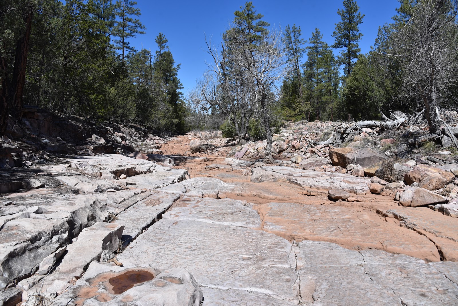
Water lingers at the bottom of Munds Canyon

In the pine forests that straddle the hilly acres between Lake Mary Road and Interstate 17 south of Flagstaff, a network of shared-use trails connect Arizona’s plateau lakes region with the community of Munds Park. 
There's lots of shade on the Munds Canyon Trail
The system of long, loopy routes is integrated with the Kelly Motorized Trail System and forest service trails adopted by the Munds Park Trail Stewards (MUTS), a volunteer group dedicated to working with land management agencies for the establishment and maintenance of multi-use trails in the Coconino National Forest.
Watch for wildlife near a tank along Rocky Road Trail
With over 100 miles of new and re-purposed trails, the Munds Park-Kelly Canyon Trail System provides recreational access with the goal of preventing destructive trailblazing while preserving access and forest health.
Woodhouse's Phlox blooms spring through fall
Over 100 miles of trails in the Kelly-Munds Park systems
Munds Park - Kelly trails are multi-use
The route is well-signed and easy to follow.
Open to hikers, bikers, equestrians and smaller motorized vehicles, the Munds Canyon Trail 240 is a pleasant walk through shady terrain that dips and climbs through the contours of a shallow gorge.  The 2.3-mile route  is well-maintained and signed and may be used in conjunction with several connecting trails for longer treks. Beginning at the roomy Pinewood trailhead where there’s plenty of parking for vehicles and trailers, the hike begins with an easy walk through pine-oak woodlands and meadows. The trail soon encounters the edge of Munds Canyon where a series of flowing switchbacks glide off the rim and into green drainages cluttered with brambles and wildflowers that thrive in the moist ecozones. 
Larkspur grow in pine forest clearings
Munds Canyon Trail ends at the junction with the Rocky Road Trail 241. Turn back here for a 4.6-mile hike, or head right on Rocky Road for a longer adventure with a few surprises thrown in.
An odd sinkhole stands out on the Rocky Road Trail
This section of Rocky Road lives up to its name with lots of loose stones that make foot travel manageable but potentially ankle-twisting. Watch your step and you’ll be fine. At the 2.9-mile point, the trail crosses a cattle guard and meets a massive sinkhole. The abrupt, boulder-jumbled crater looks strangely out-of-place among tracts of arching oaks and colorful blooms.  Not far beyond the stone pit, a noticeable increase in wildlife activity—birds, squirrels, fox, racoon, elk-- hints at the presence of a water source.  Watch for a large earthen berm off to the left which contains a wildlife water tank that attracts dozens of animal species such as skunk, herons and bobcats. During the final half-mile of the hike, the forest opens up as it enters the sunny grasslands of Horse Park.
Pine thermopsis blooms April - July
The Munds Park Trail Stewards recently constructed log fences to keep motorized traffic out of the previously damaged sensitive environment. To help in its recovery and to keep from disturbing wildlife, even hikers should respect nature by staying on designated trails.  Trails and campsites are for people. The rest of the forest is for plants and animals. 
Munds Canyon Trail descends into a forested draw
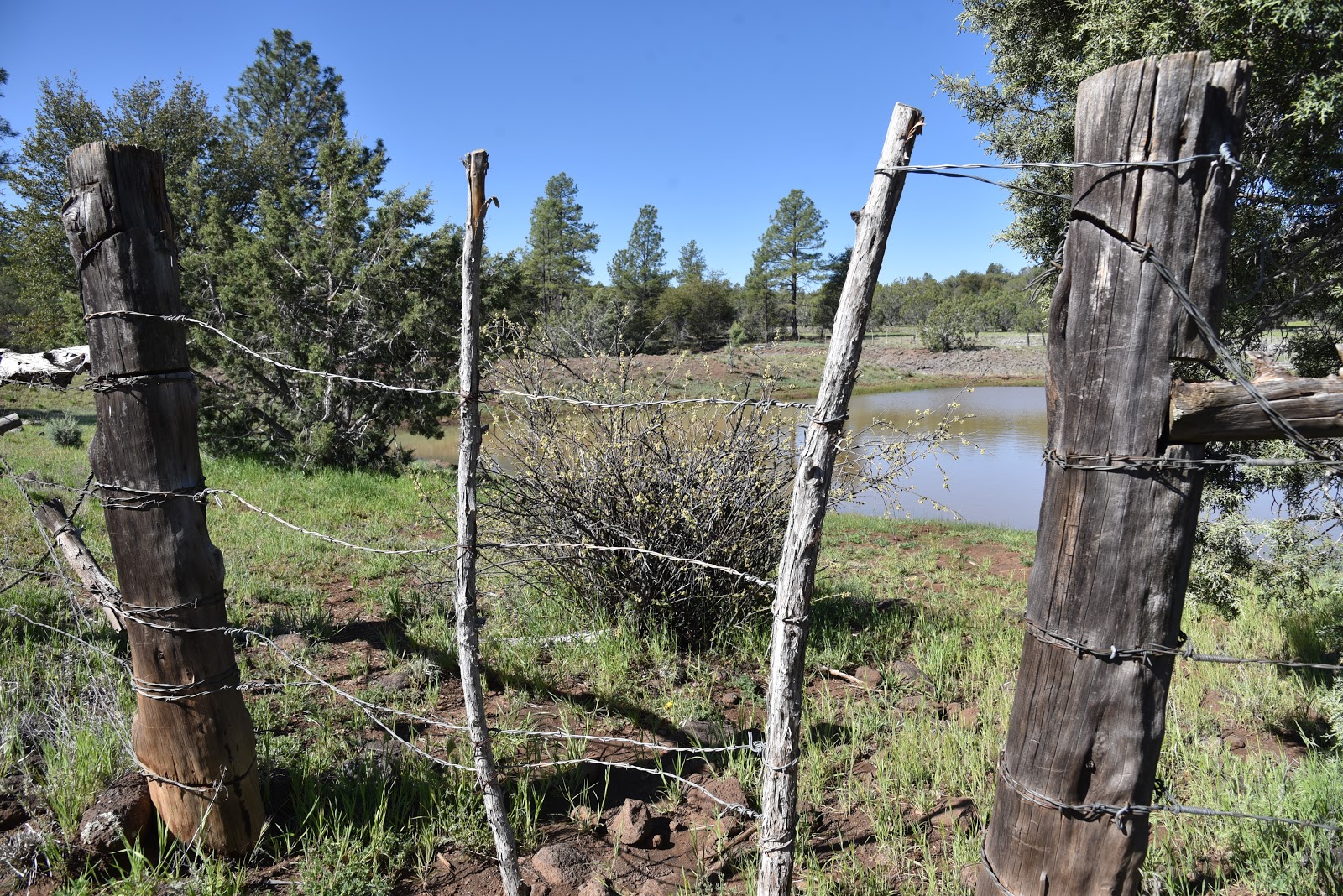
Fencing protects the recovering flats of Horse Park
Even minimal foot traffic can disrupt fragile habitats.
Rocky Road Trail is rocky, as advertised.
Lemmon's Star blooms spring through early summer
Rocky Road Trail meets Forest Road 700 at the 3.9-miles, the turnaround point for this hike.
LENGTH: 7.8 miles round trip
RATING: moderate
ELEVATION: 6,646 – 6,955 feet
GETTING THERE:
From Interstate 17, take the Munds Park exit #322 and continue 2 miles east on Pinewood Boulevard (Forest Road 240) to the parking area on the left.  Trail begins at the north end of the lot. Roads are paved with a short section of maintained dirt that's fine for all vehicles.
INFO & MAPS:


Monday, May 4, 2020

BUCKHEAD MESA

I'm posting my backlog of pre-pandemic hikes. Please observe all CDC health & safety recommendations and travel advisories while recreating on public lands. Ideally, stay close to home and away from congested trails until conditions are improved.
BUCKHEAD MESA
Tonto National Forest.
View of the Mogollon Rim from Buckhead Tank
Travel quietly & respectfully in this important wildlife area
On a mesa 700 feet above the gorge of Pine Creek and Tonto Natural Bridge State Park, a bumpy back road meanders among juniper-dotted meadows, pine-oak woodlands and open rangeland.
Waterfowl float in Buckhead Tank
The unmarked dirt road that traverses the flat expanse of Buckhead Mesa 10 miles north of Payson in Tonto National Forest is open to hikers, equestrians and motorized vehicles equipped to handle rough conditions.  A hike on the short, easy course has many points of interest and options to extend the journey on intersecting 4x4 roads or by visiting the nearby park.
A bucolic scene on Buckhead Mesa
Even when done as a standalone hike, the area’s bucolic air provides a satisfying journey.
Stemless daisies bloom early spring thru summer
A rustic corral surrounds Buckhead Tank
Tree cover provides places to sit and observe wildlife
Photo opps abound on Buckhead Mesa
Epic views begin at the trailhead with glimpses of the northernmost peaks of the Mazatzal Wilderness to the southeast.  Within a few yards, the road splits. Take either leg as they converge at a corral complex at the 0.1-mile point. Constructed of flaky juniper twigs laced together with barbed wire, metal posts and rustic gates, the site is rife with wildflowers and photo opportunities for those attuned to the details hidden among the weeds.  The road continues to the left, tracing the rickety holding pens through sunny clearings shaded by oaks, cypress and thickets of brambles.  A few jogs in the road later, the green swale of Buckhead Tank comes into view. Situated in a shallow depression backed by an earthen dam, the livestock reservoir is an important water source for wildlife and the domestic cattle that graze in the area.  For the best chance to view elk, coyotes, deer and the myriad waterfowl that visit the water hole, arrive early and wait quietly in the tree cover. You won’t be disappointed. Heading out early (before 9 a.m.) will also allow you to avoid the sporadic convoys of OHVs crawling through the rutted route.
A gate marks the final segment of the hike
Green meadows and big views are highlights of the hike
Fragrant juniper trees are abundant along the route
Fleabane blooms early spring thru summer
The trail crosses several pine-shaded drainage areas
Extend the hike on Crackerjack Road
A horseshoe handle embellishes a corral gate
Beyond the tank, the road dips and climbs through several drainage areas and a fragrant stretch of Ponderosa pines before passing under a powerline at the 1.7-mile point for the final uphill haul. Big views of the Mogollon Rim really shine on this final segment. At 2 miles, the road meets a gate where you’ll pass through (be sure to close it) and continue a short distance to the turnaround spot at Crackerjack Road (Forest Road 209). At the unsigned junction, you may choose to continue hiking in either direction. Head left and it’s just under a mile to State Route 87. Or, head right and follow the narrow jeep road to the edge of the mesa where it switchbacks down into the mineral-rich White Hills where numerous prospects hint at defunct mining operations. From the junction, it’s a 4.5-mile one-way hike to Crackerjack Mine for those looking for a more ambitious outing.
LENGTH: 4.2 miles roundtrip
RATING: easy
ELEVATION: 5,085 – 5,241 feet
GETTING THERE:
From the State Route 260/87 junction in Payson, go 10.5 miles north on SR 87 to the turn off for Tonto Natural Bridge State Park (Forest Road 583) on the left just past milepost 263.  Continue 0.8-mile on FR 583 and turn left onto a dirt road where there’s a cattle guard and stop sign. Park on the dirt turnout located a few yards past the junction. Roads are paved up to the trail turnoff.
No facilities.
INFO:
Tonto National Forest

Thursday, April 30, 2020

PYEATT DRAW

I'm posting my backlog of pre-pandemic hikes. Please observe all CDC health & safety recommendations and travel advisories while recreating on public lands. Ideally, stay close to home and away from congested trails until conditions are improved.
PYEATT DRAW Tonto National Forest.
A slick rock passage in Pyeatt Draw
There are two ways to hike through Pyeatt Draw, the hard way and the easy way. 
The major drainage that spins off of Ellison Creek a few miles northeast of Payson near the popular Water Wheel recreation site is an entertaining mix of dirt passages, water-ravaged channels and obstacle-loaded corridors.
Rock ledges close in on Pyeatt Draw
Although the challenging woodsy route is mostly used by OHV enthusiasts, it’s scenic qualities and varying terrain offer hikers a quirky alternative to more traditional trails.
The ragged course is intertwined with a primitive forest road that traces the banks above the draw, crossing it several times. The trek begins at a dirt pullout where a sign for Forest Road 1595 marks the trailhead. Begin by hiking the rocky draw roughly 400 feet to where FR 1595 continues straight ahead. To take the hard way (as described here), veer left at the junction and follow the stream bed. For the easy way, stay on the road.  
A forest road that crosses the draw offers an easier path
An easy section of the rugged Pyeatt Draw route
Pyeatt Draw trailhead
Much of the hike passes through riparian vegetation
Except for some loose footing, the first 1.3-mile segment is relatively flat and simple to navigate. Hiking conditions in the pine-shaded, uneven gorge range from open flats and slick rock channels to jumbled, step-like sections where tiny waterfalls cascade over fractured terraces.
There's abundant wildlife in Pyeatt Draw
Willows, cottonwoods and alders cluster around shallow pools feed by an intermittent stream.
The mouth of Pyeatt Draw
Sandbars flush with footprints of Great blue herons, bobcats, deer, elk, and racoons show the importance of this lush waterway for wildlife.  
Bizarre geological features add interest to the hike
The area is prone to flash floods, so avoid this hike after heavy rains and when storms are forecasted. Right around the 1.3-mile point, the draw becomes noticeably narrower, more difficult to walk and profoundly beautiful. Massive blocks of stone with streaks of color and crystalline inclusions protruding from sheer cliffs now dominate the terrain.
Pyeatt Draw tests the skills of OHV users
The hike’s high point is a box canyon dubbed “the filter” by OHV users.  Cluttered with massive, angular boulders, the filter is the crux challenge for OHVs. On my most recent visit, a heavily-modified Jeep, attached to a winch was working its way up an impossible-looking staircase of head-high rock shelves while being guided by coaches on foot.  Hikers can bypass the motorized activity by scrambling over the less abrupt chute to the right. 
Views of the Mogollon Rim peek through the pines.
A few yards beyond the filter, the route ends where the draw meets a forest road at the 1.7-mile point. Simply backtrack from here and enjoy views of the Mogollon Rim you may have missed while picking through the quagmire on the way in.
The rough access road requires a high-clearance vehicle.
Water tumbles over blocky boulders in Pyeatt Draw
Willows flourish where water pools in Pyeatt Draw
LENGTH: 3.4 miles roundtrip to “the filter” and back
RATING: moderate
ELEVATION: 5,258 – 5,747 feet
GETTING THERE:
From the State Route 87/260 intersection in Payson, go 2 miles north on SR 87 and turn right on Houston Mesa Road.  Continue 4.9 miles, turn right on Pyeatt Draw Road (Forest Road 198)
and go 4.5 miles to an unsigned prominent drainage with a concrete culvert on the left and a sign for Forest Road 1595 on the right. Park in the dirt turnouts.
Pyeatt Draw Road is a rough dirt track with deep ruts, hairpin turns and a few steep drop offs. At least a high-clearance vehicle is required and a 4x4 if the road is wet.  There are several pullouts and dispersed campsites along the road where you can park and walk before the road gets too messy for your comfort level.
INFO: Tonto National Forest

Monday, April 20, 2020

Dogs & Dilemmas


Dogs & Dilemmas

Rowdy hikes in the McDowell Sonoran Preserve

Living with a rambunctious pack of dogs helps one develop a sense of humor and an ability to appreciate the lighter side of life. If you take yourself too seriously you might see an occasional poo-poo in the kitchen or a butt-sniffing incident in front of company you’re trying to impress as disasters instead of the disarming stagings of canine Commedia dell’Arte that they are.  Dogs throw a wrench in our most cherished routines and possessions.
Layla takes a break on a Scottsdale trail
The peed-on pillow, the dug-up garden and the change in plans brought on by a trailside skunk encounter are disruptions made to bolster our resilience.
Dogs make good pilots during times of crisis.
Ironically, through their inconsistency, dogs send a consistent message: the only thing we can control is our own behavior.  That’s a good concept to embrace during a global pandemic.

Sophia Maria hikes Dixileta Trail in Scottsdale

Because of conflicting messaging, coronavirus stay-at-home orders have been particularly trying and confusing for hikers.
We’re being told to both stay home and go out and hike because it’s “safe”.
The mantra of “practicing social distancing” is proving to be just a catch phrase as parking lots at popular trailheads are crammed full while vehicles circling like vultures wait for available spaces.  Social media is replete with visuals of large groups congregating and cars parked bumper-to-bumper along forest service roads near “remote” trails where “nobody goes”.

Chessy at the Silly Mountain Park in Apache Junction

Trail closures and restrictions that began as precautions are now necessities to protect public health. For instance, Arizona State Parks had to temporarily close several parks for day-use this past weekend due to overcrowding.

Kleiden loves hiking in Flagstaff

My personal decision to avoid hiking hot spots has been met with ambivalence. 
It’s not lost on me that many hikers refer to my reviews when researching trail destinations and I am well aware that that comes with responsibility.  These past weeks, I’ve been overwhelmed with requests for suggestions about where to go to escape the crowds and questions about why I have not posted any new hike reviews. Truth is, I’m in a sort of Catch 22 situation.  Here’s why.
Maddie on the Aspen Loop Trail in Flagstaff


Like many regular bloggers, I get dozens of pitches from marketers offering me free products and services in exchange for promoting everything from trail foods and gear to free trips to outdoor vacation destinations. (I do not accept any of these perks, preferring to keep this blog non-commercial.)
The coronavirus stay-at-home orders have changed the tone of the messages that land in my inboxes. A few weeks ago, the drift was all about “stay home and stay safe”, “we’re in this together”, “let’s care for each other” and “please stay away from small towns to stem the spread of the virus.” But this weekend, the love fest took a disturbing turn.  My email was rushed with pleas from small businesses and communities to “send hikers to them” and a swell of “we’re open for business” reminders.  Clearly, the novelty of the novel virus has lost its panache.
Dogs make fine pilots in times of crisis

   
Rocco and Jasmine play on the Badger Springs Trail
All this at the end of a week where I watched two of my favorite restaurants shut down for good and heard that one of the services I use for my dogs is on the verge of going under as well.  It’s heart wrenching.  The Catch 22 is this: If I start directing hikers to the small communities that depend on tourism to survive in a time when friends are fomites and visitors are vectors of disease will it be welcome relief or a health hazard?  There is not yet enough data to decide. 

In retrospect, there might be some humor to be found in this historic episode of pandemonium.
But right now, even when surrounded by six dogs vying for lap time, it’s not funny. It’s just confusing.

Since dog is my co-pilot, I’ve decided that the best way to bring the pandemic to heel is to sit and stay.