Find A Trail. Start Your Search Here:

Tuesday, August 6, 2013

Secluded canyon on the Mogollon Rim


DIRTYNECK CANYON
Near Clint's Well

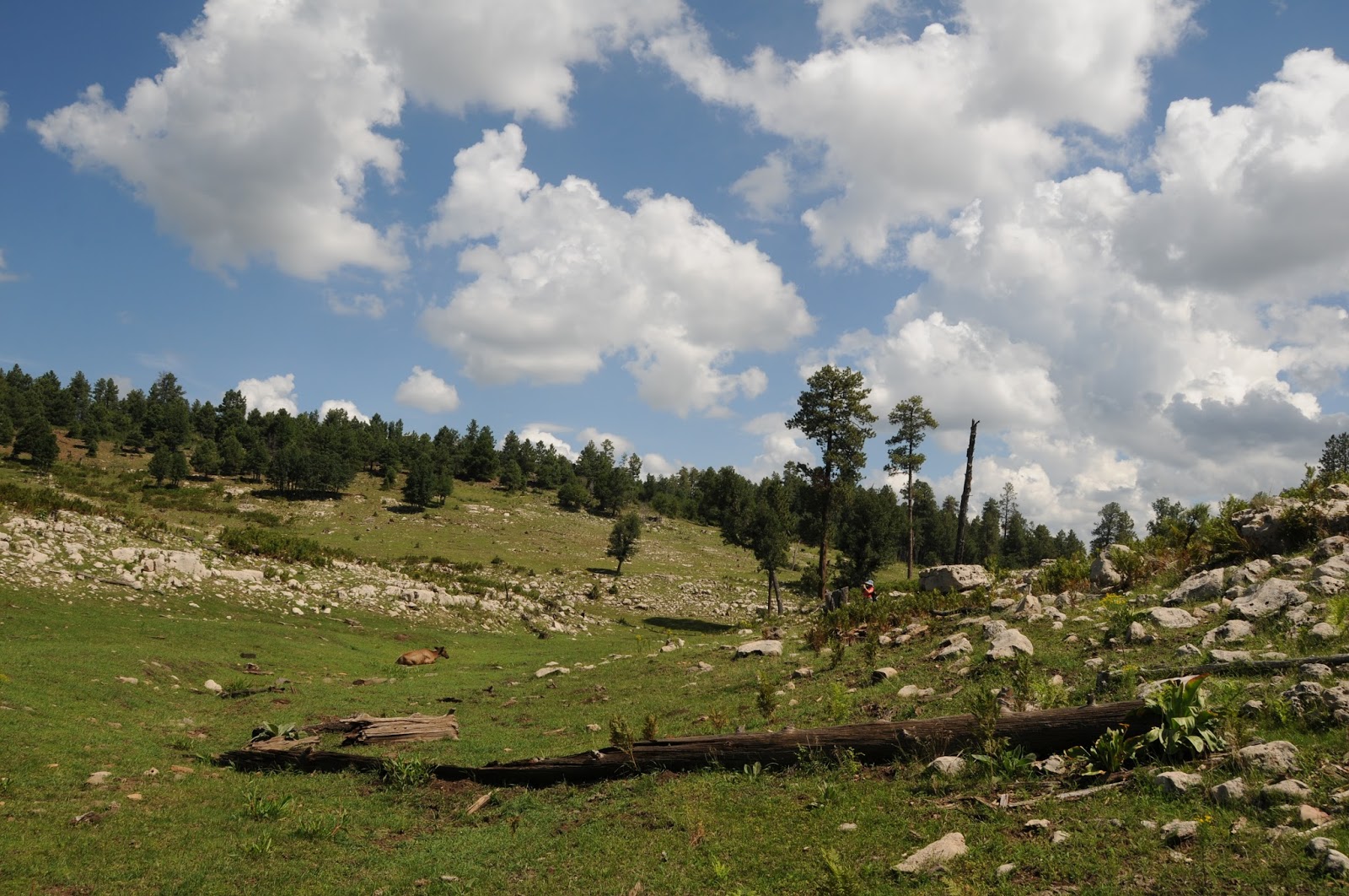
At some point in history, somebody must have emerged from this canyon with a dirty neck.  Whether it was a shepherd or a reclusive homesteader, a case of ring-around-the-collar would have been a small price to pay to live and work in this paradise on the Mogollon Rim. Although it's shown on forest maps, there's no official hiking trail through the shallow canyon.  The route briefly follows a two-track road that merges with footpaths and game trails before being swallowed up in organic mass leaving trekkers to rely on creative bushwhacking to get through.  The landscape diversity here is a wonder.  As the canyon winds north from FR 613 to the Beeline Highway just south of Clint's Well, it cuts through moist fern gullies fed by the trickling waters of Windfall Spring and elegantly swaying thickets of oaks and locusts.  Limestone boulders strewn across a tree-barren, yawning gorge share emerald meadows speckled with blooming wild geraniums, yarrows and clovers where decades of snowfalls and summer rains have soothed the scars of the wildfire that consumed the trees.  Here, the canyon comes to a fork---head right into an unscathed pine forest and the beginning of the muddy boots portion of the hike. Spring water and monsoon runoff settles in ribbony rivulets and tiny reflecting pools at the base of the canyon forming a nourishing foundation for plant and animal survival.  Each footstep releases pungent musty-earthy aromas sometimes spiked with head-clearing jolts of wild mint.  Surrounded by shoulder-high sunflowers a canopy of whispering aspens and life giving waters underfoot, you'll want to breath deep and become absorbed in the moment.
After roughly 1.2 miles of hiking, the first of several natural barriers appears.  This one is a quagmire of logs and brambles choking the creek where the canyon hits a short pinched segment.  Here, you'll need to scramble around on steep banks, which is why long pants and sleeves are recommended for this hike.  As Dirtyneck Canyon's little-known corridor approaches AZ87, the sounds of whizzing motors occult natural woodland murmurs.  A stock tank, bovine grazing field and a flimsy span of barbed wire separating paradise from the asphalt speedway mark the turnaround point.
LENGTH: 2.89 miles one-way
RATING: moderate, off trail, some bushwhacking
ELEVATION:  7300' - 6850'


GETTING THERE:
From Phoenix, travel north on AZ87 to the AZ87/260 junction in Payson.  Continue north on AZ87 to FR 613 between mileposts 282 and 283 on the right.  Drive on FR 613 veering left at the Fortynine Canyon sign and past the first Dirtyneck Canyon sign you will see on the left---this is for Dirtyneck Road.  At the 1-mile point you will see road signs for 9384Q and 6023 with a corral hidden among oak trees about 50 years off to the left.  This is the trailhead. Park in the pullouts and begin hiking on 9384Q.
MORE PHOTOS:

195 cool Arizona summer hikes

USE MY TRAIL INDEX TO BROWSE 195 COOL SUMMER HIKES
East Fork, Greer

Hi Hikers, I have been receiving lots of emails  asking about AZ summer hiking trails.  I LOVE hearing from you guys and will always do my best to reply with helpful tips.  And, I wanted to remind you about the TRAIL INDEX that runs down the left side of the blog.  You may need to scroll down to find it----then click on any or all of these: "summer hike","Flagstaff", "Mogollon Rim",  or "White Mountains" to sort for cool, high-country treks.  Happy hiking!

Friday, August 2, 2013

The little trails at Tonto Natural Bridge State Park


TONTO NATURAL BRIDGE STATE PARK TRAILS
Payson
Waterfall Trail

Hikers who visit this natural wonder on the Rim often make a beeline for the Gowan Trail.  That's not a bad plan as it is widely considered the "best" trail in the park for those looking for a challenge.  The half-mile dirt route makes a steep dip into Pine Canyon where a plank bridge leads to an observation deck at the base of the world's largest tavertine arch.  If park rangers feel conditions are safe, hikers are allowed to walk through the arch, but if water levels threaten, that's not an option---so call ahead if you're dead set on the full experience.  Although Gowan Trail is the big deal, it's a mistake to ignore the park's four other hiking trails because of their short lengths.  For instance, the Waterfall Trail is a stunning walk on a 300' staircase that hugs the canyon wall above Pine Creek with a remarkably lush wall of ferns and brambles fed by spring water trickling from the rock.  The Pine Creek Trail follows the canyon-bound water that carved the bridge culminating at a tiny swimming area and junction with the Anna Mae Trail. Finally, the paved, accessible trail that leads to four viewpoints is worth a look for the viewing scopes and interpretive signs that give deeper understanding of the park's wildlife and unique geology.
The Bridge

LENGTHS:
Gowan Trail: 0.5 mile one way
Pine Creek Trail: 0.5 mile one way
Waterfall Trail: 300' one way
Anna Mae: 500' one way
Viewpoints Trails:  0.75 mile
NOTE: some trails may be closed when water levels are high
RATING: barrier-free to difficult
ELEVATION: 4530' - 4300'
HOURS: 8 a.m. - 5 p.m. daily
FACILITIES: restrooms, water, picnic tables, swim area, gift shop
FEE:  $5 per adult, $2 ages 7-13, Free for ages up to 6 years

GETTING THERE:
From Phoenix, travel north on AZ87 to Payson.  At the AZ260/87 junction in Payson, continue 10 miles north on 87 to milepost 260 and turn left at the park sign.  Follow the winding road 5 miles downhill to the entrance.  Park in the 15 minute area, go into the gift shop to purchase your pass and then move your vehicle to any of the signed trailheads. 
INFO: Arizona State Parks, 928-476-4202
MORE PHOTOS:

Wednesday, July 31, 2013

Kid-friendly wetlands hike


PINTAIL WETLANDS
Allen Severson Wildlife Area

View from the blind

A haven for Arizona White Mountain bird populations, this 370-acre marsh area was created by the City of Show Low to increase waterfowl production while providing an eco-friendly solution for wastewater effluent.  Two accessible trails with interpretive signs wind among pinyon-juniper grasslands before emerging into a willow-wrapped wetland bird haven.  The main path splits at a fork 0.2 mile from the trailhead.  Here, go left to get to an enclosed viewing blind with seating and bird identification placards.  The right fork leads to a wood plank open-air observation platform.  Patience is required to catch glimpses of the wildlife that frequents the area.  In addition to the expected pintails and mallards, look for raptors, songbirds, antelope and elk. To get the most out of your visit, download a bird identification app and pack a pair of binoculars.


LENGTH: 1.2 miles roundtrip
RATING: easy, barrier-free, 100% paved
ELEVATION: 6400’
HOURS: dawn to dusk daily
FACILITIES: porto potty

GETTING THERE:
From Show Low, go east on US60 to AZ77 on the left.  Go 3.3 miles on AZ77 to the signed turn off, turn right and continue 0.3 mile to the parking area. Roads are paved with the last 0.3-mile on sedan-friendly cinder.

INFO: Lakeside Ranger District, Apache-Sitgreaves National Forest
928-368-2100
EPA Info document:
MORE PHOTOS:

Friday, July 26, 2013

Wetland wildlife viewing


JACQUES MARSH WILDLIFE AREA
Pinetop-Lakeside
Monsoon storm over Jacques Marsh, July 2013

What began as a creative approach to wastewater management has bloomed into  thriving wetlands on a wind-swept, White Mountains  grassland. This 93-acre site is a complex of ponds, nesting islands and wet meadows that attract swarms of birds as well as elk, deer, coyotes, turkeys and bears.  Although there are no actual trails here, visitors can hike along the cattail-choked berms and gravel roads that criss-cross the area. The going is easy, however gopher and badger holes are potential hazards, so keep an eye on your footing. The created wetlands of Jacques Marsh are fed by treated, reclaimed water pumped in from the Pinetop-Lakeside wastewater treatment plant. But, don't worry---although it's not advisable to drink the marsh water, it's perfectly safe to wander around it. And, the only aroma is that of earthy water plants and surrounding juniper-studded prairies.

LENGTH: variable, the circumference is just under 3 miles, if you hike all the berms--up to 4 miles
RATING: easy
ELEVATION: 6720'
GETTING THERE:
In Pinetop-Lakeside, travel south on AZ260 (White Mtn Blvd.) to milepost 350 and the traffic signal at Porter Mountain Road.  Turn left and go 1.5 miles north on on Porter Mtn Rd (also called Penrod Road in some publications)  to Juniper Dr. on the left.
Follow this paved/gravel/dirt road 0.6 miles (ignore the side road, keep straight and pass over 2 cattle guards)  to the trailhead on the right. The last half-mile is on bumpy dirt.  Low clearance vehicles can park along the road if necessary and walk the remaining distance.

INFO: White Mountains Online:
EPA document:
MORE PHOTOS:

Wetland wildlife viewing


JACQUES MARSH WILDLIFE AREA
Pinetop-Lakeside
Monsoon storm over Jacques Marsh, July 2013

What began as a creative approach to wastewater management has bloomed into  thriving wetlands on a wind-swept, White Mountains  grassland. This 93-acre site is a complex of ponds, nesting islands and wet meadows that attract swarms of birds as well as elk, deer, coyotes, turkeys and bears.  Although there are no actual trails here, visitors can hike along the cattail-choked berms and gravel roads that criss-cross the area. The going is easy, however gopher and badger holes are potential hazards, so keep an eye on your footing. The created wetlands of Jacques Marsh are fed by treated, reclaimed water pumped in from the Pinetop-Lakeside wastewater treatment plant. But, don't worry---although it's not advisable to drink the marsh water, it's perfectly safe to wander around it. And, the only aroma is that of earthy water plants and surrounding juniper-studded prairies.

LENGTH: variable, the circumference is just under 3 miles, if you hike all the berms--up to 4 miles
RATING: easy
ELEVATION: 6720'
GETTING THERE:
In Pinetop-Lakeside, travel south on AZ260 (White Mtn Blvd.) to milepost 350 and the traffic signal at Porter Mountain Road.  Turn left and go 1.5 miles north on on Porter Mtn Rd (also called Penrod Road in some publications)  to Juniper Dr. on the left.
Follow this paved/gravel/dirt road 0.6 miles (ignore the side road, keep straight and pass over 2 cattle guards)  to the trailhead on the right. The last half-mile is on bumpy dirt.  Low clearance vehicles can park along the road if necessary and walk the remaining distance.

INFO: White Mountains Online:
EPA document:
MORE PHOTOS:

Wednesday, July 24, 2013

Finals days to enter AZGF 2014 wildlife photo contest


ARIZONA GAME & FISH WILDLIFE CALENDAR PHOTO CONTEST
Wild burros near Bartlett Lake--NOT eligible subjects

Hikers, have you captured a terrrific wildlife photo this past year while out on the trails? Well, here's your opportunity to submit your best shots for possible inclusion in the Arizona Game & Fish 2014 wildlife calendar.
Deadline for photo submissions is 5 p.m. MST, Friday, August 2, 2013. Click the link below for details. Good luck!
INFO & RULES:

Tuesday, July 23, 2013

PANORAMA TRAIL


PANORAMA TRAIL
Pinetop-Lakeside


The energetic, leash-dragging Labrador retriever appeared out of nowhere as I was loitering on the saddle of Twin Knolls.  Her "parents", who were huffing their way up the slope, called out an apology for their companion having escaped their grasp. The well-behaved dog was wearing  hiking booties to protect her paws from the abrasive cinders laid down by the double cinder cone volcanos on which we stood.  The pup's mom crested the slope, took a deep breath and proclaimed, "So, this is why they call it the Panorama Trail".  "This " is a sprawling vista of
emerald forests, crystalline lakes and majestic White Mountain massifs stretching into New Mexico.  The immaculately groomed trail makes a lasso loop around antenna-cluttered Porter Mountain (7595' cinder cone) passing through shaded oak-pine woodlands, sunny juniper-fleeced grasslands and numerous stock ponds with a traipse across Woolhouse Wildlife Habitat Area.  But it's the views from Twin Knolls--cinder cone volcanoes that anchor the route's southern edge-- that give cause for pause.  Here, we scoped out the elongated silhouette of Escudilla Mountain and the still fresh, ashen scars of the 2011 Wallow Fire.   My new friends--who own a cabin in Lakeside, but had never hiked this route before---eagerly pointed out surrounding landmarks like Jacques Marsh, US 60 and the barely discernible rooftops of Springerville while their dog lackadaisically selected a potty spot. After discussing the approaching storm and our various wet weather gear stashes, we walked off in opposite directions into a gentle rain.


LENGTH: 8-mile loop
RATING: moderate
ELEVATION: 6750'-7300'
GETTING THERE:
From Show Low, continue south on AZ260 (toward Pinetop-Lakeside) to milepost 350 and the stoplight for Porter Mountain Road (FR45).  Turn left at the light and drive 5 miles (watch out at the 1.5 mile point where  Porter Mtn Rd makes a sharp right turn) to the trailhead on the left.
INFO:
Lakeside Ranger District, Apache-Sitgreaves National Forest, 928-368-2100
White Mountain Trails System:
MORE PHOTOS:

Sunday, July 21, 2013

Trek a White Mountain trout stream


SILVER CREEK
Show Low


Silver Creek originates from an underground spring and cuts a meandering course through bucolic White Mountain juniper grasslands.  The creek is managed by Arizona Game & Fish and is part of an 840-acre wildlife/fish hatchery area that’s open to the public for hunting, fishing and bird watching.  Although not usually billed as a hiking destination, creek side fisherman’s trails serve the needs of trekkers in search of great photo opps and wildlife encounters.  Both banks of the short waterway are hike-able. Although the west side is less overgrown, the east side—where slender footpaths are obscured by lush grasses----- offers solitude and a plethora of wet meadow wildflowers. 


LENGTH: 2.5 miles one-way
RATING: easy
ELEVATION: 6,500’
GETTING THERE:
From Show Low, travel 5 miles east on US60 to Bourdon Ranch Road near milepost 347.  Turn left (north), go 5 miles to Hatchery Road, turn right and drive 0.3 mile on the good gravel road to the parking area at the hatchery complex.
FACILITIES: restrooms, picnic table, no fees. Fishing license is required for anglers.
HOURS: Open dawn to dusk daily.  Closed
Fish hatchery complex
Thanksgiving & Christmas
INFO:  Arizona Game & Fish, 928-537-7513
MORE PHOTOS:

Wednesday, July 17, 2013

Embracing the details of an ordinary trail


SANDY SEEP TRAIL
Flagstaff
Fire scars visible on the ridge

This easy trail at the base of Elden Mountain rarely makes it onto the typical hiker's bucket list.  Widely regarded as a "connector" route for some of Flagstaff's more iconic trails (Fat Mans Loop, Little Elden, Arizona Trail) trekkers plow through this repurposed Jeep road like rockets on their way to the moon.  Although power hiking is valid use of public lands, there's also much to be gained by embarking on pensive sightseeing walks. This style of hiking embraces the details of otherwise "throw away" trails making them journeys to savor rather than tedious means to an end.  And, there's a lot to see on Sandy Seep trail.  Here's a sample of how to savor the details:
Hug a Yellow belly. Ponderosa pines that are at least 150 years old develop scaly yellowish bark with aromas similar to butterscotch, vanilla, cherry-almond and other sweet confections---take whiff!
Brush up on your geology. Bring a guidebook and learn to identify volcanic rocks like pumice, basalt, and obsidian.
Stop and smell the cliff-rose. The dominant flowering shrub on the trail blooms from April through September.
Survey Fire scars: Witness how the landscape is recovering from both the 1977 Radio Fire and 2010 Schultz Fire. The scars are visible on the high slopes to the west of the trail.
Sing with Stellars jays. These vociferous, electric blue birds sport pronounced feathered head crests and are easy to spot rustling about in the pines.
See the "seep". Located about 0.5 mile past the Little Elden/Christmas Tree junction (go right) a 
water-hogging depression feeds a tiny green cienega.
Hound for horned lizards. They're talented at hiding in plain sight, so be wary of stepping on one. Look for them near their food source--anthills.

Horned lizard

LENGTH: 6 miles roundtrip
RATING: easy
ELEVATION: 6900' - 7300'
GETTING THERE:
Sandy Seep trailhead:
From Phoenix, travel north on I17 to the I40 interchange in Flagstaff.  Head east on I40 to exit 201 for US89 north.  Drive north on US89 to milepost 421 (0.5 mile north of  Townsend-Winona Road) and turn left onto FR 9139 and drive 0.1 mile to the trailhead.
INFO:
Yellow belly Ponderosa pine
Flagstaff Ranger District, Coconino National Forest, 928-526-0866
MORE PHOTOS:

Monday, July 15, 2013

A hike through deer territory


CHRISTMAS TREE TRAIL
Flagstaff
Mule deer on the trail

For the dancing herds of mule deer roaming the grasslands on the eastern slopes of Flagstaff's Mount Elden, cliff-rose is considered a browsing delicacy. When in bloom (April-September), the delicate white roses spill a tart-sweet perfume into the mountain breezes which churn the scent through pines boughs to form an airborne elixr---"eau de cerf".  This is indeed deer paradise---ample food, wide open spaces and woodlands replete with hiding places for foals.   Wildlife-loving hikers will almost certainly share the Christmas Tree trail with the elegant beasts who will usually pause to indulge their curiosity about approaching humans before galloping off into the brush. 
Although this easy footpath  is mostly used as a connector route for the dozens of more challenging trails around Mt. Elden, it makes for an excellent solo destination when hiking with kids (and I saw quite a few hitting the dirt this week) or as a deer-spotting expedition.

LENGTH:
From south: 4 miles roundtrip
From north: 6 miles roundtrip
RATING: easy
ELEVATION: 6900'- 7250'
GETTING THERE:
South access, Elden Mountain trailhead:
From Phoenix, travel north on I17 to the I40 interchange in Flagstaff.  Head east on I40 to exit 201 for US89 north.  Drive north on US89 to just past the Flagstaff mall and turn left into a parking area marked by a hiker sign.  This turn off is between mileposts 419 and 420.  To find Christmas Tree Trail, hike 0.2 mile on the main path to the signed junction for Fatmans Loop, turn right here and go 0.3 mile to the signed junction. From here, it's 1.5 mile to the Sandy Seep Trail junction.
North Access, Sandy Seep trailhead:
From Phoenix, travel north on I17 to the I40 interchange in Flagstaff.  Head east on I40 to exit 201 for US89 north.  Drive north on US89 to milepost 421 (0.5 mile north of  Townsend-Winona Road) and turn left onto FR 9139 and drive 0.1 mile to the trailhead. Follow Sandy Seep trail 1.5 mile to the Christmas Tree junction, turn left and hike 1.5 mile to the Fatmans Loop sign.
INFO:
Flagstaff Ranger District, Coconino National Forest, 928-526-0866
MORE PHOTOS:

Thursday, July 11, 2013

Hiking dog in search of a trail.


Looking for love in all the wrong places?
Ursula: hiking dog in waiting

Having spent a full year of her life looking for love in the Maricopa County Animal Care shelter in Mesa AZ, URSULA, a beautiful, 2-year-old, female, pitbull mix has proven her tenacity and willingness to go the distance in the search for her ideal life companions. Because this little girl is so special, shelter staff thought that exposure to a more energetic audience, namely, the hiking community, might help her locate her forever home. Playful, affectionate and eager to please, URSULA would thrive with adults and older children (12+) who share her love of vigorous exercise and interactive companionship. She is a tad picky about her canine friends, so it's recommended that potential adopters bring their other dog(s) to the shelter for proper introduction. With a little bit of training and a dose of love URSULA would make an excellent hiking partner.

NAME: URSULA
ID #: A3179266
ADOPTION FEE: $60 includes shots, license and free vet exam.
She is already spayed and ready to go home!
TO ADOPT URSULA:
Maricopa County Animal Care & Control
East Valley Shelter
2630 West Rio Salado Parkway (8th Street & Loop 101)
Mesa, AZ 85201
ADOPTION HOURS: 11 a.m. - 5:30 daily except Thursdays


Wednesday, July 10, 2013

Streamside mountain trek


Thompson Trail #629
Apache-Sitgreaves National Forest


A babbling mountain stream in a pristine alpine meadow makes a welcoming gateway to the Thompson Trail.  Never straying far from the water’s edge, the trail parallels the upper reaches of the West Fork of the Black River.  The shallow tributary twists and turns through a canyon where soaring basalt walls and massive rough-hewn boulder fields add dramatic flair to the otherwise tranquil landscape.  From the trailhead, the path dips into the river gorge.  There, lacy curtains of olive-colored moss sway from the conifer canopy above the first of several dams and rock barriers put in place along the stream as part of the Apache trout recovery program.  Found only in the streams and lakes of the White Mountains, Arizona’s state fish nearly became extinct due to the damaging effects of invasive species and loss of habitat.  Thankfully, the Endangered Species Conservation Act of 1969 initiated a series of co-operative efforts to preserve the rare, speckled fish.  The recovery program has been so successful that the Apache trout is now on track to become one of the first indigenous fishes in the United States to be taken off the endangered list.  Beyond the dam, the trail heads out through a boggy field that’s alive with waist-high grasses, wildflowers and shrubs.  Marked only by hard-to-find stepping-stones, this segment of the trail is a challenge to follow.  Yet, the spectacular scenery in this corridor---which was partially destroyed by the 2011 Wallow Fire--  acts as a convenient distraction so, you’ll hardly notice the route-finding struggle and the fact that you’re sloshing through ankle-deep muck.  After that, though, the trail dries out as its crawls through damp thickets of vegetation including hops, raspberries and a spectacular array of mushrooms.  Near the end of the trail, at the junction with the West Fork Trail, the roar of swirling rapids marks the turnaround point for the hike.


LENGTH: 6.5 miles round-trip
RATING:  moderate
GETTING THERE:
From Eagar, go right (west) on Highway 260 for 2.8 miles to Highway 261.  Turn left (south) on Highway 261 and continue for just over 16 miles to Highway 273.  Turn right (north) onto Highway 273 and go another 2.1 miles to the turn off for Forest Road 116.  Turn left (south) on FR-116 and go 3.5 miles to the signed trailhead on the right.  The trail begins at a gate located a short distance down FR-116 on the left. No facilities.  No fees.

INFO: Springerville Ranger District, Apache-Sitgreaves National Forest, 928-333-6200

Tech & trek with kids


Discover the Forest web site & contest encourage kids to get outdoors

"Why don't kids play outside more?" This is a common topic of discussion while out hiking with my adult pals. Although the distractive effects of smart phones, tablets, video games and TV always play into the banter, we have not come up with a one-size-fits-all answer. Research has shown that children who recreate outdoors are less stressed, develop rich imaginations and have fitter bodies and stronger immune systems. So, where the heck are the kids on Arizona trails? One way to use entertainment technology to encourge kids to get curious about the outdoors--and hopefully whine to go on a hike--- is to visit the Discover the Forest web site. The family-friendly, interactive site offers dozens of ideas for nature-based activities such as hiking, camping and fishing. Also, to promote the July 31st release of the woodland-centric movie The Smurfs 2, the Forest Service, Sony Pictures and Discover the Forest are conducting an "America the Blue-tiful" Instagram photo contest. Just head out into nature, snap a photo of something BLUE, tag and share for a chance to win Smurfy prizes. Contest runs through July 30, 2013.  This is not a paid endorsement.
America the Blue-tiful contest info:


Tuesday, July 9, 2013

Is Bigfoot lurking on the Rim?


FIND BIG FOOT. WIN $1,000,000

The forested canyons and rugged highlands of Arizona's Mogollon Rim have long been rumored to be a haven for the mysterious human-ape creature known as Bigfoot. While out hiking, you may have even stumbled upon an unusual footprint, scat pile or bone and wondered---could it be? Now your incidental ape finds could turn into a cash cow; so dust off your cameras and scientific field testing equipment and get in the game for a chance at a $1,000,000 reward. Olympia beer, in patnership with The Falcon Project, are offering cash money to anyone who finds "irrefutable evidence" of Bigfoot. This evidence might include DNA (think, poop), skeletal remains and---of course---safe, live capture of the beast. Videos and photos will be considered as supporting evidence only and must be backed up by physical proof. A panel of experts will examine submissions for authenticity. Participants who harm Bigfoot or any other species will be disqualified, publically shamed and refered to law enforcement. This is not a hunting contest. Check out the web site below for full details, sighting reports and to participate in an online community of Bigfoot africinados. Disclaimer: no beer or cash was provided in exchange for this blog post. Nor was I under the influence when writing it.

Saturday, July 6, 2013

Trail of cinders

STRAWBERRY CRATER WILDERNESS
Flagstaff
Painted Desert view

Nothing says; “summer hiking in Arizona” quite like scrambling up the slopes of a dormant volcano. Among the eroding remains of the more than 600 volcanoes that dot the highlands north of Flagstaff, sits a particularly beautiful cinder cone called Strawberry Crater. Just a pup in geological time, this volcano began erupting around the year 1066. Since those explosive medieval times, the series of lava flows that built Strawberry Crater have cooled into a sea of gray-and-crimson-colored cinders framed by a crescent of jagged volcanic walls. Frozen in time, the contorted layers of solidified molten rock look so fresh it’s difficult to imagine that the final blobs of magma sputtered from this natural wonder nearly a thousand years ago. Because of the wild and raw nature of the route, it’s smart to wear sturdy boots with good traction when hiking the Strawberry Crater trail. The path, which is just a shoveled-out ledge on the slopes of the volcano, is sketchy (look for strategically-placed pinion pine branches as your guide) and tantamount to walking on marbles. In order to get the hardest part of the hike done first, head right at the loop junction sign located a few yards from the trailhead. From there, it’s a slow uphill slog on pesky, pea-sized cinders. However, the struggle ends at a saddle within the crater where views of the Vermillion Cliffs and the Little Colorado River gorge are visible in the distance. From the saddle, it’s possible to augment the hike by picking your way along unmarked paths (go left and uphill) to the volcano’s rim where a series of low-profile ruins of mysterious origin tease the imagination. Yet, because of the steep ascent and bushwhacking involved, most hikers prefer to skip visiting the ruins and stay on the main trail which heads down into the crater and around a collapsed ridge. Along the last leg of the trail, panoramic views of a barren landscape, dotted with wind-worn junipers stretch to the horizon. 
trailhead

LENGTH: 1.5-mile loop
RATING : moderate 
ELEVATION: 6100' -6500'  
GETTING THERE:From Flagstaff, connect to I40 east and then connect to US89 north. Continue north on US 89 to just past milepost 434 and turn right onto an unmarked dirt road (Forest Road 546). Continue east on FR546 for roughly 3.6 miles to FR 779 (continue straight at the fork). Follow FR779 for another 2 miles to the signed trailhead. There’s an interpretive sign but no facilities. The roads are dirt and passable by sedan but may be impassable when wet.
INFO: Flagstaff Ranger District, Coconino National Forest
http://www.fs.usda.gov/recarea/coconino/recreation/hiking/recarea/?recid=55186&actid=50

MORE PHOTOS:
https://www.facebook.com/media/set/?set=a.4314565081071.1073741859.1795269672&type=1&l=c1c9aad9c7

Wednesday, July 3, 2013

Leg stretch on Snowbowl Road


NO-NAME TRAIL at ASPEN CORNER
Flagstaff

Not on the map, but well-known for its shaded ease, this compact "no name" footpath is just the ticket for a stroll with the kiddies or a quick way to air  out a scenic drive on Snowbowl Road.  Aspen Corner has long been  a popular, bend-in-the-road stop off for daytrippers with cameras and picnic baskets in tow. And although one need not venture far from the location's roadside fence to enjoy majestic mountain views and a dewy meadow replete with places to throw down a blanket, a hike along this short path which punches through a perfumed tangle of tall trees fringed with ankle-tickling wildflowers adds a dose of lung clearing high country O2 to the detour.
To find this refeshing route,begin at the fence opening at the north end of the parking area heading out on the trail that goes right and continue to a fork.  Here, continue straight ahead through a pair of boulders (the left fork connects with the Arizona Trail)  and follow the trail to where it meets Snowbowl Road.  Return the way you came.

LENGTH: 0.6 mile round trip
RATING: easy
ELEVATION: 8940' - 9000'


GETTING THERE:
From Phoenx, travel north on I17 to Flagstaff.  Connect with US180 and drive 7 miles north to Snowbowl Road.  Head 5.2 miles uphill on Snowbowl Road to Aspen Corner.  There's a parking apron on the left near a splitrail fence.   

Friday, June 28, 2013

Too hot to hike!

EXCESSIVE HEAT WARNING FOR THIS WEEKEND

Hikers,
Due to a statewide excessive heat warning for this weekend, I'll be staying off the trails.  There's really no place to hike without encountering high temperatures.  If you plan to hit the trail, please be extra cautious.  Hike early in the day.  Take at least a gallon of water.  Eat foods with sodium and potassium to keep hydrated. Lightweight, long sleeve shirt and long pants will actually keep you cooler than shorts and tanks because they help contain your body's natural cooling moisture on your skin as well as protecting against sun burn. Know the signs of heat exhaustion and heat stroke and what to do if you feel them.  Stay safe.

MAYO CLINIC INFO ON HEAT EXHAUSTION:
http://www.mayoclinic.com/health/heat-exhaustion/DS01046

Wednesday, June 26, 2013

Step out at Aspen Corner


ARIZONA TRAIL PASSAGE #34
Aspen Corner to Bismarck Lake

Aspens on the Arizona Trail, June 22, 2013

There's something incredibly calming about aspen trees.  Populating mountain climes through subterranean colonial root systems, the elegant white-barked beauties sway in tight-knit groves above alpine meadows.  On the western slopes of Flagstaff’s San Francisco Peaks, canyon-born winds whip canopies of heart-shaped leaves into a symphony of whistles and whirs that only nature could score. It's usually on frantic summer Thursday afternoons when I start dreaming about hiking among the aspens on the weekend.  When I'm really in need of aspen overload (the same self-indulgent malady as a salsa binge or trip to the $30 shampoo store) there's one place that always satisfies---Passage 34 of the Arizona Trail.  Although the entire passage--which begins at Schultz Tank and ends at Cedar Ranch--- is just over 36 miles long, the very best aspens live in the 4-mile swath between Aspen Corner and the murky swale of Bismarck Lake.  For years, the meadows surrounding Bismarck Lake have been my go-to place to unwind and get a quick dose of brain-clearing high country air.  So, this week, I decided to hike to the lake by way of a slightly different route.  Aspen Corner is a small stop off marked by a split rail fence near the top of Snowbowl Road.  For years, hoards of visitors on summer drives have been pulling over to take in the sights, and since the completion of the San Francisco Peaks segment of Arizona Trail (AZT), this spot is now also a access point for the state's most iconic trek. The trickiest part of this hike is getting started.  Here's how: From the fence, take the wide trail heading north (go right).  Within 0.2 mile, go left (heading downhill) at an unsigned junction. Follow this closed 2-track roughly 0.1 mile to the AZT junction, turn right (heading north) and follow the AZT markers to the lake.  Well-signed and easy-to-follow, passage 34 features sweeping vistas, breezy open air fields, wildflowers galore and a mixture of aspen glens and pine-fir woodlands.  Bismarck Lake--which is all that remains of an extinct volcanic crater---was bone dry on our visit this week.  A wilderness "crime scene" of elk bones along the normally dusty banks whispered of either drought death or mountain lion encounter.  However, after summer monsoon rains, the shallow depression transforms into a glassy reflecting pool and (living) wildlife magnet.
View with Alfa Fia Tank


Local wildlife

LENGTH: 8.2 miles round trip  (9 miles with optional Nature Loop)
RATING: moderate
ELEVATION: 9020' - 8780'

GETTING THERE:
From Phoenix, travel north on Interstate 17 to Flagstaff.  Connect with US180 (Humphreys St), drive 7 miles north to Snowbowl Road and go 5.2 miles uphill to Aspen Corner.  There's a parking apron on the left near a split rail fence.  
INFO:
Flagstaff Ranger District, Coconino National Forest, 928-526-0866
http://www.fs.usda.gov/recarea/coconino/recreation/hiking/recarea/?recid=55064&actid=50
Arizona Trail Association:

MORE PHOTOS: