


DIRTYNECK CANYON
Near Clint's Well

At some point in history, somebody must have emerged from
this canyon with a dirty neck.
Whether it was a shepherd or a reclusive homesteader, a case of
ring-around-the-collar would have been a small price to pay to live and work in
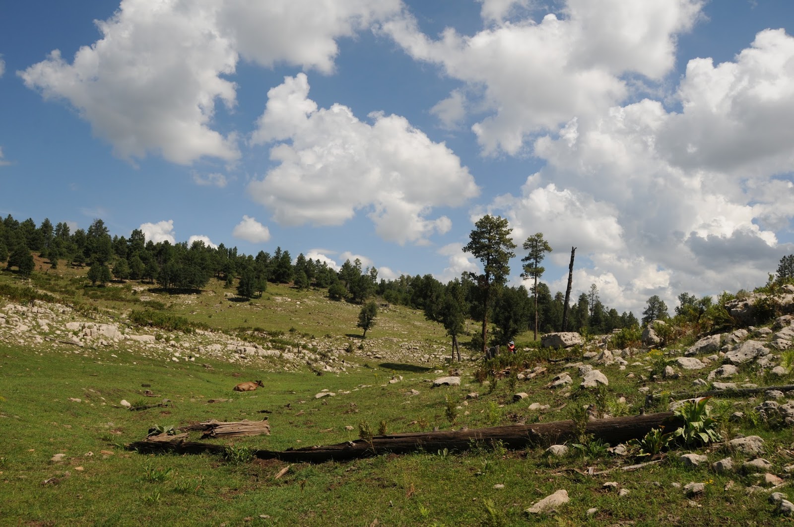
this paradise on the Mogollon Rim. Although it's shown on forest maps, there's
no official hiking trail through the shallow canyon. The route briefly follows a two-track road that merges with
footpaths and game trails before being swallowed up in organic mass leaving
trekkers to rely on creative bushwhacking to get through. The landscape diversity here is a
wonder. As the canyon winds north
from FR 613 to the Beeline Highway just south of Clint's Well, it cuts through
moist fern gullies fed by the trickling waters of Windfall Spring and elegantly
swaying thickets of oaks and locusts.
Limestone boulders strewn across a tree-barren, yawning gorge share
emerald meadows speckled with blooming wild geraniums, yarrows and clovers
where decades of snowfalls and summer rains have soothed the scars of the
wildfire that consumed the trees.
Here, the canyon comes to a fork---head right into an unscathed pine
forest and the beginning of the muddy boots portion of the hike. Spring water
and monsoon runoff settles in ribbony rivulets and tiny reflecting pools at the
base of the canyon forming a nourishing foundation for plant and animal
survival. Each footstep releases
pungent musty-earthy aromas sometimes spiked with head-clearing jolts of wild
mint. Surrounded by shoulder-high
sunflowers a canopy of whispering aspens and life giving waters underfoot,
you'll want to breath deep and become absorbed in the moment.
After roughly 1.2 miles of hiking, the first of several
natural barriers appears. This one
is a quagmire of logs and brambles choking the creek where the canyon hits a
short pinched segment. Here,
you'll need to scramble around on steep banks, which is why long pants and
sleeves are recommended for this hike.
As Dirtyneck Canyon's little-known corridor approaches AZ87, the sounds
of whizzing motors occult natural woodland murmurs. A stock tank, bovine grazing field and a flimsy span of
barbed wire separating paradise from the asphalt speedway mark the turnaround
point.
LENGTH: 2.89 miles one-way
RATING: moderate, off trail, some bushwhacking
ELEVATION:
7300' - 6850'

GETTING THERE:
From Phoenix, travel north on AZ87 to the AZ87/260 junction
in Payson. Continue north on AZ87
to FR 613 between mileposts 282 and 283 on the right. Drive on FR 613 veering left at the Fortynine Canyon sign
and past the first Dirtyneck Canyon sign you will see on the left---this is for
Dirtyneck Road. At the 1-mile
point you will see road signs for 9384Q and 6023 with a corral hidden among oak
trees about 50 years off to the left.
This is the trailhead. Park in the pullouts and begin hiking on 9384Q.
MORE PHOTOS:
No comments:
Post a Comment