Find A Trail. Start Your Search Here:

Tuesday, September 7, 2010

RANCH TRAIL

RANCH TRAIL Prescott National Forest Cavernous ravines, high-desert washes and rolling ridgelines combine for a captivating hike in the foothills of the Bradshaw mountains. Closed to motorized vehicles, the Ranch Trail #62 offers a quieter hiking experience than other shared-use routes in the district. The track rambles from ridge-to-ridge in a gently undulating rhythm through a maze of pinon pines, agaves and weather-worn boulders. The gritty earth underfoot shimmers with minerals exposed by the decaying granite that defines the area’s geology. Hovering around 6,000 feet in elevation, the trail is situated high enough above the Prescott valley to showcase fabulous views of Granite Mountain floating above the green glens that ring the town a thousand feet below. LENGTH: 6.4 miles round-trip RATING: moderate ELEVATION: 5,600 – 6,500 feet FEE: $2 daily fee per vehicle. BEST SEASONS: April - October GETTING THERE: From Phoenix, travel north on I-17 for the Cordes Junction interchange. Go west on Highway 69 toward Prescott. Just before entering town, turn left (south) onto Walker Road (Country Road 57) and continue for a half-mile to the “62” trailhead on the right. Roads are paved all the way and there’s a restroom at the trailhead. Information: fs.fed.us/r3/Prescott (928) 771-4700

WEST WEBBER CREEK

WEST WEBBER CREEK Tonto National Forest Located in the backwoods near Boy Scout Camp Geronimo beneath the Mogollon Rim, the West Webber Trail gets little publicity and few visitors. The reason for this becomes quite clear in the last two miles of the route. This hike involves connecting three trails. The circuit starts on Highline trail #31 across the road from the trailhead on the west side of Forest Road 440. After hopping shallow Webber Creek near a cluster of evergreen myrtle, follow trail #31 (marked by white diamond tree blazes) for roughly a third-of-a-mile to the junction with Geronimo trail #240 (follow the blue diamond tree blazes). From here, go right onto trail #240 and continue for 3 miles to the Turkey Springs trail junction where there’s a (usually dry) water trough and spigot. From the spring, take the left spur road and hike uphill to the signed junction for West Webber trail #228. It’s here where the hike becomes an adventure. The first half-mile hops a soggy spring seep area and is relatively easy to follow. After that, though, the path degrades into a train wreck of fallen trees, missing signposts and eroded slopes. Good route-finding skills and plenty of stamina are required to negotiate the final two-mile segment to the top of Milk Ranch Point—a promontory on top of the Rim. Those who survive the final haul to the top are rewarded with expansive vista views and hard-won bragging rights. Highlights: Seldom-seen views of the Mogollon Rim open up for those who venture onto this rugged, steep trail in the pines. LENGTH: 10.5 miles round-trip RATING: moderate (difficult in the last 2 miles) ELEVATION: 5,780’ – 7,300’ BEST SEASONS: March - November DISTANCE FROM PHOENIX: 115 miles one-way GETTING THERE: From Payson, go north on Highway 87 to Forest Road 64 (Control Road). Go right (east) on FR 64 and continue for 6 miles to Forest Road 440 (Webber Creek Road). Go left (north) on FR 440 and continue 2 miles to the Geronimo trailhead on the right. Information: (602) 225-5200 or fs.fed.us/r3/tonto

Thursday, September 2, 2010

FALL HIKING SEASON!

FALL HIKING SEASON! Ahh, September. There’s already a nip in the air in Arizona’s high country and that means fall color is just a few weeks away. Because of our state’s multifarious landscape, “autumn” conditions begin in the high elevations in late September and trickle down into the deserts through December. So whether you’re in the mood for aspens, oaks or sycamores, we have a wide window of opportunity for viewing fall foliage. FIND YOUR HIKE: Click on the "fall color" link in this blog's Trail Index bar. This will bring up 80+ trails with lots of colorful foliage. EVEN MORE FALL HIKES: pick up a copy of the October 2010 issue of PHOENIX magazine for 4 more great fall hikes---not found on this blog!! On newsstands September 23. INFORMATION: For weekly reports, call the Forest Service Fall Color Hotline, 1-800-354-4595 or visit: http://www.fs.fed.us/r3/recreation/fall-colors/fall.shtml

Tuesday, August 10, 2010

PHOENIX CITY PARKS ACCESS FEES

GET READY TO OPEN YOUR WALLET (AGAIN)! CITY OF PHOENIX PARKS & RECREATION BOARD APPROVES NEW PARKING FEE PROGRAM Budget shortfalls, layoffs, tanking stocks, earthquakes, floods, fires, plague---now this. Set to roll out in “early fall” 2010, a new City of Phoenix fee program will require visitors at five gated parking areas in South Mountain Park and Phoenix Mountains Preserve to purchase parking passes. Whoa---whoa---let’s keep our whining to a minimum, because the fees will only apply to the busiest and most congested access points, where heavy traffic results in higher maintenance costs. The fees will go toward supporting city parks & recreation programs, keeping access open and affordable and, of course, cleaning up after sloppy dummyheads and their beer cans. Soon, park rangers will begin hosting “meet & greet” events to communicate these changes. Until then---- HERE’S WHAT YOU NEED TO KNOW: WHEN: begins in early fall 2010 WHICH LOCATIONS WILL REQUIRE THE FEE: Although more than 30 access/parking areas will remain FREE, the 5 most popular locations will require a fee to park. They are: Pima Canyon, Echo Canyon-Camelback Mountain, Piestewa Peak, Dreamy Draw, North Mountain COST: annual pass: $75, 6-month pass: $50, daily pass: $2 WHERE TO PURCHASE: pass will be available online and at City of Phoenix recreation and community centers. The city has plans to install self-pay kiosks in future. WHAT HAPPENS IF YOU DON'T PAY UP?: for the first few introductory months, nothing---after that though, you may be fined. INFORMATION: http://phoenix.gov/PRL/passupdate.html

Thursday, August 5, 2010

WEST FORK of the BLACK RIVER

WEST FORK of the BLACK RIVER Apache-Sitgreaves National Forest UPDATE: this trail was damaged by the WALLOW FIRE, June 8, 2011. Check with the forest service for updates.  The Black River snakes downhill from its headwaters in the White Mountains near the Arizona-New Mexico state line to its confluence with the Upper Salt River near Fort Apache. During its 90-mile course, the river runs through mostly remote and inaccessible terrain. Yet, West Fork Trail #628, which parallels one of its most scenic tributaries, is easy to find and gives a good sense of the river's life-giving power. The trail is mostly flat and follows a simple path above the rugged volcanic walls of the river canyon. Breathtaking views of massive basalt rock-falls and expansive prairies will have you reaching for your camera every few yards as the trails moves closer to the rim above the river gorge. Known as a great place to spot elk, you’ll need to hit the trail at dawn or dusk for the best chance to see these amazing vegetarians emerge from the cover of sub-alpine forests. In summer, the Wapiti (elk) seldom venture more than a half-mile from water and can usually be seen foraging along the banks of the West Fork of the Black River in the twilight hours. LENGTH: 5 miles round-trip RATING: moderate ELEVATION: 8,870 – 8,500 feet BEST SEASONS: April - November GETTING THERE: From downtown Eagar, go west on Highway 260 for 2.8 miles to the Highway 261 junction. Go left (south) on Hwy 261 and continue for 16.3 miles to Highway 273. Turn left and go roughly 3 miles to Forest Road 249E. Turn right and follow FR249E 2 miles to Forest Road 68. Take FR 68 another mile to the trailhead on the side of the road. ALTERNATE ACCESS: See Thompson Trail blog entry. INFORMATION: Springerville Ranger Station, 928-333-4372, fs.fed.us/r3/asnf

Wednesday, August 4, 2010

ARIZONA WILDFIRE INFORMATION

ARIZONA WILDFIRE INFORMATION Summer hiking in Arizona often involves finding a trail that's NOT ON FIRE! This is the bane of my existence from June through October. Keeping up with the annual onslaught of forest fires can be a challenge--that's where your smart phone or computer can come in really handy. The following Web sites provide information on current wildfires AND some even let you link to news feeds via e-mail, Twitter and Facebook. Seriously, these services have saved me countless hours of driving. Imagine heading up to the high country in anticipation of a fun day on the trails only to have your plans thwarted by fire. No. Fun. Also, these feeds provide valuable information about prescribed burns--so you won't panic unnecessarily. InciWeb (Incident Information System): http://www.inciweb.org/state/3/ Coconino NF: http://www.fs.fed.us/r3/coconino/fire/index.shtml Tonto NF: http://www.fs.fed.us/r3/tonto/fire/ Apache-Sitgreaves NF: http://www.fs.fed.us/r3/asnf/fire/ Arizona Interagency Wildfire Prevention: http://azsf.az.gov/fire_information/

Monday, August 2, 2010

ARIZONA GEOLOGICAL SURVEY

For all you hikers who appreciate and enjoy learning about Arizona's amazing geology---check out the Arizona Geological Survey's online newsletter. The latest issue features a very cool "Photo Tour of the Verde River" as well as articles about AZ earthquakes and new findings about the origins of the Grand Canyon. If you've ever wondered about the land underfoot and on the horizon while hiking, the AZGS is a great source. Here's the link: http://www.azgs.az.gov/arizona_geology/summer10/arizonageology.html

FIRST WATER CREEK OVERLOOK

FIRST WATER CREEK OVERLOOK Superstition Wilderness Whatever you do, don’t be deterrered by the ugly electrical tower in a dirt turnoff along State Route 88, which serves as the trailhead for this hike. In fact, if you didn’t know what you’re looking for, you’d fly right by this austere landmark. But, for those in the know, it marks the start of a pleasant amble to a breezy cliff overlooking Canyon Lake and the stunning beauty of the lava-borne canyon of First Water Creek. Slightly rocky, but not to difficult to follow, the informal footpath winds among huge boulders and wind-swept desert plants for a short but memorable leg-stretch for those on their way to or from Tortilla Flat or Canyon Lake. LENGTH: 1 mile roundtrip RATING: easy ELEVATION: 2,038-1,858 feet BEST SEASONS: October - April GETTING THERE: From Phoenix, travel east on US 60 to the Idaho Road/SR 88 exit. Follow SR88 north roughly 12 miles to a dirt pull out between mileposts 207 and 208 and park near the electrical tower that bears a hand-painted #174.

Tuesday, July 27, 2010

HART PRAIRIE PRESERVE

HART PRAIRIE PRESERVE The Nature Conservancy, Flagstaff Before the arrival of European settlers on the western slopes of Flagstaff’s San Francisco Mountain, Hart Prairie was a healthy patchwork of meadows, willow-cluttered wetlands, rings of aspens and a smattering of pines where regular low-intensity natural fires and a community of top-tier predators helped keep the ecological balance in check. Over the past hundred years, the effects of altered hydrolics, fire suppression, and the introduction of invasive plants and non-indigenous animals have transformed the landscape. In 1994, 245 acres of Hart Prairie along with an historic lodge and guest cabins were donated to The Nature Conservancy. Since then, the organization has set out to restore the alpine meadows to their former natural state through creative collaboration with the forest service, local landowners and other conservation groups. This ambitious restoration project is a work-in-progress and is open to visitors only by guided nature walks offered every Sunday from June 13th to October 10th (except September 12th). The walks are easy, last roughly 90-minutes and cover topics such as topography, willow biology, and wet meadow dynamics. LENGTH: variable, but about a mile RATING: easy & educational ELEVATION: 8,500 feet BEST SEASONS: June - October GETTING THERE: Tour groups meet at 10:00 a.m. sharp at the Fort Valley Plaza Shopping Center, 1000 N. Humphreys St. at the southwest corner by the guardrail. Reservations are not required. Participants must wear sturdy shoes and bring sun protection, rain gear and plenty of water. No pets or food are allowed in the preserve. Fees: Tours are free, however, donations are appreciated. INFORMATION: http://www.nature.org/wherewework/northamerica/states/arizona/preserves/art15233.html (928) 774-8892 or e-mail hartprairie@tnc.org.

KACHINA TRAIL

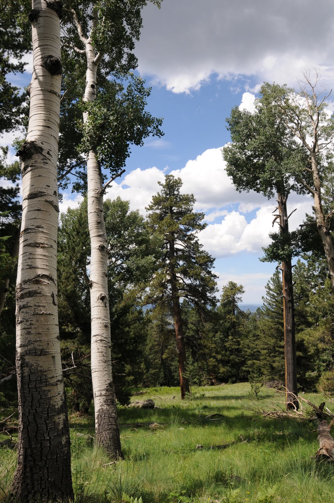
KACHINA TRAIL Kachina Peaks Wilderness The mountains of Flagstaff are known to create their own weather. In summer, that means it rains almost every day around the peaks--spiking the air over the Kachina Trail with an earthy-sweet dampness. Benefiting from its auspicious location on the windward side of the mountain, this trail sprouts green in rainforest proportions. Aspen clusters mimic white out conditions and hip-deep swaths of frothy ferns tumble over the slopes in vivid emerald waves. Add to this already amazing hike--a cozy lava cave, terrific views and fields of lupines growing in manic abundance and it’s easy to understand why this hike ranks as one of Arizona’s best. HIGHLIGHTS: Sun-drenched alpine meadows, musty pine forests and interesting geology LENGTH: 10 miles roundtrip ELEVATION: 8,600-9,500 feet BEST SEASONS: April - October RATING: moderate DISTANCE FROM PHOENIX: 155 miles one-way GETTING THERE: From Flagstaff, go 7.3 miles north on US 180 to Snow Bowl Road (Forest Road 516). Drive 6.6 miles up  FR 516 to the signed turnoff for the large parking lot and trailhead on the right. INFORMATION: Peaks Ranger District, (928) 526-0866, http://www.fs.fed.us/r3/coconino/recreation/peaks/kachina-tr.shtml

Friday, July 23, 2010

WEATHERFORD TRAIL

WEATHERFORD TRAIL Coconino National Forest Although it’s a long and difficult trek, breathtaking scenery and ever-changing eco-systems mitigate the physical pain of taking on this quintessential mountain trail. In less than nine miles, hikers are treated to a stunning journey that begins in grassy glens and ends abruptly on barren tundra beneath Arizona’s highest peaks. From dewy thistles in green alpine meadows to hardy bristlecone pines clinging to bare volcanic scree---this tough route showcases the complexity of nature on San Francisco Mountain. HIGHLIGHTS: high altitude forests, alpine meadows and Arizona’s only tundra environment LENGTH: 12 miles roundtrip (to Doyle saddle) 16.5 miles roundtrip (to Fremont saddle) 17.5 miles roundtrip (to Humphreys Peak) ELEVATION: 8,800 – 10,700 feet (11,350 to Humphreys junction, 12,633 to summit) RATING: difficult BEST SEASONS: April - October DISTANCE FROM PHOENIX: 155 miles one-way GETTING THERE: From Flagstaff, go north on US 180 to Schultz Pass Road (Forest Road 420). A HIGH CLEARANCE VEHICLE IS REQUIRED ON FR 420. Turn left and continue 6 miles to the Schultz Tank trailhead. INFORMATION: Peaks Ranger District (928) 526-0866,  http://www.fs.fed.us/r3/coconino/recreation/peaks/weatherford-tr.shtml

WATERSHED TRAIL

WATERSHED TRAIL Prescott National Forest Melding the sweet-scented breezes of pine forests with sunny hillsides blanketed in agaves, manzanitas and cactus, a hike along Prescott’s Watershed Trail #299 is a trip through an ecological transition zone. The trail itself is a mash-up of wide old roads, groomed paths and eroded walkways---enhancing the hybrid flavor of the hike. At roughly the half-mile point, look for Deer Lick Spring, a concrete trough situated in a gully off to the right. Here, seeping water fosters an incredibly lush green zone shaded by tall Ponderosa pines flanked by beaver tail cactus bursting from rock outcroppings. Over its wavy route, the trail dips into ravines dotted with log homes and crosses high ridges for excellent views of Prescott area landmarks including Goldwater Lake and the distinctive stony peaks of Granite Mountain and Thumb Butte. LENGTH: 8.6 miles round trip RATING: easy-moderate DOG RATING: 2 paws ELEVATION: 6,200-6,900 feet BEST SEASONS: March - November DISTANCE FROM PHOENIX: 117 miles one-way GETTING THERE: From downtown Prescott, go east on Gurley Street 0.3 miles to Mt. Vernon Avenue. Turn south (left) on Mt. Vernon for 4.1 miles as it turns into Senator Highway. The Watershed #299 trailhead is on the east (left) side. INFORMATION: Bradshaw Ranger District 928-771-4700, http://www.fs.fed.us/r3/prescott/recreation/trails/pdf/rec_trai_b_watr299.pdf

BIXLER SADDLE

BIXLER SADDLE Kaibab National Forest Short and scenic, this trail offers an alternative to the more challenging trails on Bill Williams Mountain. Climbing the west slope of the hill, this nicely-wooded hike features lovely views of the expansive prairies of northwestern Arizona. HIGHLIGHTS: interesting rock formations, views, ample shade LENGTH: 4 miles roundtrip ELEVATION: 7,700 – 8,740 feet RATING: moderate BEST SEASONS: April - October DRIVING DISTANCE FROM PHOENIX: 185 miles one-way GETTING THERE: From Flagstaff, go west on I-40 to the Devil Dog interchange (exit 157). Go south on Forest Road 108 for 1 mile and turn left (east) Forest Road 45. Continue 2 miles on FR 45 to the trailhead. INFORMATION: Williams Ranger District (928) 635-5600,
MAP: http://www.fs.usda.gov/Internet/FSE_DOCUMENTS/stelprdb5189842.pdf

BILL WILLIAMS MOUNTAIN TRAIL

BILL WILLIAMS MOUNTAIN TRAIL Kaibab National Forest Switchbacks are zig-zagging cuts in mountain trails designed to make steep ascents easier by adding miles and tempering vertical slopes. Don’t look for them on Bill Williams Mountain Trail #21. Constructed as a horse trail in 1902 to service the fire tower on the summit, this trail wastes no time on switchbacks, plowing straight up in abrupt, heart-pumping style. Most of the route is canyon-bound and thick with trees, vines and flowering shrubs. Views are sparse until the trail emerges on a ridgeline below the summit where fir trees and aspens embellish breathtaking vistas. HIGHLIGHTS: shady, steep route to a mountain summit LENGTH: 8 miles roundtrip ELEVATION: 6,900 – 9,256 feet RATING: moderate BEST SEASONS: April - October DISTANCE FROM PHOENIX: 185 miles GETTING THERE: From Flagstaff, go 30 miles west on I-40 to exit 161, go south on Railroad Ave. and follow the signs to Williams District Ranger Station and the trailhead. INFORMATION: Williams Ranger District (928) 635-5600, MAP: http://www.fs.usda.gov/Internet/FSE_DOCUMENTS/stelprdb5189840.pdf