Find A Trail. Start Your Search Here:

Friday, January 6, 2023

Javelina Summit Trail

JAVELINA SUMMIT TRAIL

Brittlebush colors the Tortuga Trail


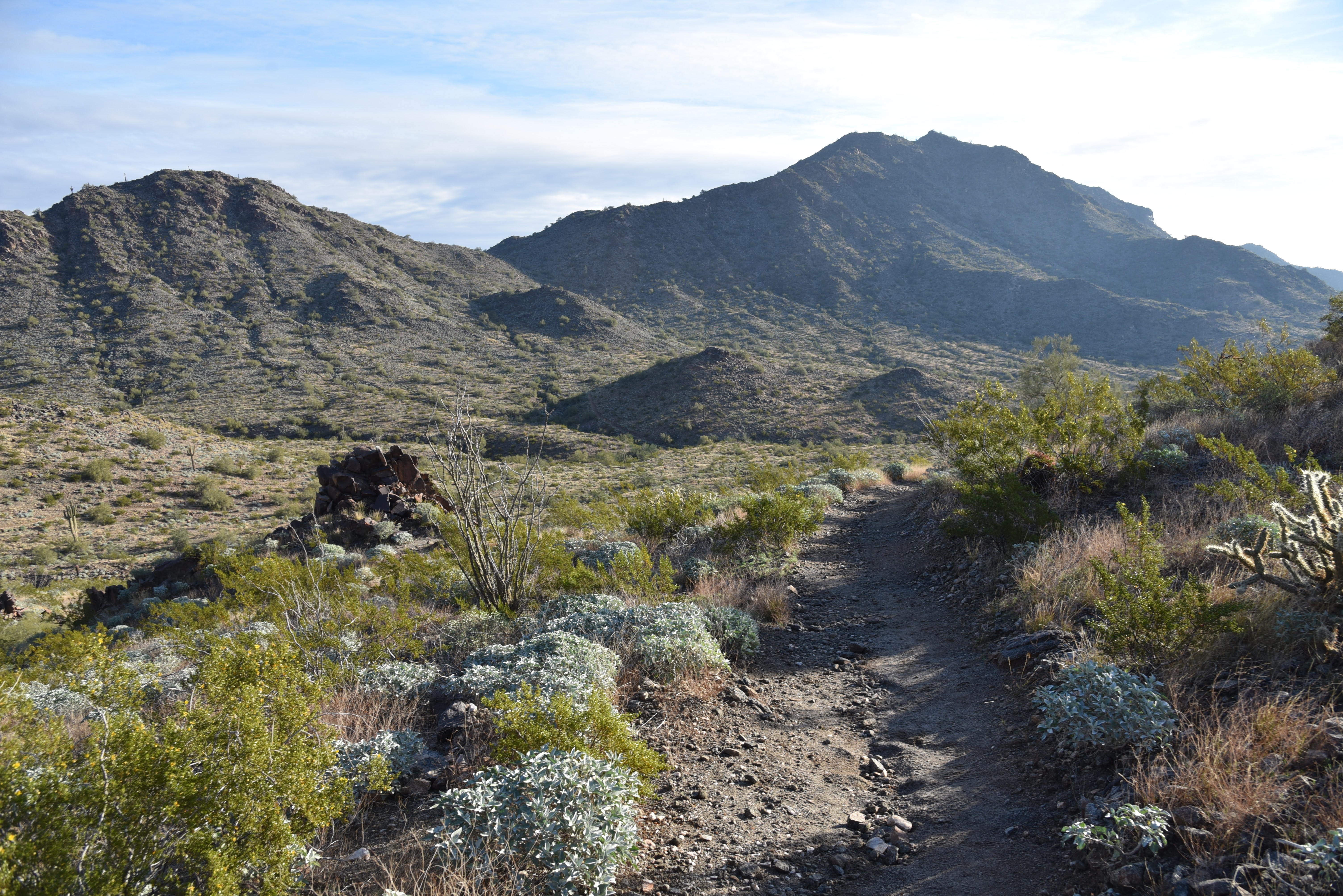
One of four difficult-rated summit hikes in the Skyline Regional Park in Buckeye, the Javelina Summit doesn’t scrimp on thrills.  The 0.9-mile-long trail spools off connecting routes in the park’s far east end. 

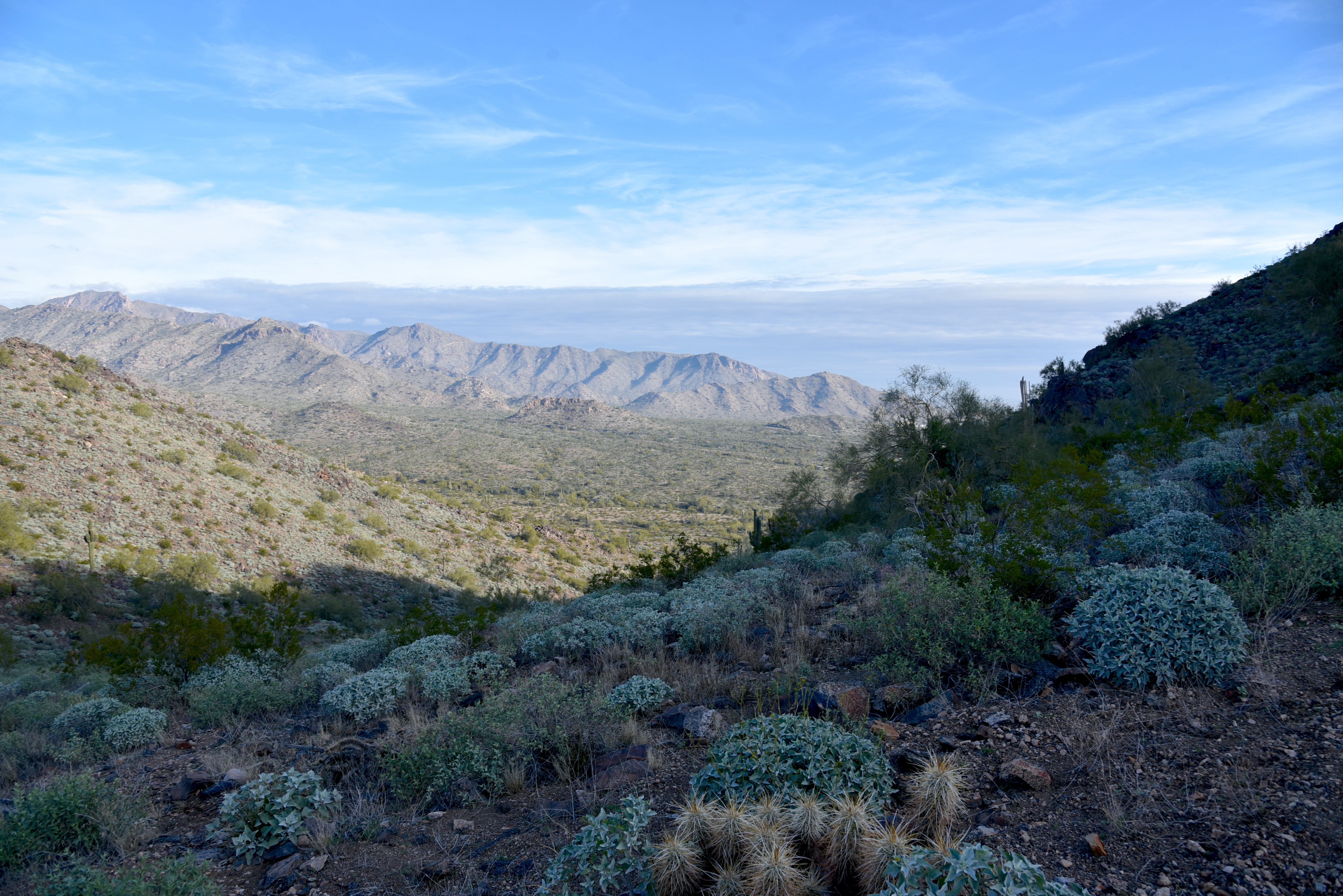
View from the Javelina Summit Trail

While it’s “just” a 745-foot climb from trail base to summit, that accounts for less than half the story.
Javelina Summit (right) viewed from Tortuga Trail

Getting to the 2,200-foot mountain highpoint involves using three trails and logging over 1,700 feet of accumulated elevation change.
Hike begins on tehe Quartz Mine Trail

The rollercoaster-style trek starts from the main trailhead area with a 1.6-mile hike on the Quartz Mine Trail. About a half mile in, first peeks at the destination loom on the horizon. The prominent ridgeline rising over foothills and valleys looks imposing. And irresistible!
Beginning of the Javelina Summit Trail

The undulating path winds through washes and slopes below ragged ridges and stone outcroppings before making an ascent to a saddle where the Tortuga Trail spins off to the east.
Brittlebush are plentiful in Skyline Regional Park

The Tortuga Trail leg of the hike takes back much of the elevation gained with a smooth downhill on long lazy switchbacks. At the half-mile point, the route encounters its final segment, the 0.9-mile Javelina Summit Trail.
View of the White Tank Mountains

It's here where the real work begins. While the lower quarter mile feels just moderate and has a few level bends, the climbing becomes an unrelenting uphill haul with loose rock and a fair amount of exposure. The trail is well engineered but still very steep and precipitous as it clamors along a knife-edge sharp, rocky backbone. Persistence and careful footwork pay off on the tiny summit.

Rock outcropping on Tortuga Trail


Javelina Summit Trail is steep and edgy.

The airy pinnacle displays 360-degree vistas of the southern White Tank Mountains, the distant profile of Downtown Phoenix, the Sierra Estrella Mountains and sprawling desert plains.

LENGTH: 5.8 miles round trip (out and back hike)

RATING: difficult

ELEVATION: 1,312 – 2,200 feet (over 1,700 feet of accumulated elevation change)

GETTING THERE:

Skyline Regional Park, 2600 N. Watson Road, Buckeye.

From Interstate 10 in Buckeye, take the Watson Road exit 117 and go 2 miles north to the park. Roads are paved.

HOURS: Sunrise to sunset daily

DAY USE FEE: none

FACILITIES: restrooms, picnic ramadas, camping

INFO:

Skyline Regional Park

https://www.buckeyeaz.gov/community/skyline-regional-park

Wednesday, January 4, 2023

Second Water Trail

SECOND WATER TRAIL

Mountain vistas on Second Water Trail


Garden Valley, on the western edge of the 160,200-acre Superstition Wilderness, is one of those places that sears vivid images into the memories of those who trek through it. 

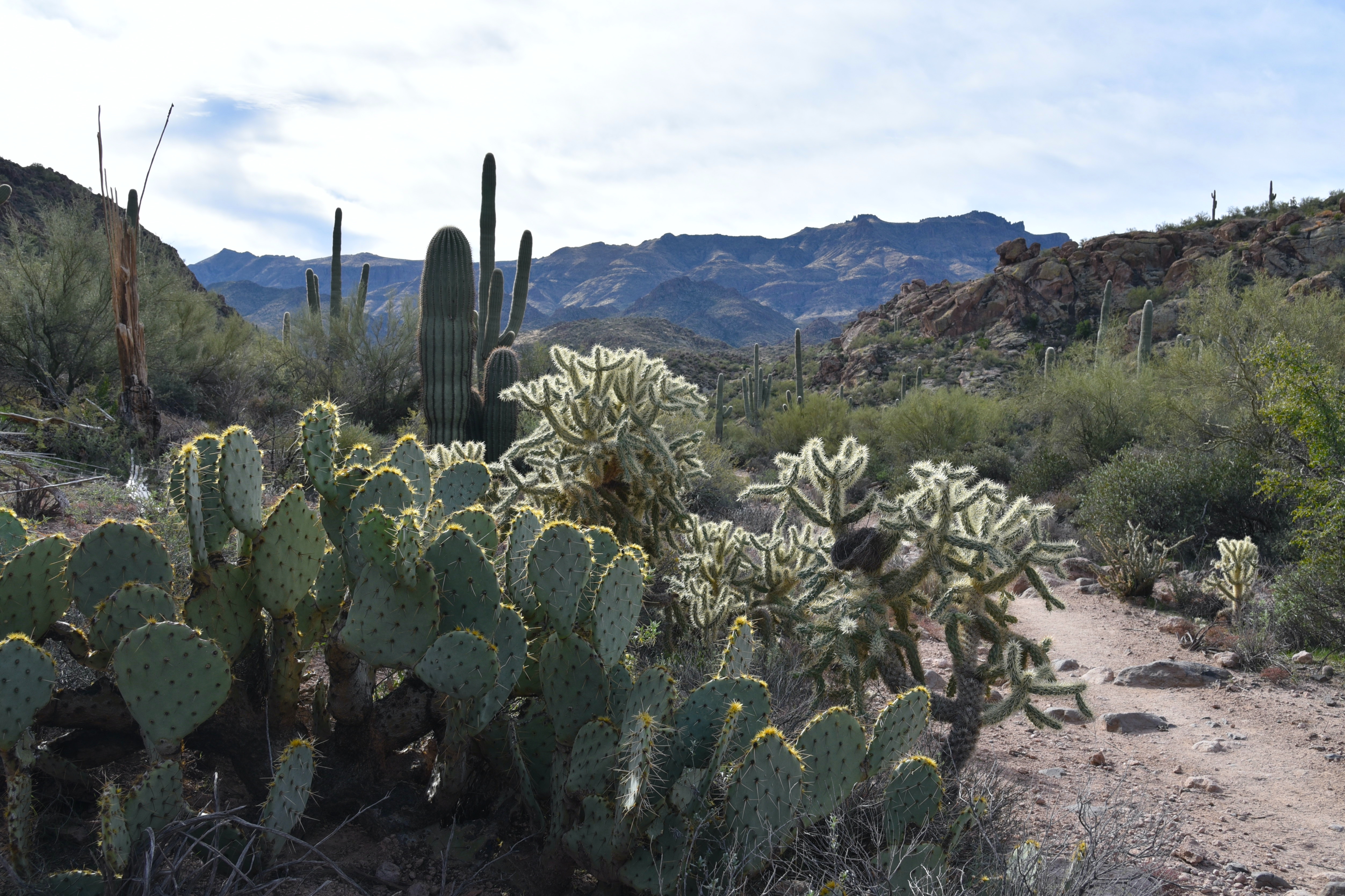
Chain fruit cholla in Garden Valley

Rife with otherworldly scenes of desert life in an environment sculpted out of ancient volcanic ash, the area’s story arc spools out from violent origins, cataclysmic geological events, erosion and resurgence.

Globemallow bloom year-round in Garden Valley

Between 25 and 15 million years ago the craggy backcountry was a roiling cauldron of molten rock and white-hot ash that eventually collapsed on itself forming a series of depressions called calderas.  The grand scale “super-volcano” activity was like what’s incubating beneath Yellowstone National Park right now.

Flatiron (center left) seen from Second Water Trail

Ringed by mesas, mountain ranges and bizarre pillars and piles of solidified ash or “welded tuff”, the yawning basins have settled into a quiet old age marked by a slow-motion epoch of falling apart.

Four Peaks viewed from Second Water Trail

 The Second Water Trail offers an approachable option for exploring this haunting hinterland of rugged terrain and mysterious tales of hidden gold caches and lost souls.
Lush desert plants on Second Water Trail

Beginning at the First Water trailhead that’s located roughly 45 miles from Downtown Phoenix near Apache Junction, Trail No. 236 is accessed by following the Dutchmans Trail 0.3-mile to the first signed junction.
Hackberry Mesa (left) rises over Second Water Trail

Twisting over slickrock and sections of crumbling stone, the trail bends northeast, flanking scoured gorges above the course of First Water Creek.
Petrified volcanic ash in First Water Creek

 
Recent wildfire damage has left spots of charred cholla and scarred saguaros, but expansive views of the Goldfield Mountains, Superstition ridgeline, the Flatiron and iconic Weaver’s Needle remain as breathtaking as ever.
White bladderpod blooms Jan - May

 
The trail swings by the junctions for Black Mesa and Hackberry Spring trails which may be used to build longer loop hikes.
Rugged terrain along Second Water Trail

Second Water trail continues through a series of rocky uphill segments that land hikers in the heart of Garden Valley—a sprawling flatland dominated by chain fruit cholla, prickly pear cacti, jojoba, mesquite, hackberry shrubs and fields of wildflowers.
Desert vegetation in Garden Valley

Superstition Ridgeline on the horizon

This once botanically lush plateau took a major wildfire hit, but many survivor specimens and green sprouts pushing out from deadwood hint at recovery.
Weaver's Needle stands out over Second Water Trail

Here, the massive forms of Hackberry Mesa, Four Peaks and the mountains around Canyon Lake to the north begin to stand out on the horizon. Plant life grows more robust as the route starts a spiral down into a reedy, damp gorge where it intersects the Boulder Canyon Trail, the turnaround point for the hike.

Jojoba shrubs and saguaros on Second Water Trail

A major geological upheaval notwithstanding, the slow-burn erosion and superficial smudges incurred regularly on the Second Water Trail are barely perceivable over a single human lifetime.
A rocky ascent on Second Water Trail


Fires, rock falls, flood displacements and seasonal transitions are like costume changes in a long-running show with ear worm tunes that hijack the mind but somehow never get old.

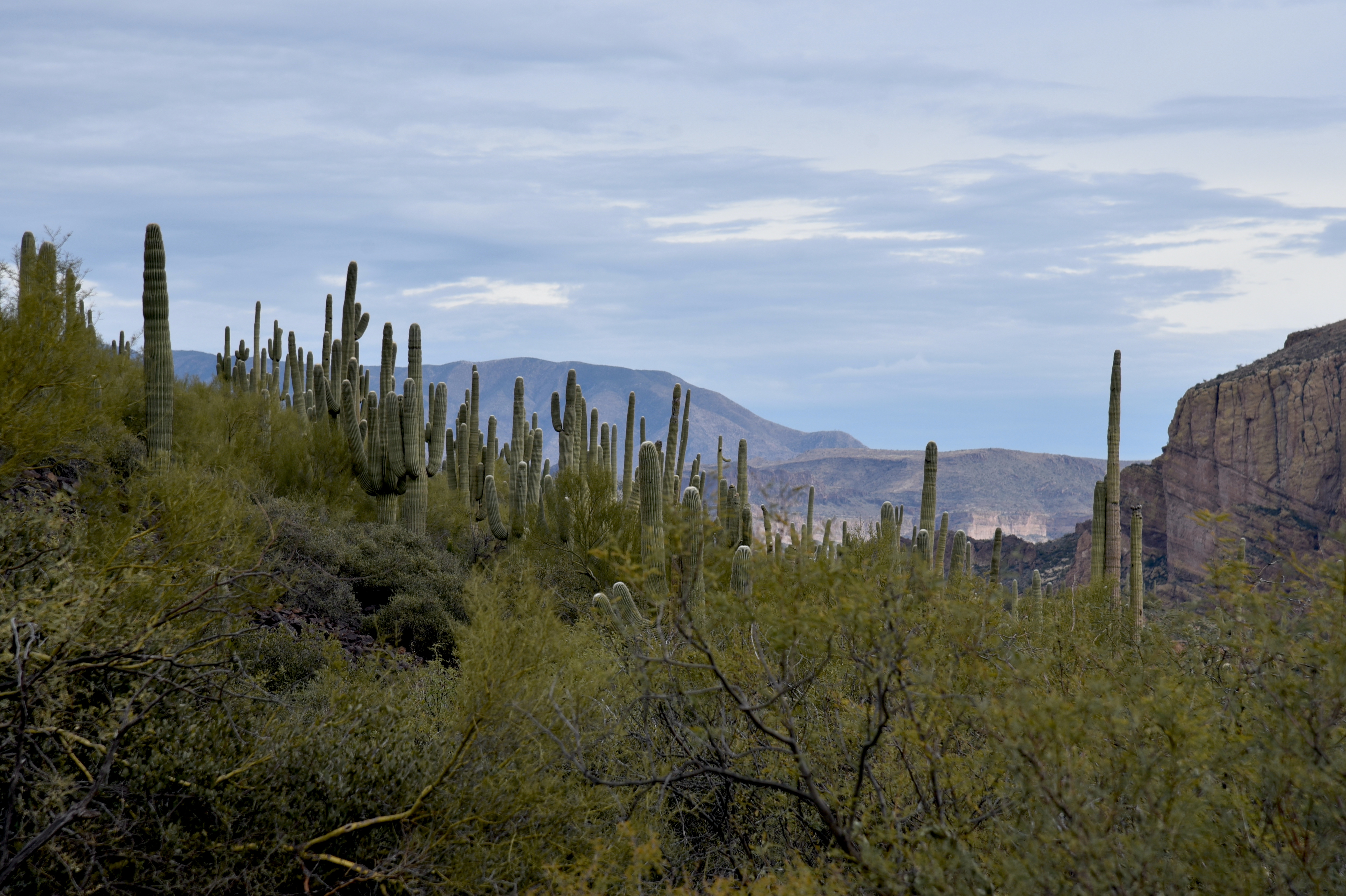
Saguaros clutter a ridge above Boulder Canyon

LENGTH: 7 miles round-trip (out-and-back hike)
RATING: Easy-Moderate
ELEVATION: 1,940 to 2,420 feet (878 feet of accumulated elevation change)

GETTING THERE:

From Phoenix, go east on US 60 to exit 196 for Idaho Road (State Route 88). Turn left and follow Idaho to SR88, turn right and continue to First Water Road (Forest Road 78), which is located about a half mile past the entrance to Lost Dutchman State Park (between mileposts 201 and 202) and is signed for First Water Trailhead. Turn right and go 2.6 miles to the trailhead. Forest Road 78 is maintained dirt with some potholes and washboard sections passable by carefully driven sedan.

INFO: Mesa Ranger District, Tonto National Forest

https://www.fs.usda.gov/recarea/tonto/recarea/?recid=35525


Tuesday, December 27, 2022

Pyramid Circuit

PYRAMID CIRCUIT

A juniper tree on Pyramid-Scorpion Loop

Prominent in the landscape and aptly named, the  4,498-foot conical sandstone formation known as the Pyramid serves as a focal point for the Carrol Canyon Area Trails on the west side of Sedona.

Route circles the Pyramid rock formation

Located south of State Route 89A and north of Oak Creek the iconic landform can be explored using a short loop circuit with options to add length and challenge by linking up with connecting trails.

A tight passage on Pyramid-Scorpion Loop

Access to the loop hike in the deeply incised, conifer-flecked pocket of Coconino National Forest starts at the Pyramid trailhead which is just a no-frills dirt pullout along Upper Red Rock Loop. The spartan trailhead sets the mood for a quiet, remote-feeling trek with alternative peeks at some of Sedona’s most familiar land features.

Pyramid trailhead sign post

Decision making begins right out of the gate, where, after a few yards, the access path splits into two trails that make up the 2.2-mile Pyramid-Scorpion Loop. Either direction works but  taking the south Pyramid leg gets the heavy lifting out of the way early. The 1.2-mile leg traces the base of the eponymous stone edifice on an uneven, boulder-strewn singletrack. 
Munds Mountain seen from Pyramid Trail

Without signs to guide most of the way, the route is sketchy and somewhat difficult to follow where is crosses slick rock and drainages. In those head-scratcher spots, hikers can maintain their bearings by paying attention to branches placed to block false starts and by looking ahead to scope out where the obvious trail picks up. Patience and observation skills will solve the conundrums.  Rife with tight bends and edgy drop offs, the Pyramid leg of the loop unpacks views of Cathedral Rock, Munds Mountain, Oak Creek, and the towering mound of Capitol Butte also known as Thunder Mountain.  At the Scorpion Trail junction, the loop may be tied up by heading right and trudging just under a mile on the return leg back to the start point.
Extend the hike on Scheurman Mountain Trail

But to add length and some truly majestic views, save the return segment for the end and instead, keep going north on the Scorpion Trail. 
View from Scheurman Mountain Vista

This 1.1-mile segment teethers on the lip of a shallow canyon beneath Scheurman Mountain with the sinuous course of Upper Red Rock Loop below. The trail makes a gradual ascent adding views of the Bradshaw Mountains, Airport Mesa, and the Cockscomb formation. Near the top of the climb, the route connects with the Scheurman Mountain and Vista trails.  Signs point the way to the scenic vista tat teeters over a stunning a red rock landscape.
Bradshaw Mountains seen from Scheurman Mountain

The vista makes for a good turnaround point but forest maps show many ways to customize an even longer trek.  

LENGTH:

Pyramid-Scorpion Loop: 2.2 miles

Pyramid-Scorpion Loop with Scheurman Mountain Vista: 6 miles round trip

RATING: moderate -difficult

ELEVATION:

Loop: 4,050 – 4,475 feet

Loop + Vista: 4,060 – 4,815 feet

GETTING THERE:

Pyramid trailhead:

From the State Route 179/89A traffic circle in Sedona, go 4 miles west (toward Cottonwood) on SR 89A to Upper Red Rock Loop. Turn left and continue 1.8 miles to the Chavez Ranch Road (Forest Road 216A) junction. The trailhead is on the right. There are no facilities at the trailhead. 

Monday, December 19, 2022

Peralta Regional Park Preview

PERALTA REGIONAL PARK

Trail users spoke. Park developers listened.

Peralta Regional Park will open Jan. 12, 2023

The footprint of Peralta Regional Park isn’t visible from the access road. That was the idea.

The master plan for the Pinal County Park that’s scheduled to open to the public on January 12, 2023, leaned heavily into stakeholder input that advocated for a minimally disruptive footprint and preservation of the natural landscape.

Park is located just outside Tonto National Forest

“The less development, the better,” says Kent Taylor, Director Pinal County Open Space and Trails of input received from stakeholders.
Kent Taylor, Director Pinal County Open Space and Trails

Pre-construction feedback from government agencies, and trail users like bikers, hikers, and equestrians, helped ensure that park planners thought of everything.

“A couple of things that we never considered came out of our conversations with stakeholders,” Taylor said. “First was an idea for stargazing which we incorporated into the plans with a trail and stargazing node.

Trail to the Stargazing Node

Second, the potential for rock climbing came up and that will be addressed in the park’s future phase two planning.”

The park offers a primitive, pristine and safe outdoor experience.

Occupying a natural pocket of Upper Sonoran Desert at the edge of the Superstition Mountains and Tonto National Forest a few miles north of U.S. 60 near Gold Canyon, the site is a unique outdoor recreation hub that straddles the gap between an amenity-rich park and bare bones backcountry experience.

A drive-up tent camping site

Roads are dirt and picnic, and camping sites are simple and designed with profiles and colors that blend into the landscape.  There’s no electricity or water.
Hike-in backpacking campsites are bare bones.

“The park is 500-acres, but only 22 acres were disturbed for construction,” Taylor said. “We used existing dirt roads where possible and didn’t want to over develop.”  Extra care was taken to preserve the native vegetation and soils as well. “We harvested 100 saguaros during construction. Eighty of those were replanted in the park and another 20 were given to Tonto National Forest to use in forest restoration projects. Disturbed ground was restored and planted with native seeds."

It's located near popular recreation hubs.

While the park is new, the surrounding desert has long been a popular destination for outdoor recreation. The park sits just a few clicks down Peralta Road (Forest Road 77) from the Lost Goldmine Trail, Carney Springs Trailhead, and the Peralta trailhead--a busy jumping off point for the Peralta Canyon, Dutchmans and Bluff Spring trails in the Superstition Wilderness.

Stargazing node, under construction on Dec. 16.


It’s not glamping (No glamorous hot showers here, kids.)

Camping in the park embraces the low-impact theme. “Glamping” it’s not. There are no RV accommodations or cabins. Only tents are allowed.  There are two types of tent camping opportunities to appeal to those in search of an authentic roughin’ it style experience with the comfort of being within a managed space with a nearby site host and rangers in case of an emergency.  The choices are simple or primitive. Traditional “car camping” sites are drive-up clearings with a picnic table and fire pit.  Hike-in backpacking sites are accessed from non-motorized trails and are no more than small clearings where pack-hanger posts are the only luxury afforded.  Neither have electricity, water, or trash service so campers must pack in what they need and pack out all waste.

The Desperado Trail in Peralta Regional Park

All camp and picnic sites have easy access to 9 miles of non-motorized trails and a quarter-mile barrier-free interpretive walking path. “Even in a compact space we were able to build trails with good diversity from easy to difficult.” Taylor says.

Except for the Desperado and North Star Trails, which have some difficult sections, park trails are rated moderate and link up nicely for creating loop options.

Barrier-free interpretive trail has educational signs

The stargazing node will be a big draw.

The park’s shiny penny is its stargazing node. Equal parts vortex, sanctuary and educational launch pad, the tiny gathering place is tucked into a natural bowl-like amphitheater with big sky views.  The science-centered node features a circular siting area with directional posts and room for telescopes.

The park was built with minimal environmental disruption

A short trail leads to the cliff-bound site that flanks a tree-cluttered wash. It’s a beautiful little spot that oozes as much spirituality as it does science.  
Picnic ramadas are designed to blend into the landscape

While it's not yet designated an official International Dark-Sky Association location, certification work is on the agenda. Taylor, who has camped out in the area, says nights here are free of light pollution and extraneous sound. So stars, planets and galaxies will be  really pop against the inky darkness.  

 “We anticipate a lot of interest in night sky viewing here as well as requests for weddings, which can be arranged by permit.”

Celestial events will shine at the Stargazing Node

When asked if there’s going to be a prize for the first person to site a UFO, Taylor laughed.

“We hadn’t thought of that.”

Park map


KEY PARK FEATURES:

• 9 miles of non-motorized trails that range in difficulty from barrier-free to challenging.

• Stargazing

• Car and tent camping sites

• Picnic ramadas

• Interpretive trail

• Equestrian staging area

• Waterless restrooms

PARK HOURS: dawn to 10 p.m. daily for day-use

FEES:

Day-use:  $7 daily. Pay in advance online, or at park entrance by scanning a QR code or with exact change at the self-serve kiosk.

Camping & Picnicing:

Camping and picnic sites are first-come-first served but may also be reserved online.

Camping reservations: $10 per night

Picnic ramada reservations: $10 per day or $35 for group ramadas.

GETTING THERE:

From U.S. 60 in Gold Canyon, turn left at the Peralta Road (Forest Road 77) stoplight and Peralta Trailhead sign just past milepost 204.  Follow Peralta Road 5 miles to the park entrance on the right. Peralta Road is maintained dirt suitable for all vehicles.

INFO:

Peralta Regional Park

https://www.pinal.gov/1204/Peralta-Regional-Park

International Dark-Sky Association

https://www.darksky.org/


Monday, November 28, 2022

Black Canyon Trail: Copper Mountain Segment

BLACK CANYON NATIONAL RECREATION TRAIL: COPPER MOUNTAIN SEGMENT

Ubiquitous yet largely invisible to the casual hiker, barn swallows play an interesting game of hide-and-seek with those who wander through their habitats.

Cattle graze near the Black Canyon Trail

The migratory species feeds in mid-air, capturing insects (they love flies, which explains their name) in acrobatic swoops over open terrain, rangeland and farms. 

Barn swallow nests in the SR 69 tunnel near the Big Bug trailhead

Similar to cliff swallows, the tiny birds build their nests in natural rock crevasses, caves and crags, but have discovered that human-made structures like highway tunnels, bridges, culverts and abandoned buildings are also suitable locations for their distinctive nests. 

Prescott Hiking Club members take a break on the Copper Mtn Segment

Plastered to ceilings and walls, the cup-shaped nests are made of dry bits of local grasses molded with mud and lined with feathers.  For observant hikers, the earth-toned cups-which mostly look like wads of mud flung onto ceilings-- can be spotted in overhead shadows in the concrete tunnels that usher trails under busy roads and freeways.

The tunnel under State Route 69 in the Yavapai County town of Mayer outside of Prescott is rife with nests as the surrounding landscape is dotted with farms, washes and open range where the swallows never hunger for a meal of insects.

A handsome longhorn regards hikes on the BCT

Said tunnel ferries trail users between the Big Bug and Copper Mountain segments of the Black Canyon National Recreation Trail, a 100+-mile historic route that runs between Phoenix and the Verde Valley.  While a walk through the tunnel is—at least for nature nerds—an interesting passage, there’s much more to love about the Copper Mountain segment. The trip begins at the Big Bug Trailhead, that's located about an hour's drive north of Phoenix,  by taking the left fork a few yards south of the restroom, passing through the tunnel and heading into wide open pastureland. Save for a few lonesome junipers, the scrubby, windswept terrain has little shade and even less to disrupt big mountain vistas including glimpses of the long mesas of the Pine Mountain Wilderness and the pine-covered Bradshaw Mountains. 
Copper Mountain Loop adds 8.7 miles to the hike

After passing a couple of ranch sites, the trail dives into the an unrelenting series of ups-and-downs.  At the 1.6-mile point, the trail meets the Copper Mountain Loop junction. 
Rock cairns mark the hilly route

The 8.7-mile add-on loop heads left for a twisting trip through the foothills below 5,026-foot Copper Mountain.
Open rangeland dominates the landscape

The loop reconnects with the Copper Mountain segment at the Russian Well Segment 3 miles north of the south junction.
Copper Mountain viewed from the trail

To stay on the main trail, head right and follow the route northward through drainages, gullies and grasslands where grazing cattle are nearly as pervasive as the swallows that dart among the cows and cacti diving for their dinners.
Pine Mountain Wilderness on horizon

LENGTH:

Copper Mountain Segment: 4.6 miles one-way ((.2 miles out-and-back)

Copper Mountain Segment with Loop: 15.1 entire loop plus access from trailhead

RATING: moderate

ELEVATION: 4,020 - 4,414 (1,265 feet accumulated elevation change)

GETTING THERE:

Big Bug Trailhead:

From Interstate 17 in Cordes Junction take exit 262 for State Route 69 heading north toward Prescott. Continue 4.2 miles to the signed turn off for the Black Canyon Trail on the left.

FACILITIES: vault toilet

INFO & MAPS:

Black Canyon Trail Coalition

https://bctaz.org/copper-mountain-loop/


ABOUT THE PRESCOTT HIKING CLUB

https://www.prescotthiking.com/


INFO ABOUT CLIFF & BARN SWALLOWS

https://azdot.gov/adot-blog/nesting-birds-are-protected-during-construction