Find A Trail. Start Your Search Here:

Monday, September 19, 2022

Honeybucket Loop

HONEYBUCKET LOOP

Prescott National Forest.

View of Granite Mountain from Honeybucket trail

At its core, the Honeybucket Loop is a mashup of old forest roads and adopted social paths tied into a hiking trail.

The loop is well signed throughout its 4.6-mile course

 
At its heart, its arguably one of the prettiest little strolls in Prescott National Forest. The route delivers generous servings of mountain vistas, shady forests, interesting geology and late summer wildflowers. It’s a true sweet spot among the dozens of trails that weave through the woodlands around Prescott’s Thumb Butte.
Western dayflowers bloom August - September

The loop is a perennial offering on the Highlands Center for Natural History annual Hiking Spree event. The Hiking Spree challenges hikers to complete 8 out of 10 selected treks over the course of 3 months for a chance to be entered into a prize raffle and purchase a commemorative medallion upon completion.

Thumb Butte peeks through pines on Honeybucket

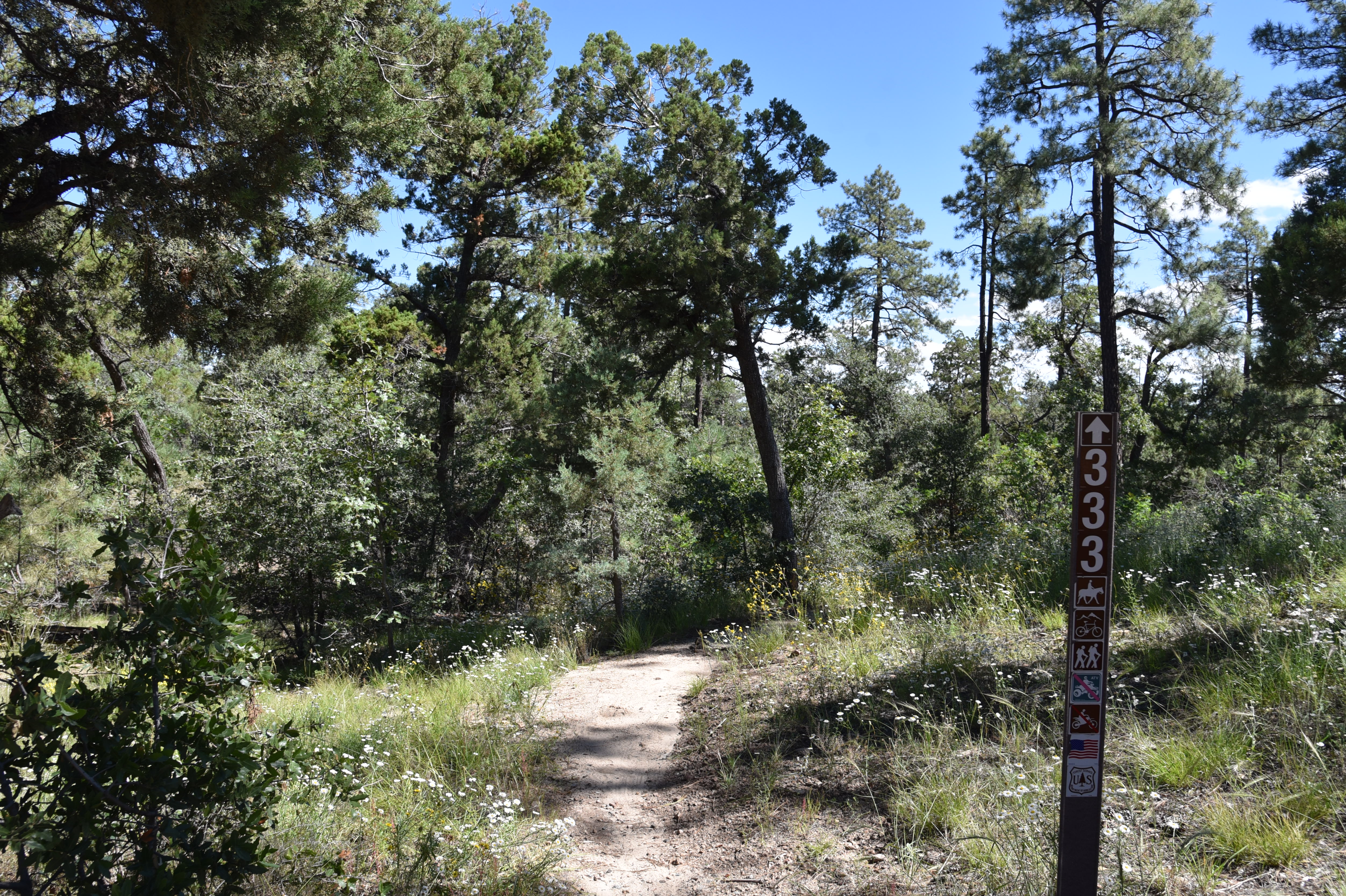
From a slightly out-there trailhead off Thumb Butte Loop Road just 6 miles west of Downtown Prescott, the circuit begins with a 1-mile walk on the Honeybucket trail #333. 

Western yarrow blooms June - September

Weaving among granite outcroppings and stands of ponderosa pines, this warmup section is ablaze in late summer wildflower color.
A boulder passage on Honeybucket trail

Fleabane, goldenrod, tansyleaf aster, western dayflowers, brickellbush, yarrow, thistle and groundsel add sprinkles of yellow, blue, purple and white in sunny spots. 
Prescott Circle Trail Connector has big views

First peeks at iconic Granite Mountain (7,295 feet) emerge at about the half-mile point where the trail bends northward picking its way through thick scrub and massive alligator juniper trees. The loop portion of the circuit departs from the Thumb Butte Bypass Trail #326 junction. 
View of Granite Mountain from Thumb Butte Bypass

Alligator juniper on the Thumb Butte Bypass

From the junction, continue hiking on Trail #333 as it makes a mild descent toward Butte Creek through a more open terrain with see-forever views of the Sierra Prieta mountain range.
Fleabane decorate the loop May - October

 
Trailhead is a dirt pull off on Thumb Butte Loop Road

The trail traverses green gullies and drainages before meeting up with the Prescott Circle Trail Connector Trail #322.  Go left at the junction and follow this 0.7-mile segment while watching for fleeting glimpses of Thumb Butte ( 6,514 feet) and the Williamson Valley that peer out between breaks in tree cover.  The last arc of the loop starts at a major intersection where the circuit heads left on the Thumb Butte Bypass Trail #326. 
The circuit crosses ravines and drainages

Arizona thistle blooms May - October

This 0.6-mile segment follows an old dirt two-track that makes a gradual climb beneath a pine-oak-juniper canopy with fields of hip-high grasses tangled with blooming shrubs lapping at the ankles.  More peeks at Granite Mountain and Thumb Butte punctuate the skyline before the trail reconnects with the Honeybucket trail for a rewind back to the trailhead. While it’s short and just moderate in its physical demands, the Honeybucket loop never scrimps on visual richness, making it a fine choice for appreciating the flora and mountain terrain of Prescott forests.
Wildflowers blanket a section of Honeybucket trail

LENGTH: 4.6 mile loop

RATING: moderate

ELEVATION: 6,094 – 6,400 feet (703 feet of accumulated elevation change)

GETTING THERE:

From Courthouse Plaza in downtown Prescott, go west on Gurley Street , which turns into Thumb Butte Road.  Continue 5.2 miles, passing the Thumb Butte and White Rock trailheads, to Thumb Butte Loop Road (Forest Road 373) on the left. Follow FR 373 for 1.6 miles to the turn off for Forest Road 51 on the left where there’s a dirt parking apron at a Trail 333 sign.

Thumb Butte Loop Road is washboard rough with some potholes but is passible by most carefully-driven vehicles. The road is not maintained in winter.

INFO:

https://highlandscenter.org/hiking-spree/

https://highlandscenter.org/wp-content/uploads/Honeybucket.pdf


Monday, August 29, 2022

Little Hackberry Wash

LITTLE HACKBERRY WASH

Prescott National Forest

Prescott National Forest views from FR9004J

The willows aren’t visible from the paved access roads that bleed into the dirt tracks leading to Little Hackberry Wash.

Sacred datura bloom along Little Hackberry Wash

Nor do the sunbaked, semi-desert grasslands of Prescott National Forest south of Camp Verde look like the kind of place the wispy, water-loving trees would thrive.
A bee collects pollen from a prickly poppy

Corral on FR 323 near Little Hackberry Wash

They’re there, though, and plenty of them, with roots augured into sandy soils that collect rain water and the issue of springs tucked into the hills that cradle the cloistered watershed.
Semi-desert terrain hides its willows

Surrounded by acres of scrub, cactus and spotty stands of junipers, Little Hackberry Wash feeds a slender green corridor of lush mesquite, hackberry and desert willows, many entwined in morning glory and scarlet creeper vines.  Getting to the isolated green-zone is a visually inspiring park-and-walk outing.  Here’s how to do it.
Storm clouds loom magnificently over Prescott NF

From any of the dirt parking aprons near the junction of Cherry Creek Road and Forest Road 323, the trip begins by hiking 1.2 miles west on FR 323.  
View from FR 9004J in Prescott National Forest

Following a rutted 4x4 road, the route makes an easy uphill climb, unwrapping gorgeous Verde Valley vistas. 
Willow and hackberry trees drape over FR 9004J

The heavy- on- the- earth- tones viewsheds are disrupted by showy summer wildflowers including sacred datura and prickly poppies that add pops of white among a gray-green fringe of scrub oak and cliff-rose while attracting clouds of pollinators. 
Shrubby purslane bloom July - September

At the half-mile point, the road crosses a major wash, veers left and ascends the face of a boulder-lined hillside.  
Windmill at the Little Hackberry Well site

Soon, the first of the willows appears where Little Hackberry Wash spills over the road in view of a small corral area and cattle guard.  Just before the cattle guard, a rough road spins off to the right. Although it’s unsigned, this is Forest Road 9004J, which traces the wash, for the second stage of the hike.  
Water pools at Little Hackberry Well

The ragged road makes a gradual climb, crossing the wash several times. It’s in the sandy crossings where the willows make their best showings, drawn out in linear clusters that drape over an understory of colorful wildflowers. Abert’s creeping zinnia, foxtail dalea, devil’s claw, red spiderling and spots of somewhat rare shrubby purslane are a few of the species that bloom from summer through fall. As the hills close in on the road, desert hackberry trees, although present as mid-size shrubs earlier in the hike, suddenly appear as robust trees. 
The 3-mile point raptor nest high in a hackberry tree

The source of the size burst lies ahead. At the 2.5-mile point, the metal blades of the Little Hackberry Well windmill reach above the canopy of the hike’s granddaddy hackberry.
Woolly morning glories and scarlet creepers twine around shrubs

At least 20 feet high, the massive specimen hangs over the windmill and a small enclosure with water tank and concrete well.  The weed-encroached site is a haven for birds, wildlife and the domestic cattle that roam the surrounding rangeland. 
Abert's creeping zinnia

Lush environ along Little Hackberry Wash

Tiny red spiderling bloom April - November

While the well makes for a good turnaround point, the road continues for about another mile-and-a-half, passing by yet another hackberry tree with a huge raptor nest at the 3-mile point before terminating at Little Walnut Spring at the head of a shallow canyon.
Devil's claw sprout woody "claws" post bloom

LENGTH: 6 miles roundtrip (to the raptor nest tree and back)

RATING: moderate

ELEVATION:  4,706 – 5,299 feet (870 feet accumulated elevation gain)

GETTING THERE:

From Interstate 17 about 8 miles south of Camp Verde, take the Dewey-Humboldt exit 278 for State Route 169. Go 5.5 miles west (left) on SR 169 to Cherry Creek Road (a.k.a. Forest Road 372, County Road 75). Turn right onto FR 372 and continue 1.2 miles to Forest Road 323 on the left. Park in any of the dirt turnouts.


Monday, August 22, 2022

High Desert Trail

HIGH DESERT TRAIL

Black Canyon City

Bradshaw Mountains seen from High Desert Trail

Tethered to both a kiddie playground a backcountry historic trail, High Desert Park in Black Canyon City doubles up as an approachable community gathering space and gateway to the rugged canyonlands of Central Arizona.
Blooming barrel cactus on High Desert Trail

Dubbed a “Desert Gem” by the High Desert Helpers, Inc., the 501(3)(c) non-profit that manages the park and the High Desert Trail within it, the Yavapai County site packs a massive amount of fun into its 89.1-acre parcel.
Kings Canyon Overlook on the "blue" loop

The park is situated west of Interstate 17 among the suburbs of Black Canyon City, Rock Springs and the foothills of the Bradshaw and New River Mountains.

Swing sets, restrooms, water, picnic tables, grills, sports facilities and community center anchor the family-friendly plot while a total of 2.7 miles of outdoor trails offer non-intimidating ways to get some exercise.

A rabbit hops through a cholla forest

The High Desert Trail has two parts. The main “blue” trail is a 1.7-mile loop and the 0.3-mile “yellow” trail (also known as Joedy’s Trail) that may be used for a shorter loop option.

"Tablelands" stand out on the High Desert Trail

The hike begins at a shade pavilion with maps and interpretive signs describing local wildlife. Heading west for a counterclockwise hike is the preferred plan as it takes on the climbing section of the trail early on. Initially the trail moves through a cholla forest that’s part of the park’s 0.8-mile original nature trail that has been lassoed into the blue perimeter loop.

Junction of the "blue" and "yellow" trails

Hike begins in High Desert Park in Black Canyon City

 Rustic wood signs placed along the route identify native plants such as jojoba, barrel cactus and saguaros.  Right from the get go and throughout the hike, gorgeous mountain views and a tableland of flat topped mesas peek through cholla forests and thickets of diverse desert vegetation.
Desert senna blooms April - October

Quartz and basalt: part of the area's complex geology

Rusty artifacts on the "yellow" trail

The trail’s appeal is augmented with benches placed at scenic spots and two spectacular overlook points. A short spur trail leads to Kings Canyon Overlook, a stony edge on the far west end of the blue loop trail that hangs over the deep gorge of Black Canyon.
Monsoon rains coax the green out of ocotillo

At the south end of the perimeter loop, the Rock Springs Overlook peers over the severe cuts of the Agua Fria River channel, and the famous Rock Springs CafĂ©, pies and all. 
Rock Springs scenic overlook

The "yellow" trail cuts through the main "blue" loop

Never quite escaping the subdued rattle and hum of Interstate 17, the loop’s east leg dips downhill to meet a connector path that leads to a popular trailhead for the  Black Canyon National Recreation Trail—a long-distance, non-motorized historic route that goes from Phoenix to the Verde Valley. The final leg swings north through classic high desert eco zones and saguaro-lined ridges replete with a sampling of the quartz outcroppings, metamorphic stone slabs and volcanic ejecta that contribute to the area’s complex geological footprint, completing a fun and informative trek lodged between freeway and wilds.
Spectacular mountain views dominate the hike

LENGTH: 2.1 miles (blue and yellow trails)

RATING: moderate

ELEVATION:  2,024 – 2,153 feet   

GETTING THERE:

19001 Jacie Lane, Black Canyon City.

From Interstate 17, take the Black Canyon City/Rock Springs exit 242. Turn left at the stop sign, then right at the Old Black Canyon Highway junction. Continue a short distance  to Jacie Lane, turn left and follow the road into the park.

PARK HOURS: Dawn to dusk daily

FACILITIES: restrooms, water, picnic tables & grills, sports facilities, kiddie playground

INFO:

Yavapai County Parks

yavapaiaz.gov/facilities/yavapai-county-parks/high-desert-park

High Desert Helpers, Inc.

highdeserthelpers.org/park/


Monday, August 8, 2022

West Side Story

WEST SIDE STORY

An alligator juniper on the West Side Story trail

While its name might imply an homage to choreographed gang brawls, the West Side Story trail is likely named for its location west of Prescott’s historic Whiskey Row.

Trail begins in sunny semi-desert grasslands

The 2.75-mile single track route in Prescott National Forest anchors the far west end of a cluster of trails in Spence Basin. Surrounded by wooded subdivisions and tucked between the popular Thumb Butte and Granite Basin Recreation areas on the outskirts of town, the creek-carved basin is laced with paths that can be looped up or tied in with the city-circumnavigating Prescott Circle Trail that connects the area with both the Granite Mountain and Thumb Butte trail systems.
Use trail map signs to customize a hike in Spence Basin

Canyon grapes grow along Spence Creek

West Side Story rumbles (pun intended) through a hilly parcel where views are bookended at the beginning and end of the trail.  Surrounding mountain vistas are swallowed up in the trail’s midsection by a rolling series of gullies, drainages and creek channels.

Granite Mtn. (center-right) seen from hike high point

The first half-mile of the route heads west through sunny scrub and juniper stands before swinging south (go left) at an unsigned junction.  Here, the trail makes its first substantial dip, this one into the water ravaged groove of Spence Creek. Populated with an odd mix of moisture-loving willows, canyon grape vines and desert cacti, the creekside environment soon morphs into a patchwork of pine-oak woodlands and high-desert grasslands. 
Wright's deervetch bloom May - September

Mushrooms pop up in moist areas along the route

The endlessly undulating trail alternates between long flowing lines and tight bends that boomerang around drainages.
A pollinator alights on Spreading sandwort

Narrowleaf penstemon bloom March - September

All told, the furrowed trail chocks up over 800 feet of accumulated elevation change.
Thumb Butte (left) seen from West Side Story trail

The pivotal scene happens on a high ridgeline with the best views of the hike.
Pine-oak woodlands on West Side Story trail

The shadeless platform reveals views of the jumbled mound of 7,295-foot Granite Mountain, the golden plains of Williamson Valley and the rock-ringed Willow Dells. Farther along, the isolated form of 6,440-foot Thumb Butte rises over green woodlands.
A woodpecker photo bombs view of Williamson Valley

The trail ends at the junction with the Waterline, Russ T. Fender and Missing Link trails.  This makes for a good turnaround point, otherwise, use the trail maps posted at most intersections to customize a loop or alternate return route.
 A mixed bag of vegetation along Spence Creek

LENGTH: 5.5 miles round trip

RATING: moderate

ELEVATION: 5,819 – 5,990 feet (817 feet of accumulated elevation change)

GETTING THERE:

From Courthouse Square in downtown Prescott, turn go north on Montezuma Street (Whiskey Row) and continue 6.1 miles—Montezuma turns into Whipple Street and then Iron Springs Road—to the trailhead access road on the left. There’s a small hiker sign across the road from the trailhead turnoff.

INFO & MAPS:

City of Prescott

https://www.prescott-az.gov/recreation-events/recreation-areas/trails/