Find A Trail. Start Your Search Here:

Tuesday, November 3, 2020

Deer Flat

DEER FLAT

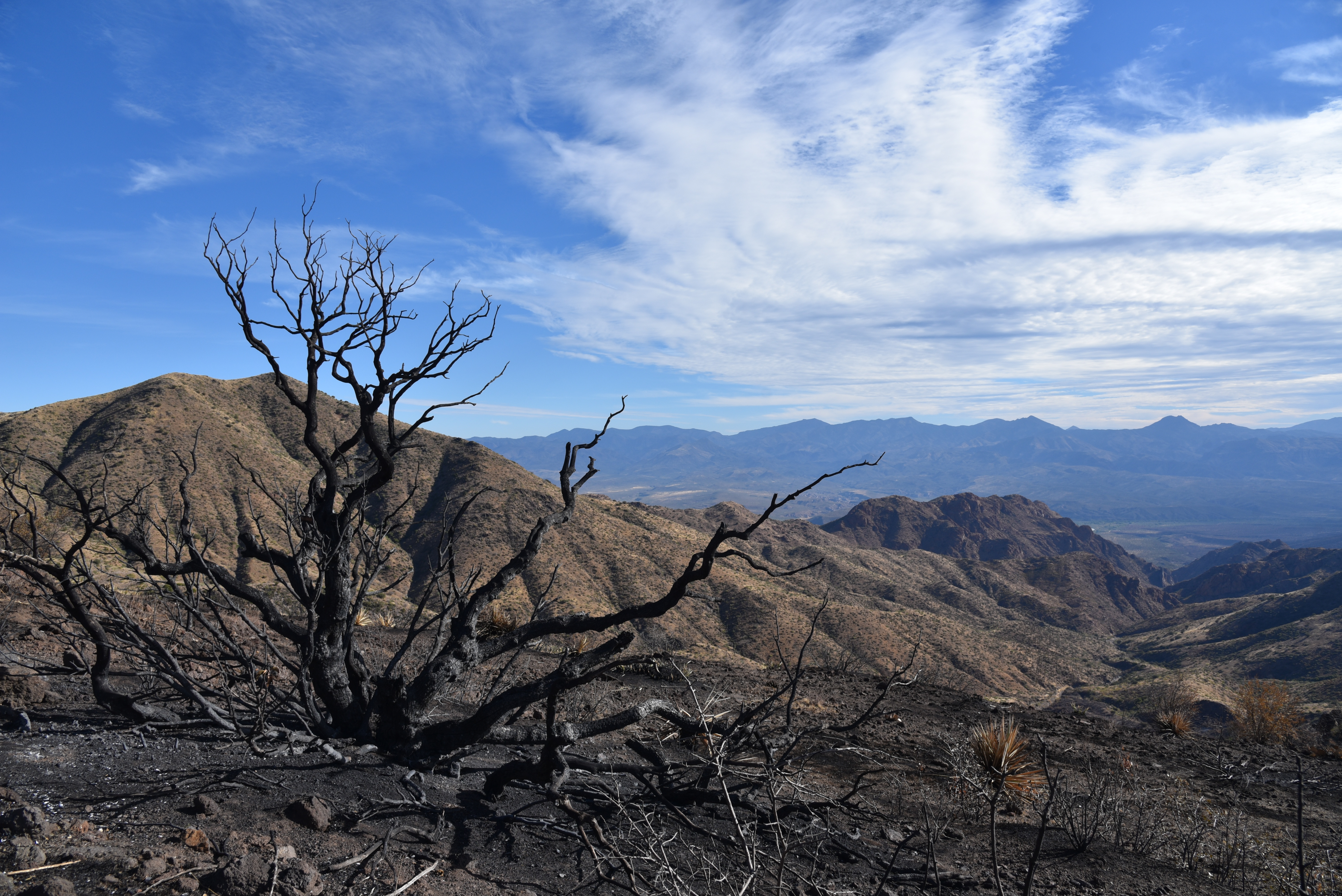
A tree burnt by the Sears Fire teeters above Buck Basin

It’s been a rough year for Deer Flat.  Pressure from an extended drought and the

Sears Fire in the back country north of Cave Creek has altered the terrain on the breezy, mountain-bound rangeland.  But the place has grit and “good bones” so it wears the effects of these most recent punches like just another pair of black eyes that will heal. 

A calming scene near the top of Deer Flat

Deer Flat sits at the top of a rise among the prominent peaks of Humboldt Mountain (5,204 feet and easily spotted by the big white ball FAA station on top), Willow Spring Mountain (4,914 feet)  and Maverick Butte (4,870 feet)—the enduring bone structure that defines the area.  Forest Road 1099, a rough OHV route that’s been adopted by the Tonto Recreation Alliance, a non-profit volunteer group that works with Tonto National Forest to educate the public about responsible off-highway vehicle use and resource conservation, provides access through the rugged desert space.

Milkweed pods dry in the sun on Deer Flat

Humboldt Mountain (center horizon) soars above Deer Flat

The hike begins with an easy walk through grassy foothills just outside of the scar of the Sears Fire which burned more than 14,000 acres of Tonto National Forest this past October.
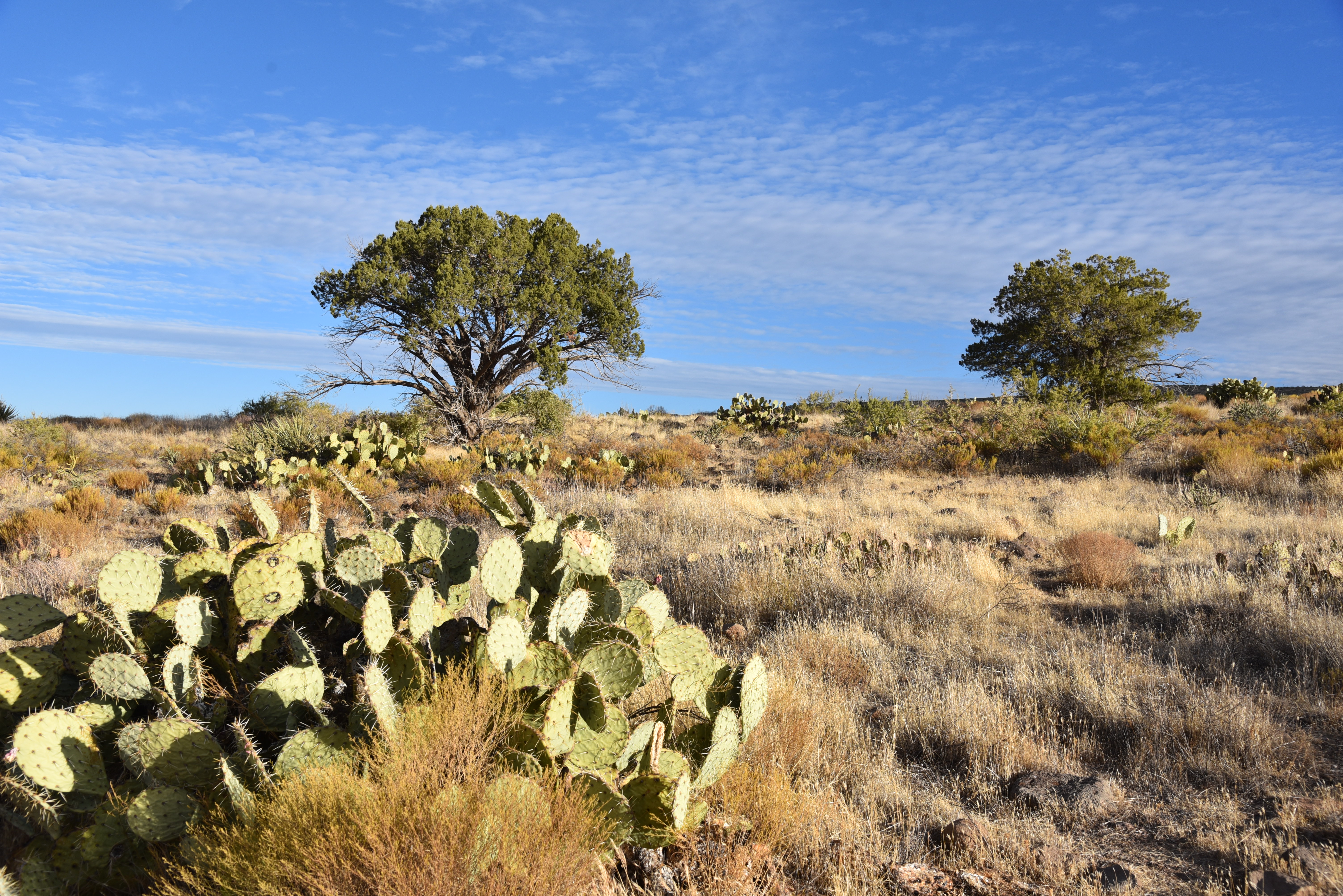
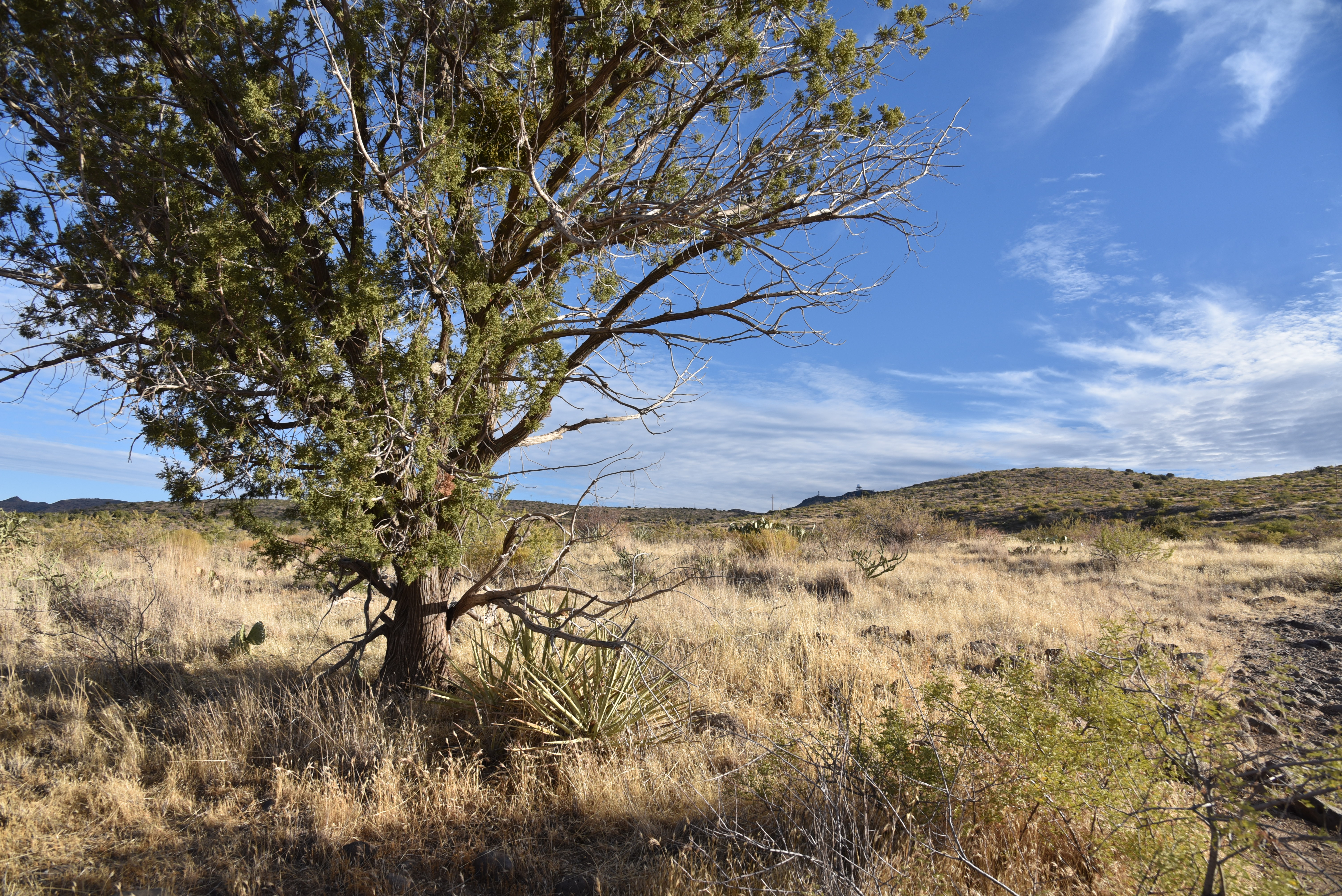
Open grasslands and junipers define Deer Flat

Cacti and scrub line FR 1099

A hiker gazes back at the New River Mountains from Deer Flat

As the road makes a gradual but constant ascent on a rocky, wobbly track, amazing views of the New River Mountains to the west and peeks at Scottsdale’s Pinnacle Peak to the south get bigger and better with each foot of elevation gained.  At near the two-mile point where a drought-dry stock tank sits off to the right, evidence of the fire begins to creep up. 
Pinnacle Peak visible in distance from the road up to Deer Flat

Evidently, the road served as a fire break that spared a scenic expanse of junipers and scrub oak north of its rough-cut route  where glimpses of hazy peaks jutting above the horizon hint at the combination of destruction and resilience that lies ahead.  The final slog to the hike’s high point culminates at the edge of Buck Basin with jaw-dropping views of the Verde River Valley more than 2,000 feet below.  The road curves sharply southward on a ledge above the precipice where the blaze took a heavy toll.  At this writing, the cause of the blaze is still under investigation but its path of blackened stubble and acres of ash bear witness to its intensity. Skeletal, charred trees and cacti fried to a crisp teeter creepily over scorched earth backed by distant views of the familiar profiles of Weavers Needle in the Superstition Wilderness and Four Peaks in the Mazatzal Mountains. 
Catclaw acacia grows abundantly on Deer Flat

From this dizzying, desolate platform, the vivid green corridor of the Verde River can be seen winding unscathed at the bottom of the gaping basin as it flows south between Horseshoe Reservoir and Bartlett Reservoir.  The road continues for a half-mile to South Deer Flat Tank, another parched water hole tucked into a ravine that makes for a good turnaround spot. 
The area around So. Deer Flat Tank is now prone to flooding

Fire damage around the tank is severe and its location in the folds of mountain foothills puts it at risk for flooding. Avoid hiking here during or immediately following storms because without deluge-mitigating vegetation water will run in torrents and you could be trapped, injured or swept away.
The hike follows Forest Road 1099

Much of Deer Flat escaped the Sears Fire


Despite the aftermath of fire and ongoing drought, a hike up to Deer Flat remains a stunning adventure.  Bemoaning memories of “what was” while hiking through a burn scar like this one might offer cathartic release, but it’s a buzz kill and also misses the big picture. 

The Sears Fire scar meets FR 1099

When viewed through the lens of geological time, human memories are short, fickle and finite.

Cycles of drought, fire, flooding and climate change may abruptly alter vegetation and surface characteristics in relatable time frames of days, months, years or centuries. This is the stuff we remember. But the underlying bone of resilient geological land forms hold steady.

Morning light in Tonto National Forest

Beautiful desert vistas abound on Deer Flat

Their appearance evolves over eons of seismic jolts and erosion. Observing these gradual transformations requires imperceptible timelines and more memory than we have. So, just enjoy the moment.
Maverick Butte (right) stands tall over Buck Basin

LENGTH: 5.7 miles round trip

RATING: moderate

ELEVATION: 3,585 – 4,493 feet

GETTING THERE:

From Loop 101 in North Scottsdale, take the Pima/Princess Road exit and go 13 miles north on Pima Road to Cave Creek Road.  Turn right (east) and continue on Cave Creek Road (a.k.a. FR 24, Seven Springs Road) to Forest Road 1099 located between MCDOT mile markers 9 and 10.  The road is signed but is easy to miss—it’s on the right.  There’s a dirt parking circle a few yards in.  Roads are maintained dirt suitable for all vehicles.

INFO:

Tonto Recreation Alliance

https://www.tralaz.org/


Wednesday, October 28, 2020

Corral Loop

CORRAL LOOP 

McDowell Sonoran Preserve

Brown's Mountain seen from Brown's Ranch Road

A mile and a half north of the busy Brown’s Ranch trailhead, a gnarled mesquite tree grows through and around the crumbling walls of concrete feed trough.  Nearby, tangled barbed wire, weather-worn and clinging tenuously to wood posts, surrounds a conglomerate of disintegrating foundations and rusty metal scraps.  

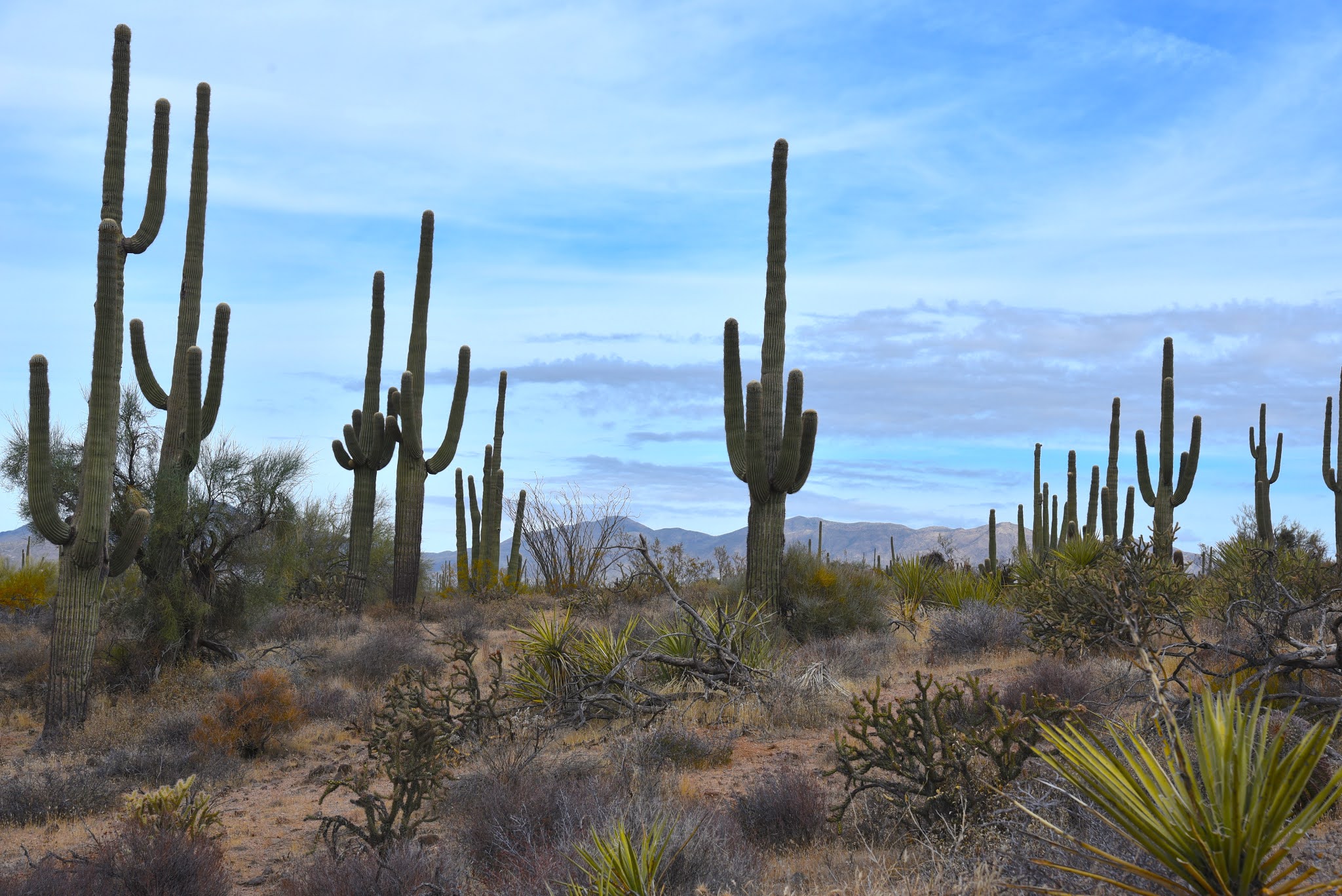
Saguaros tower over the Corral Trail

The relics are what remains of Brown’s Ranch.  Established in 1916, the 44,000 acre operation ran cattle in the mountainous desert space before being abandoned in mid-century.  The historic site, which is now part of the McDowell Sonoran Preserve, is the key attraction on the Corral Trail in the popular Scottsdale recreation hub.
Yuccas sway above Brown's Ranch Road

Desert plants grow among the ruins of Brown's Ranch

The ranch site can be reached by following Brown’s Ranch Road north to the Corral Trail.  The 2.3-mile path swings through gorgeous Sonoran Desert between the distinctive flat-top form of Brown’s Mountain (3,253 feet) and the jumbled granite mounds of Cholla Mountain (3,406 feet).  The first set of ranch ruins appear off to the left just a few yards from the road junction.  

A Phainopepla bird perched on a yucca eyes nearby mistletoe

A bird nest (usually cactus wren) built into a cholla cactus

Even with encroaching cacti, catclaw, frothy turpentine bushes and stray twigs poking through cracked stonework, the old west character is so animated here that you might expect to find cattle grazing among the ruins.  Any present-day rustlings, though, are those of browsing javelina, deer, rabbits, lizards and chattering Phainopeplas—black, red-eyed birds with head crests that resemble cardinals-- feeding on invasive mistletoe drooping from ironwood trees.

A disintegrating foundation at the Brown's Ranch site

Cholla Mountain (center) & Granite Mountain (right) seen from Brown's Ranch Road

A string of barbed wire fencing trailing off from the main site soon dissolves into thickets of jojoba bushes and spiny yucca that line the trail as it swings north and west through open desert with towering saguaros and distant views of the Cave Creek Mountains to the north and Sierra Ancha Mountains to the east.  Occasional glimpses of sagging fences are the only relics visible until near where the trail reconnects with Brown’s Ranch Road.

Blue Palo Verde trees grow along the route

Beware of the notoriously sticky "Jumping Cholla"

Navigating the trails of McDowell Sonoran Preserve is easy

The desert reclaims its territory

Cave Creek Mountains seen from Brown's Ranch Road

Here, a round cinder block structure that at one time held ranch resources now serves as a sort of giant planter for mesquite trees surrounded by untamed clusters of "jumping cholla" (Chain Fruit Cholla) that provide fodder for pack rats and nesting habitat for cactus wrens.  Tread lightly while exploring these fragile remains that are slowing being reclaimed by environmental forces and desert creatures. Leave what you find, watch where you step--there are no cow pies, but those pesky magnetic cholla stems (and snakes, maybe) can ruin your day--and enjoy the trip back in time.

LENGTH: 5.5 miles

RATING: easy

ELEVATION: 2,645 – 2,763 feet

GETTING THERE:

Browns Ranch Trailhead.

30301 N. Alma School Pkwy., Scottsdale.

From Loop 101 in Scottsdale, take the Pima/Princess exit 36, travel 6.5 miles north on Pima to Dynamite Road.  Turn right and continue 2.7 miles to Alma School, turn left and drive 1 mile to the trailhead. The preserve is open sunrise to sunset daily. There are restrooms at the trailhead.

INFO:

https://www.scottsdaleaz.gov/preserve

https://azmemory.azlibrary.gov/digital/collection/splimage/id/18/


Thursday, October 22, 2020

Rover-Axis-Girdner Loop

ROVER-AXIS-GIRDNER LOOP

Cockscomb seen from the new Rover Trail

At first glance, the map of the Western Gateway trail system can be overwhelming. There are so many interconnected trails packed into the hilly parcel in northwest Sedona that the graphic representation looks like something that escaped a bait box.

Yet, because of the map, which is posted at most junctions throughout the 30-trail system, you'll have no trouble sussing out the maze and customizing a route. The maps, which include distances, ensure that you’ll always know where you are, making it simple to navigate the system. Your biggest dilemma will be deciding where to start exploring this maze which was completed in mid-2020.

Long, flowing Axis Trail can be used to make loop hikes

Western Gateway Trails maps make navigating easy

The convoluted collection of routes located in the Dry Creek area of Coconino National Forest between State Route 89A and Boynton Pass Road offers uncongested alternatives just steps away from some of the area’s most heavily-used trails.  Two major trailheads make for easy access. The Cultural Park trailhead at the south end provides quick access to a tight-pack of curvy, edge-hugging routes while the Aerie trailhead at the north end offers a softer mix of long, flowing paths above the water-whittled pocket of Dry Creek. 

Doe Mountain seen from Cockscomb Trail

One circuit to try uses a combination of old standards, adopted user-created and newly-constructed trails for a trip through high-desert foothills and leafy drainages with outstanding Red Rock Country vistas all around.
Wilson Mountain seen from Rover Trail

The circuit takes off from the Aerie trailhead with a 1.2-mile walk on the old standard Cockscomb trail.  This classic segment unwinds with majestic views of Doe and Bear Mountains and sweeping valley views.  The hike then heads south on the Axis trail a recently adopted user-created path with some new construction thrown in.

Capitol Butte (left) and Chimney Rock (center) seen from Rupp Trail

The Axis trail is a wavy, free-flowing single track that slides through scrubby high desert on the eastern flanks of the iconic Cockscomb formation—a bristled row of red rock spires.

Pinon pine are common trees on the route


Hiking through the trail’s constant parade of bends, nooks, nobs, rockfalls and slickrock slopes never feels contrived and complements the natural rhythm of the land.

There are excellent map signs at all junctions

Follow this undulating route 3.4 miles to where it connects with the re-routed Girdner trail, another time-honored route that serves as a backbone of the system. Head north here and hike 2.3 miles through mash up of shallow canyons, riparian corridors and rangeland that roughly traces the scoured course of Dry Creek before ascending up to a ridge.  At the top of the rise, the trail intersects another old favorite, the Rupp trail. Turn left and hike a half-mile and pick up the new Rover trail.  Over Rover’s 0.6-mile length, beautiful views of Sedona’s Courthouse Butte, Capitol Butte and Chimney Rock stand out to the south while the chalky-white escarpments of Wilson Mountain dominate the northeast horizon.  When back at the Axis trail junction, just follow the signs back to the trailhead through the pinon pine-shaded, thorn-addled thickets of Sedona’s newest cluster of off-the-main-drag hikes.

Mountain views, grasslands and creek gorges ad variety to the hike

Big valley views are highlights of the hike

LENGTH: 9.8 mile loop

RATING: moderate

ELEVATION: 4,570 – 4,200 feet

GETTING THERE:

Aerie Trailhead (described here):

From the State Route 179/89A traffic circle in Sedona, head 3.2 miles west (left toward Cottonwood) on SR 89A to Dry Creek Road. Turn right and go 2.9 miles to Boynton Pass Road (FR152C), make a left and continue 1.5 miles to a “T” junction and veer left to stay on FR152C. Continue 1.4 miles to Aerie Road, turn left and go 0.4 mile to the turn off for the trailhead on the right.  There are no fees or facilities at the trailhead.

Cultural Park trailhead (optional south access):

From the State Route 179/89A traffic circle in Sedona, head 4.2 miles west on 89A Cultural Park Place on the right at the traffic signal. Go north 2.2 miles to the parking area. Follow the Outer Limits trail north to connect with Ground Control. There is a

picnic ramada and interpretive displays at the trailhead. No fees.


INFO: Coconino National Forest

https://www.fs.usda.gov/nfs/11558/www/nepa/108635_FSPLT3_4275041.pdf

Friday, October 2, 2020

Shannon Gulch

SHANNON GULCH

FR 74 leads into Shannon Gulch

More than 2,000 feet above where the East Verde River crosses State Route 87 north of Payson, snowmelt and rainwater that will eventually drain into Arizona’s rivers and streams begins with a journey through porous escarpments before spilling through springs at the base of the Mogollon Rim. 

The shrubby folds of Shannon Gulch

Below the Rim’s vertical cliffs that rise to over 7,000 feet and make a 200-mile, east-west stretch through central Arizona, an edgy, almost claustrophobic territory of high mesas, dizzying gorges and backwoods is home to a maze of tributary creeks and drainages that feed into the East Verde River which in turn flows into the Verde and Salt Rivers, two of Arizona’s most important water sources. 
Mogollon Rim vistas from the road's highpoint

A hike through this tangled, geologically and botanically diverse region is as much an origin story as it is a walk in the woods.
Milk Ranch Point, promontory on the Mogollon Rim

While the nearby 50+ mile Highline Trail, which is part of the Arizona National Scenic Trail, clings to the craggy Rim walls, the terrain farther downhill is a more bucolic, less precipitous place.

Several rough dirt roads venture into this scenic slice of hilly watershed.

Oak, cypress and junipers line FR 74

One to try is Forest Road 74 which makes a dive into the green folds of Shannon Gulch to explore a cloistered pocket of backcountry east of the popular Water Wheel recreation sites on Houston Mesa in Tonto National Forest.
The downhill section of FR 74 feature great views

The trek begins at a dirt turnout on Control Road (Forest Road 64), a historical route that traces the base of the rim for 23 miles between State Route 87 and just south of the town of Pine and State Route near Christopher Creek.  From the small parking area, the hike heads south following FR 74. The road is open to motorized vehicles capable of handling its rocky, twisted course, but hikers have the advantage of savoring the many natural features that unwind along the way.  

The backroads below the Mogollon Rim are scenic treasures

Cedar Mesa dominates the horizon on FR 74

Wide and easy to follow, the road hike begins with an easy walk through junipers and scrub oaks with the impressive bluff of Milk Ranch Point jutting skyward to the north and views of the Rim extending to the eastern horizon.  Over the first half-mile of hiking, the road inches up it to its highpoint where a short spur leads to a lookout mound with far-reaching views.  The panoramic vistas are swallowed up as the road begins a 500-foot descent along the edge of Shannon Gulch.
A grove of cypress trees grow near the bottom of Shannon Gulch

Making an abrupt cut in the landscape 12 miles north of Payson, the gulch is lodged between the hulking flattop of Cedar Mesa (5,542 feet) to the west and the Diamond Rim and the ragged valley cut by Webber Creek and to the east.  The rough-cut road spirals downhill passing root-tangled eroded cliffs and patches of tight-packed manzanita shrubs. 

See-forever vistas from the road to Shannon Gulch

After rounding a couple of bends, dramatic views of the Mazatzal Mountains open up to the south while the imposing nose of Cedar Mesa looms overhead.  At the 2-mile point, the road meets a junction with Forest Road 1582. This makes for a good turnaround point, but to ad length, veer right to stay on FR 74 which continues another 3.2 miles briefly following the course of Webber Creek over Deer Flat and hopping the jumbled cut of Cherry Creek before ending at a barely there turnout on State Route 87 just north of the East Verde River.

LENGTH:  5.2 miles one way or 4 miles round trip to FR 1582.

RATING:  moderate

ELEVATION:  5,400- 4,800 or 5,400 – 4,916 to FR 1582

GETTING THERE:

From the State Route 87/260 junction in Payson, go 12 miles north on SR 87 to milepost 265 (2 miles north of the turnoff for Tonto Natural Bridge State Park to Control Road (Forest Road 64).

Turn right and continue 3.3 miles to Forest Road 74 on the right. Park in the dirt turnout.  Control Road is maintained dirt suitable for all vehicles.  

INFO: Tonto Recreation Alliance

https://www.tralaz.org/

Monday, September 21, 2020

Blowout Wash Trail System

BLOWOUT WASH TRAIL SYSTEM

Bear grass & ocotillo on the Bullseye trail #557


Occupying a hilly slice of high desert below the east flanks of Mingus Mountain, the new Blowout Wash trail system is shaping up to become a prime Verde Valley hiking destination.

The remediation project is a multi-agency collaboration of local, state and federal land agencies working together to improve recreational opportunities in the section of Prescott National Forest southwest of Cottonwood.  

View from Campus trail #559

Before trail construction began in 2019, the wash-riddled foothills that are surrounded by popular recreation hubs in Sedona, Jerome, Dead Horse Ranch State Park and the Woodchute-Mingus Mountain complex of routes, the area was rife with wildcat user-created paths, shooting and dumping that was disrupting the ecosystems and decimating native vegetation. 
The Bullseye-Campus loop was completed in early 2020

Cacti and grasslands on Bullseye trail #557

The destructive anything-goes arena is gradually being replaced with sustainable, non-motorized trails that reduce erosion, protect natural assets and promote responsible use.
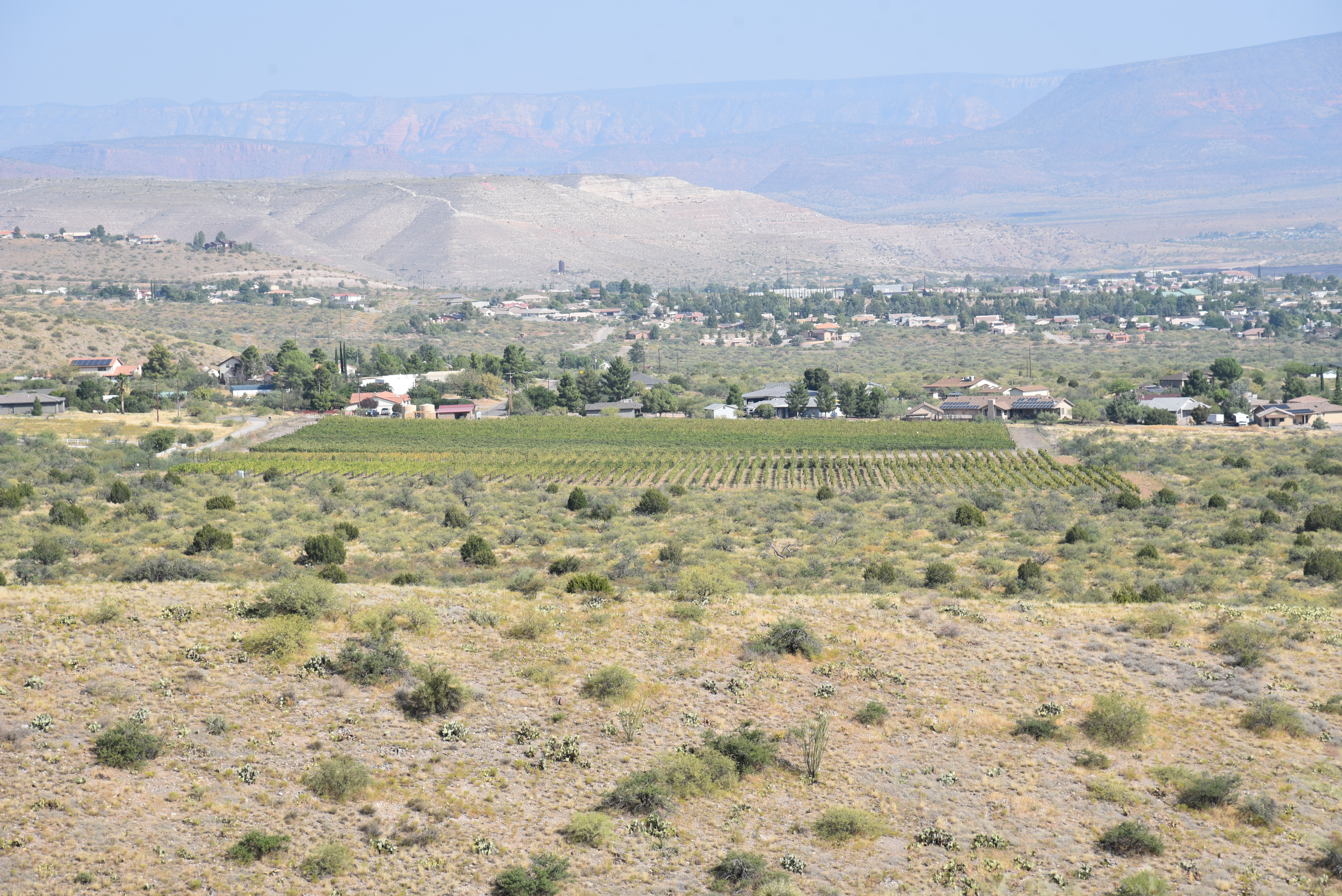
Vineyards of the Verde Valley seen from Bullseye trail

Sacred datura bloom Apr-Nov along Blowout Wash 

While a map at the trailhead teases with an overview of planned trail development, a little loop that was completed in early 2020 provides a tasty tidbit of what’s to come.

Right from the trailhead, the fresh-cut nature of the Bullseye Trail #557 and the Campus Trail #559 that pair up for a short tour of the area is apparent.  Behind the parking area kiosk, brand new sign posts mark the beginning of the system’s inaugural loop.  To get the climbing part of the hike done first, head left on trail #557.  The loopy single track that’s open to hikers, equestrians and mountain bikers heads west before making a twisting ascent of a ridgeline. 

Fruits on Silverleaf nightshade follow purple blooms

The path wanders among junipers, mesquite and crucifixion thorn trees occasionally ducking into drainages and washes where spots of cottonwoods and Arizona walnut trees sink roots deep into the water table.  Taking on the long switchbacks that lead to the hike’s high point, the trail hangs on the edge of the ridge showcasing amazing views of Mingus Mountain, and the emerald corridors of the Verde River and Oak Creek. 
Limestone pebbles spill over Campus trail #559

After a few dips and bends, the trail tops out on a ocotillo-and-bear grass cluttered knob with big views of the red rocks of Sedona and the green grids of vineyards in the valley below.  From this high vantage point, the trail begins a downward spiral through cacti-studded grasslands. At the 2.2-mile point, the route meets the back end of the loop where trail #559 spins off to the north and heads toward the Yavapai College Verde Valley Campus.  To complete the loop, head east (go right) and follow #559 through a flatter landscape marked by rugged washes and a swing by a prominent pyramid-shaped mound with white limestone chunks spilling from its slopes. 
Mingus Mountain rises over Bullseye trail #557

Along this passage, you’ll notice white flag tape tied to trees and shrubs as well as rocks blocking access to old roads and unauthorized paths. 
A shady passsage on Campus trail

Campus trail makes several drainage crossings

Crucifixion thorn trees bear spiked, egg-shaped fruits

Mesquite trees provide sporadic shade along the route

Please leave the flags in place and avoid crossing barriers as these are part of future trail development efforts. One more short uphill segment completes the loop that gives a glimpse at an emerging trail system and the taking back of a formerly neglected corner of national forest.

LENGTH: 3.3 mile loop as described here

RATING:  easy

ELEVATION:  3,706- 4,031 feet

GETTING THERE:

From Interstate 17 north of Camp Verde, take the Cornville Road exit 293 heading west (go left).

Continue 17.7 miles on Cornville Road (aka County Road 30) which will turn into Mingus Avenue and then Forest Road 493 to the large Blowout Wash trailhead.  For reference, the trailhead is 1.5 miles south of the Cottonwood Municipal Airport. Roads are paved up to the last half mile where FR 493 is a dirt/gravel track suitable for all vehicles.

INFO:

Prescott National Forest

https://www.fs.usda.gov/main/prescott/home