Find A Trail. Start Your Search Here:

Monday, November 18, 2019

AGUA FRIA RIVER OVERLOOK

AGUA FRIA RIVER OVERLOOK
Agua Fria National Monument
A hiker at an overlook above the Agua Fria River
Few things make hikers cringe more than seeing smoke rising from treasured hiking hubs. Hiker ire was raised earlier this year when the Badger Springs Fire broke out along Interstate 17 south of Cordes Junction. 
Rock pinnacles along BLM Route 9003 in AFNM
The June 2019 blaze consumed 2,525-acres of brush and high grasses in the Agua Fria National Monument near the popular Badger Springs Wash trail.  The ashen burn scar is still visible from the freeway and an acrid tang still rises with early morning fog.
Hikers make the 400-foot ascent to a scenic overlook
Despite the difficulties of managing fire incidents like this one that involve steep, inaccessible terrain, the monument’s mile-long signature trail mostly escaped major damage.  Telltale signs of the fire mar the surrounding grasslands and vertical cliffs that bolster the Agua Fria River canyon, but leafy riparian corridors remain unscathed. 
A pollinator alights on a buckwheat shrub along the road
Even though the drive-by perspective of the fire damage is quite severe, this should not be a deterrent to exploring the trails and back roads of the 71,000-acre national monument.  Although the Badger Springs Wash trail is a great place to sample the many aspects of the monument’s terrain, it barely scratches the surface in terms of grasping the scope of its natural resources and cultural importance. To fill in the gaps, during dry conditions the short hike may be extended by scooting around boulders and soggy sandbars in the rugged water channel or by trekking nearby dirt tracks.
The hike follows BLM Route 9003
Many walkable roads delve deeper into the site’s remote corners and scenic high points. One such road that leads to a heart-stirring overlook spins off just yards from the Badger Springs Wash trailhead.  Bureau of Land Management Route 9003 swerves away from the busy parking area through what initially looks like a not-too-interesting swath of scrubland. Look carefully to the northeast, and the barely visible road cut can be seen crawling up the flanks of a barren mesa.
The first quarter mile of the route is a little tricky to navigate, but once past a maze of unsigned roads that spin off the primary track, the route is obvious. Here’s how it works.
Trailing Four O'Clock is a common bloomer along the hike
Lone junipers provide spotty shade along the hike
From the parking area, continue hiking on the road you drove in on where it heads north from the Badger Springs trailhead. 
The hike begins with a crossing of Badger Springs Wash
Pass a pair of circular turn outs, drop into a drainage and veer right at a fork at the 0.1-mile point. Walk across the sprawling, sandy corridor of Badger Springs Wash and bear right at a second fork where there’s a sign for BLM road 9003.  From this point, the route is easy to follow.
Highpoint views if the Agua Fria River and Perry Mesa
The narrow, choppy 4x4 road climbs roughly 400 feet among outcroppings of volcanic rock, cacti and sporadic junipers. To the west, the peaks and ridges of the Bradshaw Mountains and Castle Creek Wilderness in Prescott National Forest rise high above Black Canyon and endless strips of open rangeland.
Cross a cattle guard midway through the hike
At the 0.6-mile point, pass a cattle guard and continue straight ahead descending along a steep, ragged bend where the fire left a patchwork of scorched earth and pockets of survivor hackberry shrubs.  


Breathtaking Bradshaw Mountain views punctuate the hike
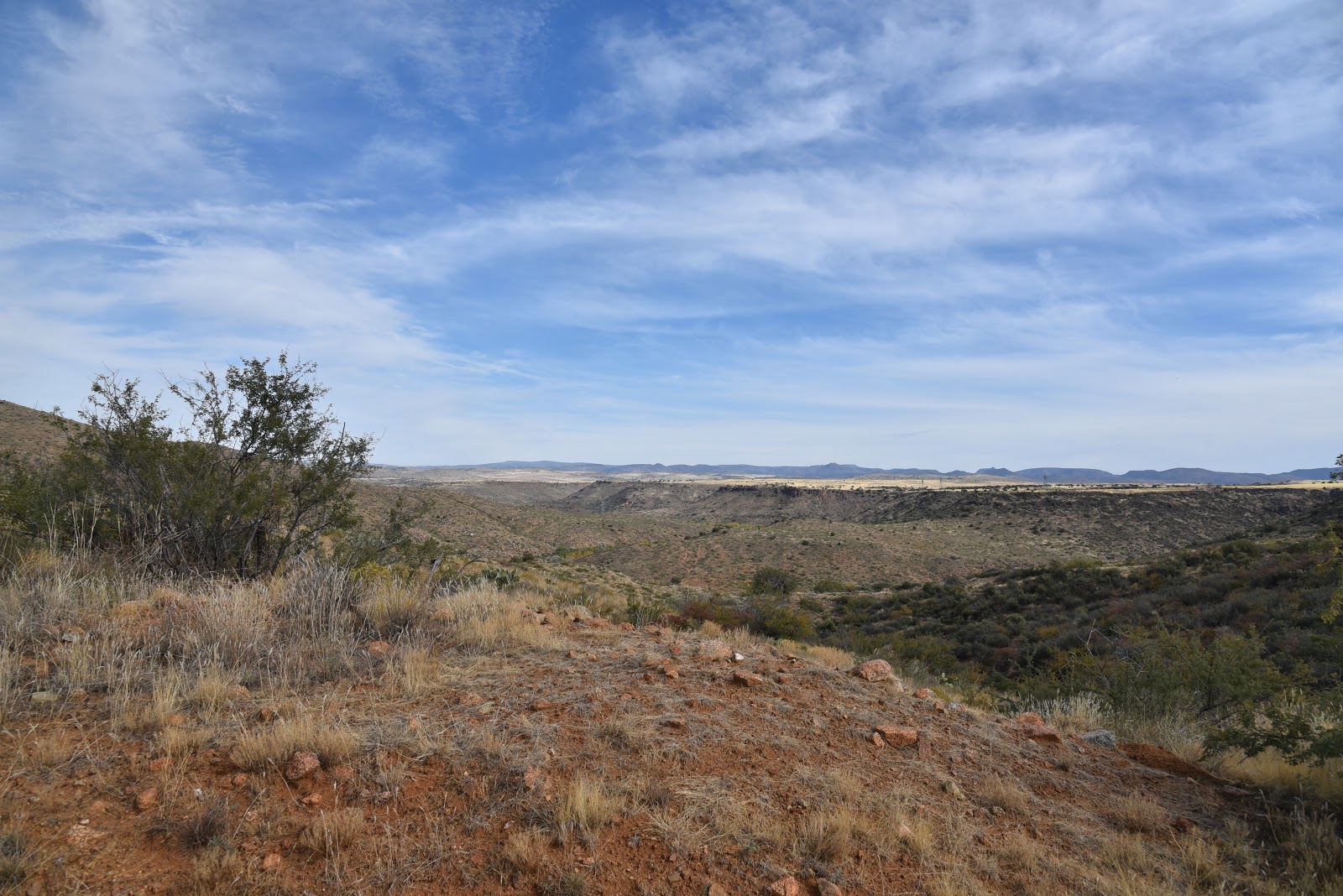
Another half-mile haul of huff-and-puff hiking culminates at a crest overlooking Perry Mesa and the twisted gorge of the Agua Fria River. 
The June 2019 Badger Springs Fire affected the area
This pinnacle is located almost d
BLM Route 9003 is rocky and steep
irectly above the point where the Badger Springs Wash trail meets the river and a heritage site with petroglyph panels.
This mind-clearing platform affords a perfect spot for contemplating scenes of a landscape where ancient inhabitants once occupied dozens of major communities, outposts and agricultural plots.  Situated among a string of power lines, the faint hum of traffic on Interstate 17 and the scribble of Bloody Basin Road meandering in the distance, the lofty post frames a juncture of heritage sites and modern technology that bridges the divide between feral and frenetic.

Hikers approach the scenic overlook site
LENGTH: 2.6 miles roundtrip  or  4.6 miles with Badger Springs Wash
RATING: moderate
ELEVATION: 3,093 – 3,456 feet or 2,,900 – 3,456 feet with Badger Springs Wash.
GETTING THERE:
From Phoenix, go 40 miles north in Interstate 17 to the Badger Springs exit #256.  Follow Badger Springs Road 1 mile (past the main kiosk and restroom) to the Badger Springs trailhead. Dirt and gravel access road is passable carefully-driven sedans. 
INFO: Agua Fria National Monument


Tuesday, November 5, 2019

RANGER TRAIL

RANGER TRAIL
South Mountain Park, Phoenix
View from the National Trail on the Gila Range of So.Mtn.
South Mountain cuts an impressive profile in the skyline south of downtown Phoenix.  
The “mountain” isn’t a singular massif as the name implies, but a conglomerate of three parallel ranges that sit within the park boundaries and dovetail in a way that creates a fascinating environment of canyons, washes and rugged pinnacles. Over 50 miles of trails explore the park’s nooks, alcoves, high points and heritage sites.
The Ranger Trail crosses a scoured bajada.
Trails range in difficulty form the barrier-free Judith Tunell trail near the South Mountain Environmental Education Center to the challenging routes that ascend the three ranges for panoramic views of the Valley. As the park undergoes a major freshening-up in advance of its 100-year anniversary in 2024, there are more reasons than ever to take a hiking trip to this 16,000+-acre municipal park and Phoenix point of pride. Improved facilities, more and better trails and upgraded trailheads will undo much of the spoilage caused by nearly a century of use.
The Ranger Trail departs from the Five Tables picnic area
Seed pods on a Foothills palo verde tree
An edge-hugging section of the Ranger Trail.
Hikers looking for a trail with a moderate level of difficulty and enough elevation gain to get to outstanding mountaintop vistas, will find the Ranger Trail is an excellent choice. Beginning at the Five Tables picnic area where crowds are lighter than at many of the park’s bigger trailheads, the moderated-rating route heads up to a scenic notch in the Gila Range, the linear hill that rises at the cusp of the Ma Ha Tauk Range to the north and the massive Guadalupe Range to the east. 
The Sierra Estrella Mountains on the western horizon
A few yards from the trail, the route crosses a mesquite-cluttered bajada—a wash-like geological feature where debris and sediments scoured from the surrounding mountains have cut a deep channel through the foothills. The first 0.7-mile of the hike is an easy walk through open desert with sporadic palo verde trees, huge saguaros and fragrant creosote shrubs that frame views of the pointed peaks of the Sierra Estrella Mountains on the western horizon. 
Much of the Ranger Trail follows a rocky, edgy path
Where the trail crosses Summit Road, the route begins a continual climb on edge-hugging switchbacks that  dodge in-and-out of stony clefts and tight bends.  On the way up, views of the geometric layout of downtown melts into suburbs and distant wilderness mountains. Sometimes, pop-pop sounds of target practice coming from the nearby police academy rifle range echo off the slopes. 


View from the top of the Gila Range in So. Mtn. Park
The Ranger Trail ends just a few yards from the National Trail, a 15.5-mile path that’s the highest and longest in the park.  The final trudge to the crest pays off with sweeping 360-degree vistas that incorporate urban centers, farmlands and sprawling bedroom communities. 
Ranger Trail crosses Summit Road 
Although this perch makes for a satisfying 3-miler turnaround point, the hike may be extended by consulting the park map. One easy add-on option is to head hike 1.4 miles east on the National Trail to the iconic Telegraph Pass Lookout for a 5.8-mile trip. 
View of the destination high point on the Ranger Trail
Fragrant creosote shrubs line the lower section of the trail
Steep switchbacks near the top of the Ranger Trail
LENGTH: 3 miles round trip
RATING: moderate
ELEVATION: 1,443 – 2,278 feet
GETTING THERE:
From downtown Phoenix, go south on Central Avenue to the main park gate. Continue one mile on the main park road (Steven Mather Drive) to the turn off for the Five Tables picnic area, turn left, go 0.1-mile and turn right into the trailhead parking area.
INFO:
-->

Monday, October 28, 2019

Kel Fox Trail

KEL FOX TRAIL
The highpoint saddle on Kel Fox trail

Kel Fox trail, quelle surprise. 
The under-the-radar outlier route located on the southern fringes of the Village of Oak Creek suffers from bland 2-star ratings. Its scenic qualities are often besmirched by online trail reviews because it shares space with a gas pipeline.

Kel Fox trail begins near Fuller Tank
View along FR 9500N near Fuller Tank
But those who buy into naysayers cracklings and visions of noxious fumes will be deprived of a perfectly fine trek with epic vistas and a pleasing backcountry mood.
View from the highpoint of Kel Fox trail
Truth be told, the moderate out-and-back trail does follow the course of an underground natural gas pipeline, but the only evidence of the buried utility feed are blaze-yellow posts placed every hundred yards or so along the two-part hike.  
The first part of the hike follows FR 9500L
Eroded FR 9500L leads to the Kel Fox trailhead
The first segment of the trek follows Forest Road 9500L, a rugged, 1.4-mile track that leads to Fuller Tank and the official Kel Fox trailhead in Coconino National Forest. 
Cacti-studded slopes on Kel Fox trail
Although the road is open to motorized travel, washouts, sandy sections and deep ruts require at least a high clearance vehicle.  Hikers will do better to park and walk the road instead.  Forest Road 9500L parallels Beaverhead Flat Road--a busy byway between State Route 179 and the communities of Cornville and Cottonwood--for roughly a quarter-mile before it swings north leaving the road rumble behind.  Wide and easy to navigate, the road plows north on an undulating course through yucca-studded rangeland and scoured gullies.
Only yellow posts betray the maligned pipeline location 
Directly ahead, colorful sandstone mesas and volcanic peaks dominate the landscape. At the 1-mile point, veer left onto Forest Road 9500N that traces the contours of the massive stone formations on its way to Fuller Tank and the start of the second leg of the hike.  
Approaching Fuller Tank
Built into a cleft at the foot of a mountain pass, the tank sits behind a weedy, earthen dam where a small patch of cottonwood trees soak up water that ebbs and expands with precipitation and snowmelt. 
Kel Fox trail ascends a scenic mountain pass
A sign points to the Kel Fox trail, but during times when the tank spills over the main entryway, the route may also be accessed by crossing the dam, passing through three metal posts and following the workaround path back to the main trail.  Beyond the tank, the route becomes a slender singletrack that heads up the pass through abundant cacti, ocotillo and mesquite trees.  In several spots where game trails and drainages muddle the way, the maligned gas pipeline posts redeem themselves as handy directional beacons. 
Fuller Tank (dry on 10-27-19) near the Kel Fox trailhead
As the trail climbs along forested edges and rocky cliffs, terrific views of the Verde Valley and Prescott National Forest mountain ranges open up to the south.  Just under a mile above the tank, the route emerges from the narrow canyons and enters a high meadow where views of Sedona-area rock formations begin to peek out over a grassy saddle. 
The breezy, grassy saddle on Kel Fox trail
Soon, the trail tops out on the hike’s premier attraction, a breezy mountain pass slung between high-desert plateaus with surprising, breath-taking vistas.  It’s here where the trail reveals its hidden charms and earns absolution from its ho-hum reviews.
FR 9500N leads to Fuller Tank
From the rewarding high point, the trail heads downhill swallowing up the views as it descends on a fairly steep and slippery path.  The trail ends at a nondescript gate in a residential community where very limited parking squashes any idea of making this a car-shuttle hike. That’s why many hikers prefer to call the scenic saddle the turnaround point for the hike.
Mesas and peaks along FR 9500L
Approaching the scenic pass on Kel Fox trail
LENGTH: 6.8 miles roundtrip
RATING: moderate
ELEVATION:  3,780 – 4,235 feet
GETTING THERE:
From Interstate 17 north of Camp Verde, take the Sedona/Oak Creek exit 298 for State Route 179. Go 4 miles northwest on SR 179 (toward Sedona), turn left on Beaverhead Flat Road (County Road 78) and continue 0.8-mile to Forest Road 9500L on the right.  Cross the cattle guard and park in the pullouts along the road.
INFO: Coconino National Forest
-->

Monday, October 21, 2019

GO JOHN TRAIL

GO JOHN TRAIL:Cave Creek Regional Park
View of the Cave Creek Mountains from Go John Trail

Situated in a hilly slice of desert just a few miles east of Interstate 17, Cave Creek Regional Park is bordered by an eclectic brew of subdivisions, strip malls, nature preserves and national forest. 
West leg of the Go John loop is part of the Maricopa Trail
Somehow, the seemingly miss-matched adjacencies blend into a sort of extended back yard for North Valley outdoor recreation. Replete with the standard amenities of suburban patio life, the family-friendly park has a nature center, frequent workshops and events, picnic ramadas, restrooms, water, playground, horse staging area and camping. 
Flaky metamorphic rock outcroppings line the route
But beyond the grills and easy interpretive trails, there are also plenty of ways to escape into the wild end of the 2,922-acre site.
Of the eight trails in Cave Creek Regional Park, Go John is the deep-cut classic. As the core loop in the Maricopa County park’s 14-plus-mile trail system, the moderate-rated hike explores some of the most remote and scenic corners of the property.

Elephant Mountain in distance
Downtown Phoenix visible on the distant horizon
Scaly rock formations at Gunsight Pass
The beautiful thing about loop hikes like this one are the continually-changing views and Go John delivers the goods in far-reaching vistas, cloistered passages, a variety of geological features and rich plant communities. To get the major climbing done first, begin the loop at the north trail sign where the route dives right into the zig-zagging western leg of the loop that’s also part of the Valley-circumnavigating Maricopa Trail that connects all 10 county parks.
Long switchbacks mitigate the climb on Go John Trail
Quartz deposits appears along the route
The ascent is mitigated by long switchbacks cut from foothills that swing around desert trees and saguaro-cluttered bends. The first big views are revealed after less than a mile of uphill trudging. Sloping canyon walls frame hazy patterns of Downtown Phoenix and the jagged silhouettes of the Hieroglyphic Mountains west of the Valley.  The west leg tops out at a saddle where the first of several benches offers a place to enjoy glimpses of the Cave Creek Mountains and the distinctive pachyderm profile of Elephant Mountain appear to the north.
Continually-changing vistas are key features on Go John Trl
A large clearing on the saddle makes for a good spot to regroup and take a breather before continuing on the less steep segments that complete the loop.  The route dips and climbs through shaded drainage areas, washes and ridges lined with outcroppings of vertically-tilted metamorphic rocks that shed in thin sheets, coating the ground in glinting tile-like scales. 
Palo verde and mesquite trees thrive in drainage areas
Creosote is a common shrub along the trail
Adding to the park’s interesting geology are deposits of white quartz that show up as scattered pebbles and artfully-veined boulders near defunct mining operations.  About halfway through the hike, Gunsight Pass, a high point with bizarre blade-like rock pinnacles on the loop’s east leg, hovers above golf communities and ranches backed by the commanding form of Black Mountain and the distant Superstition Mountains. 
Part of theeast leg of the hike traces a drainage gorge
A final swing on cliffs above a deep gorge leads hikers through sunny rangeland where the Quartz and Jasper Trail spin off for optional geology-themed side trips or a shorter loop for young kids.
Cholla cacti frame views of the Cave Creek Mountains
LENGTH:  5.8-mile loop
RATING: moderate-difficult
ELEVATION:  2,088 - 2,520 feet
FEE: $7 daily fee per vehicle
GETTING THERE:
37900 E. Cave Creek Parkway Cave Creek.
From Carefree Highway in Cave Creek, go 1.5 miles north on 32nd Street to the park entry gate.  Follow the main park road to the Go John trailhead.
INFO:
-->