AGUA FRIA
RIVER OVERLOOK
Agua Fria National Monument
 |
| A hiker at an overlook above the Agua Fria River |
Few things
make hikers cringe more than seeing smoke rising from treasured hiking hubs. Hiker
ire was raised earlier this year when the Badger Springs Fire broke out along
Interstate 17 south of Cordes Junction.
 |
| Rock pinnacles along BLM Route 9003 in AFNM |
The June 2019 blaze consumed
2,525-acres of brush and high grasses in the Agua Fria National Monument near
the popular Badger Springs Wash trail.
The ashen burn scar is still visible from the freeway and an acrid
tang still rises with early morning fog.
 |
| Hikers make the 400-foot ascent to a scenic overlook |
Despite
the difficulties of managing fire incidents like this one that involve steep,
inaccessible terrain, the monument’s mile-long signature trail mostly escaped
major damage. Telltale signs of the fire
mar the surrounding grasslands and vertical cliffs that bolster the Agua Fria
River canyon, but leafy riparian corridors remain unscathed.
 |
| A pollinator alights on a buckwheat shrub along the road |
Even though the drive-by perspective of the
fire damage is quite severe, this should not be a deterrent to exploring the
trails and back roads of the 71,000-acre national monument. Although the Badger Springs Wash trail is a great
place to sample the many aspects of the monument’s terrain, it barely scratches
the surface in terms of grasping the scope of its natural resources and cultural
importance. To fill in the gaps, during dry conditions the short hike may be
extended by scooting around boulders and soggy sandbars in the rugged water
channel or by trekking nearby dirt tracks.
 |
| The hike follows BLM Route 9003 |
Many
walkable roads delve deeper into the site’s remote corners and scenic
high points. One such road that leads to a heart-stirring overlook spins off
just yards from the Badger Springs Wash trailhead. Bureau of Land Management Route 9003 swerves
away from the busy parking area through what initially looks like a
not-too-interesting swath of scrubland. Look carefully to the northeast, and
the barely visible road cut can be seen crawling up the flanks of a barren
mesa.
The first
quarter mile of the route is a little tricky to navigate, but once past a maze
of unsigned roads that spin off the primary track, the route is obvious. Here’s
how it works.
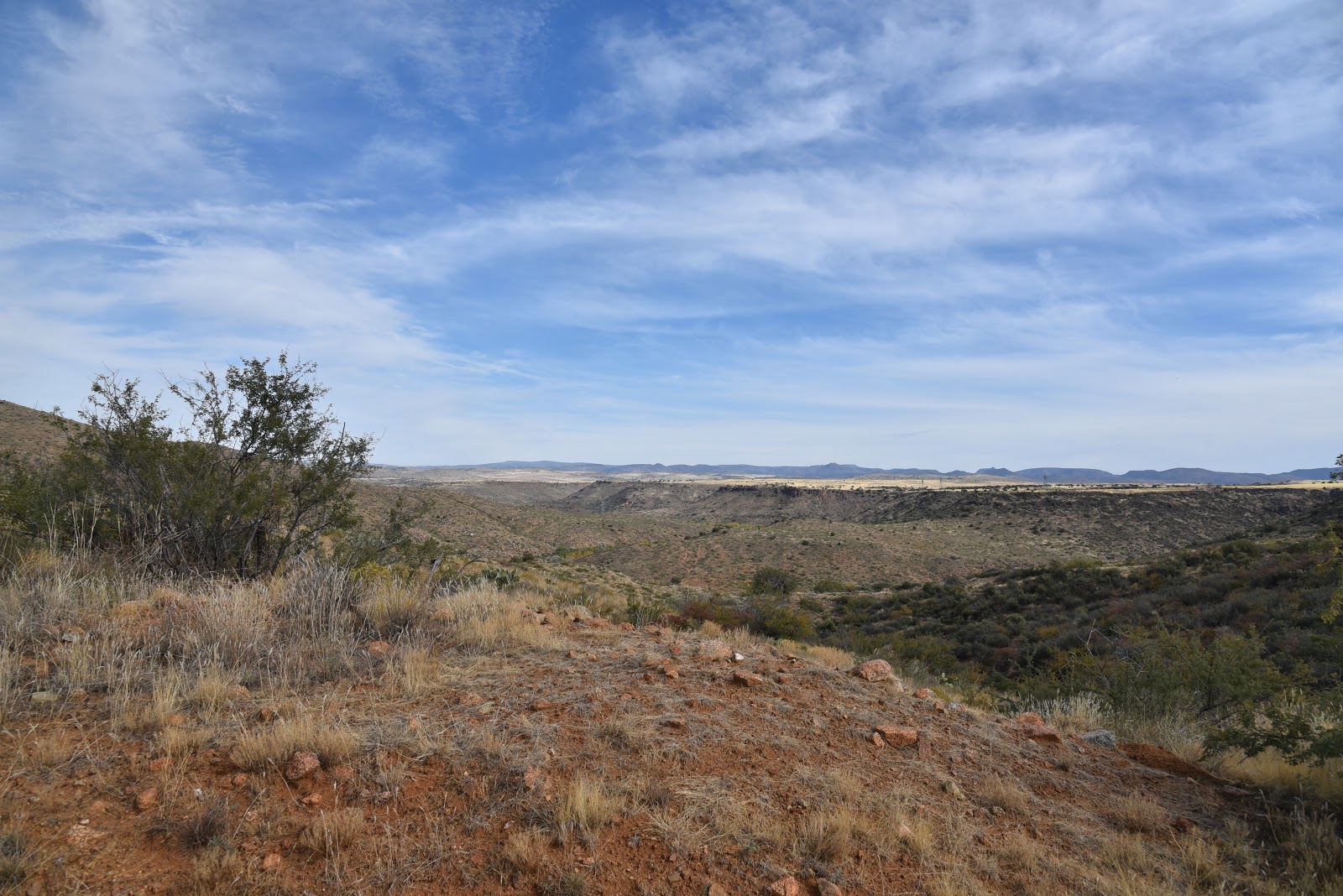
This mind-clearing platform affords a perfect spot for contemplating scenes of a landscape where ancient inhabitants
once occupied dozens of major communities, outposts and agricultural plots. Situated among a string of power lines, the faint hum of traffic on Interstate 17 and the scribble
of Bloody Basin Road meandering in the distance, the lofty post frames a juncture of heritage sites and modern technology that bridges the divide between feral
and frenetic.
 |
| Hikers approach the scenic overlook site |
LENGTH:
2.6 miles roundtrip or 4.6 miles with Badger Springs Wash
RATING:
moderate
ELEVATION:
3,093 – 3,456 feet or 2,,900 – 3,456 feet with Badger Springs Wash.
GETTING
THERE:
From
Phoenix, go 40 miles north in Interstate 17 to the Badger Springs exit
#256. Follow Badger Springs Road 1 mile
(past the main kiosk and restroom) to the Badger Springs trailhead. Dirt and
gravel access road is passable carefully-driven sedans.
INFO: Agua
Fria National Monument


No comments:
Post a Comment