Find A Trail. Start Your Search Here:

Wednesday, November 21, 2018

BROWN MOUNTAIN

BROWN MOUNTAIN
Browns Mountain Trail surprises with sweet vistas.
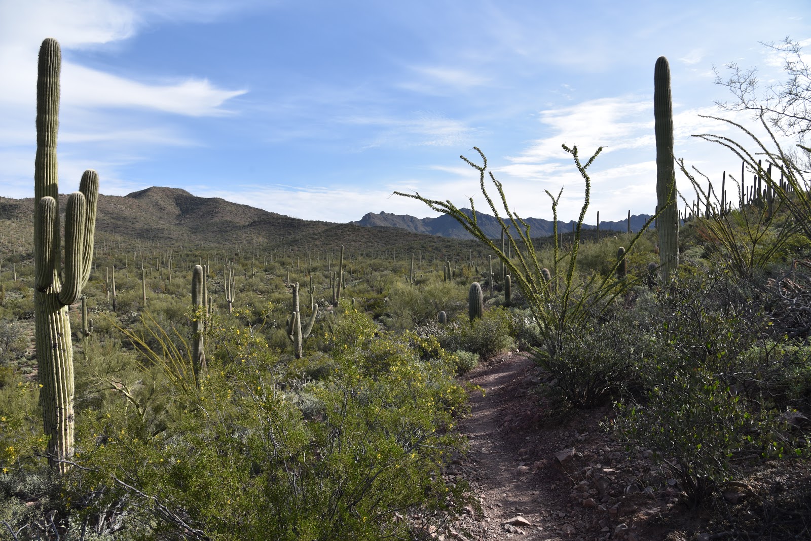
When compared to the soaring peaks and jagged ridges that surround it, Brown Mountain reads more like a molehill. But don’t be too quick to shrug off hiking the hill that anchors the west end of Tucson Mountain Park in Pinal County. Its wallflower appearance belies a memorable hike replete with rich Sonoran Desert vegetation and far-reaching vistas.
Ascending the flanks of Browns Mountain.
Although a hike on the moderate-rated Brown Mountain Trail is a less intimidating trek than say, adjacent King Canyon Trail to Wasson Peak, the little adventure still packs a respectable punch with some edgy exposure and steep slopes.
Overlooking the Tohono O'Odham reservation.
Seeds of a Slender Janusia vine cling to a shrub.
C.B. Brown is considered the founder of Tucson Mtn. Park.
Accessible by way of several picnic areas within the park, the hike begins with an initial descent and wash crossing before taking on the switchbacks that climb to the mountain’s crest.
Except for a few places where the trail clings to cliffs with vertical drop offs and some areas of loose rock, the climb requires only moderate effort. 
Fruits on Anderson's Thornbush.
Twisting skyward among impressive stands of saguaros, cholla, mesquite and blooming shrubs entwined with wild vines, the trail dodges stony crags stained in the colors of wine and rust.  It doesn’t take long for the ascent sweat to start paying dividends. As the trail loops up and over the mountain, it delivers a carousel-like experience of ever-changing scenery.
A rugged wash cuts into the base of the mountain.
Distant peaks on horizon.
The lower leg of the loop features views of the Tuscon Mtns.
Colorful rock outcroppings line the route.
Atop the mountain’s hogback ridgeline, an unobscured panorama of sprawling valleys and layers of mountain ranges takes center stage. To the north and east, the Tucson Mountains form a ragged wall of imposing pinnacles. To the south and west, expansive flatlands of the Tohono O’Odham reservation and the Aguirre Valley melt into the hazy silhouettes of Kitt Peak, the Santa Rosa Mountains, Mount Wrightson and the singular form of Baboquivari Peak. 
Directly north, the muted green scrub and grasslands of Saguaro National Park remind that this is one of most dense and diverse desert plant and wildlife environments in Arizona.  The return leg of the hike traces the mountain’s lower north flank capping off a short but rewarding outing.  Because this hike won’t take very long to complete, plan on extending your visit by exploring nearby Arizona-Sonora Desert Museum, Old Tucson Studios or the many attractions at Saguaro National Park.
Arizona-Sonora Desert Museum seen from the trail.
LENGTH: 3.7-mile loop
RATING: moderate
ELEVATION: 2650- 3100 feet
GETTING THERE:
From Interstate 10 in Tucson, take the Speedway Blvd. exit 257, head west and continue 9.4 miles on Speedway (turns into Gates Pass Road at 4.6 miles) to Kinney Road. Turn right on Kinney Road and continue to either of the two main access points along the road. It’s 0.8-mile to the Brown Mountain picnic area or 2.2 miles to the Juan Santa Cruz picnic area.  At the Brown Mountain site, the trail begins at the picnic area near the C.B. Brown sign. At the Juan Santa Cruz site, the trail begins just past the fenced-off ramada near a grill and picnic table.
INFO & MAPS:
Tucson Mountain Park

Monday, November 19, 2018

Celebrate & Support the Maricopa Trail

Celebrate & Support the Maricopa Trail
Full Circle.
On Saturday, November 17, 2018, the sweet aroma of singed wood at Cave Creek Regional Park marked the completion of Phase 1 of the Maricopa Trail.  Using a hot branding iron, Former Maricopa County Board Supervisor Andy Kunasek and current Maricopa County Board Supervisor, Steve Chucri brought the nearly two-decade-long effort of building the Valley-circumnavigation route full circle by burning the initials “MT” into a wood panel, exactly as was done at the trail’s 2004 groundbreaking.
Ceremonial final shovelfuls.
American Conservation Experience.
The branding followed a ceremonial tossing of the final shovelfuls of dirt onto the trail and the unveiling of a new informational kiosk at the Overton trailhead where the Maricopa Trail departs the park on its 315-mile journey. Speakers, information booths, guided hikes and the release of two Harris's Hawks rehabilitated by Wild at Heart, a rescue organization for birds of prey, made for a full morning of festivities.
Brian Derrick
Initial plans for the trail were rolled out in 2000. What followed was years of cooperative planning and elbow grease across multiple governmental agencies, businesses, communities and volunteer organizations.
The primary driver was Andy Kunasek, an outdoor enthusiast and former public servant who saw the value in creating a non-motorized  trail that would connect ten county parks to provide recreational opportunities while protecting natural and cultural resources along its route.  
Andy Kunasek
Often referred to as “The Father of the Maricopa Trail”, Kunasek pushed for the financial support, alliances, easements and ongoing partnerships that made the route possible. He is also the founder of the Prickly Pedal mountain bike race which supports the Maricopa Trail + Park Foundation (MT+PF), a nonprofit organization that provides sustainable financial support and volunteer trail maintenance.
Maricopa Trail + Park Foundation
The annual event will take place on January 19, 2019 and will include a grueling 40-mile race on the trail between Spur Cross Ranch Conservation Area in Cave Creek and Lake Pleasant Regional Park, a 13-mile Fun Ride tailored to more casual riders and the ever-popular Kids Race where young riders ages 6 to 11 vie for medals and glory.  New this year—for non-bikers-- is an 8k trail run that will feature a rumble through the trail’s rugged beauty and diverse terrain.  But you don’t have to be a rider or runner to show your support for the trail. Spectators can enjoy a day of fun and activities followed by an awards ceremony and post-ride party by the lake with live music, food and beer garden.
Desert beauty on the Maricopa Trail.
Hiking the Maricopa Trail
Hawk release
Although the main big loop is now complete, the Maricopa Trail will continue to evolve and grow with added connectivity to municipal parks, communities and urban centers.  With dozens of trailheads and access points along its route, it’s easy to step out on the trail from just about anywhere in the Valley.  A good place to start is at Cave Creek Regional Park with a moderate
Dedication ceremony
Prickly Pedal Bike Race 2018
trek to the Andy Kunasek at Spear S Ranch Trailhead. 
Scorpion demonstration
This stretch of the trail wanders through a lush and diverse desert landscape in the shadow of Apache Peak. 
Harris's hawks take flight
Running through washes, mesquite forests and foothills lodged between the Tonto National Forest and north Phoenix suburbs, the segment has a remote feel and outstanding vistas.  Hike this section as a 13.2-mile out-and-back or a 6.6-mile one way car shuttle.  As Brian Derrick, MT+PF President said at the dedication ceremony, “One of the best ways you can show support for the trail is to get out and hike on it.”

PHOTO CAPTIONS
Full Circle: RJ Cardin, Maricopa County Parks and Recreation Director displays the ceremonial brand denoting the completion of Phase 1 of the Maricopa Trail.
Ceremonial Final Shovelfuls: Dignitaries place the final touches on the trail.
American Conservation Experience:
The Flagstaff-based volunteer organization began assisting with Maricopa Trail building and maintenance in 2016.
Brian Derrick: Maricopa Trail + Park Foundation President spoke about the importance of trail maintenance and volunteerism.
Andy Kunasek: The Father of the Maricopa Trail spoke about the history of the trail.
Maricopa Trail + Park Foundation:
Board members, Larry Sneed and Jan Hancock, invite visitors to check out the volunteer trail maintenance trailer provide by REI.
Desert beauty on the Maricopa Trail: View from the trail that runs between Cave Creek Regional Park and Spear S Ranch.
Hiking the Maricopa Trail:
View from the trail that runs between Cave Creek Regional Park and Spear S Ranch.
Hawk release:  Steve Chucri, Maricopa County Board of Supervisors Chairman and former Chairman, Andy Kunasek get ready to release rehabilitated Harris's hawks into the park.
Dedication ceremony: RJ Cardin, Maricopa County Parks and Recreation Director emceed the event.
Prickly Pedal: Finish line scene from the 2018 race.
Scorpion: An Arizona Game and Fish representative displays a scorpion at the event.
Harris's hawks take flight: Two raptors rehabilitated by Wild at Heart fly into their new home. A silhouette of a Harris's hawk appears in the Maricopa Trail logo.


Maricopa Trail Anthem-Cave Creek-Spur Cross Segment Sampler:
LENGTH: 6.6 miles one-way
RATING: moderate
ELEVATION: 2050' - 2295'
GETTING THERE:
Cave Creek Regional Park Overton Trailhead:
37900 N. Cave Creek Parkway, Cave Creek.
From Carefree Highway in Cave Creek, go north on 32nd Street to the park entry gate.  Follow the main park road to the Overton trailhead at the nature center.  There’s a $7 daily fee per vehicle.
Andy Kunasek at Spear S Ranch Trailhead:
41799 N. New River Road.
From Carefree Highway in Cave Creek, go north 4.5 miles north on 7th Street, (turns into New River Road) to the trailhead on the right just before Linda Lane.


INFO & MAPS: Maricopa Trail

Prickly Pedal Bike Race: January 19, 2019.

Maricopa Trail + Park Foundation

Friday, November 16, 2018

LaBARGE NARROWS

LaBARGE NARROWS
LaBarge Narrows in the Supes.
Hike begins near Canyon Lake.
LaBarge Creek route.
Not for the novice hiker, this combination hike and cross-county exploration leads to a breathtaking, secluded box canyon with that harbors a cloistered riparian ecosystem in the Superstition Wilderness near Canyon Lake.
Hiker at the base of Narrows walls.
The adventure follows Boulder Canyon Trail #103 along a desert ridge above Canyon Lake Marina before making a steep descent to where LaBarge Creek flows across the trail at the 2.9-mile point.
LaBarge Creek terrain.
Boulder Trail crosses the stream and veers right, but to get to the box canyon, leave the trail, veer left and follow the creek bed heading southeast. (Note: this route may be impassible after heavy rains.) From this point on, the hike is a cross-country boulder scramble.
Heading down Boulder Trail.
Do not attempt this hike if you are not in shape or lack basic route-finding skills.  
Battleship Mtn. flanks the rough route.
Save some energy for the hike out.
Inside the Narrows
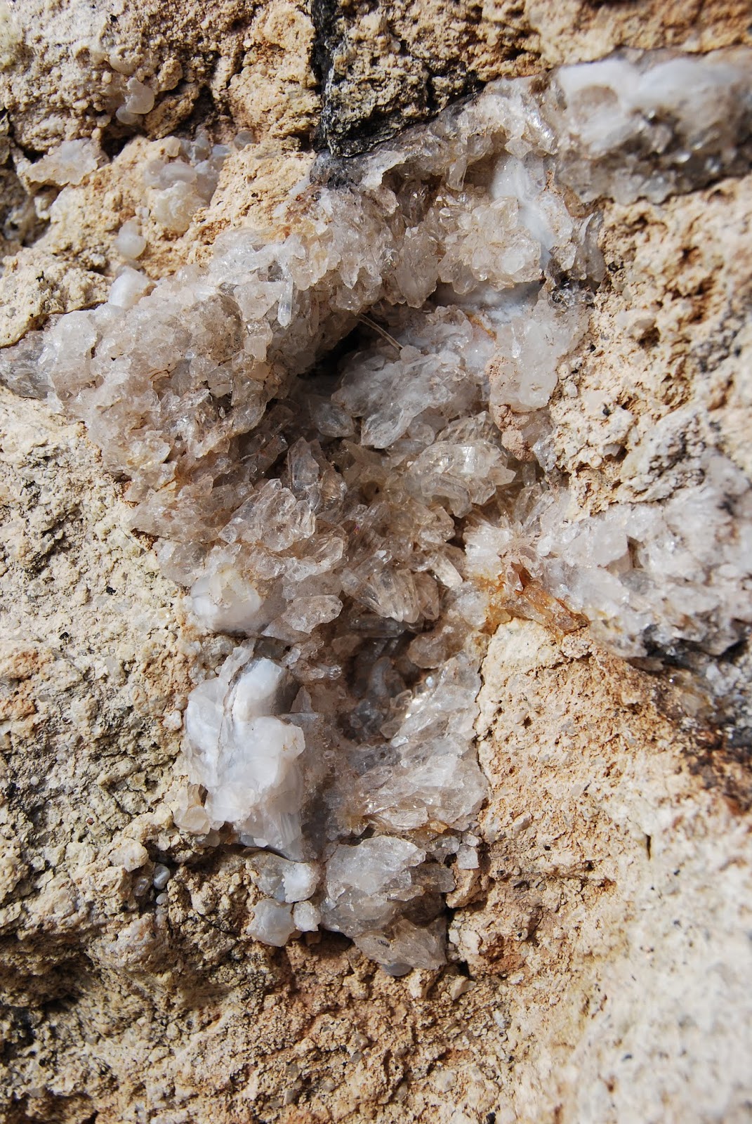
The destination appears as a prominent pyramid-shaped outcropping upstream--use that as your guide. As the route traverses the rugged sycamore-and-bear-grass-lined washes in the shadow of blocky Battleship Mountain, which flanks the western edge of the watercourse, the passage gets progressively tougher until, at the entrance to the “narrows”, the canyon is choked with massive quartz-encrusted monoliths.
Boulders at the Narrows entrance.
Strong hikers will have no trouble picking through the rocks to reach the goal. Within the towering walls of the narrows, golden Velvet ash trees dot the shores of tiny pools like windswept beacons of light. Autumn foliage color usually lasts through mid-December here unless frost turns the leaves prematurely brown.
Rough route is not for novice hikers.
Darting flocks of canyon wrens, chattering cardinals and roosting hawks find food and shelter among the cattails, reeds and willows that feast on the precious waters of LaBarge Creek.
Quartz crystals embedded in boulders.
Depending on water levels, you can hike through the twisting, rocky corridor as far as you like but consider your time wisely as the return trip back up the canyon will feel worse and take longer than you’d expect. The second bend within the narrows at roughly the 4.7-mile point makes for a good turnaround point leaving plenty of time to slog your way out with daylight to spare.
LENGTH: 9.4 miles out-and-back
RATING: moderate-difficult
ELEVATION: 1,600 – 2,400 feet
GETTING THERE: From U.S. 60 in Apache Junction take the State Route 88 (Idaho Road) exit. Turn left at the off-ramp light and continue on SR 88 for 15 miles to the Canyon Lake Marina between mileposts 210 and 211. A Tonto Pass is not required if you park in the designated hiker parking area. The trail begins at the sign for Boulder Canyon Trail #103 across the road.
Battleship Mtn (L) and Weavers Needle (C) from Boulder Trl
Canyon Lake seen from Boulder Trail.
INFO:
Tonto National Forest, Superstition Wilderness

Monday, November 12, 2018

PYRITE TRAIL

PYRITE TRAIL
The Pyrite trail traverses several ridges & high passes.
One of the most striking features of Skyline Regional Park’s Pyrite Trail is its quiet atmosphere.  The fresh-cut route is one of the newest trails in the 8700-acre park located 2 miles north of Interstate 10 in Buckeye. 
Sierra Estrella Mountains on the far horizon.
The moderate-rated path begins 1.4 miles from the trailhead and can be harnessed into several loop hike options.  Exploring the park’s western edge, the trail spins off the heavily-travelled Granite Falls-Chuckwalla-Turnbuckle circuit and heads into a cloistered wilderness of sound-stifling mountain peaks and scoured washes.
Creosote bloom along the park trails.
 
View from a high pass on Pyrite Trail.
The muffled sounds of wind, wings and scampering critters dovetail nicely with the desert solitude.
Washes and mountains muffle noise.
Like a great actor in an even better play, the silence here is the character that anchors the storyline without disrupting the plot.  The “plot” of this adventure is how the trail mitigates a 700-foot climb to a climatic summit by way of deceptively intimidating switchbacks.
Milky quartz spills from fractured cliffs.
Just under a mile into the trail, a set of climb-calming zig-zags take on a ragged ridgeline of mineral-stained volcanic and metamorphic rocks.  Although the switchbacks look imposing from a distance, the climbing is only a moderate slog. 
The final set of switchbacks visible below a peak.
On the way up the ridge, chunks of milky quartz that somestimes occurs with pyrite-- an iron sulfide mineral commonly known as "fools gold"--cascade down the escarpments settling in shiny heaps at the bases of barrel cacti and cholla. As the trail gains elevation, views to the south feature the peaks of the Sierra Estrella Mountains and the sprawling Gila River drainage basin. After roughly a quarter-mile, the trail comes to a pass where the foothills and valleys of the southern White Tank Mountains roll out to the north. Ahead, another set of switchbacks creep up a steeper ridge with several sheer drop offs and scenic vista points. 
Chuckwalla Trail return route visible in the valley below.
Pyrite Trail ascends the ridgeline in the center of photo.
The slightly more vertical and precipitous segment culminates at an airy gap overlooking the park’s trail-rich midsection (those squiggly lines below are the return routes), green farmlands to the southwest and a glimpse of the remainder of the trail as is snakes up a bluff on a scary-looking edge to the trail’s highpoint.  Again, it’s not as bad as it looks.
Switchbacks appear more difficult than they are.
Desert lavender grows in washes along the trail.
At the top, the optional 0.6-mile roundtrip Pyrite Summit spur trail wanders out onto a queasy lookout point for rewarding 360-degree vistas.  From the highpoint, the trail then makes a 0.4-mile descent to connect with the Chuckwalla Trail where heavier foot traffic and swooping bikes mark the end of the nature-insulated hush. For a 6.7-mile roundtrip hike, go right at the junction and follow the signs back to the trailhead or use the park maps to build a longer trek.
Trailhead in distance seen from Pyrite Trail.
LENGTH: 6.7-mile loop (as described here)
RATING: moderate
ELEVATION: 1500 – 2200 feet
GETTING THERE:
Skyline Regional Park, 2600 N. Watson Road, Buckeye.
From Interstate 10 in Buckeye, take the Watson Road exit 117 and go 2 miles north to the park. Roads are paved.
Pyrite Trail spins off busier park trails.
There are restrooms, campsites and picnic areas at the trailhead. No day use fees. Camping is by reservation only.
HOURS: Trails open daily from sunrise to sunset. Gates close at 10 p.m.
INFO & MAPS: