BROWN MOUNTAIN
 |
| Browns Mountain Trail surprises with sweet vistas. |
When compared to
the soaring peaks and jagged ridges that surround it, Brown Mountain reads more
like a molehill. But don’t be too quick to shrug off hiking the hill
that anchors the west end of Tucson Mountain Park in Pinal County. Its wallflower appearance
belies a memorable hike replete with rich Sonoran Desert vegetation and
far-reaching vistas.
 |
| Ascending the flanks of Browns Mountain. |
Although a hike
on the moderate-rated Brown Mountain Trail is a less intimidating trek than
say, adjacent King Canyon Trail to Wasson Peak, the little adventure still
packs a respectable punch with some edgy exposure and steep slopes.
 |
| Overlooking the Tohono O'Odham reservation. |
 |
| Seeds of a Slender Janusia vine cling to a shrub. |
 |
| C.B. Brown is considered the founder of Tucson Mtn. Park. |
Accessible by
way of several picnic areas within the park, the hike begins with an initial
descent and wash crossing before taking on the switchbacks that climb to the
mountain’s crest.
Except for a few places where the trail clings to cliffs with vertical drop offs and some areas of loose rock, the climb requires only
moderate effort.
 |
| Fruits on Anderson's Thornbush. |
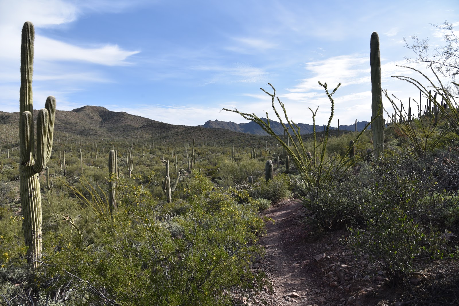
Twisting skyward among
impressive stands of saguaros, cholla, mesquite and blooming shrubs entwined
with wild vines, the trail dodges stony crags stained in the colors of wine and
rust. It doesn’t take long for the
ascent sweat to start paying dividends. As the trail loops up and over the
mountain, it delivers a carousel-like experience of ever-changing scenery.
 |
| A rugged wash cuts into the base of the mountain. |
 |
| Distant peaks on horizon. |
 |
| The lower leg of the loop features views of the Tuscon Mtns. |
 |
| Colorful rock outcroppings line the route. |
Atop the
mountain’s hogback ridgeline, an unobscured panorama of sprawling valleys and
layers of mountain ranges takes center stage. To the north and east, the Tucson
Mountains form a ragged wall of imposing pinnacles. To the south and west,
expansive flatlands of the Tohono O’Odham reservation and the Aguirre Valley
melt into the hazy silhouettes of Kitt Peak, the Santa Rosa Mountains, Mount
Wrightson and the singular form of Baboquivari Peak.
Directly north,
the muted green scrub and grasslands of Saguaro National Park remind that this
is one of most dense and diverse desert plant and wildlife environments in Arizona. The return leg of the hike traces the
mountain’s lower north flank capping off a short but rewarding outing. Because this hike won’t take very long to
complete, plan on extending your visit by exploring nearby Arizona-Sonora
Desert Museum, Old Tucson Studios or the many attractions at Saguaro National
Park.
 |
| Arizona-Sonora Desert Museum seen from the trail. |
LENGTH: 3.7-mile
loop
RATING: moderate
ELEVATION: 2650-
3100 feet
GETTING THERE:
From Interstate
10 in Tucson, take the Speedway Blvd. exit 257, head west and continue 9.4
miles on Speedway (turns into Gates Pass Road at 4.6 miles) to Kinney Road.
Turn right on Kinney Road and continue to either of the two main access points along
the road. It’s 0.8-mile to the Brown Mountain picnic area or 2.2 miles to the Juan
Santa Cruz picnic area. At the Brown
Mountain site, the trail begins at the picnic area near the C.B. Brown sign. At
the Juan Santa Cruz site, the trail begins just past the fenced-off ramada near
a grill and picnic table.
INFO & MAPS:
Tucson Mountain
Park


No comments:
Post a Comment