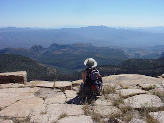
FOSSIL CREEK Bob Bear Trail
PERMITS REQUIRED
April 1st - OCT 1st.
Info & Permits:
https://www.recreation.gov/permits/251863Temporary closures may go into effect for various reasons. Check before you go.
HIKE DESCRIPTION:Hidden within the walls of a 1,600-foot-deep canyon carved out of rose-tinted sedimentary rock, Arizona’s largest and most diverse riparian area stands in stark contrast against the surrounding arid landscape. Saturated with robust greenery, countless gushing springs, soaring cliffs and refreshing swimming holes, a hike along the Fossil Springs Trail is a veritable road to a desert Garden of Eden. No serious Arizona hiker’s portfolio is complete without a trip down this classic trail. Extremely popular, the Fossil Springs trail holds many delights. The hike begins in the high desert above the canyon where scrub oak, stunted junipers, manzanita, cliff rose, and skunk bush cling to red rock escarpments. There’s little shade for the first three miles, so it’s smart to carry a gallon or more of water per person on this hike. At the bottom of the canyon, the trail becomes somewhat difficult to follow. To find your way, just head toward the canopy of green and you’ll soon encounter a series of progressively larger pools of water in the sandstone. The real adventure begins beyond the pools. After a short scramble through a jungle of cottonwoods and humungous sycamore trees, the sound of gushing water fills the air. Here, at the base of a knarled tree is the first of many springs that pump gallons of icy water per minute into Fossil Creek. At this point, the trail takes on a tropical rainforest flavor. Dozens of species of trees and shrubs grow tall and wide in the rich soil while tangled masses of Canyon grape, yuccas and beds of bright yellow columbine and monkey flowers contribute to an impenetrable undergrowth community. Arizona walnut, alder and hackberry trees make an admirable showing amid massive specimens of water-loving sycamores. The trail continues along the banks of the creek passing numerous pools complete with rope swings and wet dogs. Roughly one mile from the first spring site, the trail reaches an old concrete dam and flume system that at one time diverted Fossil Creek water to a couple of power generating plants downstream. Happily for water-loving hikers, the flume was recently de-commissioned, sending a roaring cascade of water over the cliffs into swimming holes where, on any given weekend, swarms of manic Labrador retrievers and their human companions thrash happily in the warm, mineral-rich spring water.
HIGHLIGHTS: Arizona’s largest riparian habitat, splendid waterfalls, gushing springs and sycamore-canopied alcoves.
LENGTH: 7 miles round-trip
RATING: moderate
ELEVATION: 3,800’ - 5,100’
Driving distance from Phoenix: 110 miles one-way
GETTING THERE: From Payson, travel north on Highway 87 to the town of Strawberry. From Strawberry, go left onto Fossil Springs Road (Forest Road 708) and continue for roughly 5 miles to the signed trailhead turnoff on the right. Finding the route: From the trail register, go right and downhill a short distance to an intersection with a dirt road. From there, turn right and descend along a wide path into the canyon. Facilities: vault toilet at the trailhead


 Posts
Posts


 PERALTA CANYON
Superstition Wilderness
The blistering heat of summer kicks the Sonoran desert into survival mode. During daytime, the sun’s heat sends critters scurrying for cover, wilts foliage and mutes the songs of insects and birds. Yet, under the resurrecting respite of darkness, the desert transforms into a hauntingly beautiful hiking destination. This year, the Full Buck Moon*—which will emerge within minutes of sunset—will rise on the weekend of July 28th. Although lunar glow is surprisingly bright, night hiking in the desert is still risky business. That’s why it’s smart to select familiar trails for post-sunset treks. For Valley hikers, one of the most intriguing nighttime destinations is the popular Peralta Canyon trail near Apache Junction. Moonlight bathes the jagged hoodoos that hover above this well-worn local path in an unforgettable, dreamy mauve and ocher haze. As dusk creeps through the canyons, the fragrance of night-blooming cacti--accompanied by a serenade of crickets and frogs—rides on the sultry desert air. If you begin hiking around sunset, you’ll reach the Fremont Saddle—the turnaround point for the hike--in time to witness the celestial dance of twilight as it fades to black. On the craggy saddle, in the embrace of utter darkness, the sight of the moon drifting across the night sky beguiles the senses as it drags an eerie cloak of lunar light over the desert canyon below.
*In folklore, July’s full moon is named to celebrate the budding of new antlers on deer and elk. It’s also known as the Full Thunder Moon or Full Hay Moon.
Source: Farmers Almanac
LENGTH: 4.5 miles round-trip (out-and-back hike to the Fremont saddle)
RATING: moderate
ELEVATION GAIN: 1,400 feet
GETTING THERE:
From Phoenix, take US 60 east to about 8 miles past Apache Junction and look for the “Peralta Trailhead” sign on the side of the road. Turn left onto Peralta Road (Forest Road 77) and drive 8 miles to the trailhead.
Information: fs.fed.us/r3/tonto/wilderness/superstition
Information about sunset & moonrise dates, visit:
spacearchive.info/moonrise-moonset-phoenix.txt
PERALTA CANYON
Superstition Wilderness
The blistering heat of summer kicks the Sonoran desert into survival mode. During daytime, the sun’s heat sends critters scurrying for cover, wilts foliage and mutes the songs of insects and birds. Yet, under the resurrecting respite of darkness, the desert transforms into a hauntingly beautiful hiking destination. This year, the Full Buck Moon*—which will emerge within minutes of sunset—will rise on the weekend of July 28th. Although lunar glow is surprisingly bright, night hiking in the desert is still risky business. That’s why it’s smart to select familiar trails for post-sunset treks. For Valley hikers, one of the most intriguing nighttime destinations is the popular Peralta Canyon trail near Apache Junction. Moonlight bathes the jagged hoodoos that hover above this well-worn local path in an unforgettable, dreamy mauve and ocher haze. As dusk creeps through the canyons, the fragrance of night-blooming cacti--accompanied by a serenade of crickets and frogs—rides on the sultry desert air. If you begin hiking around sunset, you’ll reach the Fremont Saddle—the turnaround point for the hike--in time to witness the celestial dance of twilight as it fades to black. On the craggy saddle, in the embrace of utter darkness, the sight of the moon drifting across the night sky beguiles the senses as it drags an eerie cloak of lunar light over the desert canyon below.
*In folklore, July’s full moon is named to celebrate the budding of new antlers on deer and elk. It’s also known as the Full Thunder Moon or Full Hay Moon.
Source: Farmers Almanac
LENGTH: 4.5 miles round-trip (out-and-back hike to the Fremont saddle)
RATING: moderate
ELEVATION GAIN: 1,400 feet
GETTING THERE:
From Phoenix, take US 60 east to about 8 miles past Apache Junction and look for the “Peralta Trailhead” sign on the side of the road. Turn left onto Peralta Road (Forest Road 77) and drive 8 miles to the trailhead.
Information: fs.fed.us/r3/tonto/wilderness/superstition
Information about sunset & moonrise dates, visit:
spacearchive.info/moonrise-moonset-phoenix.txt