SYCAMORE POINT TRAIL
 |
| Sycamore Point sits above Sycamore Canyon Wilderness |
Roughly 23 miles southeast of Williams, Arizona’s second largest canyon splits the landscape at the juncture of three national forests and two wilderness areas.
 |
| High-desert grasslands: one of several eco-zones on the hike |
Anchoring a 55,937-acre wilderness, Sycamore Canyon is one of the most remote and primitive gorges in the state. Unlike the Grand Canyon--which claims the number one spot in terms of canyon size-- there are no maintained roads, amenities or reliable water sources within Sycamore Canyon.
 |
| A sheer drop off marks the rim of Sycamore Canyon |
Except for a few easy-access, well-travelled trails like Parsons Spring near Cottonwood and the Sycamore Rim Trail south of Williams, exploring in and around this wilderness is not for the casual visitor. Those who venture into its deepest corners best be prepared to navigate miles of tire-eating, confusing back roads to get to trailheads, hike on strenuous paths and carry enough water for the entire trip. Despite the fact that maps show Sycamore Creek meandering through the canyon, water is a rare find.
 |
| AZ's second largest canyon is raw and untamed. |
 |
| Meadows define the mid-section of the hike |
 |
| The trail is open to hikers, bikes and motorized vehicles |
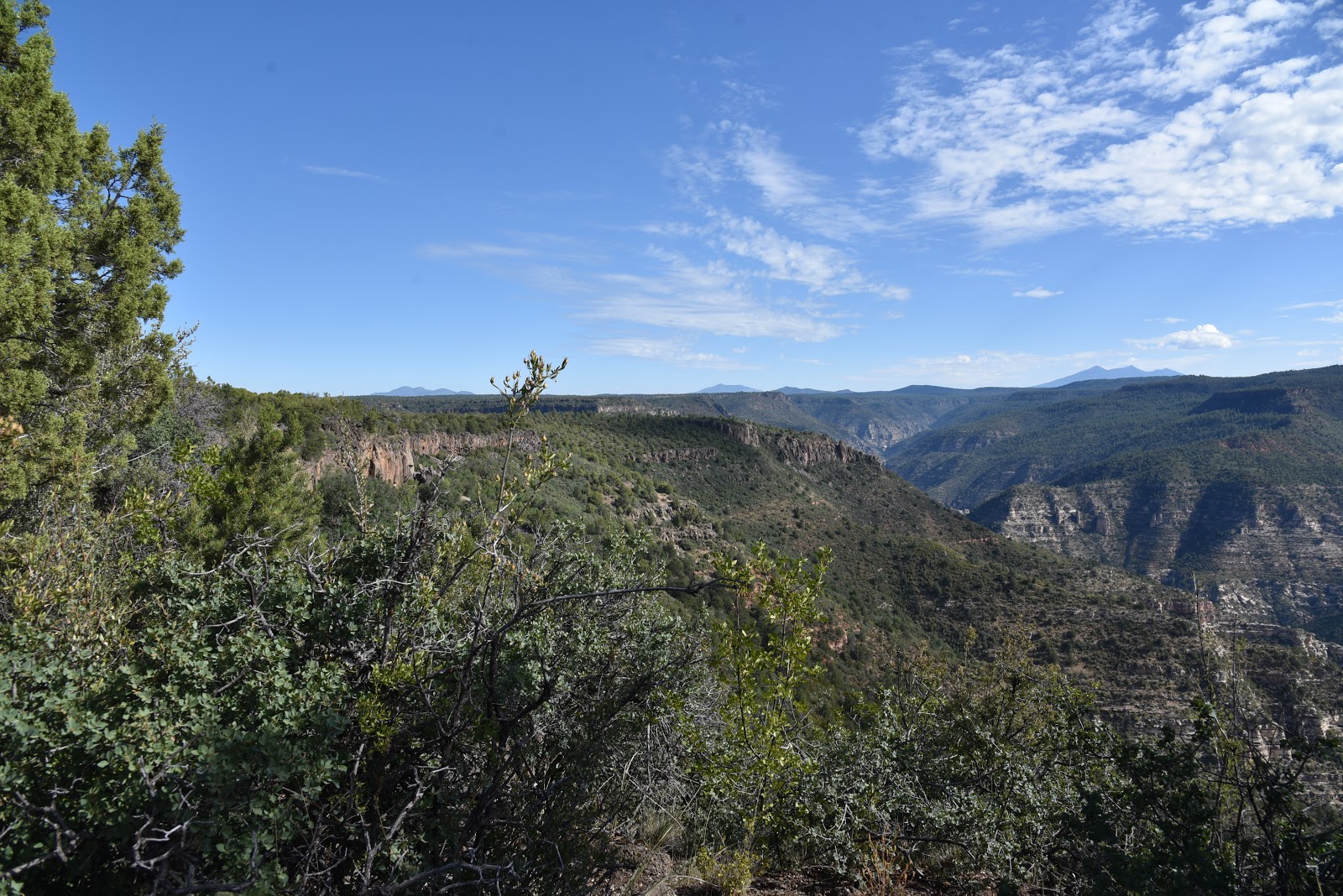
Although a multi-day backpacking trip is the optimum way to experience the multifarious features of this unforgiving backcountry, there’s an easier way to get an overview of the canyon’s scale and diversity. A hike or bike ride on the Sycamore Point Trail #131 culminates at a breathtaking overlook that rivals those along the south rim of the Grand Canyon, but without the crowds and concession stands. This ersatz Ooh Aah Point sits near the intersection of the Prescott, Kaibab and Coconino National Forests, where the Red Rock Secret Mountain and Sycamore Canyon Wilderness areas collide 1000 feet below. There are no guard rails to stall a fall, so use extreme caution when approaching the edge.
 |
| Domestic cattle graze in the forests around the trail |
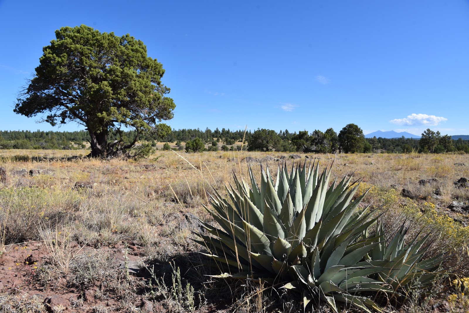
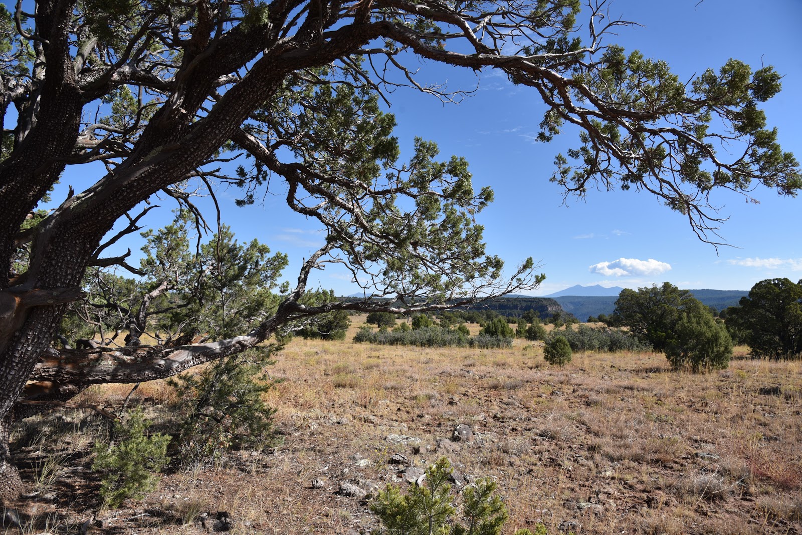
The 10-mile out-and-back trek follows the graveled, rough tail-end of Forest Road 110 that has been designated as multi-use recreational trail. From the trailhead near JD Dam Lake, the hike begins by heading southeast on a dirt track through shady pine-oak forests. Watch for tiny bike trail signs placed at junctions to stay on track. Near the 2.5-mile point, the environment changes from thick woodlands to open meadows before gradually emerging on a grand plateau with sweeping, high-desert grasslands dotted with pinion pines, agave and Alligator junipers. Soon thereafter, first glimpses of the canyon rim appear on the eastern horizon backed by hazy views of Kendrick Peak and the San Francisco Peaks near Flagstaff.
 |
| Distant San Francisco Peaks seen from Sycamore Point |
 |
| A twisted Alligator juniper survives on an open prairie. |
Where the road ends, a wide gravel roundabout makes a swing around the edge of the canyon. Ringed by junipers, shrubs and an understory of yucca and cacti, views of the 20+-mile-long chasm are dominated by russet-stained buttes and chiseled limestone pillars.
 |
| Spent agaves frame Bill Williams Mtn on center horizon |
At the brim, a sheer drop off unsettles the nerves while expansive views of the of the wild canyon assault the senses like a rogue tidal wave. From the precipitous perch, layer upon layer of complex geological features and eco-zones roll out below.
 |
| Beautiful rangeland near the canyon's rim. |
The point juts out from the edge of the Colorado Plateau to showcase a rare mix of mountain peaks, coniferous woodlands, high deserts and faint strips of riparian trees and shrubs that sink roots into seasonal water pools around Sycamore Creek and feeder streams that drain into the Verde River.
 |
| High-desert scrubland near trail's end |
Directly under the overlook, the impossible to spot Winter Cabin and Taylor Cabin trails wind among buff-and-vermillion-colored cliffs and water-sculpted ravines while the tree-covered mesas above Sedona’s Oak Creek Canyon bolster the eastern horizon. The isolated, exposed and utterly raw beauty visible from this rim-top platform might inspire you to start training and preparing for an expedition into the wilds beneath it. But, an extended dive into Sycamore Canyon requires skill and a healthy dose of humility.
 |
| Mountains of Prescott NF on the southwest horizon |
 |
| Pine forests shade the first 2 miles of the hike. |
 |
| Follow the bike signs to stay on course. |
It’s easy to succumb to the come-hither call of the canyon, but surviving its clutch is a whole other matter.
 |
| Pinion pine are common along the trail |
LENGTH: 10 miles out-and-back
RATING: moderate
ELEVATION: 6583 – 6296 feet
GETTING THERE:
From Interstate 40 in Williams, take the Garland Prairie exit 167, go left at the off ramp and drive south on the access road. Just over the railroad tracks, make a sharp left onto Forest Road 141 and continue 7.9 miles to Forest Road 109. Turn right on FR 109 and continue 5.6 miles south to Forest Road 12, veer left and continue 4.9 miles to the signed trailhead at FR 110. There’s a parking turnout a few yards to the left of the sign. Access roads are gravel/dirt with some washboard sections that are suitable for passenger vehicles.
INFO: Kaibab National Forest


No comments:
Post a Comment