Find A Trail. Start Your Search Here:

Friday, November 10, 2017

MARCUS LANDSLIDE TRAIL

MARCUS LANDSLIDE TRAIL
Marcus Landslide Trail
Scottsdale's McDowell Sonoran Preserve is home to dozens of impressive geological features. While many, like Tom's Thumb, and Brown's Mountain, are impossible to miss, the one that eclipses them all takes a trained eye to locate and appreciate. 
Granite boulders along the trail
If you didn't know it was there, you'd probably never even notice the massive rockfall area called Marcus Landslide. Discovered in 2002 by a pair of local geologists, the nearly mile-long wreckage is comprised of an estimated 25.8 billion pounds of rubble.
Mushroom rock
The slide occurred during the Pleistocene Ice Age about a half-million years ago when a colder, wetter climate may have instigated the slide which shaved 1,200 feet off the ridge line releasing energy equivalent to an atomic bomb blast. The trail, which is named for former Arizona State University geography professor Melvin Marcus, loops among the slide's components giving a comprehensive overview of the magnitude and scope of the event.  Although interpretive signs placed along the eponymous trail that leads to the site give enough information for the casual visitor,  scheduled steward-led hikes get deeper into the science.
Marcus Landslide site
This highly-trained corps of McDowell Sonoran Conservancy volunteers in bright blue shirts will help you gain an appreciation for the complex beauty of the McDowell Mountains.
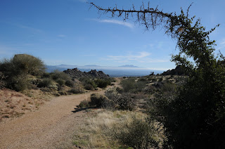
Besides the ubiquitous landslide, the easy trail makes a loopy tour through crops of weathered granite “mushroom” rocks and stony hackberry-lined corridors with breathtaking views of the Fountain Hills area, Verde River valley and Superstition Wilderness. The more you learn about this fascinating, 30,580-acre slice of pristine Sonoran Desert, the more you'll want to return again and again to hike its more than 180 miles of trails.
Mushroom nursery
LENGTH: 3.7-mile loop (4.2 miles with optional side trips)
RATING: easy
ELEVATION: 2,800’ – 2,500’
HOURS: sunrise to sunset daily
FACILITIES: restrooms, NO water
BEST SEASON: October -April
View of Four Peaks 
GETTING THERE: Tom's Thumb Trailhead:
From the Loop 101 in Scottsdale, take the Pima/Princess Road exit 36 and continue 5 miles north on Pima to Happy Valley Road. Turn right (east) and go 4.1 miles on Happy Valley to Ranch Gate. Turn right on Ranch Gate, follow it 1.2 miles then turn right onto 128th St. and continue 1 mile on 128th to the signed trailhead. Roads are paved all the way.
INFO:
McDowell Sonoran Conservancy: http://mcdowellsonoran.org/home
Scheduled Hikes: http://www.mcdowellsonoran.org/events/
McDowell Sonoran Preserve
Arizona Geological Survey

No comments: