CAMP CREEK FALLS
Cave Creek
 |
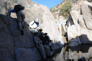
| Early December on Camp Creek |
 |
| Camp Creek Falls |
The innocuous, wildfire-tinged roadside
pullout that marks the beginning of this hike gives little insight to
the wonders that lie in the canyons below. This unmarked route
ventures into the craggy desert canyons of Blue Wash and Camp Creek.
Although this is not an “official” trail, it’s easy to stay on
course by simply following the obvious footpaths and bends in the
canyon. The first of several tricky spots happens at roughly the
half-mile point where the trail seems to dead-end over a dry
waterfall. Here, veer right and hike up above the rise following a
narrow path-of-use. Once back in the gully, there are several more
minor hand-over-foot rock scrambles to overcome before Blue Wash
meets the wide, sandy course of Camp Creek. At this “T”
intersection, head left and hike upstream, hopping the many rivulets
that flow in meandering lacy currents. Soon, the rangy walls of a
box canyon open up to reveal a cascade of water tumbling over a
20-foot-high granite escarpment. From here, those with good
route-finding skills can opt to scramble up to the top of the falls
and continue hiking north along Camp Creek where water-hungry reeds
and velvet ash trees live side-by-side with drought tolerant cactuses
and acacia. Please be respectful of the pockets of private property
in the area.
LENGTH: 3.5 miles round-trip
RATING: moderate
ELEVATION: 3,243-2,643 feet
GETTING THERE:
From the Loop 101 in Scottsdale, take
the Pima/Princess Road exit. Go north on Pima Road for 13 miles to
Cave Creek Road. Turn right (east) onto Cave Creek Road and continue
6.5 miles just past a sign on the right that reads “Blue Wash #1”.
Park in the gravel turnouts on either side of the road. The trail
begins near the cottonwood trees.
INFO:
Cave Creek Ranger District, Tonto
National Forest, (480) 595-3300


No comments:
Post a Comment